


- Brief description
-
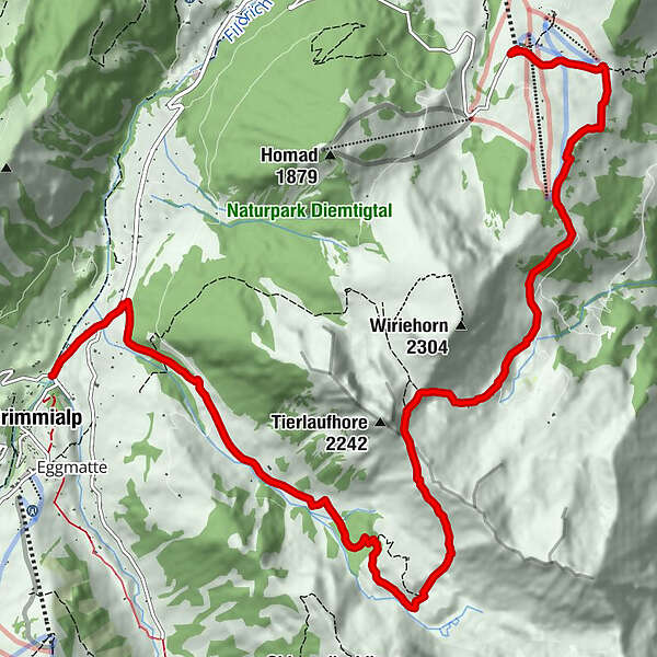
A circular hike that will take you through diverse countryside, expanses of mountain woodland, alpine meadows and along towering rock faces. Some extremely steep sections. On a clear day, it’s worth making a detour to the Wiriehorn. Be careful of the steep slope on the descent from the Gurbsgrat. 1 km of paved track at the beginning and end of the hike.
- Difficulty
-
medium
- Rating
-
- Route
-
Bergrestaurant NüeggSchwarzeberg0.9 kmGurbssattel (2,109 m)5.3 kmGrimmialp (1,235 m)12.1 km
- Best season
-
JanFebMarAprMayJunJulAugSepOctNovDec
- Description
-
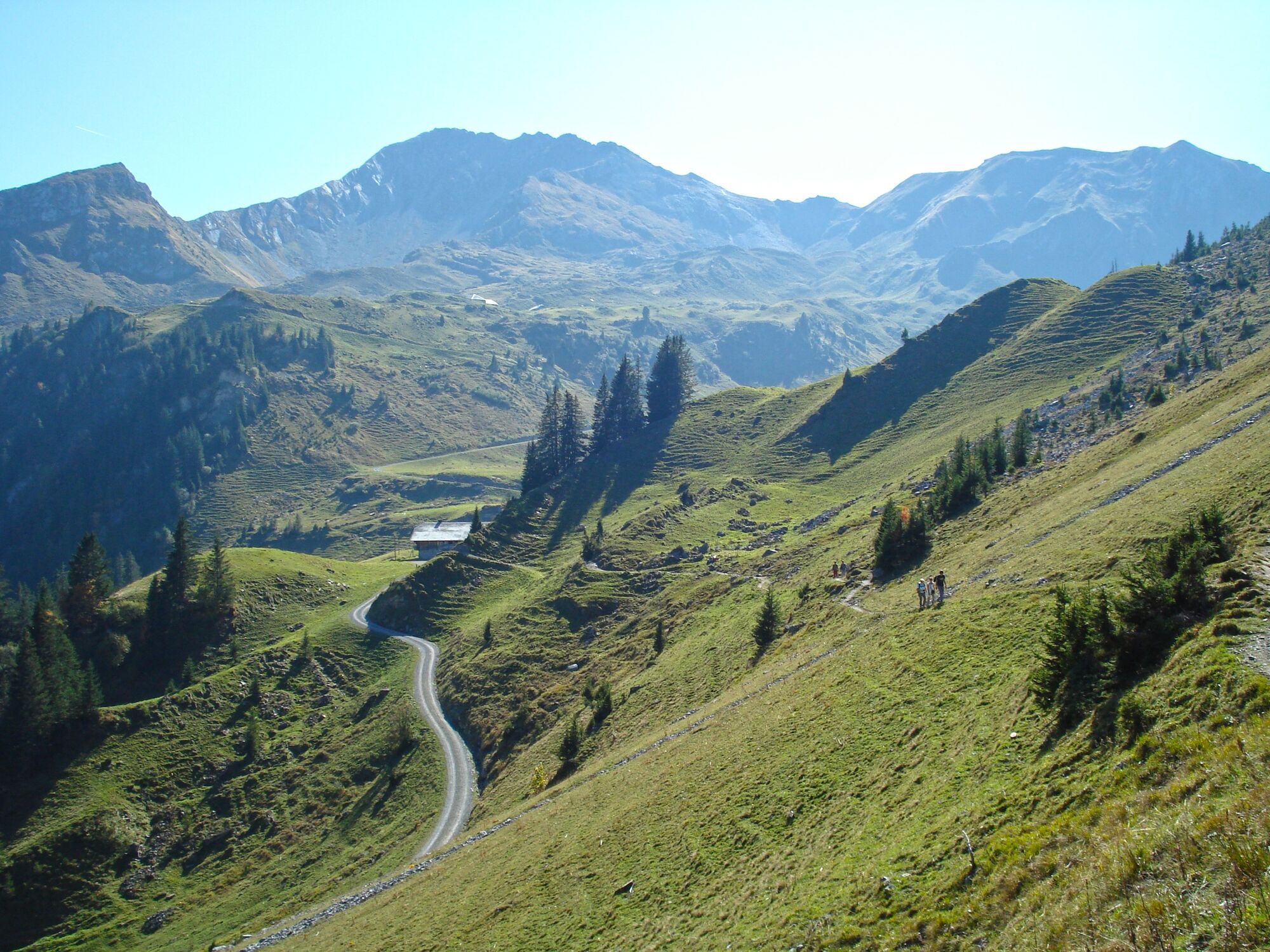
From the Berghaus Nüegg, a surfaced alpine road leads to the Alphütte Schwarzenberg restaurant. The view of the majestic Wiriehorn, Hohmad, Turnen and Abendberg, as well as the Niesen mountain range, is certain to impress. At the cabin climb over the expansive Egg, which leads up to the Wiriehorn. At the sign for Toobefärrich, the path curves round the eastern flank of the Wiriehorn. It then heads up the Abendmatte alp at a fairly even level, before climbing through a wide, marshy, meadowed valley to the Sennhütte Gurbs Mettenberg. Past the walls of the Wiriehorn, Tierlaufhorn and Gurbsgrat come into sight. Through a rubble-strewn hillside, the trail now extends westwards towards Gratsattel at point 2031 (to Wirie–Wiriehorn 1hr 15; to Wirie–Zwischenflüh 2hr 10). The mountain path once again ascends the eastern flank of the Tierlaufhorn up to Gurbsgrat at a gentle incline, where you will be greeted by a magnificent view. Below you spans the long basin of the Gurbs alp, while the vista beyond comprises the Männliflue, Albristhorn, Giferspitz and the jagged crags of the Spillgerte mountains. The snow fields of the Wildhorn and Diablerets are bathed in sun. The narrow path crosses the sheer western flank of Gurbsgrat (particular care is advised in wet weather!) and descends until finally reaching the edge of a marshy basin and the spacious Sennhütte Oberste Gurbs. Crossing meadows and woodland, you reach the Alphütte Unterste Gurbs and the main road through the floor of the valley. The Tiermatti PostBus stop (next to the splendidly decorated guesthouse) and the Post Schwenden stop (to Zwischenflüh in 1 hour) are both within short walking distance.
- Highest point
- 2,105 m
- Endpoint
-
Schwenden
- Height profile
-
 © outdooractive.com
 - Equipment
-
We recommend the following equipment: Sturdy hiking shoes, medium-sized backpack with hip belt, sun protection, rainwear, hiking sticks, first aid kit, picnic, water.
- Safety instructions
-
This route runs entirely or partially along mountain trails.

-

-
AuthorThe tour Around the Wiriehorn is used by outdooractive.com provided.


General info
-
Oberwallis
1871
-
Naturpark Diemtigtal
933
-
Weissenburg - Därstetten
180


