- Brief description
-
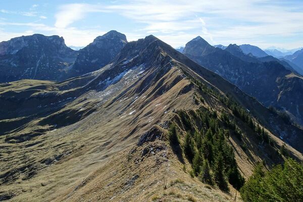
On the medium hike to Seebergsee and around the Muntiggalm, hikers enjoy views of Zweisimmen, Saanenmöser, Rinderberg and Sparenmoos.
- Difficulty
-
medium
- Rating
-
- Starting point
-
Meienberg
- Route
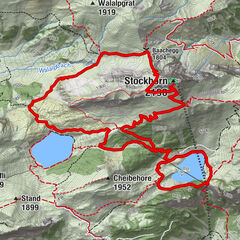
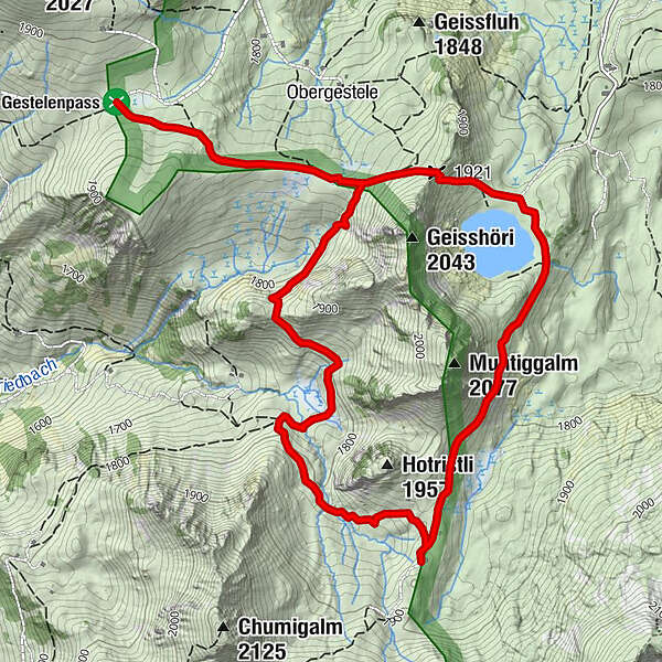
-
Stierenberg3.4 km
- Best season
-
JanFebMarAprMayJunJulAugSepOctNovDec
- Description
-
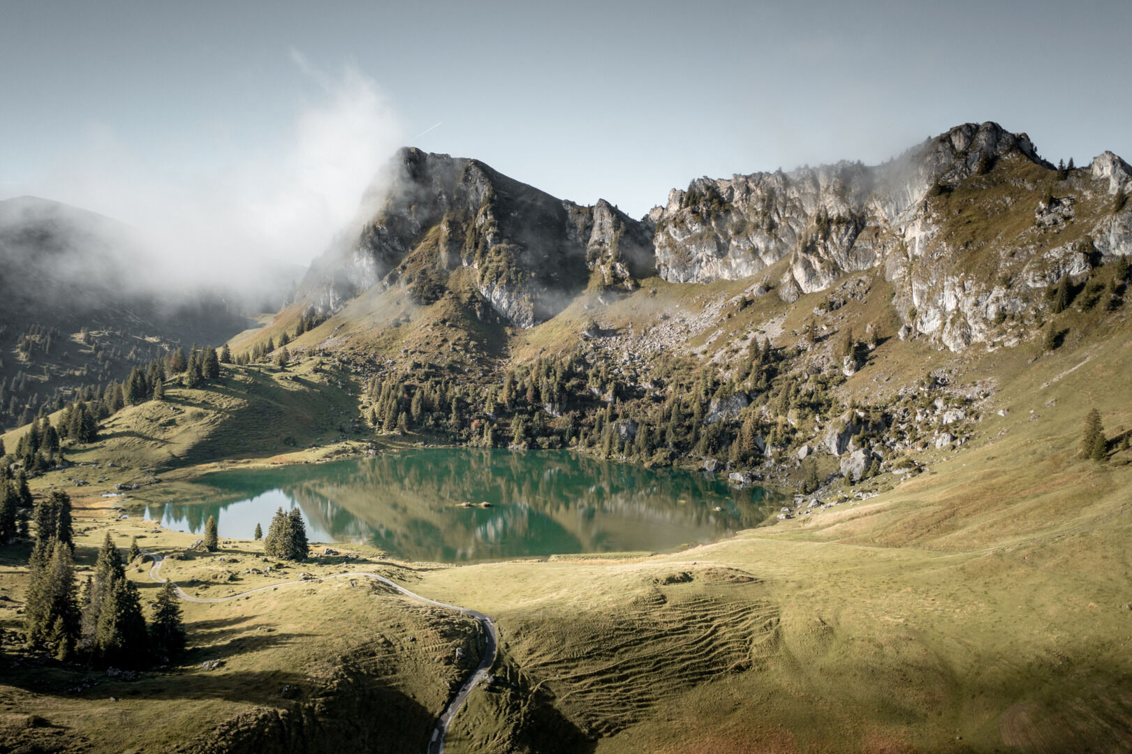
The opening of the new circular hiking trail has turned the picturesque Seebergsee above Zweisimmen and the surrounding Alps into an even more attractive hiking area than before. When walking around the Muntiggalm, hikers enjoy views of Zweisimmen, Saanenmöser, Rinderberg and Sparenmoos. After leaving the car park above the Meienberg, you take the narrow footpath over the ridge to the small pass, the Puur, above the Seebergsee. From there a winding path takes you straight down to the lake. A refreshing dip in the clear spring water of the Seebergsee is sure to invigorate you.
The route then takes you along the Alpweg to Alp Stiereberg. The view to the Seehore can also include ibex. For refreshments you can stop off at the rustic alpine hut Stierenberg. Then the trail runs down to the Muntiggrabe, before it rises somewhat as it leads to the Eggmad and from there back to the starting point.
- Directions
-
Meienberg - Puur - Seebergsee - Stiereberg - Muntiggrabe - Eggmad - Meienberg
- Highest point
- 1,917 m
- Endpoint
-
Meienberg
- Height profile
-
 © outdooractive.com
 - Equipment
-
Good footwear, snacks to savor during a break - why not a Fondue-Backpack?
- Tips
-
Swim to the little island in the Seebergsee.
- Additional information
- Directions
-
The Destination Gstaad is located in the south-west of Switzerland right on the border to the French-speaking part of the country. The Destination is easily accessed by rail or car from the regions around Lake Thun and Lake Geneva and the Gruyere region Direct connections to the European high-speed rail network and all international airports in Switzerland guarantee a time-saving and pleasant journey.
- Public transportation
-
By bus or train to Zweisimmen, train station.
Then by hiking cab to Meienberg. The hiking cab only runs during the season (June - October) and only twice a week (Tuesday & Thursday) by reservation at the Tourist Info Point Zweisimmen (+41 33 722 11 33, zweisimmen@mob.ch).
Ride: 9:00 a.m.
Descent: 15.30 p.m. - Parking
-
Parking lot Meienberg
On route 11 from Spiez or Château d'Oey to Zweisimmen. There take the partly unpaved private road to Grubenwald to Meienberg. From Grubenwald "Hofstette" is signposted. In Hofstette there is a ticket machine. There you can buy a driving permit including a parking ticket. You stay on the road for about 15 minutes and after about 500 m you reach a gate where there is a small number of parking spaces.
Due to the limited number of parking spaces, we recommend parking at the train station in Zweisimmen and then taking the hiking cab to Meienberg. The hiking cab departs twice a week during the season by appointment at the Tourist Info Point Zweisimmen (+41 33 722 11 33, zweisimmen@mob.ch).


-

-
AuthorThe tour Meienberg – Round hike Seebergsee - Meienberg is used by outdooractive.com provided.


General info
-
Oberwallis
1872
-
Lenk-Simmental
744
-
Zweisimmen
244