


- Brief description
-
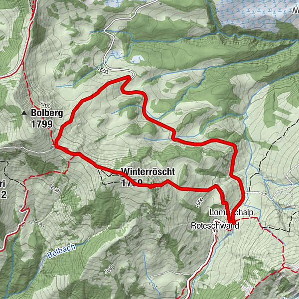
This circular observation trail starts at the Restaurant Jägerstübli (1559 m above sea level) and returns via Winterröscht (1759 m above sea level) and Färrichegg.
- Difficulty
-
easy
- Rating
-
- Starting point
-
Restaurant Jägerstübli Lägerstutz/Roteschwand
- Route
-
Lombachalp0.0 kmJägerstübli0.1 kmWinterröscht (1,759 m)1.4 kmLombachalp5.1 kmJägerstübli5.1 km
- Best season
-
JanFebMarAprMayJunJulAugSepOctNovDec
- Description
-
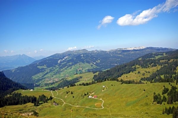
The trail is uphill from Lägerstutz, with a steep section leading through the forest at the trail’s highest point, then via a flat slope to Winterröscht. From there the trail leads back down to Färrichegg via Läger. The observation trail runs along an asphalted road between Färrichegg and Lägerstutz. The trail encompasses stunningly beautiful, diverse moorland areas.
Looking for more hiking choices?
Here you will find details of hiking trails to inspire you in the Bernese Oberland. - Directions
-
Lägerstutz - Winterröscht - Färrichegg - Lägerstutz
- Highest point
- 1,753 m
- Endpoint
-
Restaurant Jägerstübli Lägerstutz/Roteschwand
- Height profile
-
 © outdooractive.com
 - Equipment
-
Appropriate footwear; binoculars are recommended to allow you to observe the animals.
- Safety instructions
-
To protect the vegetation and the animals, you should stay on the trails at all times.
- Additional information
- Arrival
-
Drive from Lucerne over the Brünig Pass or from Bern along the autobahn and motorway via Thun-Spiez to Interlaken. On passing Unterseen you come to the junction for Habkern.
At the intersection in the centre of Habkern (bank, post office, shops), drive straight ahead towards Schwendi. The distance from Habkern village to Lombachalp is 6 km. Parking at Schwendi/Tschieme is paid. There are two payment machines:
- Habkern village / Dorfbrunnen (village fountain)
- Lombachalp / Lägerstutz car park
Alternative: Use the parking facilities in the middle of the village or at the swimming pool, both of which are close to bus stops, and take the Bus alpin (shuttle bus) to Lombachalp.
- Public transportation
- Parking
-
Please be aware that the number of parking spaces available is limited.


- Author
-
The tour Lägerstutz-Winterröscht-Färrich-Lägerstutz observation trail is used by outdooractive.com provided.


General info
-
Obwalden
2039
-
Interlaken
1119
-
Habkern
343


