
- Brief description
-
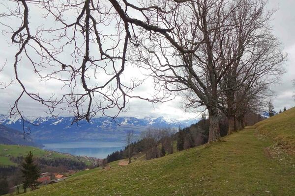
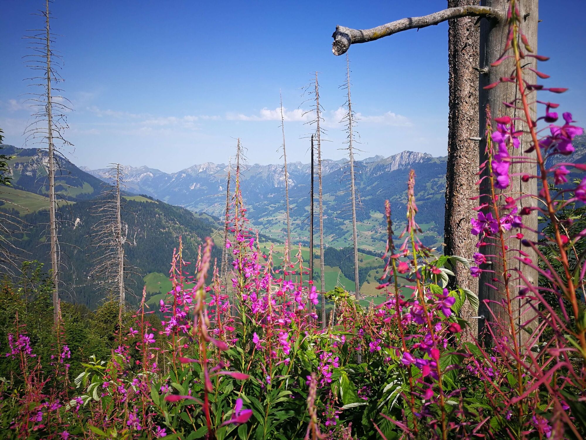
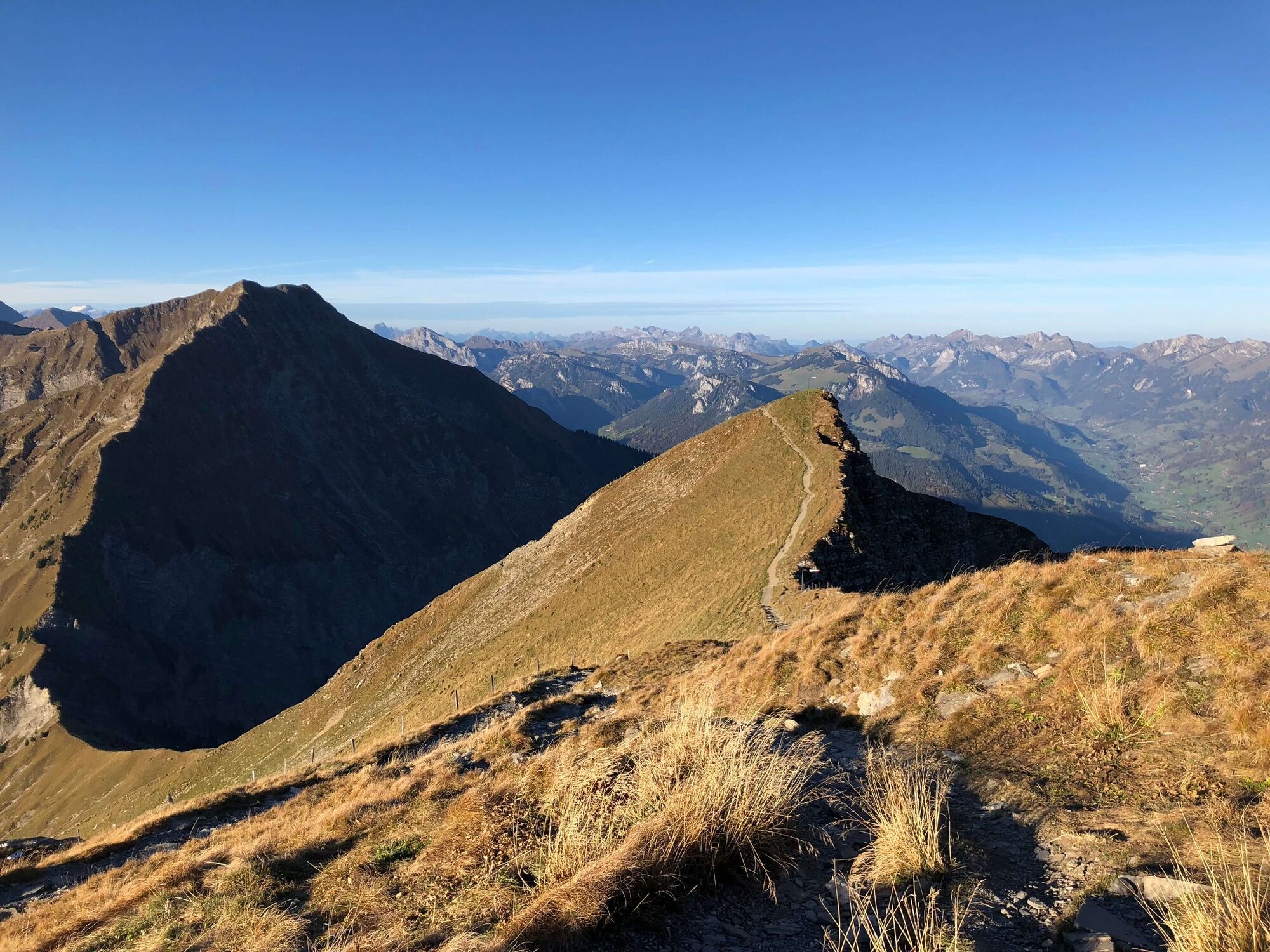
Hiking from the Niesen into the Diemtigtal, you have a magnificent view of Lake Thun and the Simmen and Diemtigtal valleys.
- Difficulty
-
medium
- Rating
-
- Starting point
-
Niesen Kulm mountain station (Mülenen)
- Route
-
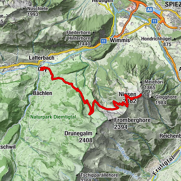
Niesen Kulm (2,336 m)Berghaus Niesen Kulm0.1 kmZünegg10.2 kmOey (669 m)12.0 kmOey-Diemtigen (670 m)12.3 kmLatterbach (700 m)12.3 km
- Best season
-
JanFebMarAprMayJunJulAugSepOctNovDec
- Description
-
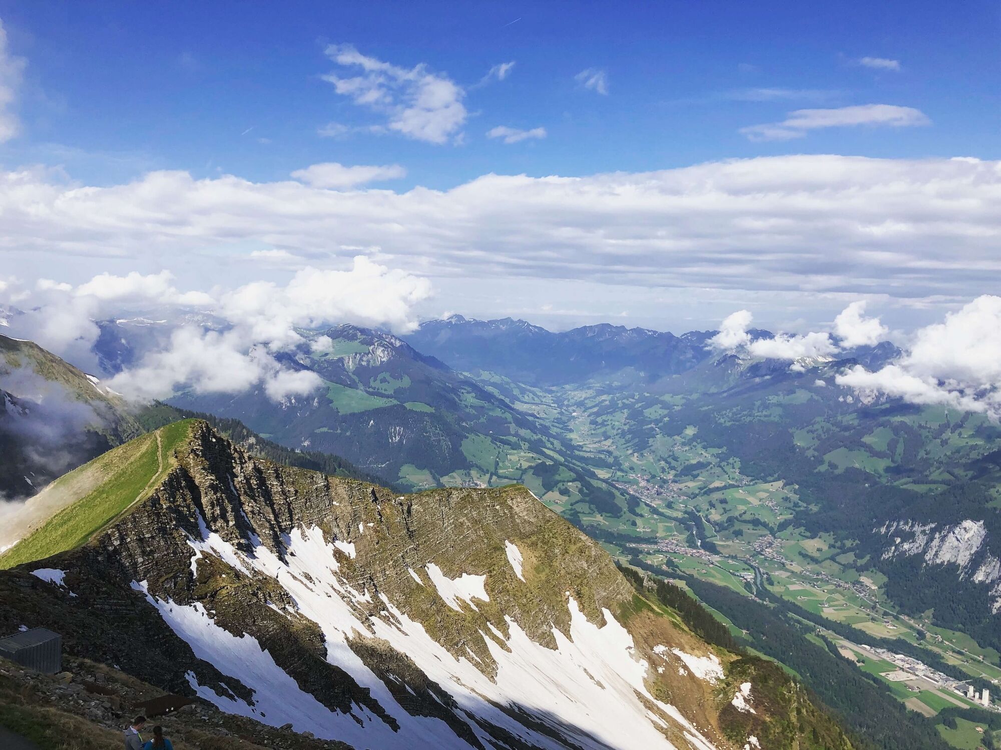
The 3.5 km long route up Niesen Kulm is divided into two sections. The 26-minute ride with the two funiculars up "the swiss pyramid" provides an impressive panorama of Lake Thun and the Kander valley. Once you reach the top station, a wonderful panoramic view of the neighbouring valleys and the peaks of the Bernese Oberland awaits you. The signposted mountain trail to the neighbouring Diemtigtal leads over alpine meadows, through forests and stone fields to the village of Oey.
- Directions
-
The mountain trail is marked with yellow directional signs and green route fields and leads from the Niesen mountain station down to the Oberen and Unteren Stalde, over the Chummli to the Geeri. This is where the trail splits:
If your destination is Oey railway station, turn right and follow the path via Bruchgeere via Zünegg to Hasli, where you tackle the last descent to the railway station.
Alternatively, you can continue straight on at Geeri until you reach the Hoschüpfe viewing platform. Here you get a last view over Lake Thun before you reach the Springenboden area via Untere Drunen. The hiking trail leads you from here down to the valley road in Horboden, where you can either hike along the valley hiking trail to Oey or return by PostBus from Horboden, Chirel.
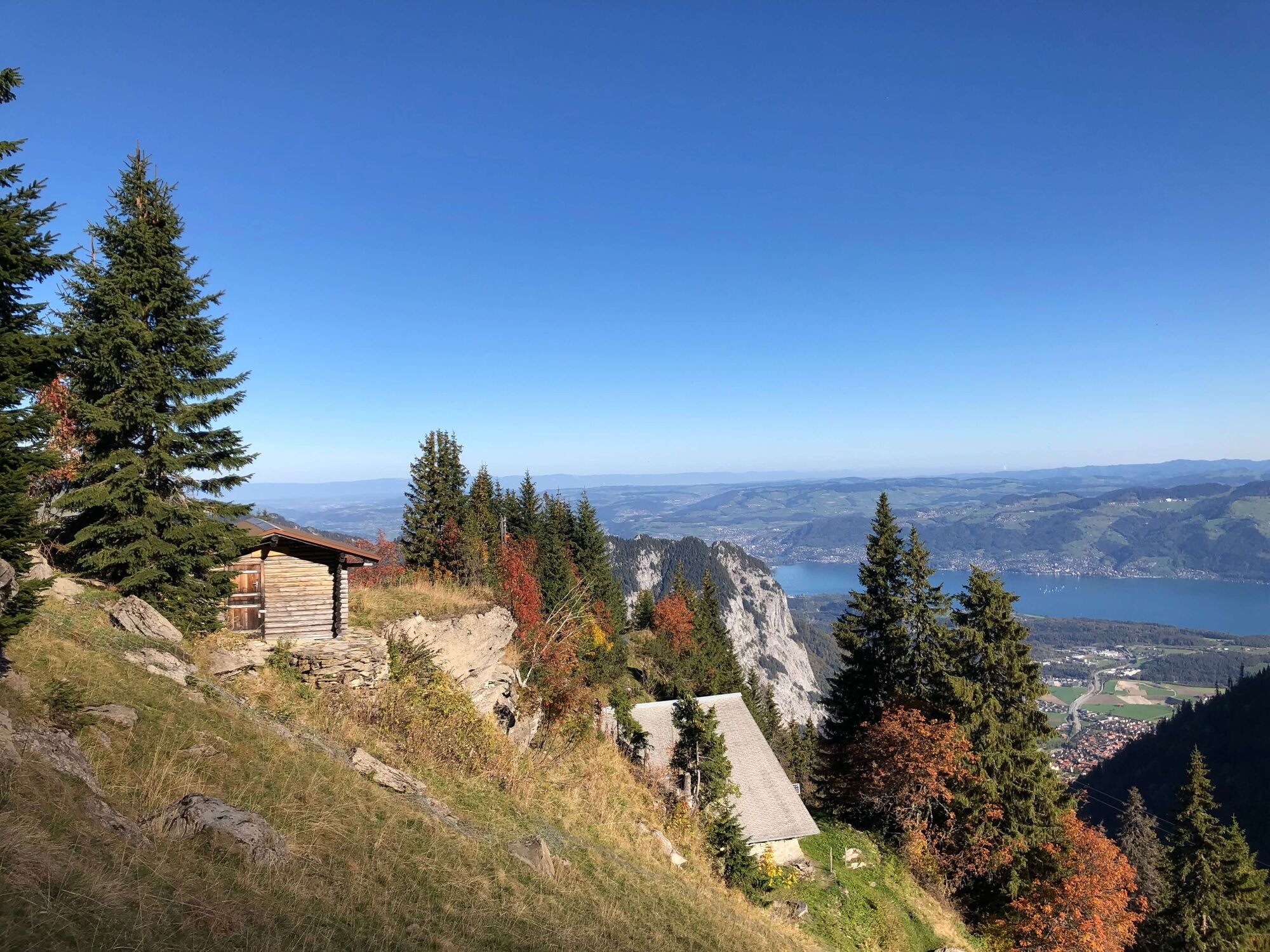
By the way: If you book an overnight flat rate at the Gsässweid Inn from the Diemtigtal Nature Park office, you will spend the night in a dormitory or double room and be taken back to the Oey-Diemtigen or Mülenen railway station the next day after breakfast. - Highest point
- 2,338 m
- Endpoint
-
Oey-Diemtigen railway station
- Height profile
-
 © outdooractive.com
 - Equipment
-
Mountain boots, weather appropriate clothing (sun/rain protection), hiking poles, food and sufficient drinks for the way
- Safety instructions
-
Despite the proverb «if the Niesen has a hat, the weather will be fine again», it is important to pay attention to the weather situation. Around the peaks of the Niesen chain, snow can sometimes lie until May/June.
The Panorama Trail leads through pastures with cattle and along fenced flocks of sheep, which are guarded by dogs. It is recommended that you do not bring a dog on the hike. Please note the corresponding information boards on site. - Tips
-
The descent from Geeri to Oey is not for the faint-hearted: book our overnight offer at Springenboden with return transport the next day.
- Additional information
- Directions
-
Take the A6 motorway from Spiez in the direction of Frutigen and Kandersteg. After 5 minutes you will reach Mülenen and see the valley station of the Niesenbahn on the right.
- Public transportation
-
Take the train to Mülenen station (Spiez-Brig line), the stop in Mülenen is on request.
The funicular takes you to the Niesen Kulm mountain station every 15 minutes. - Parking
-
At the valley station of the Niesen cable car there are around 140 parking spaces available for a fee in three car parks.
Parking rates
for 5 hours: Fr. 5
for the whole day: Fr. 8
Season parking card for Fr. 60 per vehicle
- Author
-
The tour Niesen-Diemtigtal panoramic hiking trail is used by outdooractive.com provided.


General info
-
Oberwallis
1873
-
Naturpark Diemtigtal
937
-
Wimmis
275