


- Brief description
-
High altitude hike to the oldest mountain hotel in Europe
- Difficulty
-
medium
- Rating
-
- Starting point
-
Schynige Platte, summit station
- Route
-
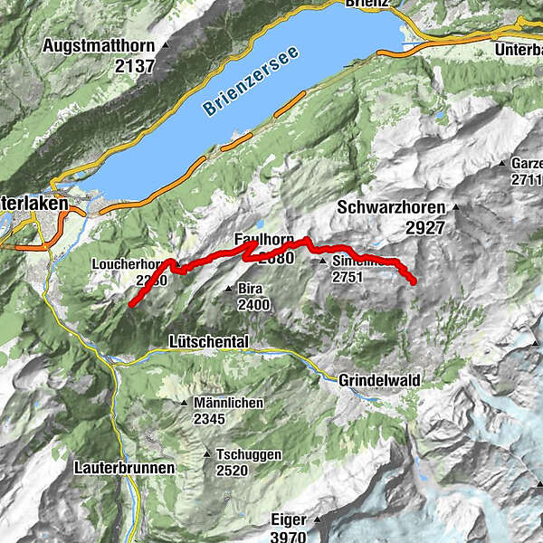
Schynige Platte (1,987 m)路徑2.6 kmBerghaus Männdlenen7.2 kmFaulhorn (2,680 m)10.2 kmFirst16.0 km
- Best season
-
JanFebMarAprMayJunJulAugSepOctNovDec
- Description
-
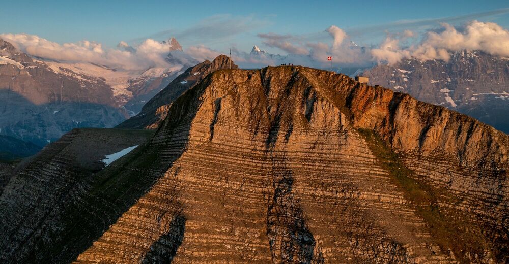
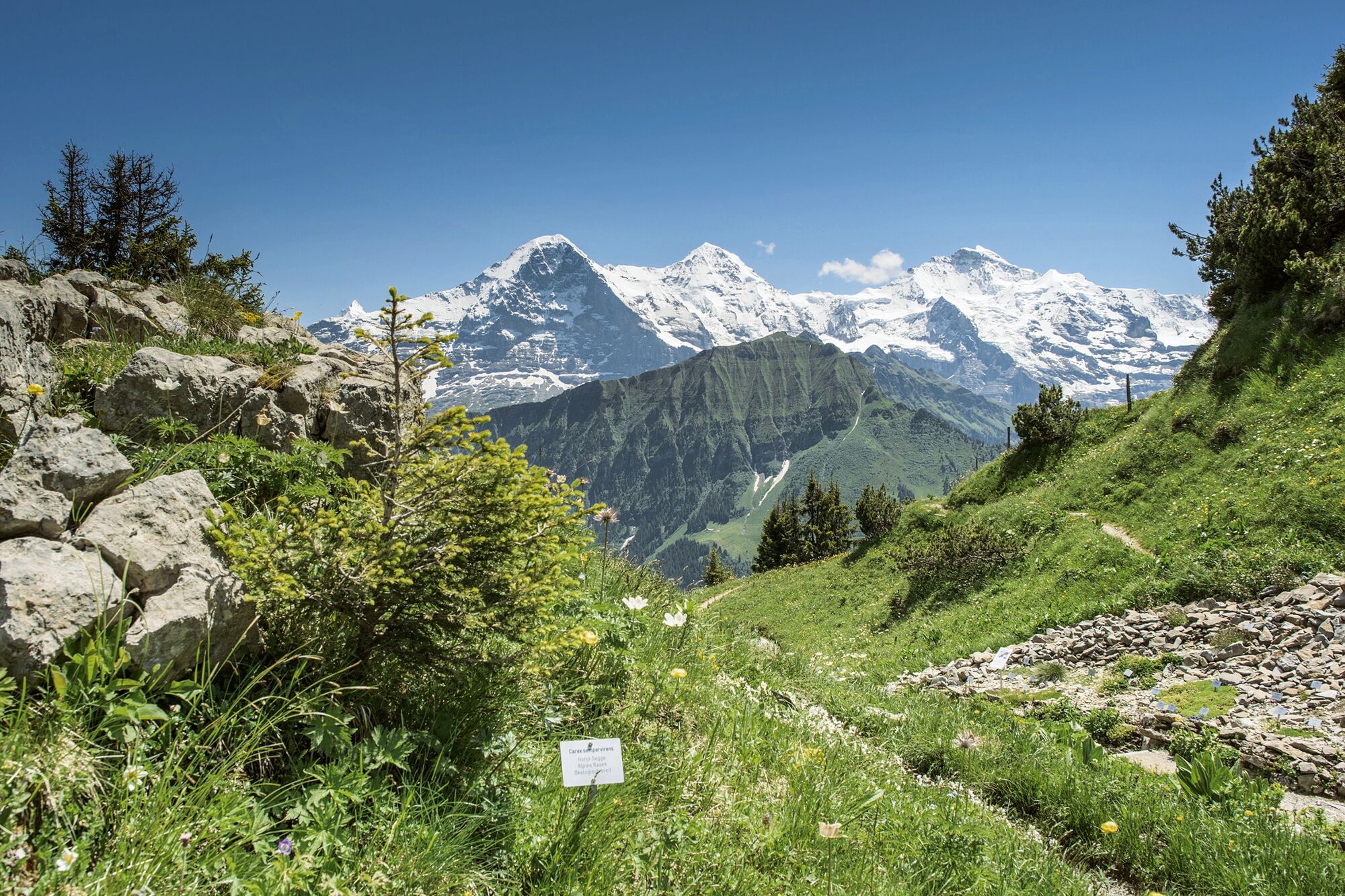
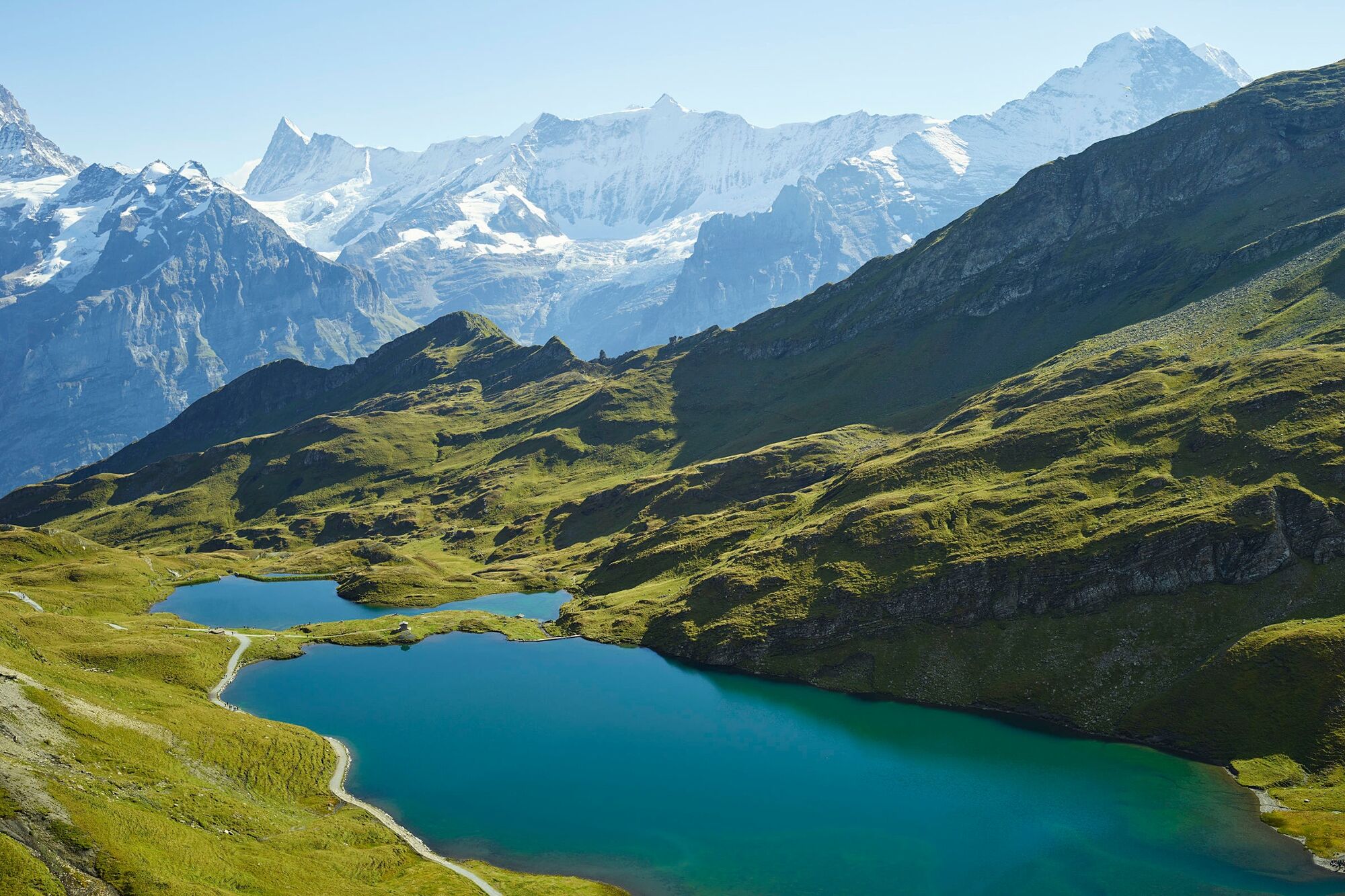
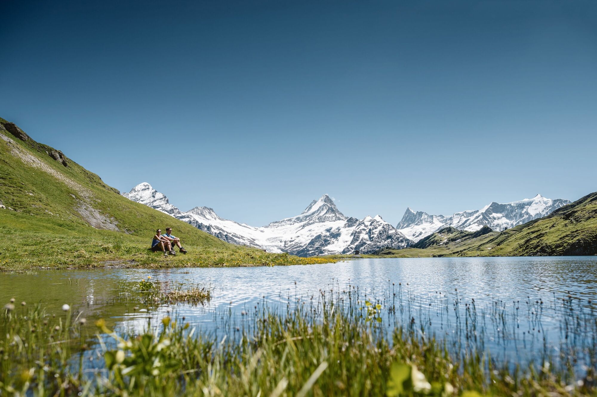
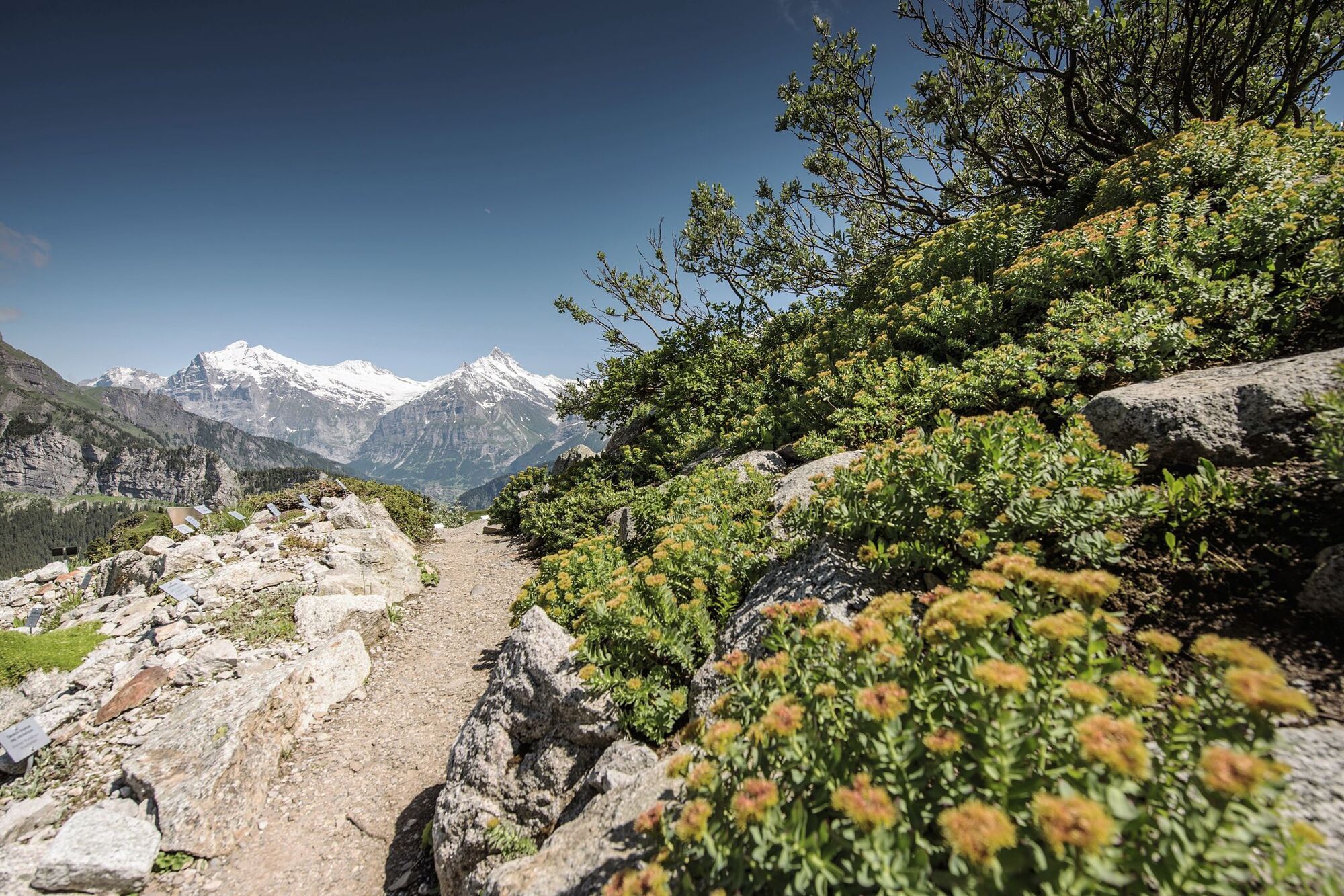
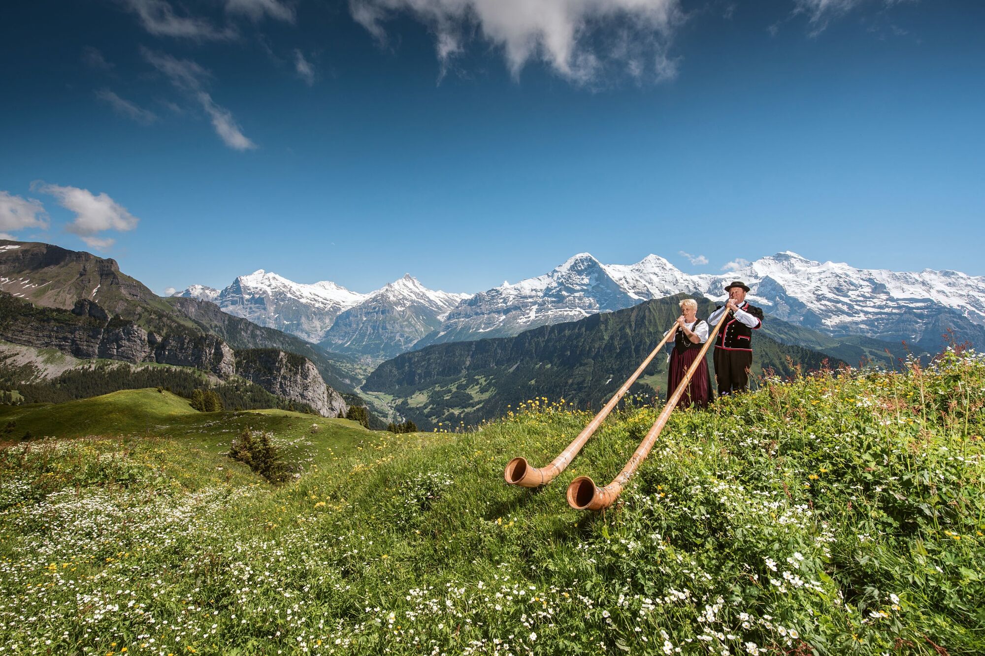
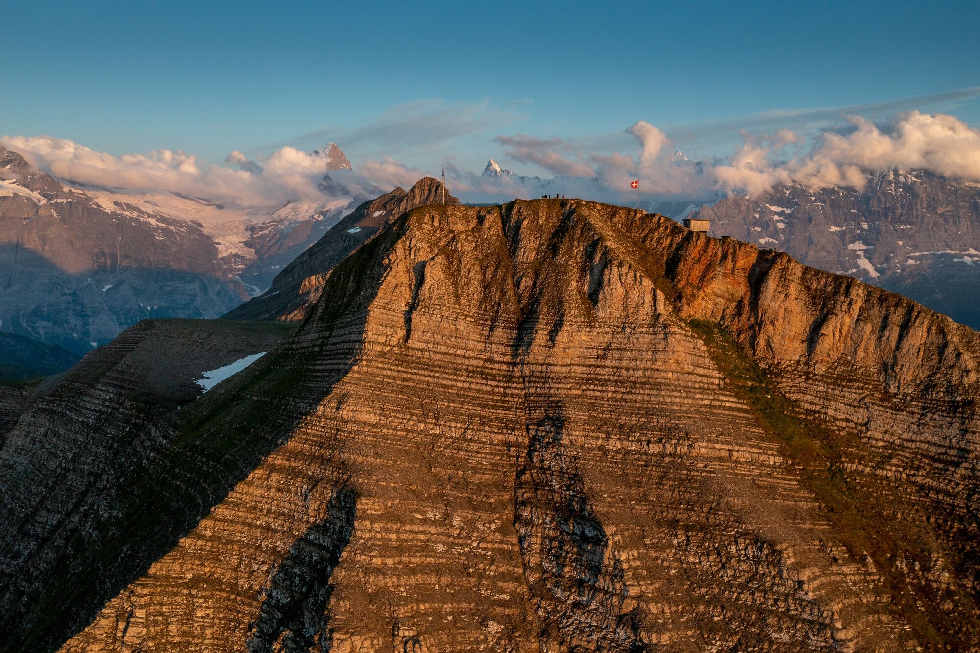
Incomparable walk at an altitude above the tree line. The snow-capped Alpine peaks form a wonderful contrast with the green valleys of the Lütschine and Aare rivers. Also worth mentioning are the Alpine Gardens on the Schynige Platte with over 500 local varieties of Alpine flowers, the two-hour panoramic loop trail affording fabulous views down to the lakes Brienz and Thun, the Alpine lakes Sägistal and Bachalp which are so different in their nature, at 170 years Europe's oldest mountain hotel Faulhorn, and finally also the overwhelming views of Grindelwald's mountains from First. Entirely natural footpath, partly in rock and over scree.
- Directions
-
Schynige Platte - Oberberg - Louchera - Güwtürli - Egg - Männdlenen - Faulhorn - Bachsee - First
- Highest point
- 2,662 m
- Endpoint
-
First, summit station
- Height profile
-
 © outdooractive.com
 - Equipment
-
hiking daypack (approx. 20 liters) with rain cover
comfortable and sturdy footwear
adequate and durable outdoor clothing in multiple layers
sun and rain protection
snacks and drinking water
first aid kit
penknife
mobile phone
if necesessary: telescope sticks, headlight, maps
- Safety instructions
- Tips
-
Overnight stay on the Schynige Platte, at Berghaus Männdlenen or at Berghotel Faulhorn.
- Additional information
- Directions
-
From Basel and Geneva, the fastest route to the Jungfrau Region is via Bern. From Zurich, the route via Lucerne and the Brünig Pass is recommended. The pass is open all year round.
From the south, travel to the Jungfrau Region via the Grimsel or Susten Pass. Both passes are only open in summer. An alternative is the Simplon Pass with subsequent car transport through the Lötschberg tunnel.
Grindelwald
From Interlaken we follow the main road to Zweilütschinen. Here we turn left towards Grindelwald. The whole trip takes about 30 minutes and leads over a partly winding road.
- Public transportation
-
Thanks to its central location in Europe, Switzerland is served by international trains from over 12 countries. Within Switzerland, Intercity trains run from Basel and Lucerne directly to the Jungfrau Region. Travellers from Zurich change trains in Bern. The trains run every half hour.
Grindelwald
From Interlaken Ost railway station we reach Grindelwald without changing trains on the Bernese Oberland Bahn (BOB). Important: Get on the rear part of the train, as it splits in Zweilütschinen. If you get on at the front, you will end up in Lauterbrunnen. The journey takes 30 minutes to Grindelwald Terminal (V-Bahn). Three minutes later we are at the terminal in the village.
There are three stations in Grindelwald (Terminal, Grund and Dorf). The terminal station (Dorf) is in the centre of Grindelwald.
- Parking
-
Wilderswil
In Wilderswil, parking spaces are available at the railway station for a fee.
Grindelwald
There are three public car parks: Parkhaus Eiger+ (252 parking spaces), Parkhaus Sportzentrum (160 parking spaces) and the new Terminal Parking (1000 spaces) of the V-Bahn. Alternatively, we can also use the car park in Grindelwald Grund.

- Author
-
The tour Schynige Platte - Männdlenen - Faulhorn - First No. 62 is used by outdooractive.com provided.

General info
-
Obwalden
2014
-
Jungfrau Region
1007
-
Grindelwald - Männlichen
466


