


- Rating
-
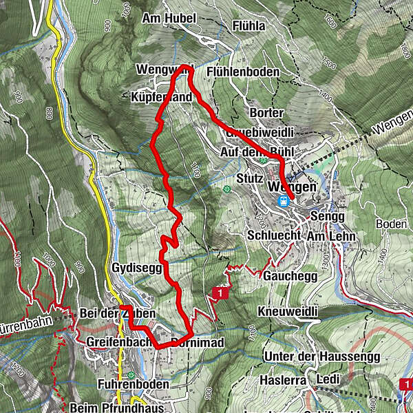
- Starting point
-
Lauterbrunnen, BOB end station
- Route
-
Bei der ZubenLauterbrunnen0.1 kmGreifenbach0.2 kmGsteigermatte0.2 kmLauterbrunnen0.4 kmDornimad0.5 kmGydisegg1.2 kmKüpfenland2.5 kmAm Sattel2.5 kmGruebi im Wengwald2.5 kmWengwald2.6 kmBrawendli2.6 kmAn der Matte2.8 kmBeim alten Haus3.1 kmBirchen3.2 kmGinschegg3.2 kmStadelmatte3.3 kmStäublisegg3.3 kmBorter3.4 kmGalliweidli3.4 kmGruebiweidli3.4 kmTrogihalten3.5 kmAuf dem Bühl3.5 kmBodendiehle3.6 kmAuf der Burg3.7 kmSchilt3.7 kmRestaurant 19033.7 kmPasta & More Restaurant3.9 kmWengen3.9 kmRestaurant Eiger (1,276 m)4.0 kmGruebi beim Falken4.0 kmGlausfuhren4.0 kmSchonegg4.0 kmAm Acher4.0 km
- Best season
-
JanFebMarAprMayJunJulAugSepOctNovDec
- Description
-
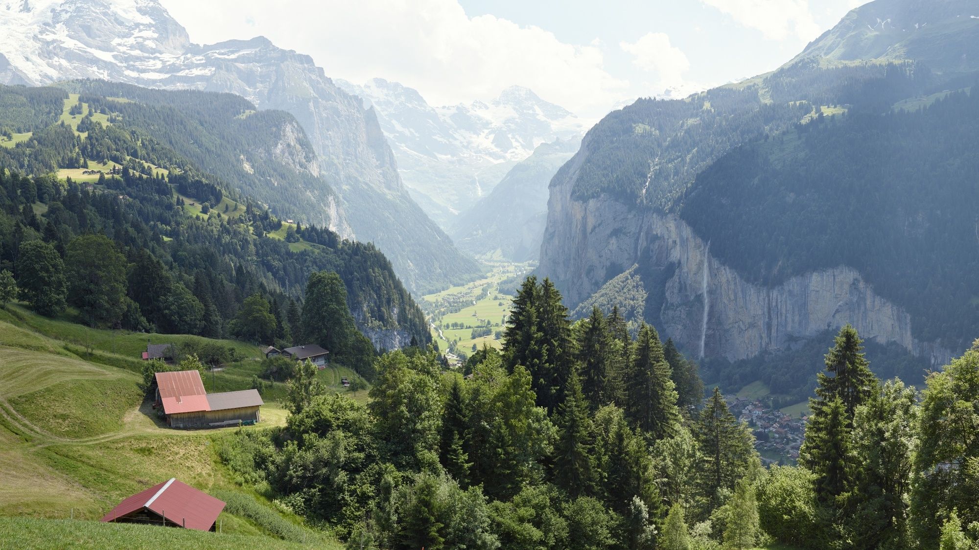
Lauterbrunnen lies between immense rock walls and mountain summits, in one of the most impressive trough valleys in the Alps. With 72 thundering waterfalls and quiet side valleys, colourful alpine meadows and secluded mountain guesthouses, the Lauterbrunnen Valley is also one of the largest nature reserves in Switzerland. From Lauterbrunnen railway station, the route follows the "Hohstäg", the trail from Lauterbrunnen to Wengen, to the part of the village called Stocki. The first part of the hike is accompanied by the sound of the Staubbach Fall thundering over the overhanging cliff to plunge almost 300 metres into the depths. With the sound of 72 waterfalls: The trail climbs steeply up around steep hairpin bends to Heimegg and through Bachweidli to the last houses in Küpfenland. It then leads alongside the mountain stream with another steep climb up to the Wengwald forest. Passing the Wengenerhof and Bellevue Hotels on a good road, you soon reach the village church and continue along Dorfstrasse to Wengen railway station. The holiday resort of Wengen is a typical picture-postcard mountain village. The wide terrace opening out towards the southwest guarantees an above average amount of sunshine and magnificent views of the Swiss Alpine world.
- Directions
-
Lauterbrunnen - Wengwald - Wengen
- Highest point
- 1,280 m
- Endpoint
-
Bahnhof Wengen, Zwischenstation der Wengernalpbahn
- Height profile
-
 © outdooractive.com
 - Equipment
-
Normal hiking gear, hiking boots with good soles and walking sticks help with the ascent.
- Safety instructions
-
Good but sometimes rather steep hiking trail.
- Author
-
The tour Lauterbrunnen - Wengwald - Wengen is used by outdooractive.com provided.
GPS Downloads


General info
Refreshment stop
A lot of view
Other tours in the regions
-
Aletsch Arena
1485
-
Jungfrau Region
1021
-
Lauterbrunnen
441


