- Brief description
-
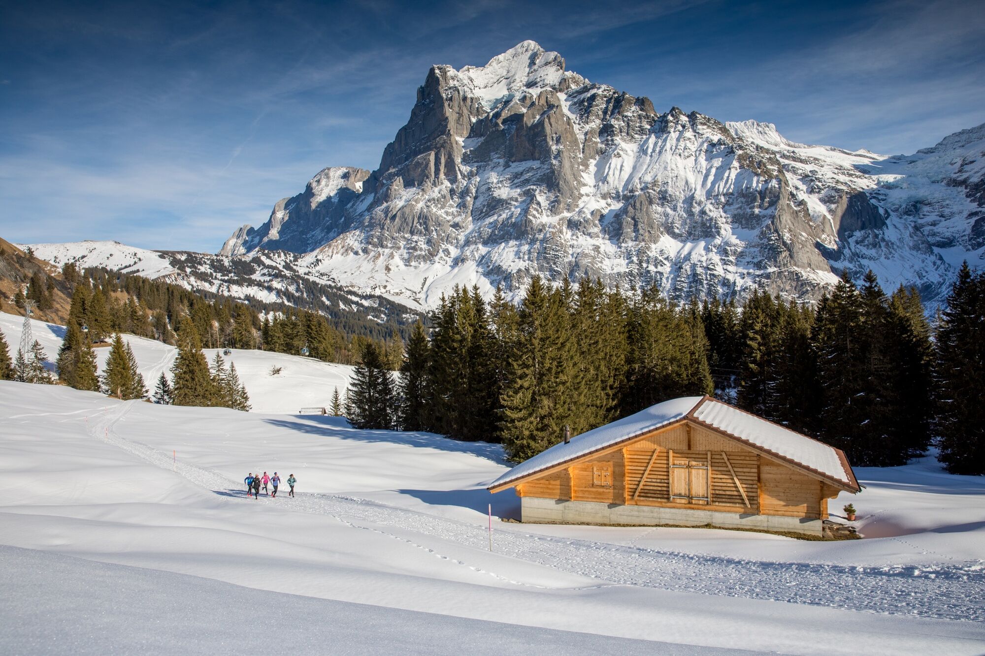
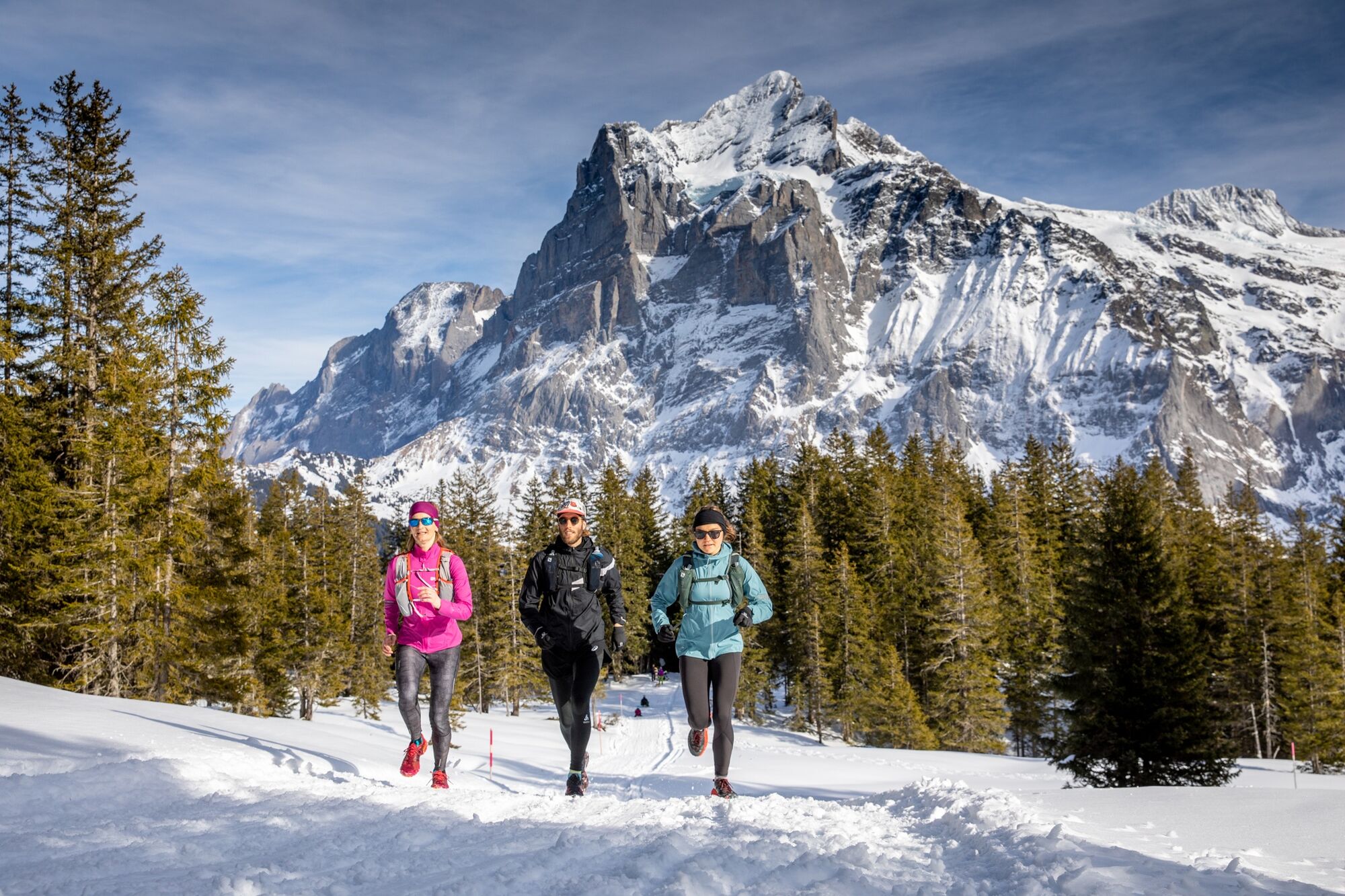
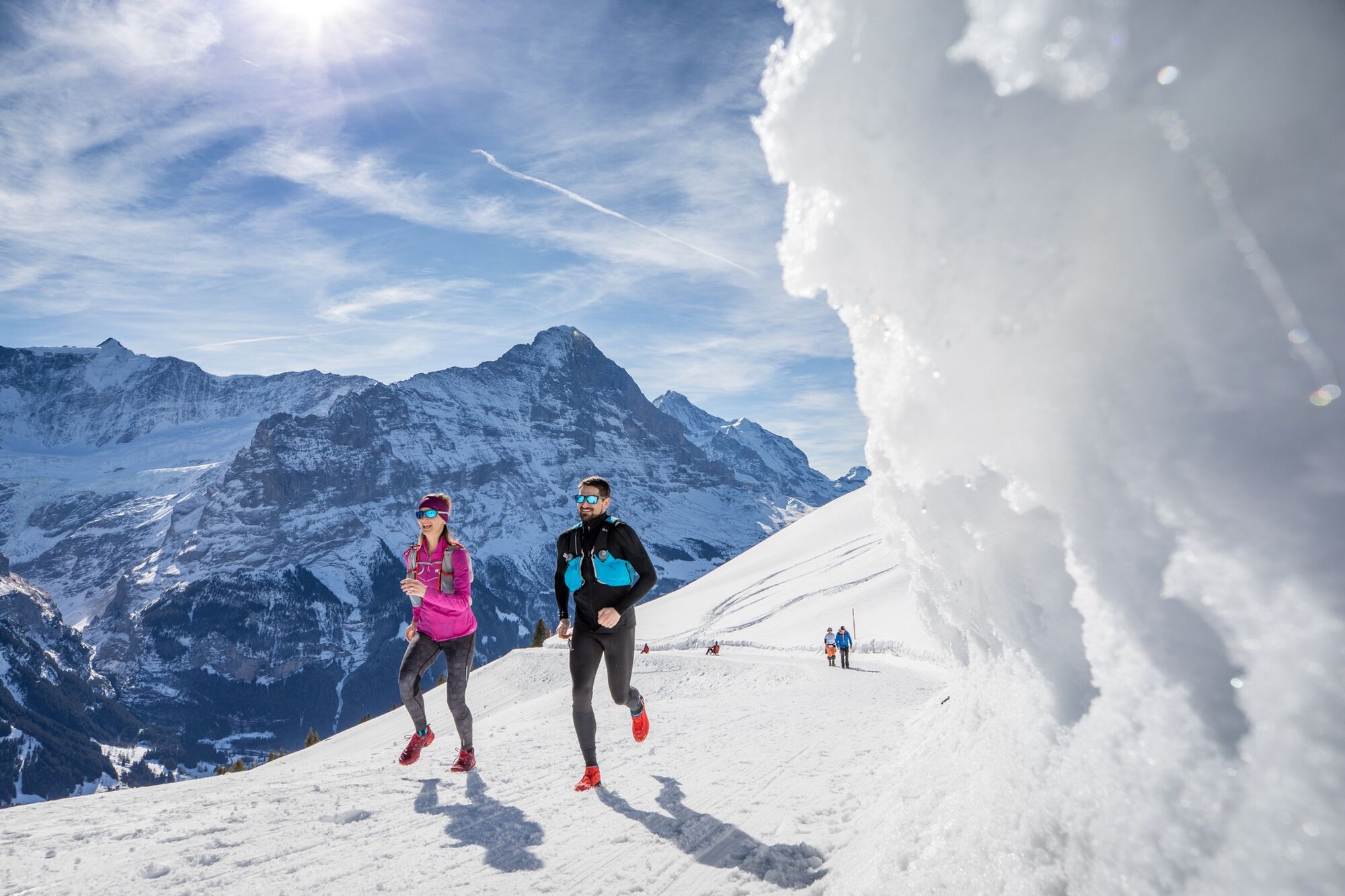
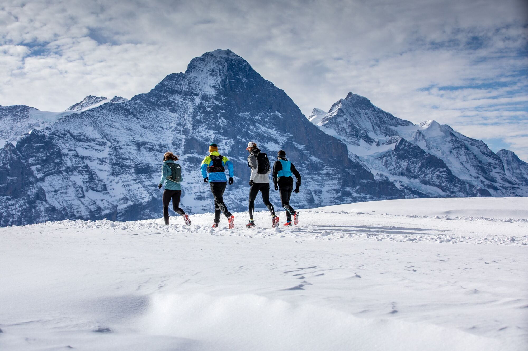
A beautiful winter trail run with impressive views of the snow and glacier landscape of the surrounding peaks. This tour, which is almost 14 kilometres long and covers 770 metres of elevation, can also be taken at a leisurely pace with many places to stop for a bite to eat along the way.
- Difficulty
-
medium
- Rating
-
- Starting point
-
Firstbahn, middle station Bort (1561 asl)
- Route
-
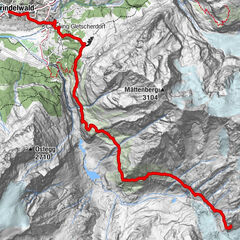
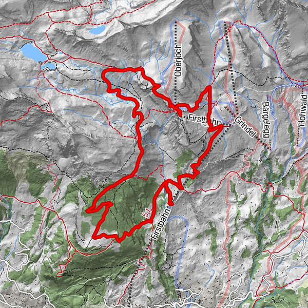
Chuestall0.0 kmBergrestaurant Bort0.0 kmNodhalten2.2 kmBerggasthaus Waldspitz4.8 kmBachlägerwasserfall5.5 kmFirst9.5 kmBort (1,564 m)14.1 kmChuestall14.1 km
- Best season
-
JanFebMarAprMayJunJulAugSepOctNovDec
- Description
-
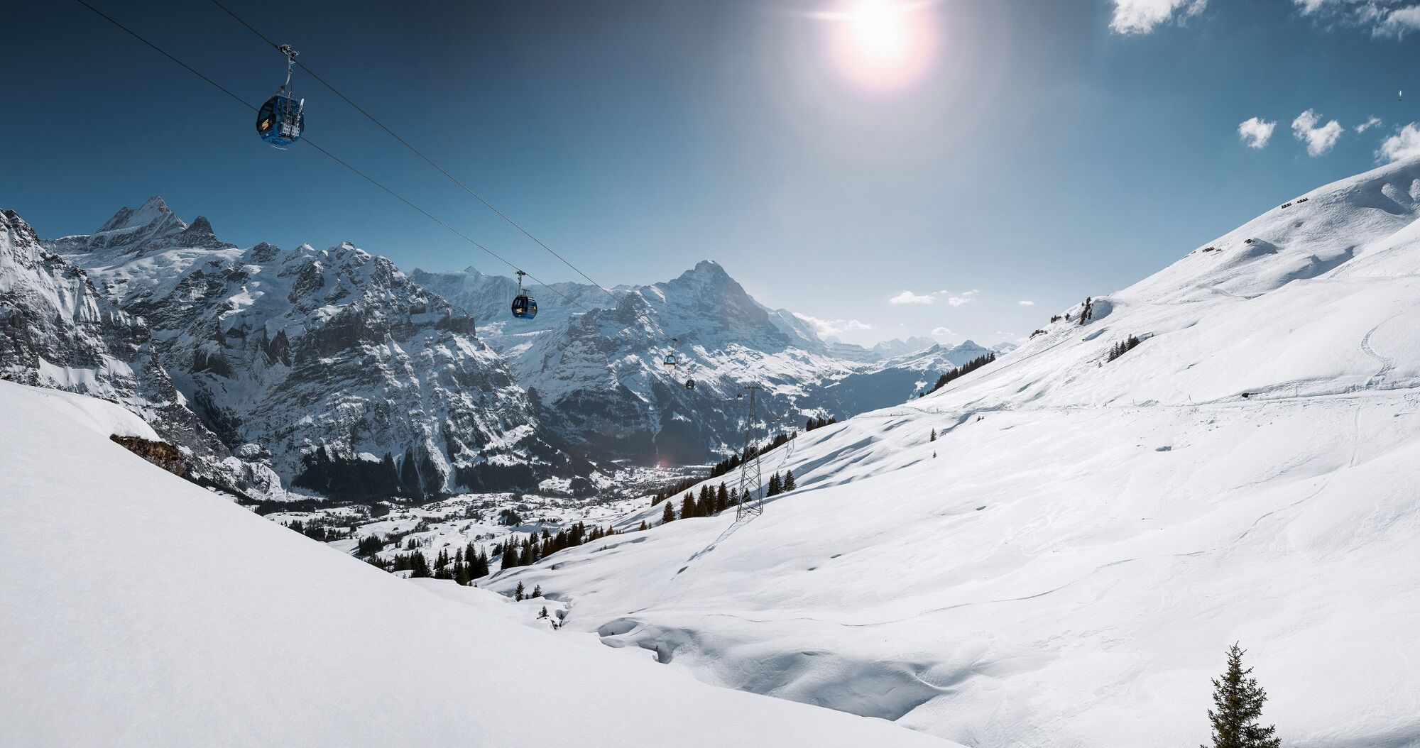
The gondola goes from the bottom station of the First Aerial Cableway up to the Bort station. From there, the signposted sledging trail passes through mostly forests to the Waldspitz mountain inn, where hungry hikers can enjoy a bite to eat on the wonderful sunny terrace. The trail continues on past the snow-covered alpine huts of the Bachläger. After a final ascent, we reach the popular winter hiking trail, which branches off to Lake Bachalp on the left and the First mountain inn on the right. We keep to the right and soon reach the First, where we can relax with a fantastic view of the massive peaks of the Eiger, Schreckhorn and Wetterhorn. Finally, the winter hiking trail and sledging run can be followed down to the Bort station and the gondola taken back to Grindelwald.
- Directions
-
Bort-Waldspitz-First-Schreckfeld-Bort
- Highest point
- 2,272 m
- Endpoint
-
Firstbahn, middle station Bort (1561 asl)
- Height profile
-
 © outdooractive.com
 - Equipment
-
First aid kit
weather-appropriate clothing - Onion principle (always carry waterproofs)
drink and food provisions
mobile phone - Safety instructions
- Tips
-
First Cliff Walk, First & Mountain Restaurant Waldspitz, Adi’s Skibar
- Additional information
- Directions
-
There are different ways to reach the region by car. The fastest way from Basel and Geneva is via Berne. The fastest route from Zurich is through Lucerne and the Brünig Pass. The pass is open in summer and winter.
From the south, the route goes over the Grimsel or Susten Pass into the region. Both passes are only open in summer. Alternatively, you can take the Simplon Pass and then Lötschberg car transport.
- Public transportation
-
Travelling to Grindelwald, take the cable car Grindelwald-First to Bort station.
Thanks to its central location in Europe, Switzerland is served by international trains from over 12 countries. Within Switzerland, Intercity trains run directly from Basel and Lucerne to the Jungfrau Region. Travellers from Zurich have to change in Berne. The trains run every half hour.
Ticket purchase Jungfrau Region
- Parking
-
Grindelwald has public car parks with covered parking spaces: Eiger+ car park (252 parking spaces) and Sportzentrum car park (160 parking spaces). They cannot be reserved in advance. Uncovered parking spaces are available everywhere in the village.


- Author
-
The tour The winter pleasure round on the sunny side W1 is used by outdooractive.com provided.
General info
-
Obwalden
66
-
Jungfrau Region
54
-
Grindelwald - First
40