- Brief description
-
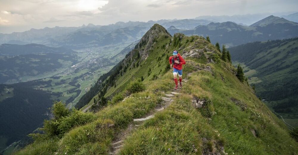
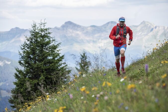
Challenging trail up on the heights of the Lauenen valley.
- Difficulty
-
difficult
- Rating
-
- Starting point
-
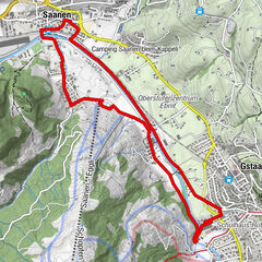
Wispile mountain station, Gstaad
- Route
-
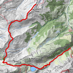
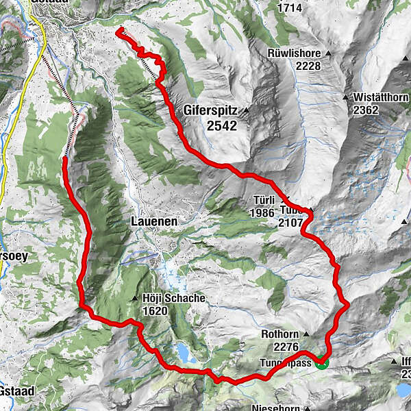
Berghaus Wispile0.0 kmWispile0.3 kmTungelschuss9.2 kmTungelpass13.0 kmStüblenipass (1,992 m)15.5 kmTrütlisbergpass (2,032 m)17.7 kmTube (2,107 m)18.0 kmTürli (1,986 m)18.8 kmTurnelssattel (2,085 m)21.1 kmWandeliflue (2,202 m)22.5 kmStand (2,190 m)23.0 kmEagles Ski Club24.2 km
- Best season
-
JanFebMarAprMayJunJulAugSepOctNovDec
- Description
-
Take the Wispile gondola ropeway and travel up in comfort to the starting point of the route at the mountain station at 1907 m. From the starting point, follow the No. 24 Trail Running signposts to the Lauenensee. The first 4 km are on a slight downward incline along the mountain ridge to Chrinetritt. From there the trail drops steeply to the Chrine Pass where, right away, there are some 100 vertical metres to conquer. Follow the downward sloping mountain trail in the direction of the Lauenensee Nature Reserve.
From the Lauenensee follow the yellow hiking trail signposts in the direction of the Tungel Pass. If you wish, take a refreshing dip in the waters of the Lauenensee before setting off for the most challenging section of the trail. Over the next 4 km the trail climbs from 1385 m to 2094 m. But the natural setting has lots to offer by way of compensation for all these exertions. Then catch your breath at the Stierentungel Bergbeizli mountain inn (check the opening times!) with snacks and refreshments as you gather your thoughts and enjoy the wonderful mountain scenery. From the Tungel Pass it’s on to the Wasserngrat via the Stübleni Pass, Trütlisberg Pass and Turnelssattel. Continue to follow the yellow hiking signposts in the direction of the Wasserngrat mountain station.
At the Turnelssattel there is a rather narrow and exposed ridge that runs north-south, leading to the Wasserngrat mountain station. While the exposed sections of the trail are secured with ropes, you need to have a head for heights and a sure footing. After 3 km along the ridge with its breath taking views you will reach the Wasserngrat mountain restaurant (check the opening times!) where you can enjoy delicious food out on the terrace. If the Wasserngrat ropeway is operating, you may want to dispense with the descent and go for the more relaxing option instead. Here again, please check the operating times. If not, follow the trail as it descends steeply over the final 3 km to the Wasserngrat valley station. From there the PostBus (check the timetable!) will take you back to the village of Gstaad.
This route was compiled together with ALPSinsight and is also to be found on their website.
Tips
Please take note of the operating dates for the cable car Wispile. The trail can be shortened with the chair lift Wasserngrat, please take note of the operating dates for the Wasserngrat chair lift as well.
See also
Gstaad Saanenland Tourismus
Promenade 41
3780 Gstaad/Switzerland
Tel.: +41 (0)33 748 81 81
E- Mail: info@gstaad.chwww.gstaad.ch
- Directions
-
Wispile – Chrinetritt - Chrine - Lauenensee - Tungelpass - Stüblenipass - Trütlisbergpass - Turnelssattel - Wasserngrat - Bissen
- Highest point
- 2,189 m
- Endpoint
-
Talstation Wasserngrat Bahn, Scheidbachstrasse 2, 3780 Gstaad
- Height profile
-
 © outdooractive.com
 - Equipment
-
Good trail running shoes, a couple of trail running poles and a small backpack with food and drinks are recommended.
- Safety instructions
-
Exposed ridge (Turnelssattel-Wasserngrat). This tour is only suitable for sure-footed runners with a good head for heights. In wet weather, fog or snow this route should be avoided.
- Tips
-
Enjoy the view and the delicacies from the mountain restaurants and rustic alpine huts: Wispile mountain restaurant, rustic alpine hut Vordere Wispile, rustic alpine hut Stierentungel, Wasserngrat mountain restaurant
- Additional information
- Arrival
-
The Destination Gstaad is located in the south-west of Switzerland right on the border to the French-speaking part of the country. The region is easily accessed by rail or car from the regions around Lake Thun and Lake Geneva and the Gruyere region Direct connections to the European high-speed rail network and all international airports in Switzerland guarantee a time-saving and pleasant journey.
- Public transportation
-
Gstaad, Wispile
- Parking
-
Parking Unter Gstaad, parking bottom-station Eggli or parking Ober Gstaad
The parking spaces in the villages of Gstaad, Saanen, Schönried and Saanenmöser are managed by the municipality of Saanen or by Bergbahnen Destination Gstaad AG. With a few exceptions, you can use the ParkingPay app to pay parking fees and access free parking (www.parkingpay.ch).

-

-
AuthorThe tour Wispile – Lauenensee – Tungelpass – Wasserngrat is used by outdooractive.com provided.


General info
-
Thyon les Collons
85
-
Destination Gstaad
38
-
Lauenen
21