- Brief description
-
Dieser aussichtsreiche Trail eignet sich ideal für Anfäger oder Einsteiger.
- Difficulty
-
easy
- Rating
-
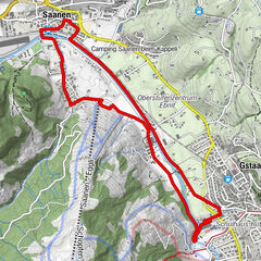
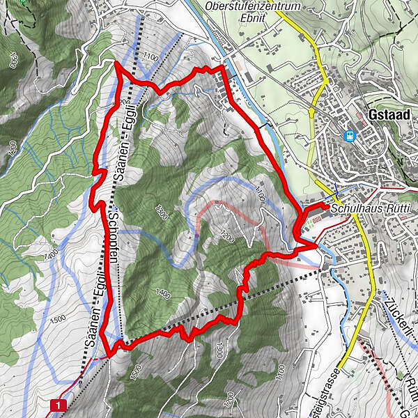
- Starting point
-
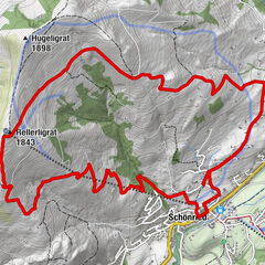
Gstaad, sports centre
- Route
-
Snoasis4.7 kmEggli (1,559 m)4.8 km
- Best season
-
JanFebMarAprMayJunJulAugSepOctNovDec
- Description
-
This route starts right by the sports centre in Gstaad. Follow the Trail Running Gstaad signs. First, behind the sports centre, turn right over the bridge and continue towards Saanen. Shortly after the equestrian centre, turn left as you go up towards Eggli. Following the Saanen-Eggli chair lift, you reach the Eggli mountain station after approx. 4.5 km. Your route back down towards Gstaad starts between the Eggli mountain station and the mountain restaurant
Notes: You can extend this route if you wish. For example, you can walk from the Eggli mountain station via Vorderes Eggli and towards Grund b. Gstaad and then back to the sports centre. The sports centre is about 900 metres from the Gstaad train station. The Eggli mountain restaurant and the Saanen/Gstaad-Eggli mountain railway are closed in summer.
See also
Gstaad Saanenland Tourismus
Haus des Gastes
Promenade 41
3780 Gstaad/Switzerland
Tel.: +41 (0)33 748 81 81
E- Mail: info@gstaad.ch
www.gstaad.ch - Highest point
- 1,552 m
- Endpoint
-
Gstaad, Sportzentrum
- Height profile
-
 © outdooractive.com
 - Safety instructions
-
There may be cattle or people with dogs along the way.
- Tips
-
After the run enjoy a swim in the sport centre Gstaad.
- Directions
-
The Destination Gstaad is located in the south-west of Switzerland right on the border to the French-speaking part of the country. The region is easily accessed by rail or car from the regions around Lake Thun and Lake Geneva and the Gruyere region Direct connections to the European high-speed rail network and all international airports in Switzerland guarantee a time-saving and pleasant journey.
By Car
From the Berne region (Western and Northern Switzerland): A6 Berne-Spiez motorway: Wimmis exit. Follow the main road (Simmental valley) to Boltigen-Zweisimmen - Saanen-GstaadFrom the Central Switzerland region: Lucerne-Brünigpass-Brienzwiler: A8 motorway to Interlaken: Follow the main road to Spiez: A6 motorway to Wimmis. Follow the main road (Simmental valley) to Boltigen-Zweisimmen - Saanen-GstaadFrom the Valais region: A9 Sierre - Lausanne motorway: Aigle exit. Follow the main road to Col du Pillon-Gsteig-Gstaad From the Lausanne region (Western Switzerland): A9/A12 Lausanne-Vevey-Berne motorway: Bulle exit. Follow the main road to Château d'Oex-Saanen-Gstaad

-

-
AuthorThe tour Gstaad - Rübeldorf - Eggli - Gstaad (Nr. 23) is used by outdooractive.com provided.


General info
-
Thyon les Collons
94
-
Destination Gstaad
47
-
Saanen
15