


- Rating
-
- Starting point
-
Grindelwald, aerial cableway First summit station
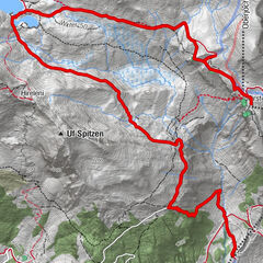
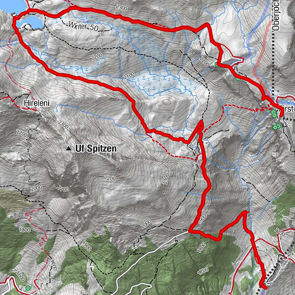
- Route
-
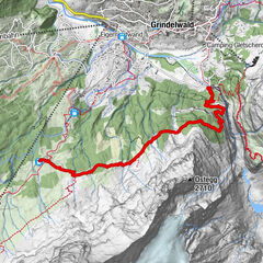
First0.0 kmBachlägerwasserfall5.9 kmBerggasthaus Waldspitz6.5 kmBort (1,564 m)7.9 kmChuestall8.0 kmBergrestaurant Bort8.0 km
- Best season
-
JanFebMarAprMayJunJulAugSepOctNovDec
- Description
-
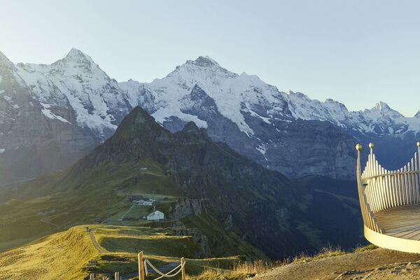
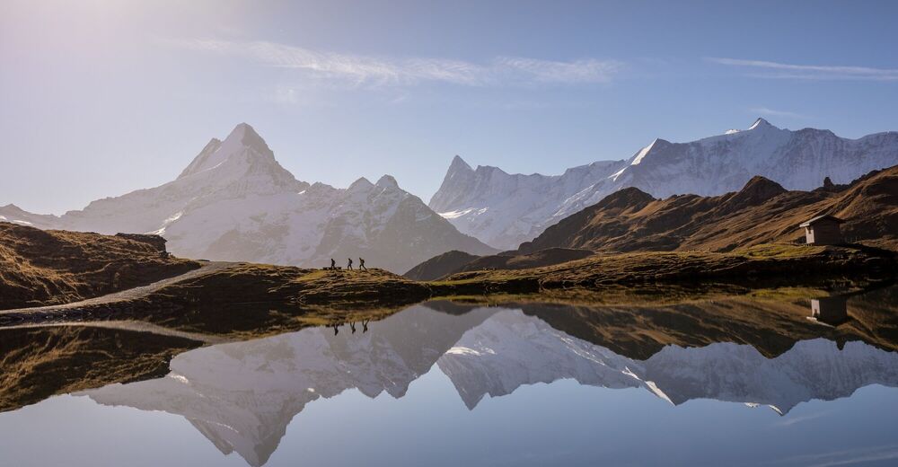
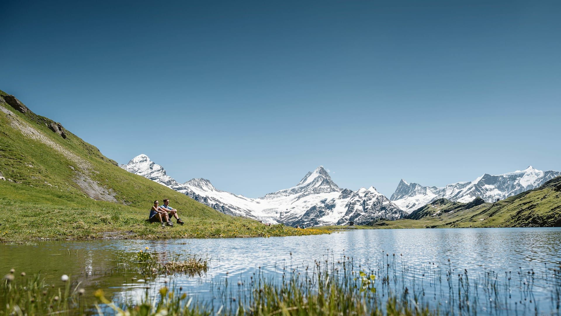
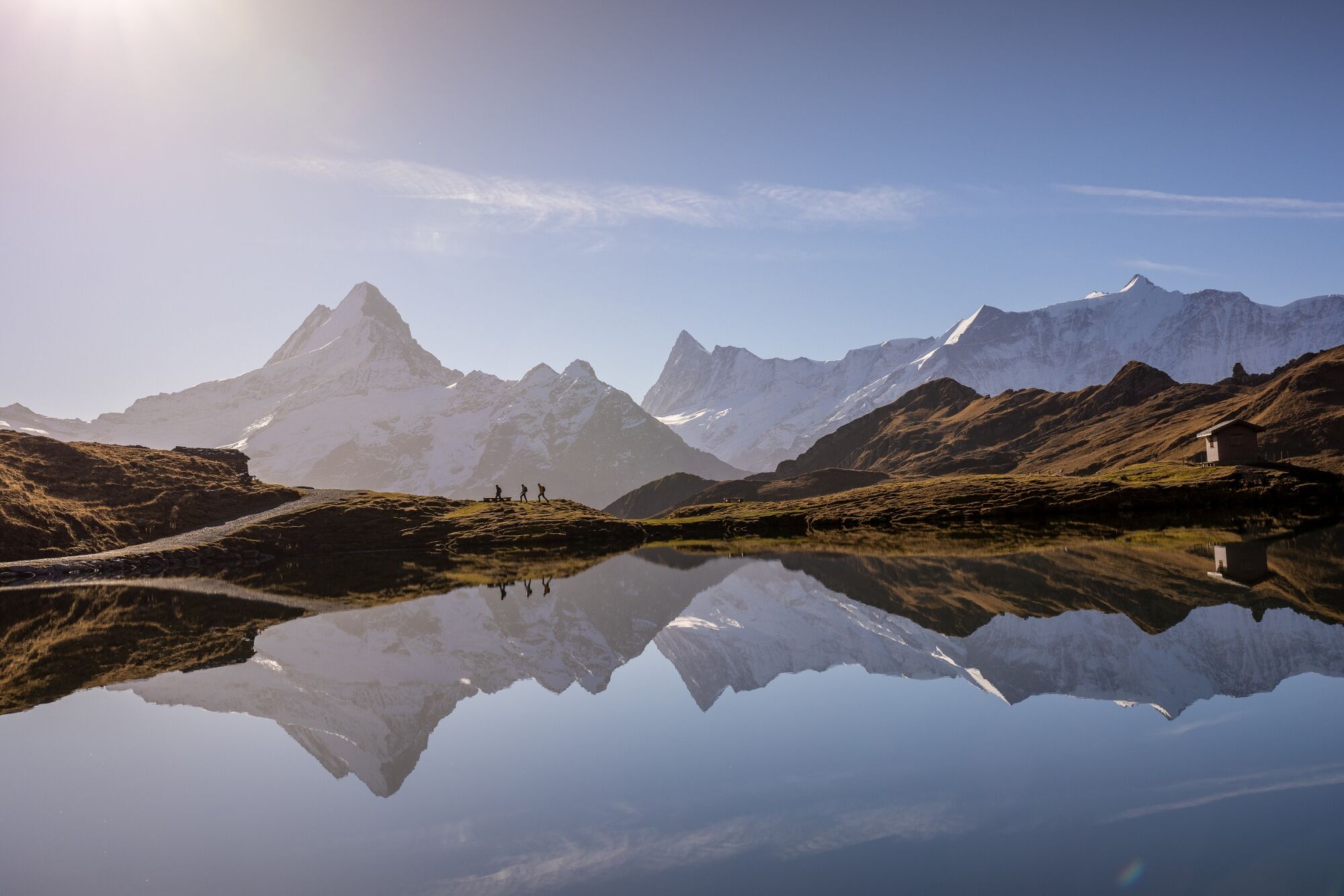
You can get from Grindelwald to First with the First Aerial Cableway. During the ride in the gondola, hikers can enjoy a unique view of the Grindelwald Glacier and the Eiger North Face on the opposite side of the valley. Once you arrive at 2168 metres above sea level, the trail begins right next to the summit station. Diverse alpine flora borders the wayside. Gentian, thistles, blue vervain, leopard's bane, cotton grass and mountain anemones are just a few flowers and herbs that can be discovered using the detailed signs. After a roughly fifty minute, gently rising walk you reach Lake Bachalpsee. The unique view of the Schreckhorn and the Finstaarhorn, the highest mountain in the Bernese Alps, is breathtaking. Shortly before Lake Bachalpsee, the flower trail continues towards Bachläger and Waldspitz. Babbling brooks are all around you. From Bachläger, the walk takes approximately 20 more minutes before you arrive in Waldspitz. Below the restaurant, the path turns into the woods and winds sometimes quite steeply through the forest and small high moorland. After another 40 minutes, you arrive at the Bort middle station of the First Aerial Cableway. If you have had enough of walking, you can grab a trottibike scooter and whizz to Grindelwald or ride down on the First Aerial Cableway.
- Directions
-
First - Bachalpsee - Waldspitz - Bort
- Highest point
- 2,277 m
- Endpoint
-
Firstbahn, Mittelstation Bort
- Height profile
-
 © outdooractive.com
 - Equipment
-
Normal hiking equipment, hiking boots with good treads, hiking poles an advantage on downhill sections.
- Safety instructions
-
Mountain trail without exposed passages, steeper section on the descent from Waldspitz to Bort.
- Tips
-
Flower trail: approx. 60 flower species are marked with signs.
- Additional information
-
Hike 4
(in the printed summer panoramic map of the Jungfrau Railways) - Directions
-
Via Bern or Lucerne to Interlaken. Or from the south, via the Grimsel Pass (summer only) or the Simplon Pass and the Lötschberg car-transport train to Interlaken. Then follow the signs to Grindelwald.
- Public transportation
-
Via Bern or Lucerne to Interlaken Ost. Change to the Bernese Oberland Railway to Grindelwald. With the First Aerial Cableway from the valley station in the upper village centre in three sections to Grindelwald-First. Journey time from Grindelwald: approximately 25 minutes.
- Parking
-
In Grindelwald there are two public car parks with covered spaces to choose from: Eiger+ multi-storey car park (252 spaces) and Sportzentrum multi-storey car park (160 spaces). Uncovered parking spaces are available throughout the village.


- Author
-
The tour First - Bachalpsee - Waldspitz - Bort | Blumenweg is used by outdooractive.com provided.


General info
-
Obwalden
2014
-
Jungfrau Region
1007
-
Grindelwald - First
396