

- Rating
-
- Starting point
-
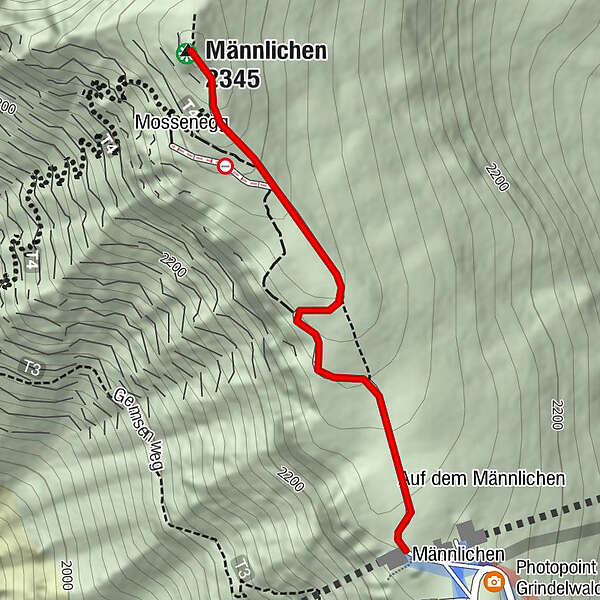
Männlichen, cable car summit station Wengen-Männlichen or Grindelwald-Männlichen
- Route
-
Mossenegg0.5 kmMännlichen (2,345 m)0.6 kmMännlichen (2,230 m)1.4 km
- Best season
-
JanFebMarAprMayJunJulAugSepOctNovDec
- Description
-
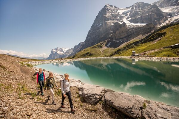
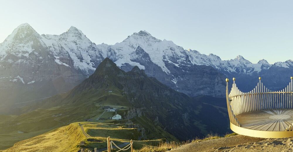
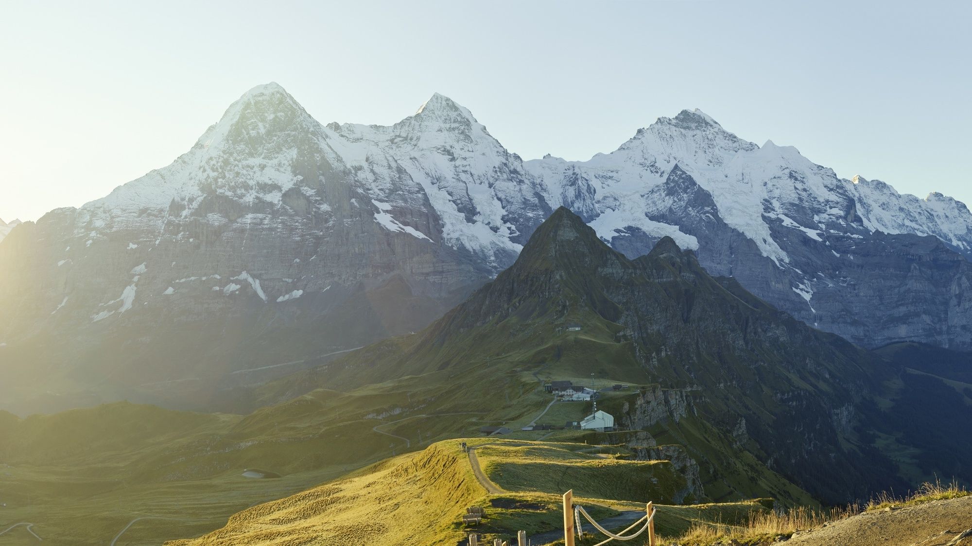
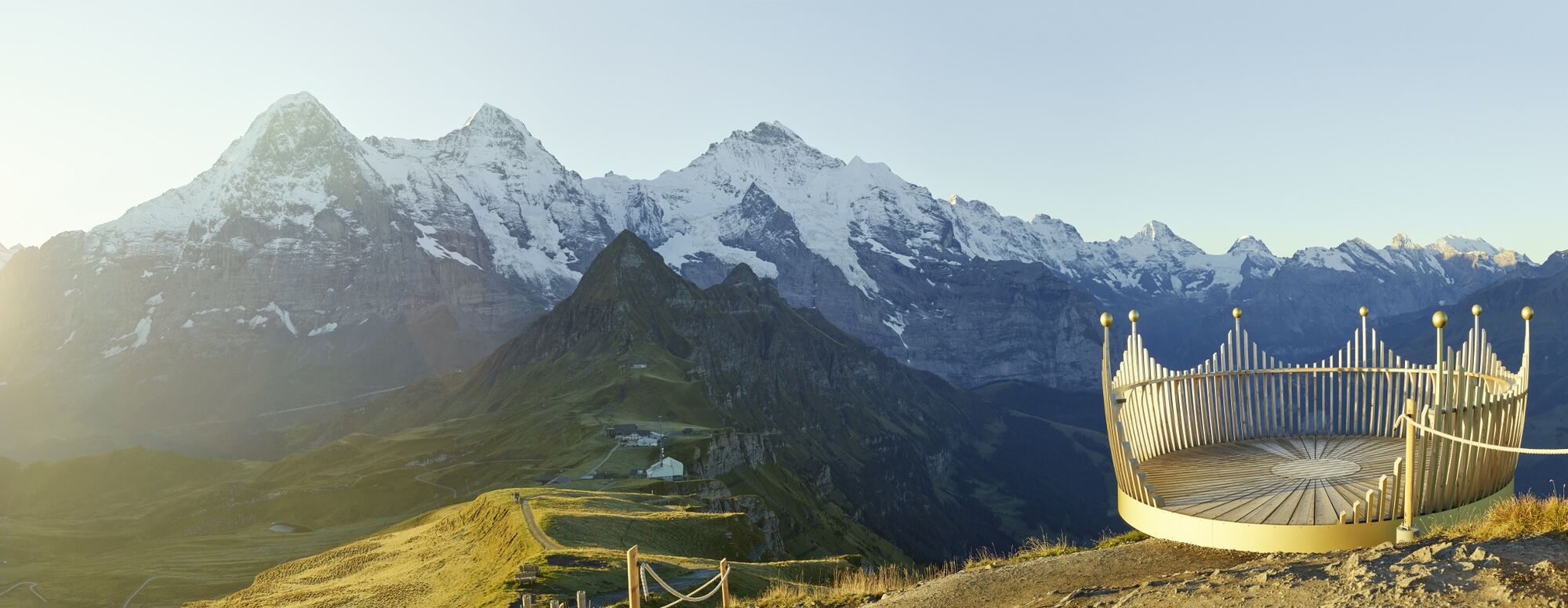
Männlichen has two completely different faces. From the Grindelwald valley, the mountain appears as a gentle, green slope. In summer large numbers of cows graze on the succulent alpine pastures, in winter skiers and snowboarders curve elegantly down the wide pistes. When seen from the Lauterbrunnen side, the Männlichen appears very different. Its west flank is as unsuitable for alpine farming as it is for winter sport. Here barren grassy slopes and craggy rock formations fall steeply away to the valley. The actual Männlichen summit is above the top stations of the two aerial cableways that link the mountain with Grindelwald and Wengen. The ultimate vantage point: The good mountain trail climbs northwards to the summit. The detour is well worthwhile as the views are impressive and rich in contrast. With the Eiger, Mönch & Jungfrau constantly in sight, on one side views extend down to Grindelwald's wide valley floor, bordered to the east by the rock bastions of the Wetterhorn and Mättenberg. On the other, the views deep down into the Lauterbrunnen valley are spectacular. In the distance Lake Thun, the Niederhorn and the Schrattenfluh. This is the place where mountain dreams really do come true.
- Directions
-
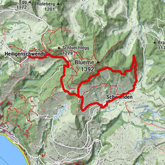
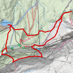
Männlichen - Männlichengipfel - Männlichen
- Highest point
- 2,329 m
- Endpoint
-
Männlichen, Bergstation Luftseilbahn Wengen-Männlichen bzw. Grindelwald-Männlichen
- Height profile
-
 © outdooractive.com
 - Equipment
-
Normal hiking gear.
- Safety instructions
-
Mountain trail without exposed sections.
- Tips
-
The trail is groomed in winter and can be used during the operation time of the cable cars.
- Additional information
-
Hike 47
(in the printed summer panoramic map of the Jungfrau Railways) - Directions
-
Via Bern or Lucerne to Interlaken. Or from the south, via the Grimsel Pass (summer only) or the Simplon Pass and the Lötschberg car-transport train to Interlaken. Then follow the signs to Lauterbrunnen or Grindelwald.
- Public transportation
-
Via Bern or Lucerne to Interlaken Ost. Change to the Bernese Oberland Railway to Lauterbrunnen. Change to the Wengernalp Railway to Wengen. From there, take the Wengen-Männlichen aerial cableway to the starting point of the hike, the summit station of the aerial cableway.
- Parking
-
Grindelwald
There are three public car parks: Eiger+ multi-storey car park (252 spaces), Sports Centre multi-storey car park (160 spaces) and Grindelwald Terminal Parking (1,000 spaces). Alternatively, you can also use the car park at Grindelwald Grund.Lauterbrunnen
Lauterbrunnen multi-storey car park directly at the railway station or the uncovered car park by the church.
- Author
-
The tour Männlichen - Männlichengipfel - Männlichen | Royal Walk is used by outdooractive.com provided.


General info
-
Aletsch Arena
1489
-
Jungfrau Region
1027
-
Wengen
489