- Brief description
-
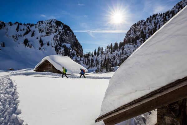
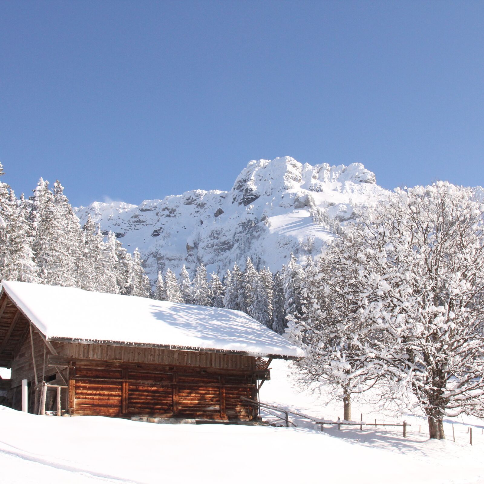
Die Region um Sigriswil und dem stattlichen Sigriswiler Rothorn ist im Sommer ein beliebtes Wandergebiet. Die sonnige Lage ob dem Thunersee und das ausgezeichnete Panorama locken auch im Winter Wanderbegeisterte an. Bei wenig Schnee sind kurze Spaziergänge zur Wilerallmi oder Richtung Margel möglich. Wenn genügend Schnee liegt, bieten sich mit dem Dünzenegg Trail oder dem Rüeggers Trail wunderbare signalisierte Schneeschuhtrails an.
- Difficulty
-
medium
- Rating
-
- Route
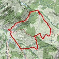
-
SchwandenSchwanden4.9 km
- Best season
-
AugSepOctNovDecJanFebMarAprMayJunJul
- Description
-
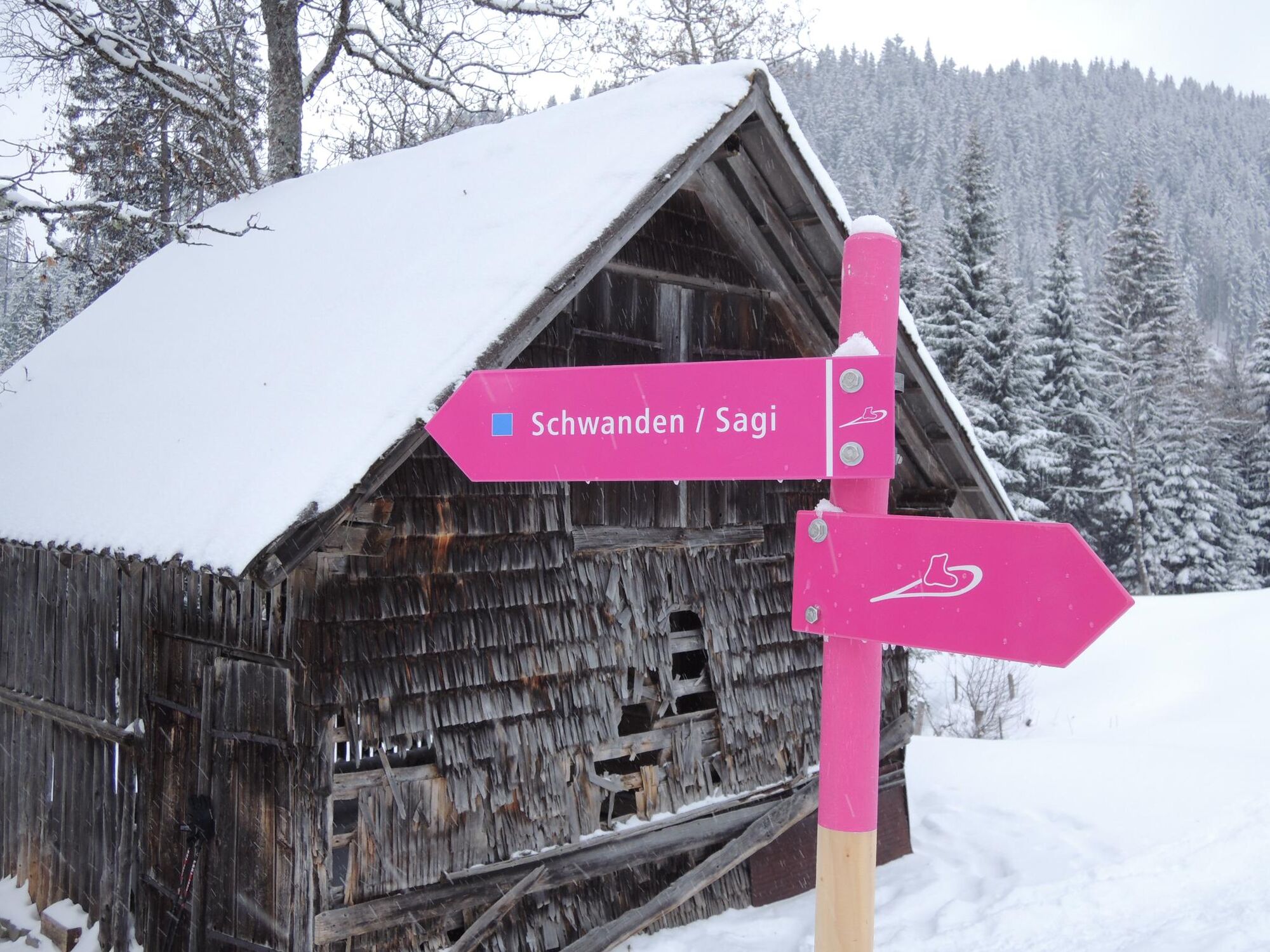
Both snowshoe trails start just after the bus stop “Schwanden Säge”. The trails follow the summer hiking trail until you reach the water reservoir. From here you slowly climb through forests and meadows, past the “Zenggisboden” to the “Stampfhut”. At this point a breathtaking view of the Lake of Thun and the Bernese Alps await you.
The easier route, “Rüeggers Trail” (blue) follows the same trail for the first 1.8 km. When you reach “Untere Matte” it turns left and from there you go to “Rüeggershütte”. Afterwards it will lead you back into the “Dunzenegg Trail”.
- Highest point
- 1,324 m
- Endpoint
-
Schwanden (Sigriswil) Säge
- Height profile
-
 © outdooractive.com
 - Safety instructions
-
Use the trails at your own risk!
The time needed for the routes can vary, depending on the amount and texture of the snow, the condition of the trails, and the physical fitness of the hiker. An approximate time of 2 to 3 hours would be appropriate.
Level of difficulty blue (easy): Suitable for beginners. Simple terrain during ascent and descent, no difficulties such as high crossings or steep passages. Possible dangerous sections have been secured appropriately. No special prior knowledge is necessary.


-

-
AuthorThe tour Rüeggers Trail - Sigriswil (signalisiert) is used by outdooractive.com provided.
GPS Downloads


Other tours in the regions
-
Obwalden
122
-
Eriztal
52
-
Sigriswil und Gunten
13