- Difficulty
-
medium
- Rating
-
- Starting point
-
Sunnbüel mountain station
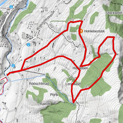
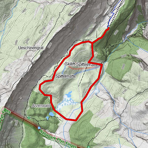
- Route
-
Altelshütte0.2 kmAltelshütte4.6 kmSunnbüel4.9 km
- Best season
-
AugSepOctNovDecJanFebMarAprMayJunJul
- Description
-
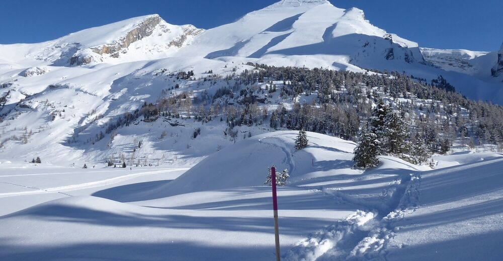
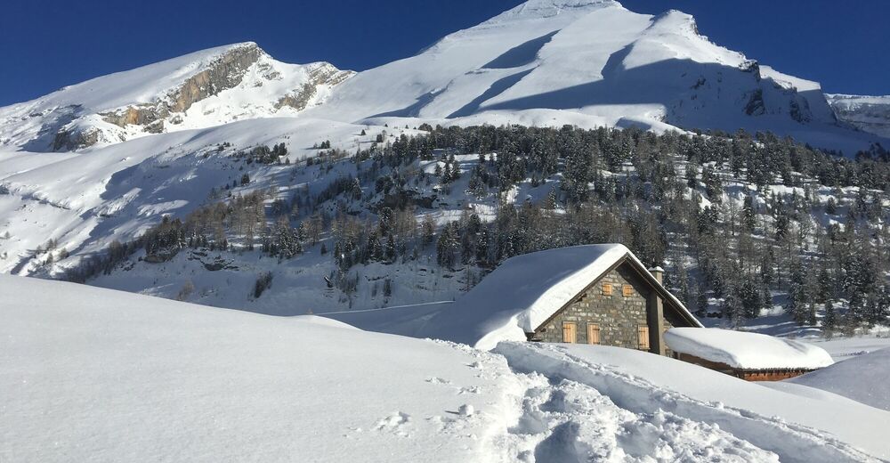
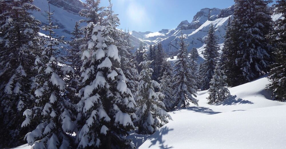
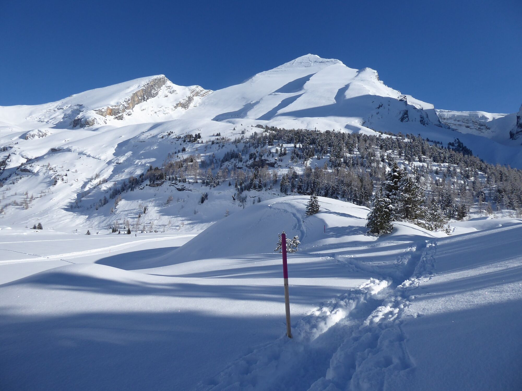
Snowshoe hike in the magnificent mountain world on Sunnbüel.
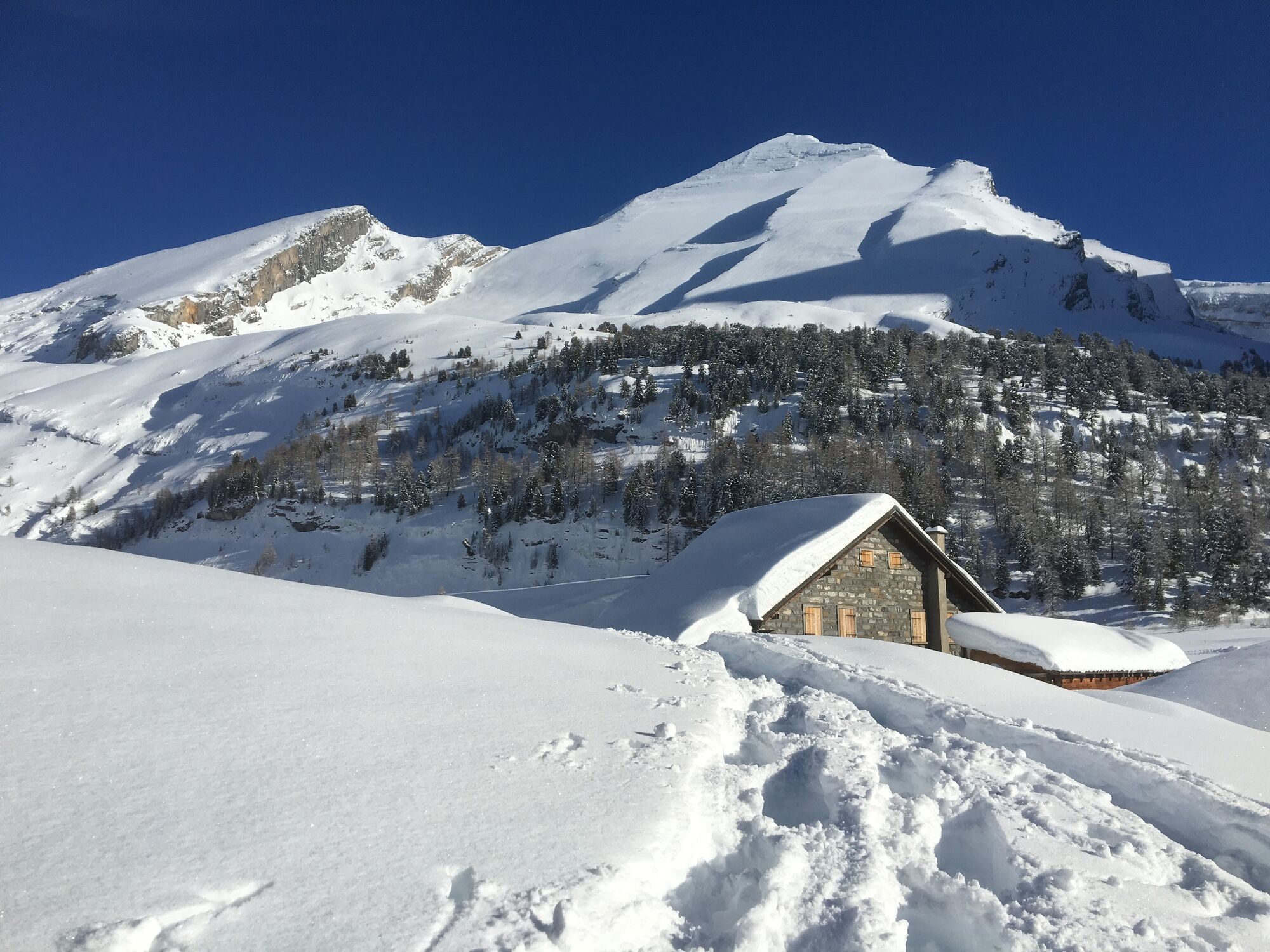
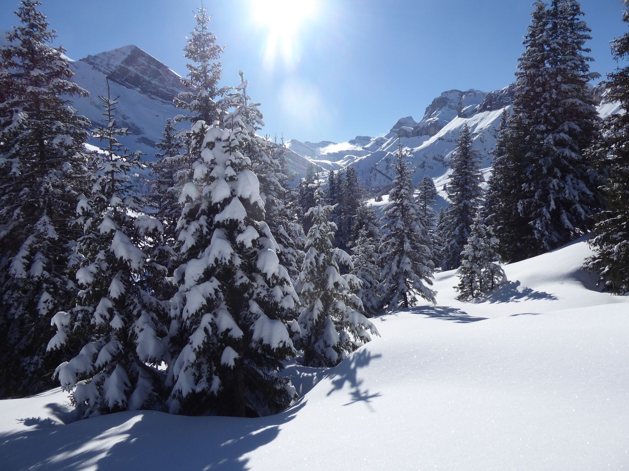
From the Sunnbüel mountain station, the trail leads southwards along the foot of the Üschinengrat slope. In good weather you have a wonderful view of the neighbouring 3000-metre peaks of Altels and Rinderhorn. In the Spittelmatte area, a short descent leads to an alpine hut that invites you to linger. The way back across the plateau leads past the cross-country ski trail and the winter hiking trail which leads via Schwarrenbach to the Gemmi Pass.
- Highest point
- 1,961 m
- Endpoint
-
Sunnbüel mountain station
- Height profile
-
 © outdooractive.com
 - Equipment
-
From telescopic poles to avalanche shovels - well prepared, you're better off heading for the trail. Professional snowshoe equipment can also be rented in various sports shops in the destination.
- Safety instructions
-
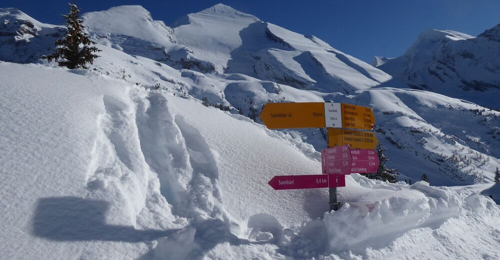
The signposts of winter hiking trails are pink. The intermediate markers are poles and have a pink tip.
Winter hiking trails can usually be walked on without danger. In case of icing, be aware of the danger of slipping.
Walking is at your own risk: Tourism Adelboden-Lenk-Kandersteg accepts no liability whatsoever when using local routes.
- Tips
-
2 or 8 kilometres, across the plateau or the valley floor: The choice of winter hiking trails is large in Adelboden-Lenk-Kandersteg. Even experienced outdoor walkers will still find enough new territory to explore.
- Arrival
- Public transportation
-
To the south the Lötschberg, to the north the Kandertal: for this station between Brig (38 min.) and Bern (61 min.) there is an hourly service - an ideal base for many excursions.
The AFA bus runs every hour within 10 minutes from Kandersteg station to the valley station of the cable car. The gondola then takes you comfortably up to 1936 metres above sea level.
- Parking

-

-
AuthorThe tour Snowshoe trail Sunnbüel - Spittelmatte is used by outdooractive.com provided.