- Brief description
-
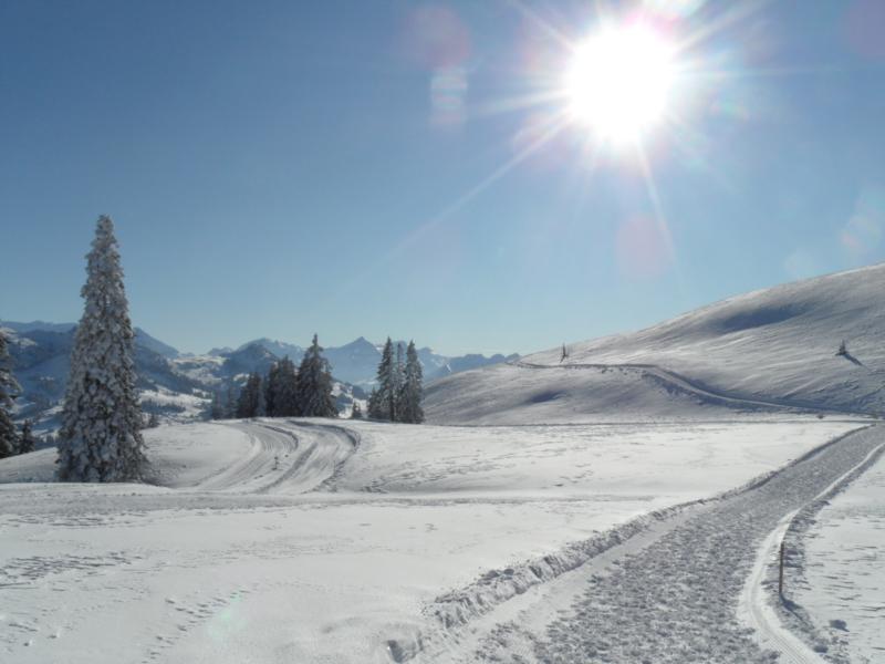
The signposted "Nüjeberg Trail" is a little more challenging and requires some stamina. Once you reach the highest point, you are sure to be suitably rewarded. Let yourself be surprised!
- Difficulty
-
medium
- Rating
-
- Starting point
-
Sparenmoos, DAO Sparenmoos
- Route
-
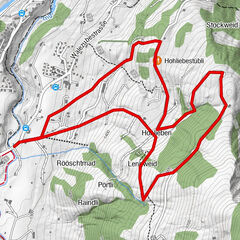
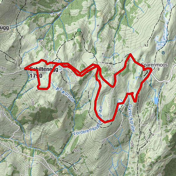
Schiltenegg (1,790 m)3.8 kmSparenmoos6.7 km
- Best season
-
AugSepOctNovDecJanFebMarAprMayJunJul
- Description
-
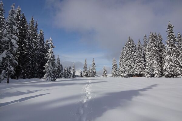
The Nüjeberg Trail starts at the DAO Sparenmoos seminar centre. For the first 600 metres, the trail follows the winter hiking trail westwards towards Hüsliberg. After a great vantage point, the trail turns off the hiking trail and climbs gently up to the highest point of the Hüsliberg. The views of the Obersimmental and Saanenland are already marvellous here. The trail then leads through a hollow over to the Nüjeberg. Passing the snow-covered alp, you climb up to point 1757, where you are again greeted by a marvellous view. But it gets even better. Towards Hundsrügg, the trail crosses the cross-country ski trail and the winter hiking trail. The trail then climbs up to the highest Hubel in the uf de Huble area. More views are not possible on this trail. Mittagflue, Stockhorn, Niderhorn, Spillgerten, Albrist, Wildstrubel, Wildhorn, Giferspitz, Rubli etc. are all lined up around us.
Now it's back over the Nüjeberg ridge to Sparenmoos. On the way back, we alternate between open terrain and some wonderful forest sections. Shortly before Tolmoos, we cross a small ditch. From Tolmoos, the trail leads along the winter hiking trail, past the Fuchsbau (barbecue area with hut), back to Sparenmoos.
The trail is also highly recommended in the opposite direction!
- Directions
-
Sparenmoos - Hüsliberg - Schiltenegg - Sparenmoos
- Highest point
- 1,782 m
- Endpoint
-
Sparenmoos, DAO Sparenmoos
- Height profile
-
 © outdooractive.com
 - Safety instructions
-
This tour is signposted, but not prepared.
Plan every snowshoe tour carefully and adapt to participants’ fitness level as well as the weather and season.
Weather conditions can change quickly in the mountains. Appropriate clothing is therefore essential, along with adequate supplies of food and water. In uncertain weather, turn back in good time.
Inform others of planned route, and whenever possible avoid going alone.
Please be considerate to other walkers and to plants and animals.
- Additional information
- Directions
-
The Destination Gstaad is located in the south-west of Switzerland right on the border to the French-speaking part of the country. The Destination is easily accessed by rail or car from the regions around Lake Thun and Lake Geneva and the Gruyere region Direct connections to the European high-speed rail network and all international airports in Switzerland guarantee a time-saving and pleasant journey. The main means of transport in the destination of Gstaad are the "MOB" (Montreux-Oberland Bernois) train and numerous post bus lines.
- Public transportation
- Parking
-
Parking Sparenmoos
Attention!
From Heimchueweid: One way road drivable with snow chains or 4x4.
Way up: xx:30 - xx:45
Way down: xx:00 - xx:15
Due to the limited number of parking spaces, we recommend parking at the train station in Zweisimmen and then taking the bus.

-

-
AuthorThe tour Nüjeberg Trail is used by outdooractive.com provided.


-
Alpes Vaudoises
58
-
Lenk-Simmental
78
-
Saanenmöser
28