
- Brief description
-
As the name suggests, the 64 kilometres of this e-bike route are legendary. Sometimes dwarves cross your path, sometimes mysterious horsemen, sometimes you ride through fairytale forests, sometimes you cross mystical gorges. Enjoy the fantastic regional products in farm and village shops, stop off at legendary country inns or spend the night under the stars.
- Difficulty
-
medium
- Rating
-
- Route
-
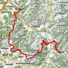
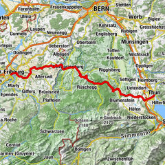
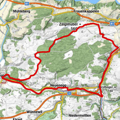
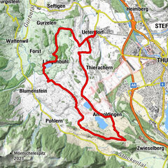
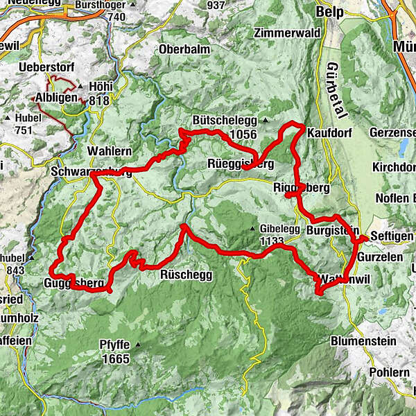
Burgistein (567 m)0.1 kmWattenwil (603 m)3.0 kmKirche Wattenwil3.3 kmRüti bei Riggisberg9.4 kmRüti9.9 kmUntere Rüti10.6 kmLaueli11.0 kmGasthof Bären14.2 kmRüschegg-Graben14.4 kmReformierte Kirche16.7 kmRüschegg Gambach18.1 kmKappelen23.0 kmRiffenmatt23.3 kmGasthof Löwen Riffenmatt23.4 kmGuggisberg (1,115 m)25.6 kmKalchstätten27.6 kmRiedstätt29.0 kmChäppeli34.2 kmSchwarzenburg (792 m)34.3 kmSchwarzenburg (792 m)34.4 kmSchönentanne36.0 kmSchönentanne36.3 kmBrünnen36.8 kmElisried37.0 kmHinterfultigen42.6 kmRestaurant Linde42.7 kmVorderfultigen44.5 kmAussicht auf Berner Oberland47.8 kmVIVA Bistro + Bar mit Konfiserie47.8 kmRüeggisberg (930 m)48.4 kmGofers49.3 kmSternen51.9 kmHasli55.0 kmRestaurant Rössli55.2 kmAussicht auf Berner Alpen56.1 kmRiggisberg (762 m)56.5 kmBistro Bosphorus57.0 kmRestaurant Brunnen57.6 kmGasse61.3 kmBungertli61.4 kmAebnit61.7 kmRothmettlen62.5 kmBurgiwil62.5 kmBurgiwil62.8 kmAlthaus63.2 kmBurgistein (567 m)64.1 km
- Best season
-
JanFebMarAprMayJunJulAugSepOctNovDec
- Description
-
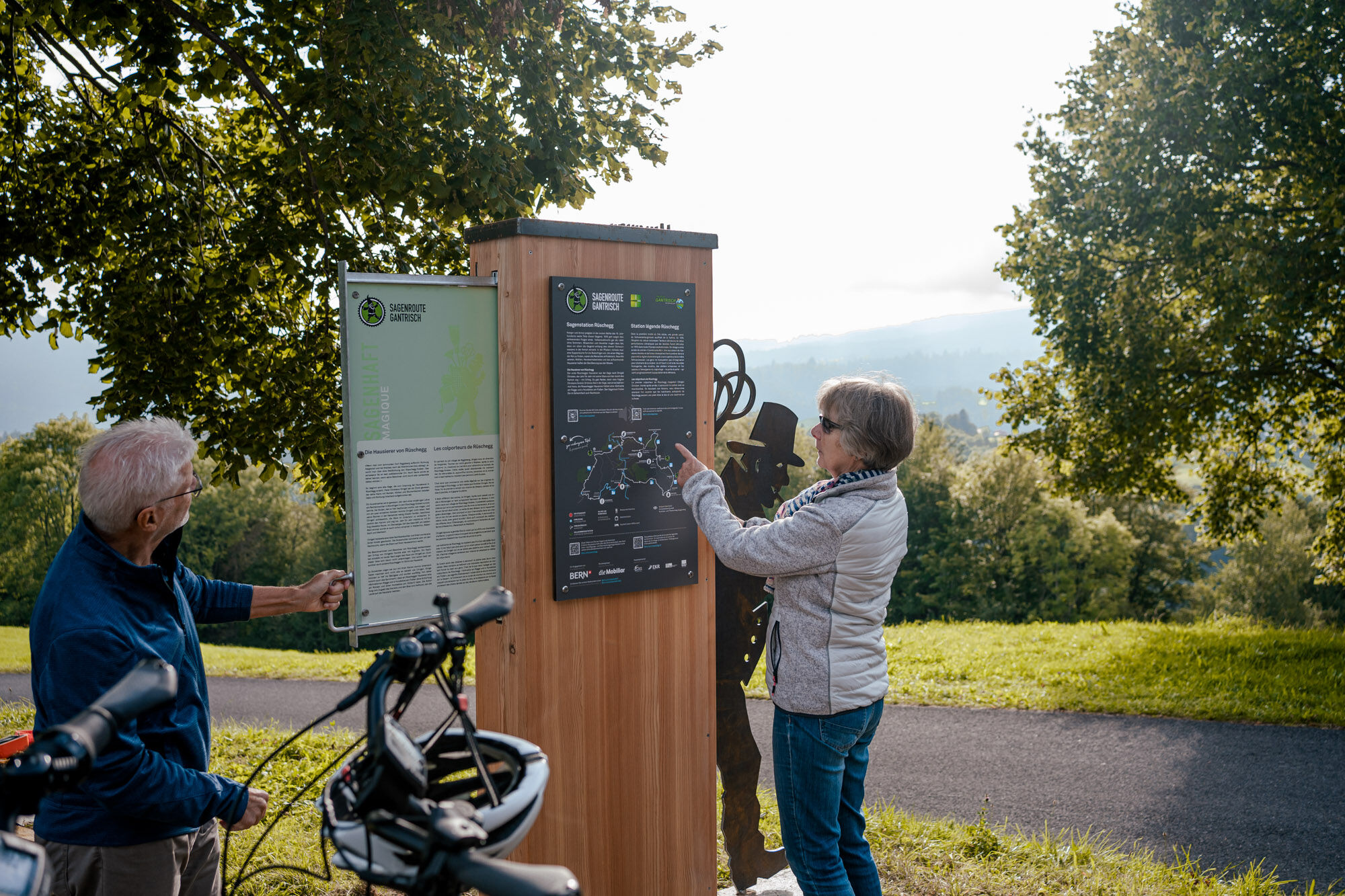
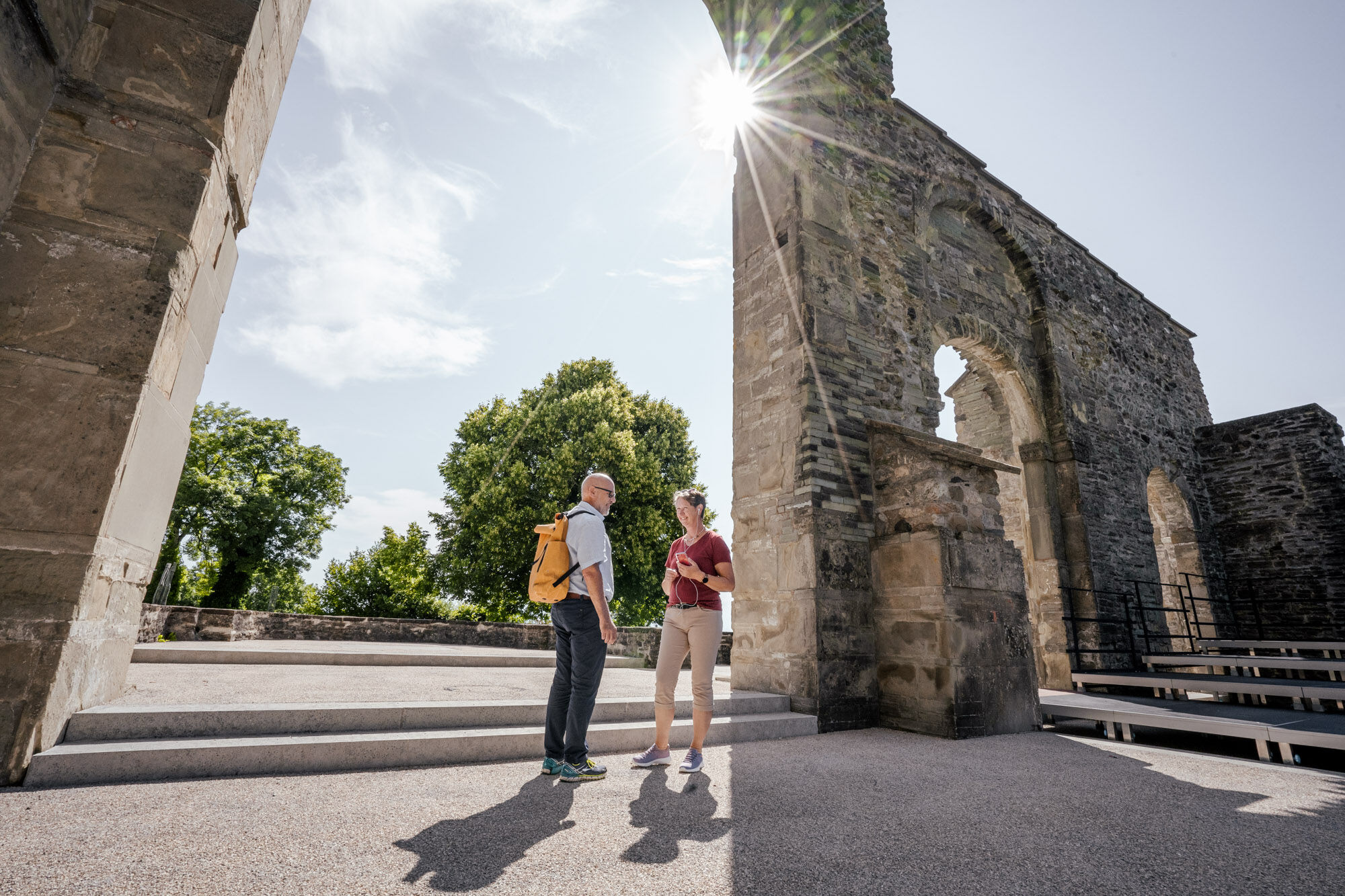
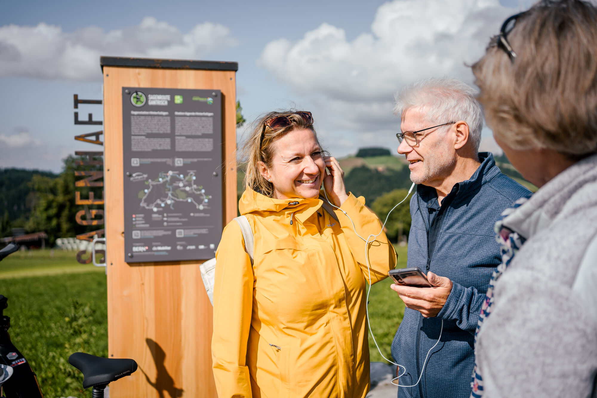
The history of the Gantrisch region is not only shaped by its geography and its inhabitants. Over the centuries, natural disasters, crop failures, famines and social structures have shaped the character of this now extremely fertile region. In their distress, people repeatedly sought answers and comfort from the spirits of nature, which explains the wealth of legends in the Gantrisch region. Discover the six legend stations on your e-bike route - and get to know the history of the land and people of the Gantrisch Nature Park with all your senses.
- Directions
-
Discover the legend of "Chatz u Muus" from Burgistein
Starting and finishing points with connections to public transport as well as e-bike rental options are in Burgistein, Riggisberg or Schwarzenburg. For example, start the e-bike tour at the welcome point at Burgistein railway station. From here, the Veloland Route 74 leads to Wattenwil, where the first adventure spot is already located. Who knows why the rock formation on the Walalp ridge above Wattenwil is still called "Chatz u Muus" today? The legend of the same name answers this question, simply scan the QR code with your smartphone and listen to the legend on site or read it thanks to the plaque in the secret compartment on site.
Of peddlers and dwarf secrets
Now it's uphill on Veloland Route 4 to the scenic adventure spot in Rüschegg. The church can be seen from afar, and here those with a thirst for knowledge can hear or read the story of what is said to be the first pedlar in this region. Continue leisurely on your e-bike along Veloland Route 37 towards Riffenmatt. Here, at the adventure spot in the Riffenmatt car park, a view of the Horbühl Pass with its dense and mysterious forests opens up. Legend has it that many years ago the villagers captured two dwarfs to uncover their secret.
Through the impressive Rossgraben to Hinterfultigen
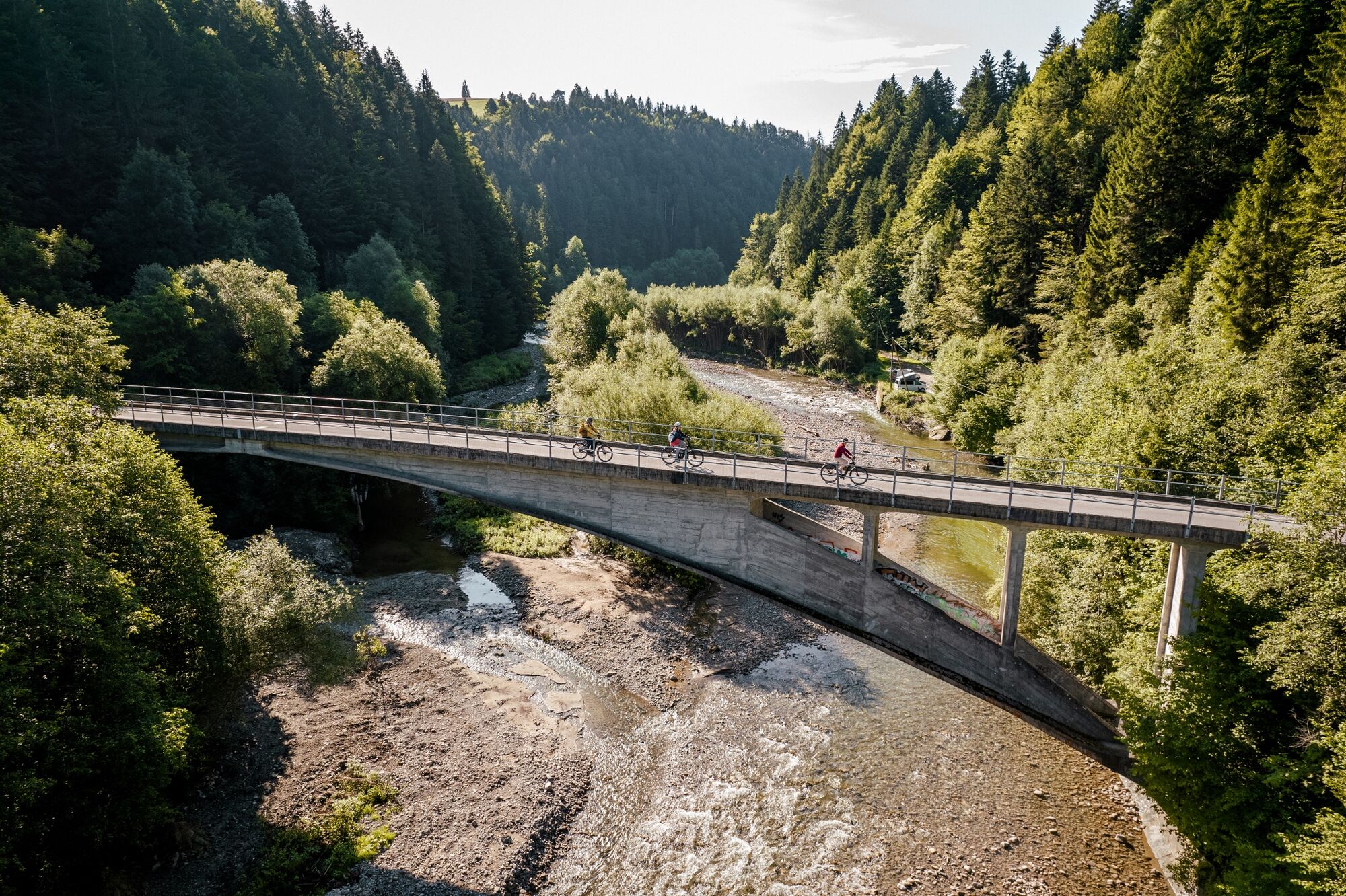
In Kalchstätten, the route from Veloland Route 37 now continues on Route 62 towards Schwarzenburg. After a restorative descent, an impressive stretch now follows through the Rossgraben, up over the well-known Maillart bridges, to Hinterfultigen. Fortunately, it is pleasantly cool in the forest, past sandstone. Once you reach the top, it's time to rest. It was here, in Hinterfultigen, that the legend of the burning man originated, which is still thought-provoking today.
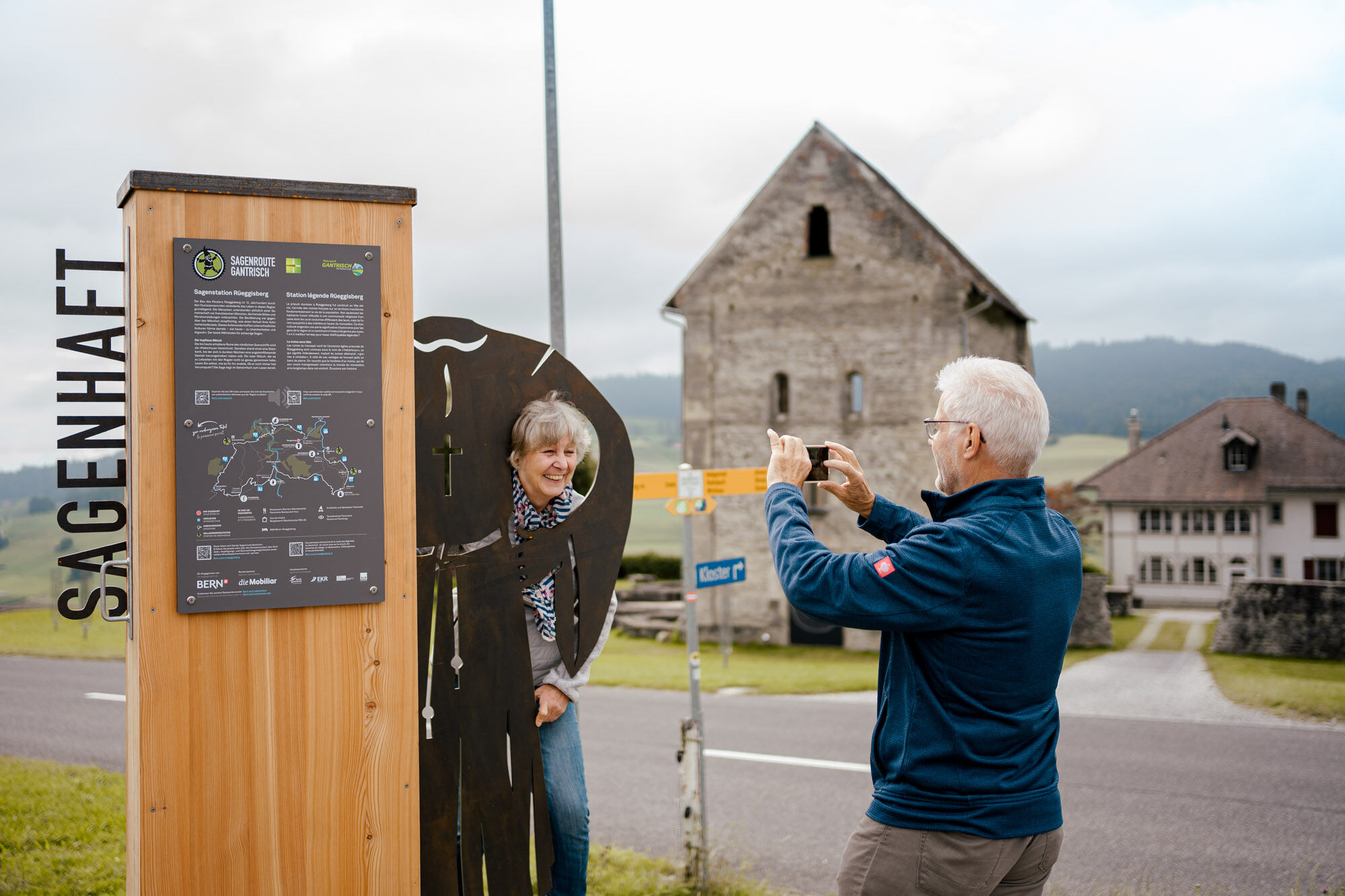
From Rüeggisberg Monastery to Riggisberg Castle
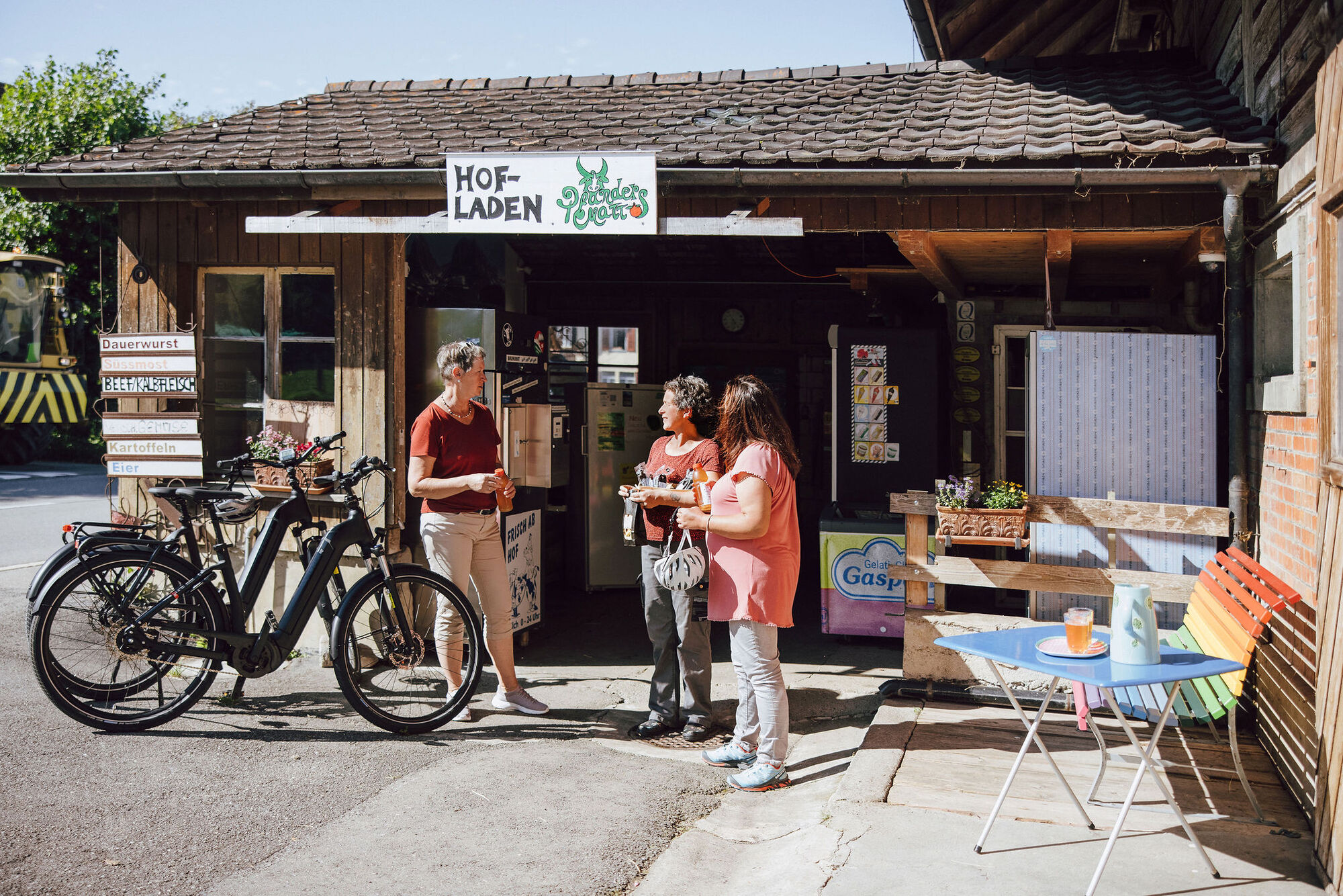
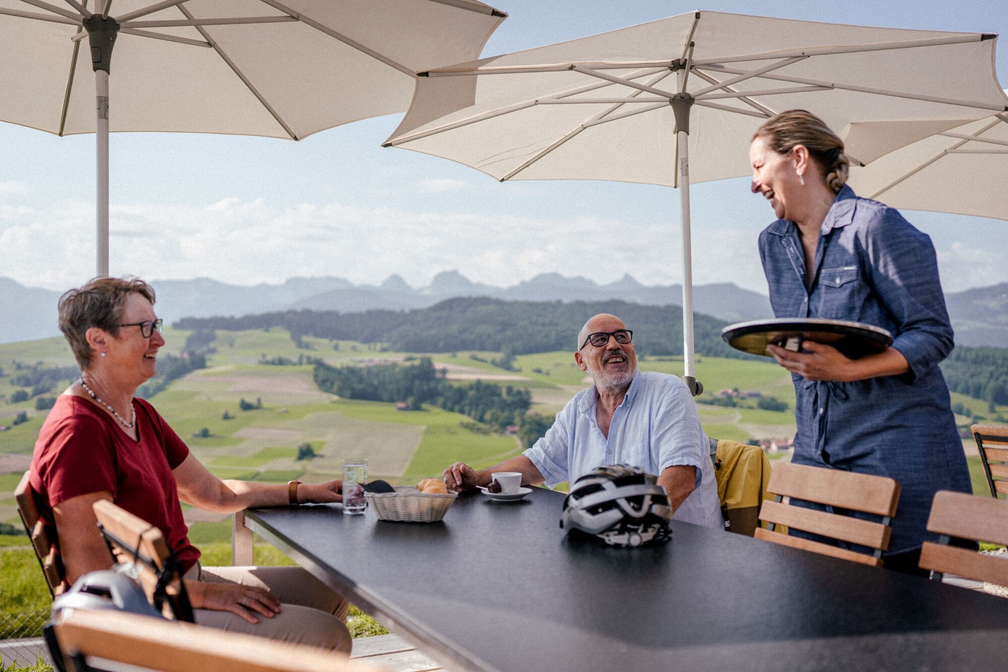
The Gantrisch Legend Route leads to the village of Rüeggisberg. Here, next to the monastery, the terrifying legend of the headless monk can be heard or read. A little further down, in Riggisberg, an equally scary legend is told at the castle, namely that of the Rabbentaler, the former castle lord. So many experiences and stories make you hungry and thirsty. On the way, it is worth stopping at legendary inns, village and farm shops. A refreshing drink and a sensational menu with regional specialities - the Gantrisch Nature Park has a lot to offer in terms of culinary delights. Full of impressions, we now head downhill on the Veloland Route 99, back towards Burgistein station. The Gantrisch Legend Route is truly an impressive experience for all the senses.
- Highest point
- 1,119 m
- Endpoint
-
Burgistein
- Height profile
-
 © outdooractive.com
 - Equipment
-
E-bike or bicycle Helmet
E-bike charger
Comfortable clothing
Sun protection
Bag, backpack or bike basket for shopping in the farm and village shops - Safety instructions
-
Wear a bicycle helmet and switch off the e-bike motor (45 km/h) in the event of a ban on motorised bicycles.
- Tips
-
It is recommended to discover the route as a multi-day tour or in several stages so that there is more time to enjoy the experiences. Starting and finishing points are Burgistein, Riggisberg and Schwarzenburg.
- Additional information

- Author
-
The tour Gantrisch Legend Route is used by outdooractive.com provided.


General info
-
Biel Seeland
76
-
Naturpark Gantrisch
55
-
Rüeggisberg
19