- Brief description
-
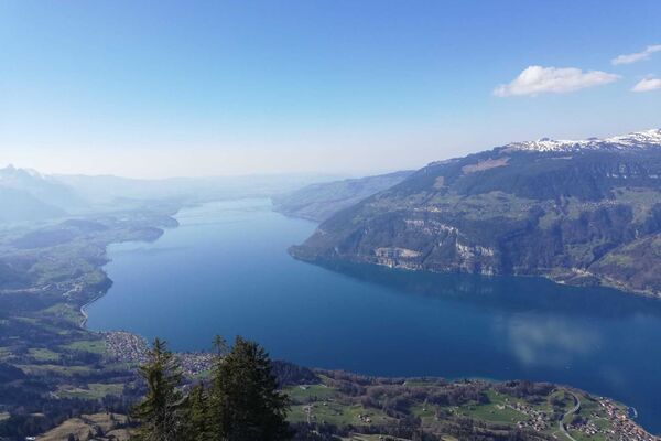
On the way you enjoy a magnificent panoramic view of the ice-covered Bernese Alps.
- Difficulty
-
medium
- Rating
-
- Starting point
-
Grindelwald, Train Station
- Route
-
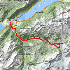
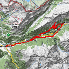
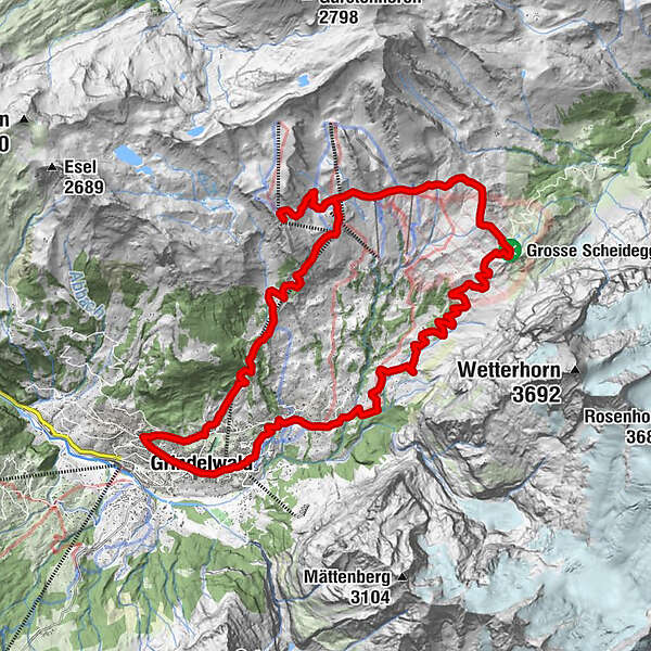
Grindelwald0.2 kmDorfkirche0.9 kmStählisboden3.0 kmBlümlisalp3.4 kmIschboden-Hütte5.6 kmGrosse Scheidegg (1,962 m)10.7 kmAlp Grindel13.9 kmFirst (Oberjoch) (2,164 m)16.3 kmFirst16.5 kmSchreckfeld (1,952 m)18.8 kmBort (1,564 m)21.4 kmChuestall21.5 kmBergrestaurant Bort21.5 kmTuftbach25.3 kmSwiss Alp Resort26.0 kmGrindelwald26.2 km
- Best season
-
JanFebMarAprMayJunJulAugSepOctNovDec
- Description
-
A long but pleasant climb over asphalt roads and field paths leads you over Grosse Scheidegg to the ridge. On a rather difficult trail you drive to Schreckfeld. From there the gravel road leads left past the small lake to Grindelwald.
Note(s)
.
See also
Grindelwald Tourismus
Dorfstrasse 110
Postfach 124
CH-3818 Grindelwald
Tel.: +41 33 854 12 12
Web: www.grindelwald.swiss
E-Mail: info@grindelwald.swiss - Directions
-
Grindelwald - Oberer Gletscher - Grosse Scheidegg - First - Grindelwald
- Highest point
- 2,164 m
- Endpoint
-
Grindelwald, Train Station
- Height profile
-
 © outdooractive.com
 - Equipment
-
Mountain bike (well maintained)
Repair kit
First aid kit
Helmet, gloves and bike bell
Proper attire for the weather condition (It is recommended to always check the weather conditions the day prior to riding. We recommend to always bring a rain jacket)
Carry adequate supplies of food and water
Please observe the signs and guidelines for mountain bike riders online as well as on the path - Safety instructions
-
Wearing gloves, helmet and MTB/Bike protective gear is recommended.
Use only the marked paths and roads. Always follow the signs.
Always close gates and pasture fences behind you.
Respect hikers, plants and animals
Hikers always have priority
Assess your own abilities and your physical condition carefully before riding
Use of the unmarked routes are at your own risk. - Tips
-
First Cliff Walk
Mountain restaurant First
- Additional information
- Directions
-
From Basel and Geneva, the fastest route to the Jungfrau Region is via Bern. From Zurich, the route via Lucerne and the Brünig Pass is recommended. The pass is open all year round.
From the south, travel to the Jungfrau Region via the Grimsel or Susten Pass. Both passes are only open in summer. An alternative is the Simplon Pass with subsequent car transport through the Lötschberg tunnel.
Grindelwald
From Interlaken we follow the main road to Zweilütschinen. Here we turn left towards Grindelwald. The whole trip takes about 30 minutes and leads over a partly winding road.
- Public transportation
-
Thanks to its central location in Europe, Switzerland is served by international trains from over 12 countries. Within Switzerland, Intercity trains run from Basel and Lucerne directly to the Jungfrau Region. Travellers from Zurich change trains in Bern. The trains run every half hour.
Grindelwald
From Interlaken Ost railway station we reach Grindelwald without changing trains on the Bernese Oberland Bahn (BOB). Important: Get on the rear part of the train, as it splits in Zweilütschinen. If you get on at the front, you will end up in Lauterbrunnen. The journey takes 30 minutes to Grindelwald Terminal (V-Bahn). Three minutes later we are at the terminal in the village.
There are three stations in Grindelwald (Terminal, Grund and Dorf). The terminal station (Dorf) is in the centre of Grindelwald.
- Parking
-
Grindelwald
There are three public car parks: Parkhaus Eiger+ (252 parking spaces), Parkhaus Sportzentrum (160 parking spaces) and the new Terminal Parking (1000 spaces) of the V-Bahn. Alternatively, we can also use the car park in Grindelwald Grund.

- Author
-
The tour Grindelwald - First - Grindelwald is used by outdooractive.com provided.

General info
-
Obwalden
166
-
Jungfrau Region
61
-
Grindelwald - First
18