


- Brief description
-
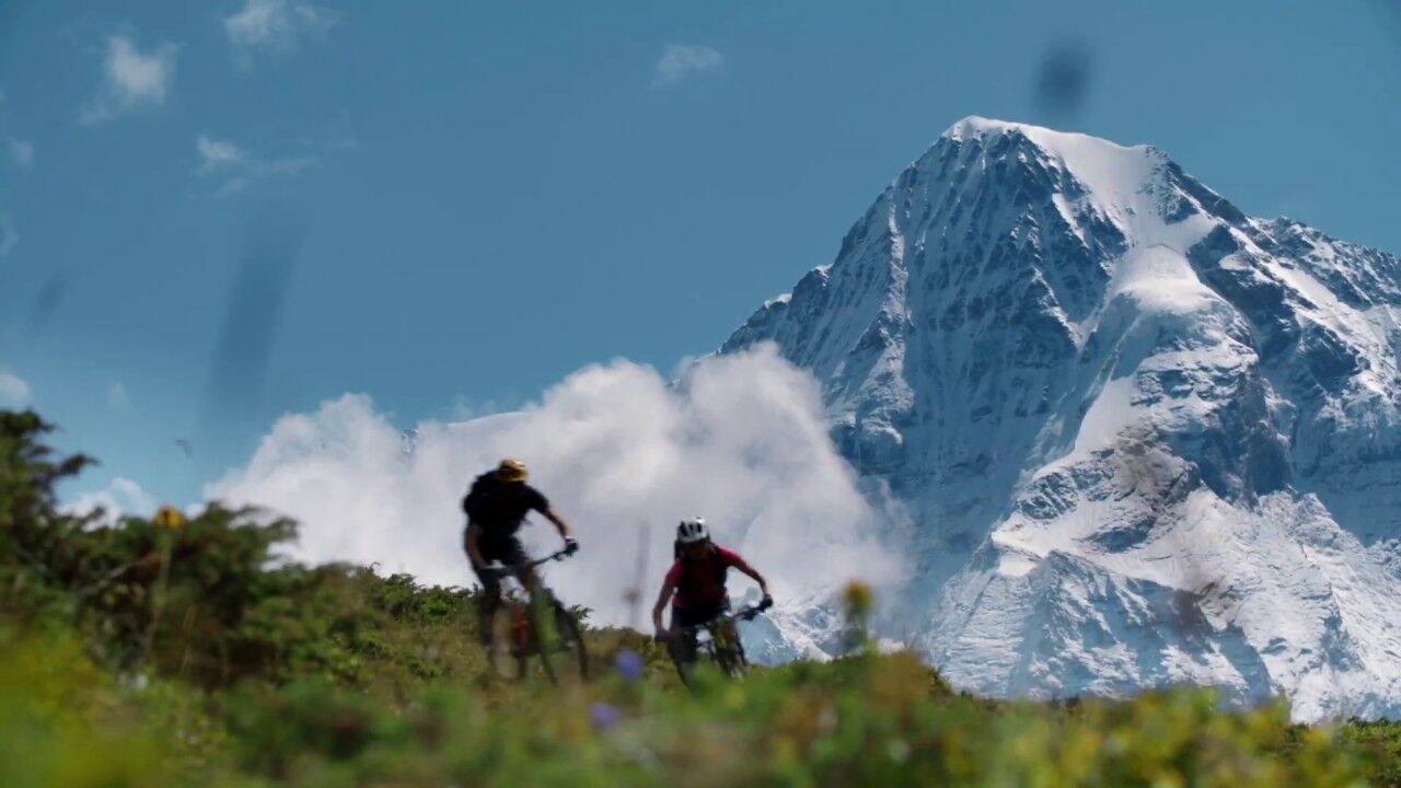
It’s all in the name. Short bike tour in front of the impressive north faces of the Bernese Alps.
- Difficulty
-
medium
- Rating
-
- Starting point
-
Mürren, Station Schilthornbahn (station Schilthorn cableways)
- Route
-
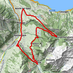
Mürren (1,650 m)EggliAuf dem BühlAuf den BalmenBeim SchulhausBachstutzBrunnen0.0 kmHinter der Egg0.1 kmUnderwald0.2 kmBrich0.5 kmGimmeln1.3 kmDonneren1.7 kmGimmelenweid1.7 kmPension Suppenalp4.4 kmRestaurant- Hotel Sonnenberg4.9 kmMirrenberg5.0 kmStafelzaun5.4 kmAm Eggli5.7 kmBrunnen5.8 kmGritt5.8 kmBachstutz5.9 kmMürren (1,650 m)5.9 kmAchermannshaus5.9 kmAuf den Platten5.9 kmAuf dem Bort5.9 kmPlace Centrale5.9 kmLus5.9 kmBorthalten5.9 kmBeim Schulhaus6.0 kmGeissdiehleboden6.0 kmHinter der Egg6.0 kmAuf dem Bühl6.0 kmUnderwald6.1 kmAuf den Balmen6.1 kmEggli6.1 km
- Best season
-
JanFebMarAprMayJunJulAugSepOctNovDec
- Description
-
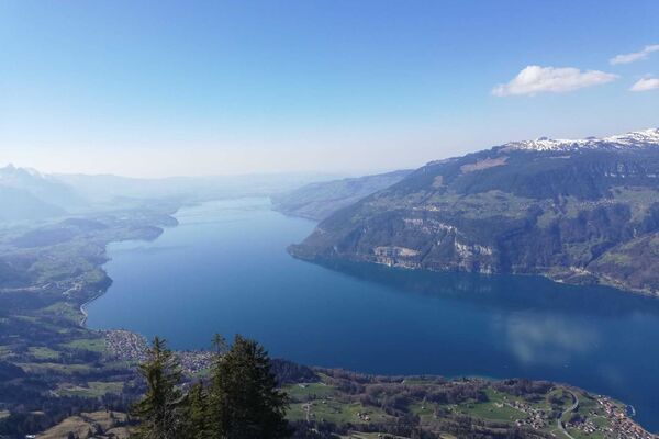
The first part of the climb is challenging. The asphalted road climbs steeply after the Schiltgrat chairlift. As soon as the ascent becomes flatter, ground changes. The gravel road leads past Schiltalp, where, during the alpine season (summer), you can buy delicious local cheeses. On the Höhenweg, it is worth stopping for a photo and taking in the views of the Bernese Alps which are simply magnificent. After the Höhenweg, there is the short and partly challenging single trail to Suppenalp. From there, the wide alpine road leads back to the village.
- Directions
-
Mürren - Spielbodenalp - Schiltalp - (Suppenalp) - Mürren
- Highest point
- 1,955 m
- Endpoint
-
Mürren, Station Schilthornbahn (station Schilthorn cableways)
- Height profile
-
 © outdooractive.com
 - Equipment
-
Mountain bike (well maintained)
Repair kit
First aid kit
Helmet, gloves and bike bell
Proper attire for the weather condition (It is recommended to always check the weather conditions the day prior to riding. We recommend to always bring a rain jacket)
Carry adequate supplies of food and water
Please observe the signs and guidelines for mountain bike riders online as well as on the path - Safety instructions
-
Wearing gloves, helmet and MTB/Bike protective gear is recommended.
Use only the marked paths and roads. Always follow the signs.
Always close gates and pasture fences behind you.
Respect hikers, plants and animals
Hikers always have priority
Assess your own abilities and your physical condition carefully before riding
Use of the unmarked routes are at your own risk. - Tips
-
The Nothface- and Mountainview Trail can be combined with each other.
- Directions
-
By car: There are different ways to reach the region by car. The fastest way from Basel and Geneva is via Berne. The fastest route from Zurich is through Lucerne and the Brünig Pass. The pass is open in summer and winter.
From the south, the route leads over the Grimsel or Susten Pass into the region. Both passes are only open in summer. Alternatively, you can take the route via Simplon Pass and then use Lötschberg car transport.
- Public transportation
-
Thanks to its central location in Europe, Switzerland is served by international trains from over 12 countries. Within Switzerland, Intercity trains run directly from Basel and Lucerne to the Jungfrau Region. Travellers from Zurich have to change in Berne. The trains run every half hour.
- Parking
-
In Lauterbrunnen, there is a covered car park, linked with the BLM cable car station. You may also drive to the Schilthornbahn station in Stechelberg where you will find a large number of parking spaces.
The Lauterbrunnen car park is located at the outskirts of the village, just before the train station. Parking spaces can be reserved for a minimum of 5 days (winter) online.


-

-
AuthorThe tour Northface Trail Mürren is used by outdooractive.com provided.
Surfaces
General info
-
Oberwallis
207
-
Jungfrau Region
63
-
Mürren - Schilthorn
19