Hundsrügg: Zweisimmen - Jaunpass - Rellerligrat - Schönried - Saanenmöser - Zweisimmen


- Brief description
-
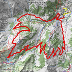
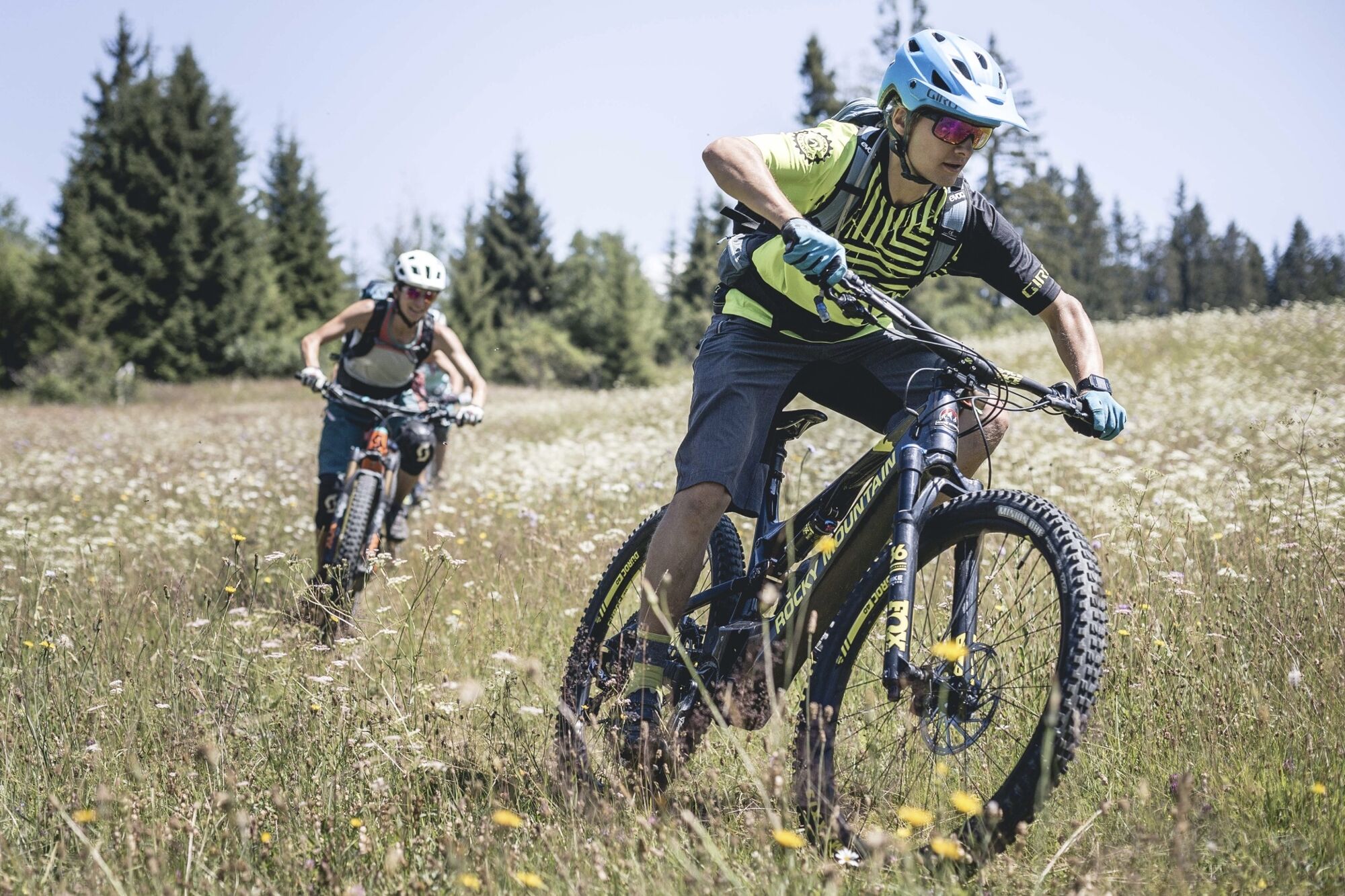
The big panoramic loop around Hundsrügg and Rellerli.
- Difficulty
-
difficult
- Rating
-
- Starting point
-
Zweisimmen
- Route
-
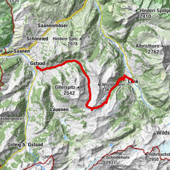
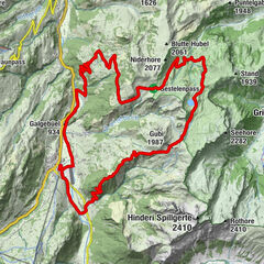
ZweisimmenStalde0.9 kmGalgebüel (934 m)2.7 kmGrubenwald3.7 kmSchlündi (1,661 m)19.3 kmBire (1,789 m)22.6 kmRellerligrat (1,843 m)27.3 kmSchönried (1,200 m)31.4 kmLa Nicchia31.6 kmPizzeria da Corrado31.6 kmSaanenmöser34.3 kmOeschseite37.7 kmBrasserie Zur Simme42.6 kmZweisimmen42.6 km
- Best season
-
JanFebMarAprMayJunJulAugSepOctNovDec
- Description
-
From Zweisimmen you reach the Jaunpass on narrow side roads and forest trails; then the trail leads up to the Oberenegg Läger.Then a pleasant route guides along the Hundsrügg with breath-taking views towards the Gastlosen. After a short climb, you reach Bire. A beautiful, narrow trail winds along the mountain ridge along to the Rellerli mountain ridge, from there a singletrail descent leads to Schönried. On a short main road part and a side road, you ride back through Saanenmöser to Oeschseite. There you take the technical Simmegrund trail back to Zweisimmen.
- Directions
-
Zweisimmen - Garstatt - Littisbach - Schaffmoos - Jaunpass - Oberenegg Läger - Bire - Rellerligrat - Gspan - Schönried - Saanenmöser - Oeschseite - Simmegrund - Zweisimmen
- Highest point
- 1,859 m
- Endpoint
-
Zweisimmen
- Height profile
-
 © outdooractive.com
 - Equipment
-
Mountainbike, clothing and equipment appropriate to the weather, tool kit and first aid kit.
- Safety instructions
-
Technically challenging tour; for proficient e-mountain bikers only. This tour is not signposted along the way. Use GPS.
- Tips
-
Not many restaurants on the route, take a picnic with you or stop in Schönried.
- Additional information
- Directions
-
The Destination Gstaad is located in the south-west of Switzerland right on the border to the French-speaking part of the country. The Destination is easily accessed by rail or car from the regions around Lake Thun and Lake Geneva and the Gruyere region Direct connections to the European high-speed rail network and all international airports in Switzerland guarantee a time-saving and pleasant journey.
- Public transportation
-
Zweisimmen station
- Parking
-
Behind Zweisimmen station


-

-
AuthorThe tour Hundsrügg: Zweisimmen - Jaunpass - Rellerligrat - Schönried - Saanenmöser - Zweisimmen is used by outdooractive.com provided.


General info
-
Alpes Vaudoises
98
-
Lenk-Simmental
105
-
Saanenmöser
37