- Brief description
-
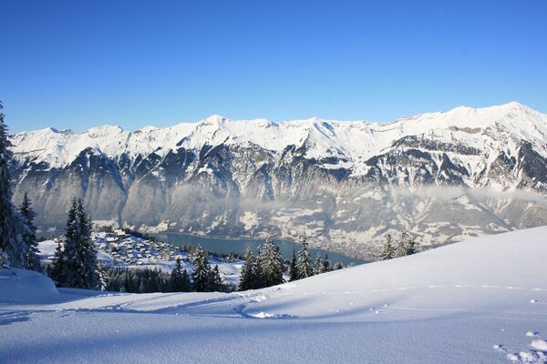
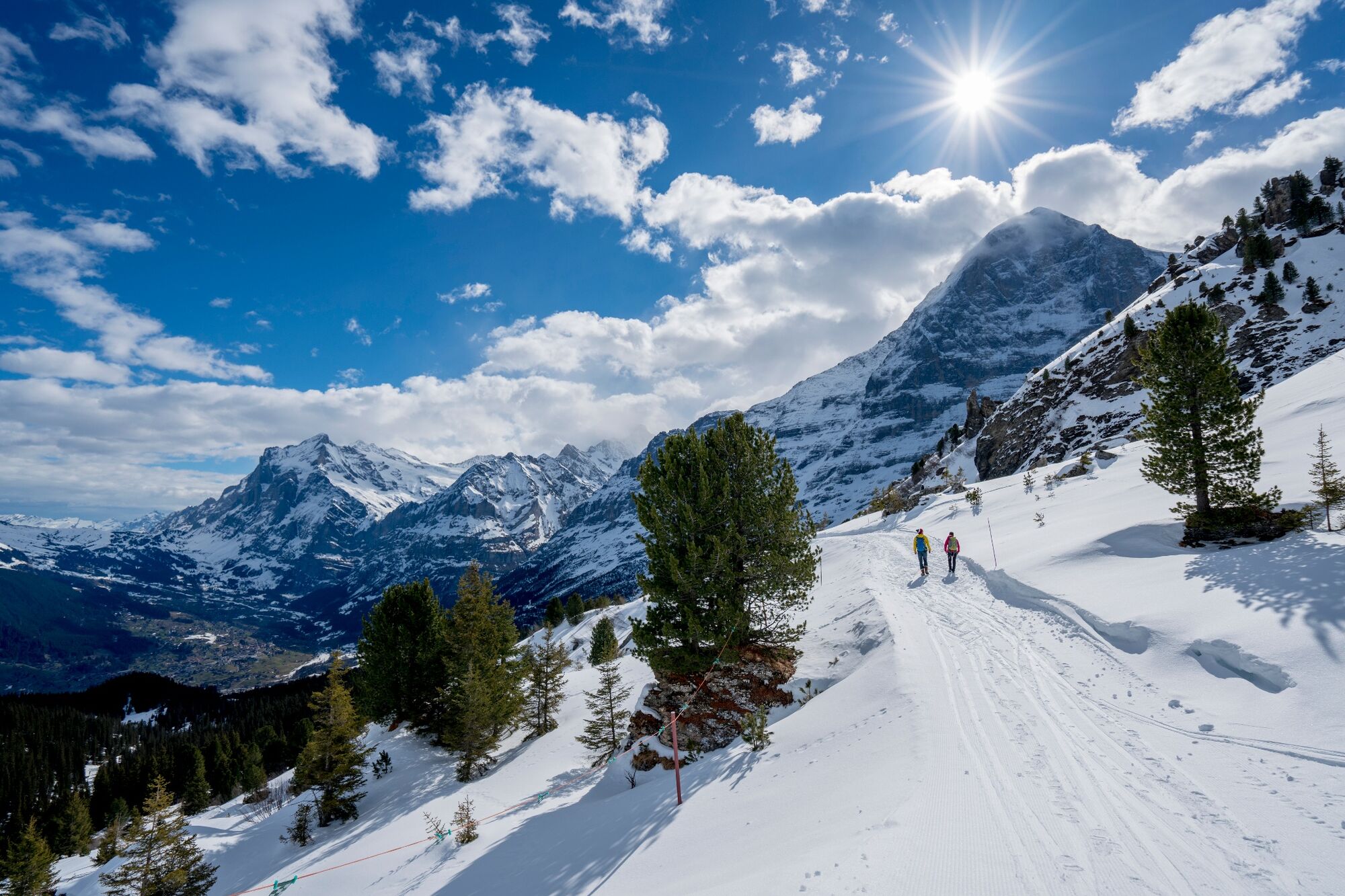
More than 1,000 meters above your daily grind. The hike leads high above Grindelwald and Wengen from the Männlichen to the Kleine Scheidegg.
- Difficulty
-
medium
- Rating
-
- Starting point
-
Bergstation Männlichen (2225 m ü. M.)
- Route
-
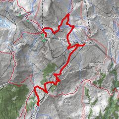
Auf dem MännlichenMännlichen (2,239 m)0.0 kmMännlichen (2,225 m)0.1 kmBerghaus Männlichen0.2 kmMännlichen0.3 kmBustligen4.6 kmArven Garde Bar4.6 kmKleine Scheidegg5.8 kmRestaurant Eigernordwand5.8 kmKleine Scheidegg6.0 kmBergrestaurant Kleine Scheidegg6.0 km
- Best season
-
AugSepOctNovDecJanFebMarAprMayJunJul
- Description
-
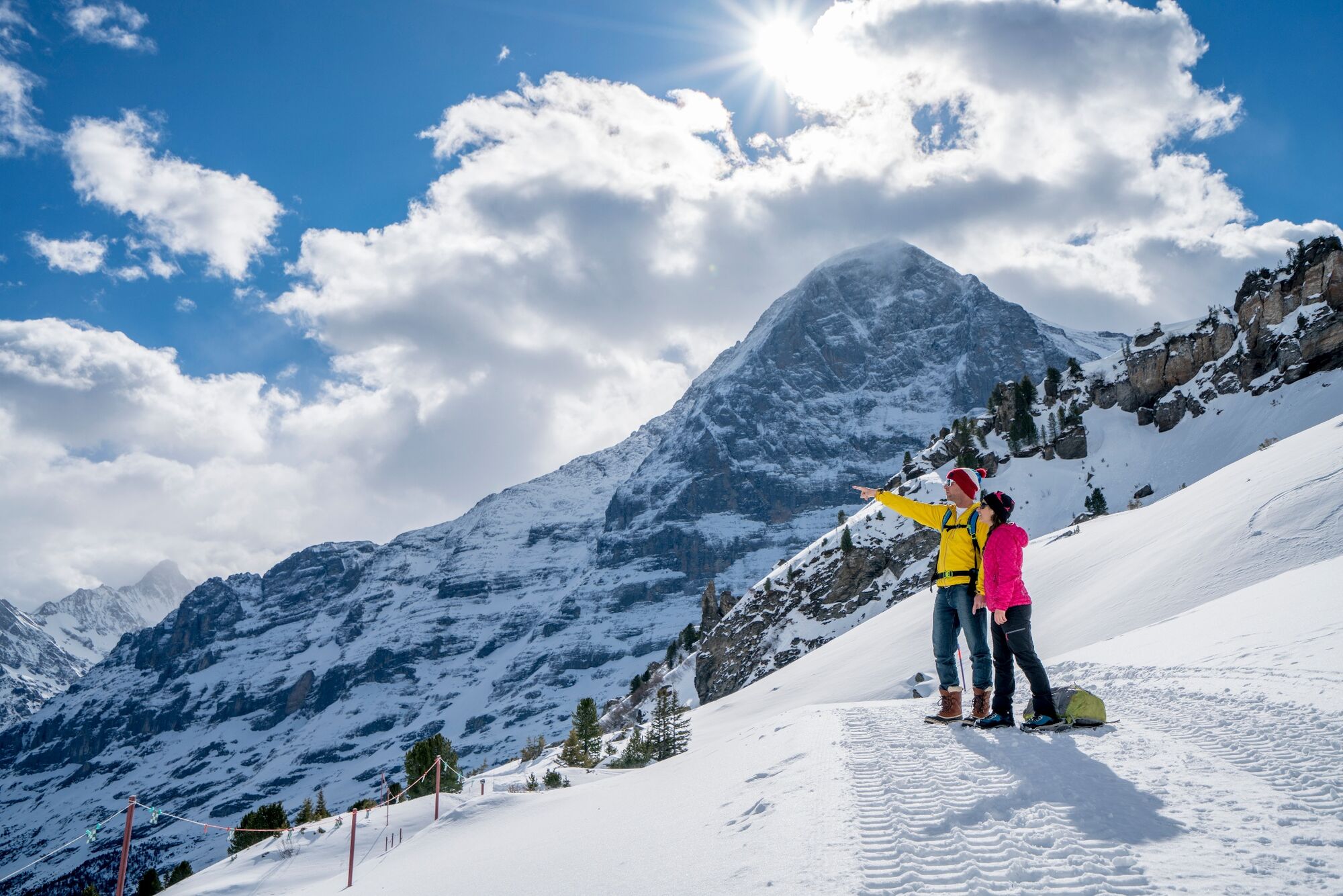
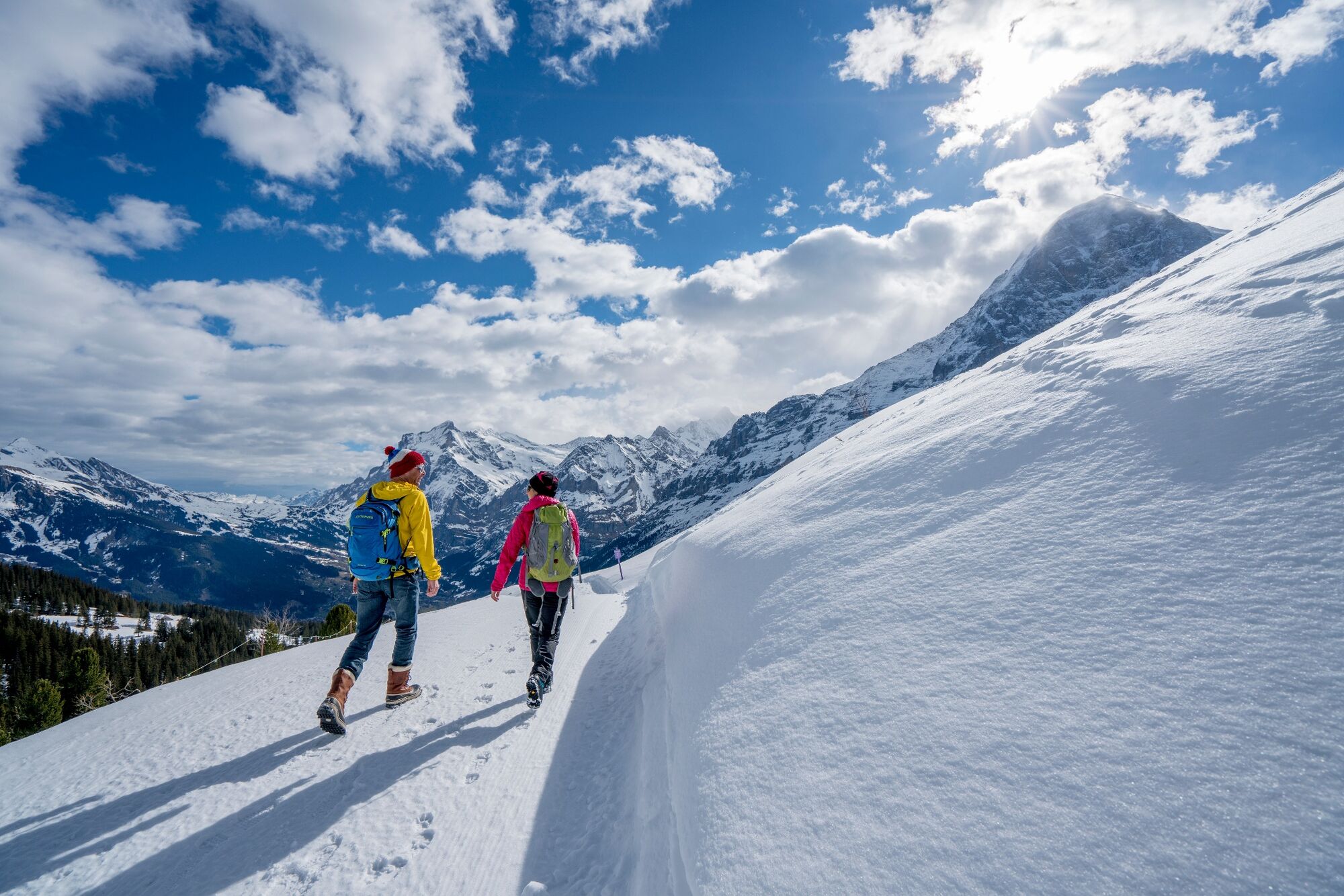
Probably the most beautiful winter hike in Europe starts at the Männlichen guest house at over 2,000 metres above sea level. The view of the Eiger, Mönch and Jungfrau already upon arrival is truly thrilling. Hikers and sledgers share the same path for the first few metres. At the foot of the Tschuggen, the winter hiking trail meanders over snow-covered fields and through fragrant pine forests towards the Kleine Scheidegg. Constant companion on the tour: the mighty and fascinating Eiger North Face.
Click here for the status of the winter hiking trails.
- Directions
-
Bergstation Männlichen - Gummi - Bustiglen - Kleine Scheidegg
- Highest point
- 2,221 m
- Endpoint
-
Bahnhof Kleine Scheidegg (2061 m ü. M.)
- Height profile
-
 © outdooractive.com
 - Equipment
-
The sun’s rays are more intense in the mountains. Don’t forget to bring sunscreen with a high protection factor, a hat and sunglasses with UV protection.
We recommend bringing warm clothing and rain gear even in summer and in good weather in winter. We recommend layering your clothing.
Charged mobile phone
First-aid kit
Winter shoes with non-slip sole
Drinks and snacks
If available: hiking sticks - Safety instructions
-
After a snowfall, the ground can be softer and more difficult to walk on.
- Tips
-
After arrival on the Kleine Scheidegg, continue hiking or sledging towards Alpiglen and Brandegg. Both towns have train stations and places to eat.
- Directions
-
From Basel and Geneva, the fastest route to the Jungfrau Region is via Bern. From Zurich, the route via Lucerne and the Brünig Pass is recommended. The pass is open all year round.
From the south, travel to the Jungfrau Region via the Grimsel or Susten Pass. Both passes are only open in summer. An alternative is the Simplon Pass with subsequent car transport through the Lötschberg tunnel.
Grindelwald
From Interlaken we follow the main road to Zweilütschinen. Here we turn left towards Grindelwald. The whole trip takes about 30 minutes and leads over a partly winding road.
Wengen
Wengen is car-free. If we arrive by car, we have to leave it in Lauterbrunnen and take the train. The journey from Interlaken to Lauterbrunnen takes about 20 minutes.
- Public transportation
-
Thanks to its central location in Europe, Switzerland is served by international trains from over 12 countries. Within Switzerland, Intercity trains run from Basel and Lucerne directly to the Jungfrau Region. Travellers from Zurich change trains in Bern. The trains run every half hour.
Grindelwald
From Interlaken Ost railway station we reach Grindelwald without changing trains on the Bernese Oberland Bahn (BOB). Important: Get on the rear part of the train, as it splits in Zweilütschinen. If you get on at the front, you will end up in Lauterbrunnen. The journey takes 30 minutes to Grindelwald Terminal (V-Bahn). Three minutes later we are at the terminal in the village.
There are three stations in Grindelwald (Terminal, Grund and Dorf). The terminal station (Dorf) is in the centre of Grindelwald.
Wengen
From Interlaken Ost station we reach Wengen in 44 minutes. The blue and yellow train of the Berner Oberland Bahn (BOB) takes us to Lauterbrunnen. Important: We sit in the front part of the train, as it splits in Zweilütschinen. If you take a seat at the back, you will make a detour to Grindelwald. In Lauterbrunnen we change to the yellow-green train of the Wengernalp Bahn (WAB). This takes us to Wengen in 12 minutes.
- Parking
-
Grindelwald
There are three public car parks: Parkhaus Eiger+ (252 parking spaces), Parkhaus Sportzentrum (160 parking spaces) and the new Terminal Parking (1000 spaces) of the V-Bahn. Alternatively, we can also use the car park in Grindelwald Grund.
Wengen
There is a multi-storey car park directly below Lauterbrunnen station. Alternatively, you can use the car park at the Lauterbrunnen church. From here, a bus leaves for the station every half hour. On foot we need about 10 minutes.
A covered passage leads from the Lauterbrunnen car park to the cable cars to Wengen.
- Author
-
The tour Männlichen - Kleine Scheidegg (Nr. 63) is used by outdooractive.com provided.

General info
-
Aletsch Arena
185
-
Jungfrau Region
113
-
Wengen
50