- Brief description
-
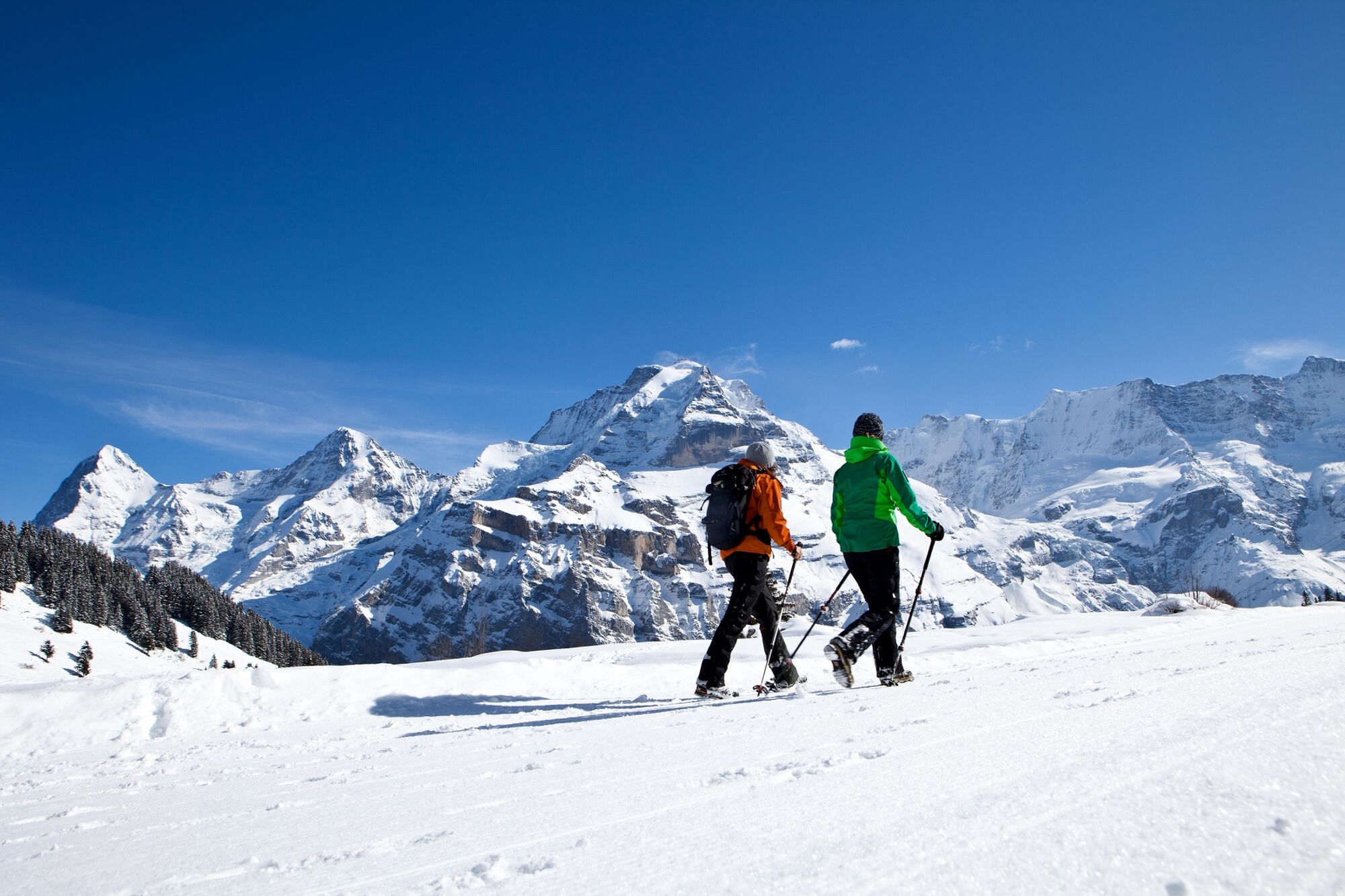
Short, but promising winter hike to the family-friendly Allmendhubel.
- Difficulty
-
easy
- Rating
-
- Starting point
-
Mürren Dorf (1659 m ü. M.)
- Route
-
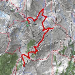
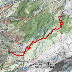
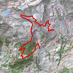
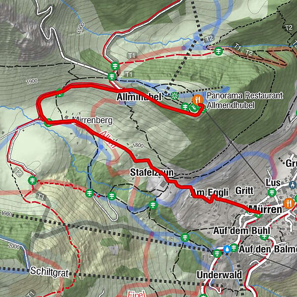
Place CentraleGeissdiehlebodenAuf den PlattenMürren (1,650 m)BorthaltenLusAuf den BalmenBeim SchulhausAuf dem BortAchermannshausBachstutz0.0 kmEggli0.0 kmAuf dem Bühl0.0 kmGritt0.1 kmBrunnen0.1 kmAm Eggli0.2 kmHinter der Egg0.3 kmStafelzaun0.5 kmMirrenberg0.9 kmRestaurant- Hotel Sonnenberg1.0 kmAllmihubel1.6 kmAllmihubel (1,932 m)1.8 km
- Best season
-
AugSepOctNovDecJanFebMarAprMayJunJul
- Description
-
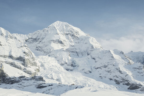
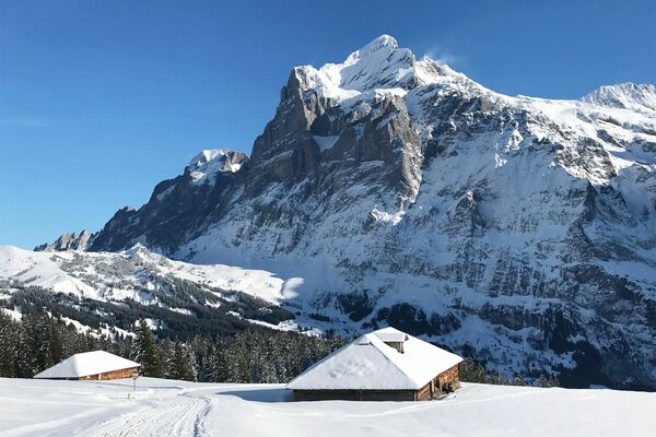
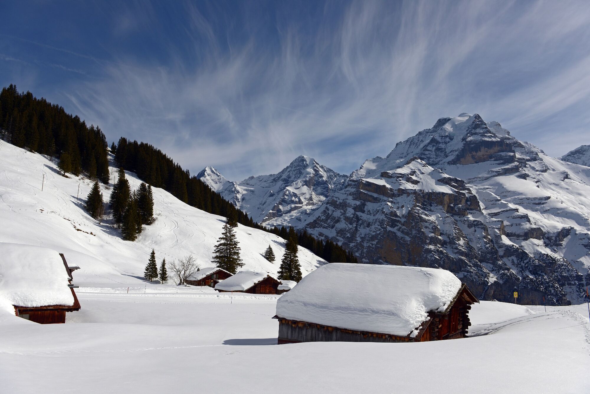
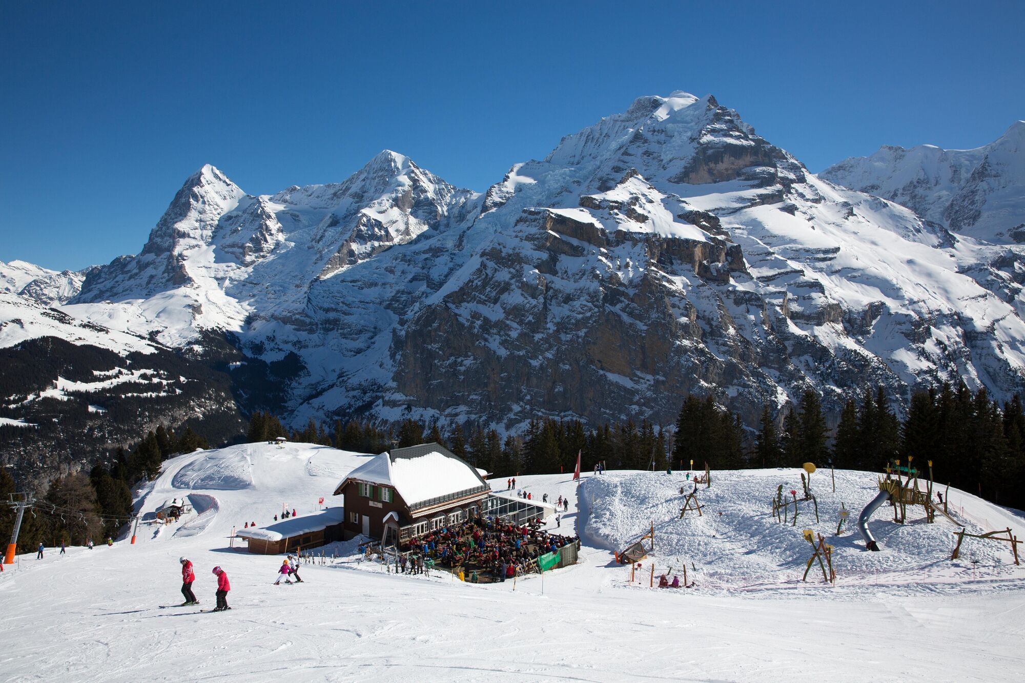
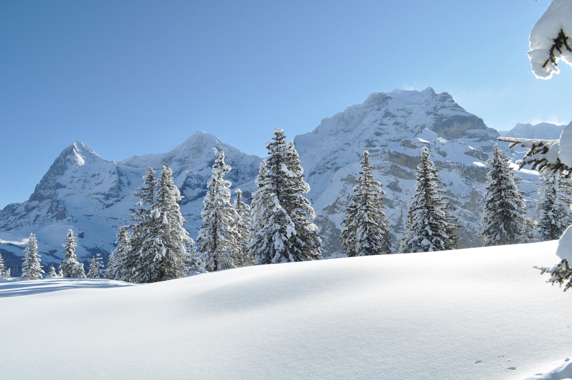
The trail starts in the quiet alpine village of Mürren and winds uphill towards Sonnenberg. Passing traditional chalets, you climb steadily towards the peaks. It’s worth taking the occasional break to enjoy the mountain panorama with the Eiger, Mönch and Jungfrau. After the first stage, you reach the Pension Sonnenberg which has a wonderful terrace for a bite to eat. Reenergised, you can now tackle the final ascent up to the Allmendhubel. The Allmendhubel is a great place for families with its playground, terrace and restaurant.
- Directions
-
Mürren – Sonnenberg - Allmendhubel
- Highest point
- 1,908 m
- Endpoint
-
Allmendhubel (1907 m ü. M.)
- Height profile
-
 © outdooractive.com
 - Equipment
-
The sun’s rays are more intense in the mountains. Don’t forget to bring sunscreen with a high protection factor, a hat and sunglasses with UV protection.
We recommend bringing warm clothing and rain gear even in summer and in good weather in winter. We recommend layering your clothing.
Charged mobile phone
First-aid kit
Winter shoes with non-slip sole
Drinks and snacks
If available: hiking sticks - Safety instructions
-
After a snowfall, the ground can be softer and more difficult to walk on.
- Tips
-
From the Allmendhubel, a sledging run goes to Mürren. But you can also take the Allmendhubel funicular railway down the mountain to Mürren.
- Additional information
- Directions
-
Car: There are different ways to reach the region by car. The fastest way from Basel and Geneva is via Berne. The fastest route from Zurich is through Lucerne and the Brünig Pass. The pass is open in summer and winter.
From the south, the route goes over the Grimsel or Susten Pass into the region. Both passes are only open in summer. Alternatively, you can take the Simplon Pass and then Lötschberg car transport.
- Public transportation
-
Thanks to its central location in Europe, Switzerland is served by international trains from over 12 countries. Within Switzerland, Intercity trains run directly from Basel and Lucerne to the Jungfrau Region. Travellers from Zurich have to change in Berne. The trains run every half hour.
The cable car brings guests to the Grütschalp. From here you continue by train to Mürren BLM.
Alternatively, the aerial cableway Stechelberg - Gimmelwald- Mürren to choose from.
- Parking


- Author
-
The tour Mürren - Sonnenberg - Allmendhubel is used by outdooractive.com provided.

General info
-
Aletsch Arena
176
-
Jungfrau Region
104
-
Mürren - Schilthorn
40