- Brief description
-
Enjoy the sun and the view of a breathtaking mountain panorama: the hike from the Grütschalp to the quaint alpine village of Mürren is well worth it.
- Difficulty
-
easy
- Rating
-
- Starting point
-
Grütschalp (1487 m ü. M.)
- Route
-
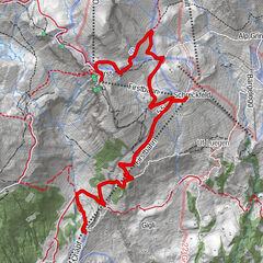
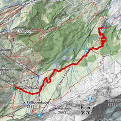
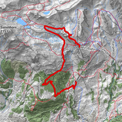
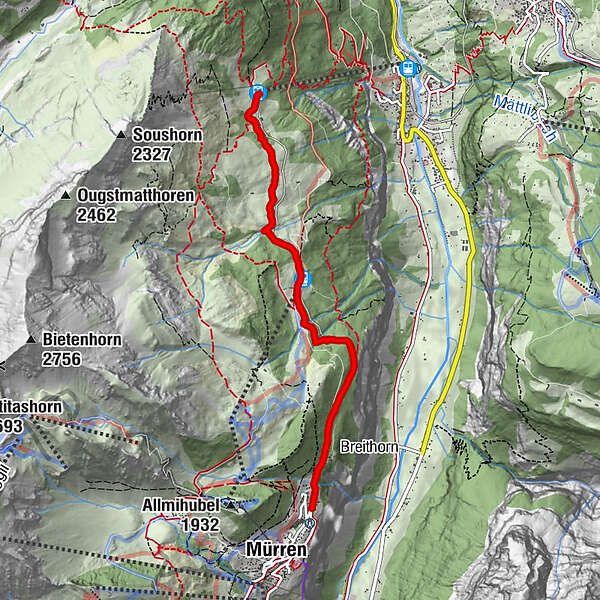
Grütschalp (1,481 m)0.0 kmGrütsch0.0 kmWinteregg (1,588 m)2.0 kmÄgertenbachfall4.1 kmÄgerten4.4 kmMürren Bahnhof4.4 kmResidence Eiger4.4 kmHöhenmatte4.4 km
- Best season
-
AugSepOctNovDecJanFebMarAprMayJunJul
- Description
-
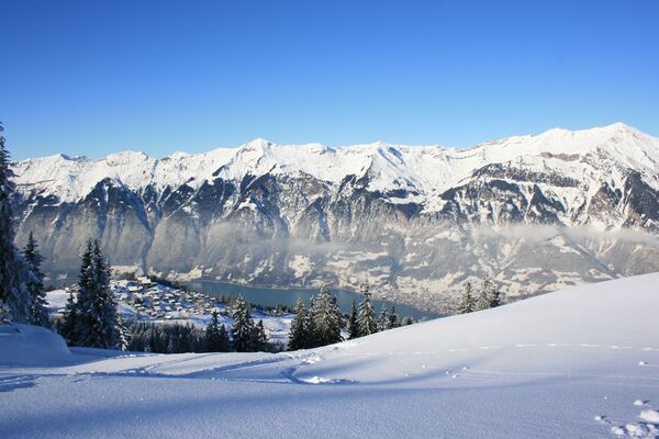
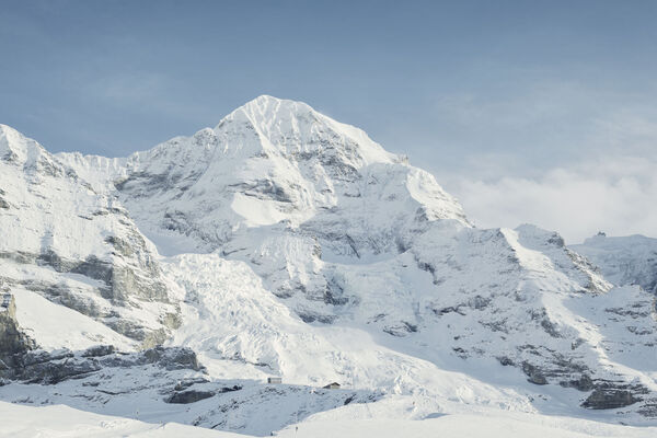
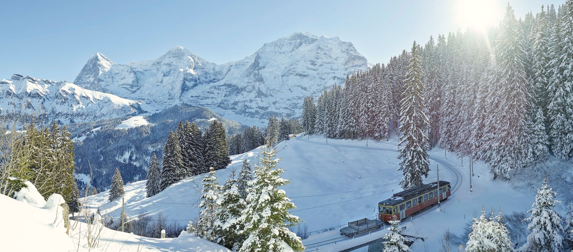
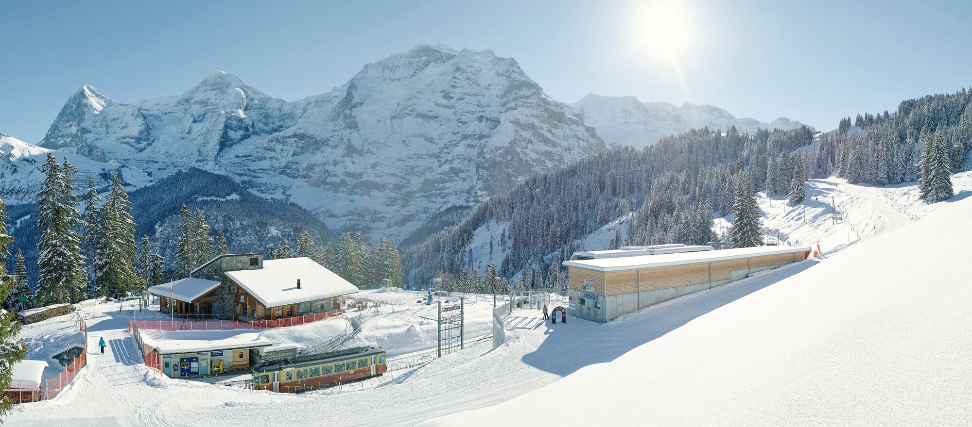
High above the deep basin of the Lauterbrunnen Valley, the winter hike from the Grütschalp to Mürren captivates with fantastic views of the Eiger, Mönch and Jungfrau. The world-famous mountain trio is visible for the entire duration of the hike. The hiking trail meanders along the slope at sunny elevations and is extremely well-maintained. The final destination of the tour is the car-free alpine village of Mürren. Its decorative wooden houses exude warmth and rustic charm. Children and adults frolic on the outdoor ice rink and practise their skating skills in the fresh air. On the return journey to the Grütschalp, the Männlichen and Faulhorn mountain ranges in the background create a panoramic view that is nothing short of magnificent. If you want to shorten the hike by a few kilometres, follow the trail to Winteregg and take the train to Mürren or Grütschalp.
- Directions
-
Grütschalp - Winteregg - Mürren
- Highest point
- 1,639 m
- Endpoint
-
Mürren Dorf (1650 m ü. M.)
- Height profile
-
 © outdooractive.com
 - Equipment
-
The sun’s rays are more intense in the mountains. Don’t forget to bring sunscreen with a high protection factor, a hat and sunglasses with UV protection.
We recommend bringing warm clothing and rain gear even in summer and in good weather in winter. We recommend layering your clothing.
Charged mobile phone
First-aid kit
Winter shoes with non-slip sole
Drinks and snacks
If available: hiking sticks - Safety instructions
-
After a snowfall, the ground can be softer and more difficult to walk on.
- Tips
-
After the hike, relax and recharge your batteries in the spa of the Alpine Sports Centre in Mürren.
- Additional information
- Directions
-
Car: There are different ways to reach the region by car. The fastest way from Basel and Geneva is via Berne. The fastest route from Zurich is through Lucerne and the Brünig Pass. The pass is open in summer and winter.
From the south, the route goes over the Grimsel or Susten Pass into the region. Both passes are only open in summer. Alternatively, you can take the Simplon Pass and then Lötschberg car transport.
- Public transportation
-
Thanks to its central location in Europe, Switzerland is served by international trains from over 12 countries. Within Switzerland, Intercity trains run directly from Basel and Lucerne to the Jungfrau Region. Travellers from Zurich have to change in Berne. The trains run every half hour.
The cable car takes visitors up to the Grütschalp. Continue on from here by train to Mürren with the Lauterbrunnen-Mürren mountain railway (BLM).
Another alternative is the Stechelberg – Gimmelwald – Mürren aerial cableway.
Ticket purchase Jungfrau Region
Timetable and ticket purchase SBB
- Parking
- Author
-
The tour Grütschalp - Winteregg - Mürren is used by outdooractive.com provided.
General info
-
Aletsch Arena
176
-
Jungfrau Region
104
-
Lauterbrunnen
46