- Brief description
-
Classic mountain hike over the wide Spittelmatte up to the Berghotel Schwarenbach and through the quiet rocky valley of the Rote Chumme up to the impressive mountain basin of the Tälli. Between glacier and mountain lake up to the Engstligengrat ridge, which is rich in wildlife, and over flower-filled alps down to the cosy mountain huts on the Engstligenalp.
- Difficulty
-
medium
- Rating
-
- Route
-
Sunnbüel (1,936 m)0.0 kmAltelshütte0.3 kmBerghotel Schwarenbach3.9 kmEngstligenalp14.1 kmEngstligenalp (1,973 m)14.5 km
- Best season
-
JanFebMarAprMayJunJulAugSepOctNovDec
- Description
-
A traditional mountain hiking trail via the expansive Spittelmatte up to the mountain Hotel Schwarenbach and through the tranquil valley in the mountain setting of Rote Chumme up to the impressive bowl-shaped hollow of the Tälli.The ascent is between the glacier and mountain lake to Engstligengrat, where there are plenty of ibex, and across Alpine wildflower meadows down to the mountain guesthouses on Engstligenalp.
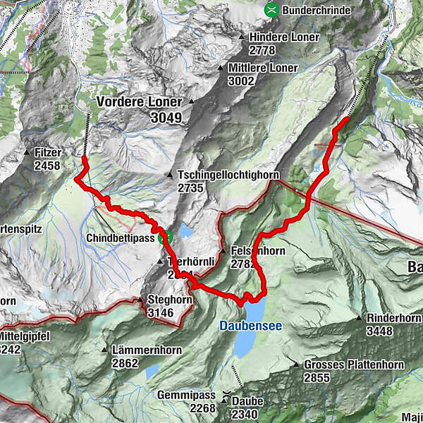
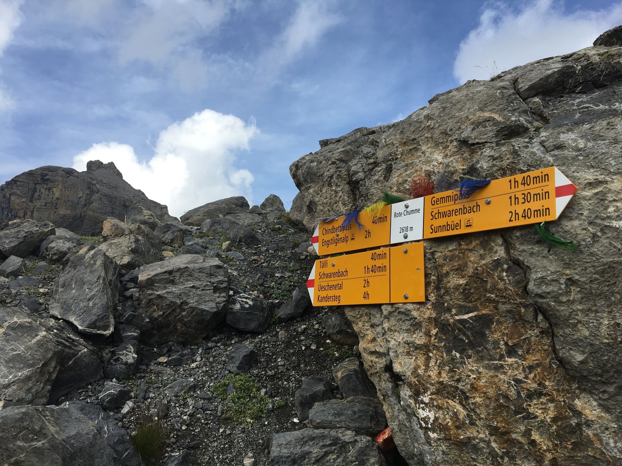
From Kandersteg-Sunnbüel cable car mountain station it is a gentle descent to Spittelmatte. Here you link up with the wide Gemmiweg and continue the gentle climb back towards the valley. On the right is the bright chain of Üschenegrat, and on the left-hand side the glacial valley climbing between Altel and Rinderhorn to the Schwarz glacier and Zackengrat. From here the normal route carries on to Balmhorn. Don’t miss the minor detour at the mountain hut to the idyllic Arvesee and pine and larch mixed forest. You soon cross the border of cantons Bern and Valais; now there is a steeper ascent to reach Hotel Schwarenbach via a side valley. The hotel dates back to an inn built in 1742.From Schwarenbach continue on Gemmiweg to Daubensee . Here, turn right onto the mountain route. Above the northern end of Daubensee the path winds up the mountain into the narrow valley and mountain setting of Rote Chumme. The steep ascent quickly leads to the summit. There is a reassuring sound of sheep bells as they forage for sparse vegetation. The occasional raven or even an eagle hunts for a black viper sunning itself on a warm rock. The ridge between Roter Totz and Felsenhorn is at an altitude of 2'628 m.
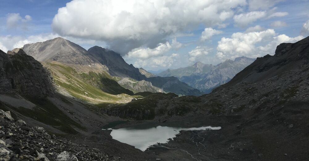
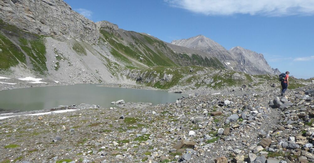
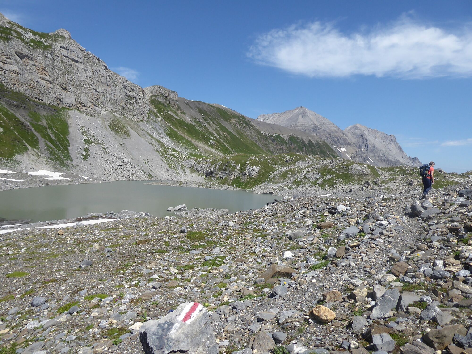
Via Felsenbuckel and Geröll there is a short descent, usually without a marked route, to the edge of the Tälli glacier. This is almost covered with debris. You would hardly know that you are already on ice. The subsurface is very smooth and can be tricky, although there is no risk from crevasses in the glacier. The climb to Sattel on the Engstligen ridge between Tierhörnli and Chindbettihorn is relatively easy up to the Chindbetti Pass. The small Tälli lake is far behind and down in the valley. Towering above the glacier are the peaks of Rinderhorn, Altels, Balmhorn, Doldenhörner, Blüemlisalp and Jungfrau. The white summits of Fletschhorn and Weissmies are in the distance in the Valais. The view ahead is also impressive: the white bowl-shaped hollow of Engstligenalp is surrounded by Wildstrubel, Ammertengrat, Rotstock and Fitzer. On the right the green valley of Adelboden stretches into the distance. The many peaks of the Niesen mountain chain are behind.
The well maintained route makes a sharp descent about 300 m to Tossenseeli, and continues on a steep descent through Alpine meadows to the edge of the impressive Alpine plateau and mountain huts of Märbenen. The Alpine plantain grass (Plantago alpina L.) grows here - the German name “Märbena” gave the location its name. Via Engstligenalp you reach the guesthouses and the cable car mountain station.
Duration:5 hrs. (Sunnbüel - Rote Chumme - Engstligenalp)
Gastronomy:Bergrestaurant Sunnbüel, Berghotel Schwarenbach, Engstligenalp
Mountain rail transport:Sunnbüel cable carEngstligenalp cable car
Return trip:Engstligenalp cable car - Unter dem Birg, Adelboden bus - Kandersteg
- Highest point
- 2,617 m
- Endpoint
-
Bergstation Engstligenalp
- Height profile
-
 © outdooractive.com
 - Directions
- Public transportation
- Parking


-

-
AuthorThe tour Rote Chumme 2628 m is used by outdooractive.com provided.


General info
-
Oberwallis
1880
-
Leuk/Leukerbad
1021
-
Leukerbad
305