

- Brief description
-
Easy hike, suitable also for strollers or buggies.
- Difficulty
-
easy
- Rating
-
- Starting point
-
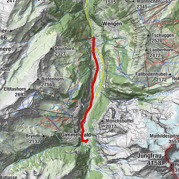
Train station Lauterbrunnen (795 m a. s. l.)
- Route
-
Steinbock0.0 kmLauterbrunnen0.1 kmBei der Zuben0.1 kmGsteigermatte0.2 kmFood Point0.2 kmGreifenbach0.3 kmBeim Schulhaus0.4 kmFuhrenboden0.5 kmLauterbrunnen0.6 kmBeim Pfrundhaus0.6 kmCascada de Staubbach0.9 kmStaubbach1.0 kmBei der Buche2.4 kmGydisdorf2.8 kmBrüggmatte3.6 kmMatta5.8 kmGimmelwald (1,367 m)6.1 kmSefinenfall6.3 kmHotel Restaurant Stechelberg6.6 kmRüti6.6 kmStechelberg (867 m)6.7 km
- Best season
-
JanFebMarAprMayJunJulAugSepOctNovDec
- Description
-
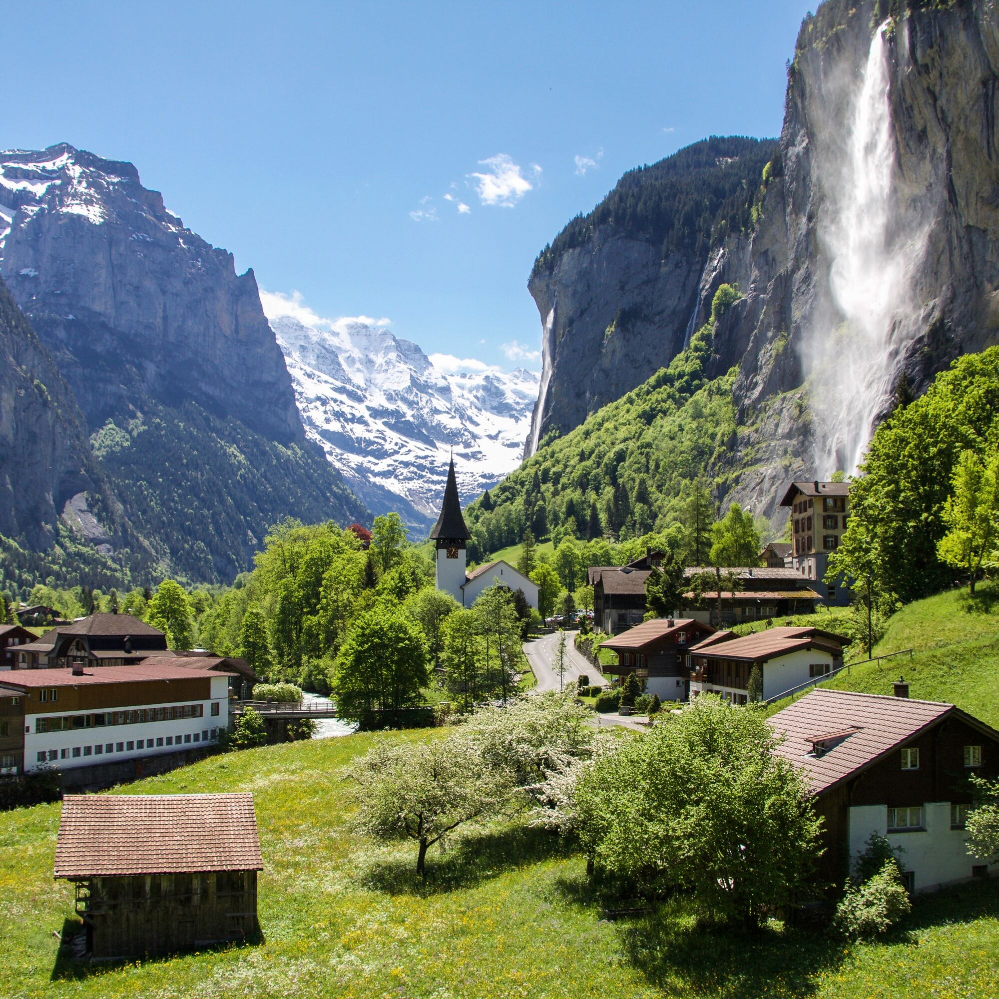
Water plays a huge part in the picturesque Lauterbrunnental valley. This hike, which in fact could also be described as a walk, takes us past the Staubbach waterfall after only a short distance. We then pass the thundering Trümmel Falls before the path takes us across the Weisse Lütschine to Stechelberg once we have passed the Breithorn campsite. The small village is the perfect spot to enjoy a delicious meal or warm up with a hot drink. Lauterbrunnen can be reached again either along the same route or by bus.
- Directions
-
Train station Lautebrunnen - Staubbachfall - Trümmelbachfall - Ägertenbachfall - Mürrenbachfall - Bus station Stechelberg
- Highest point
- 913 m
- Endpoint
-
Bus station Stechelberg (910 m a. s. l.)
- Height profile
-
 © outdooractive.com
 - Equipment
-
Exposure to the sun’s rays is much stronger in the mountains. So always make sure you pack some sunscreen with a high protection factor, a sun hat, and sunglasses with UV protection.Always take warm clothing and rain gear with you, even in summer and even if you’ve set off in fine weather. ‘Plenty of layers’ is always the recommended option.
Fully charged mobile phone
First-aid travel kit
Snacks and refreshments
If available: telescopic poles
In winter: winter footwear with non-slip soles
- Safety instructions
- Tips
-
While the Staubbach gallery is accessible only in the summer season, the Staubbach waterfall itself can be admired all year round. In winter it often freezes over and, in the evening, is impressively illuminated. The Trümmel Falls, also on the route, are open from April to November, from 9 a.m. to 5 p.m.
- Additional information
- Directions
-
There are various ways to get here by car. From Basel and Geneva, the fastest route is via Bern. From Zurich, the quickest route is towards Lucerne and the Brünig Pass. The pass is open in summer and winter.
From the south, the Grimsel or Susten Passes lead to the region. Both passes are only open in summer. Alternatively, you can take the Simplon Pass and then the Lötschberg car transport.
- Public transportation
-
Thanks to its central location in Europe, Switzerland is served by international trains from over 12 countries. Within Switzerland, Intercity trains run from Basel and Lucerne directly to the Jungfrau Region. Travellers from Zurich change trains in Bern. Trains run every half hour.
- Parking
-
Reservations for the Lauterbrunnen multi-storey car park can be made online. There is also a large car park next to the village church (fees apply).
- Author
-
The tour Lauterbrunnen - Stechelberg is used by outdooractive.com provided.


General info
-
Aletsch Arena
1471
-
Jungfrau Region
1006
-
Mürren - Schilthorn
340


