
© Intersoc VZW - Lien Degryse


- Brief description
-
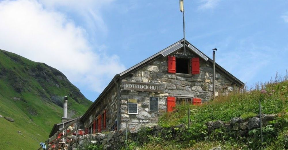
Mürren - Schilthorn - Rotstockhütte - Mürren
- Difficulty
-
difficult
- Rating
-
- Route
-
Mürren Bahnhof0.0 kmÄgerten0.0 kmResidence Eiger0.1 kmRauft0.1 kmHöhenmatte0.2 kmGruebi0.6 kmGritt0.9 kmAm Eggli1.0 kmBrunnen1.0 kmMürren (1,650 m)1.1 kmStafelzaun1.4 kmMirrenberg1.7 kmAllmihubel1.8 kmSchilthorn7.9 kmSkyline View Platform7.9 kmDrehrestaurant Piz Gloria7.9 kmRotstockhütte (2,040 m)12.2 kmSpielbodenalp16.0 kmGimmelenweid16.3 kmDonneren16.4 kmGimmeln16.6 kmBrich17.4 kmUnderwald17.9 kmHinter der Egg18.0 kmAuf den Balmen18.1 kmEggli18.1 kmAuf dem Bühl18.1 kmBrunnen18.2 kmBeim Schulhaus18.3 kmBachstutz18.3 kmGritt18.3 kmAchermannshaus18.3 kmMürren (1,650 m)18.3 kmGeissdiehleboden18.3 kmLus18.4 kmBorthalten18.4 kmAuf dem Bort18.4 kmAuf den Platten18.4 kmPlace Centrale18.5 kmGruebi18.5 kmRauft18.6 kmHöhenmatte18.8 kmÄgerten18.9 kmMürren Bahnhof19.0 kmResidence Eiger19.0 km
- Highest point
- 2,956 m
- Endpoint
-
Mürren
- Height profile
-
 © outdooractive.com

-

-
AuthorThe tour WEN-DW - Mürren - Schilthorn - Rotstockhütte - Mürren is used by outdooractive.com provided.
GPS Downloads

Other tours in the regions
-
Oberwallis
1872
-
Interlaken
1099
-
Mürren - Schilthorn
343


