- Brief description
-
This continual downhill trail from Saanenmöser via Schönried to Gstaad is a varied hike for enthusiastic hikers. It offers views of towering mountain peaks and into the historic heart of the Saanenland.
- Difficulty
-
easy
- Rating
-
- Starting point
-
Saanenmöser
- Route
-
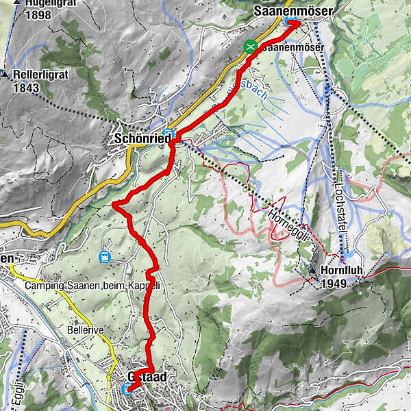
Saanenmöser (1,271 m)0.0 kmSchönried (1,200 m)2.4 kmGstaad (1,050 m)6.8 kmMango6.8 kmPizerria Victoria6.9 kmGstaad (1,049 m)7.0 km
- Best season
-
JanFebMarAprMayJunJulAugSepOctNovDec
- Description
-
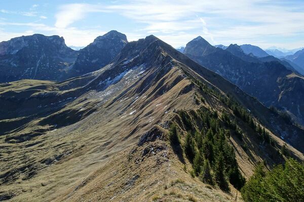
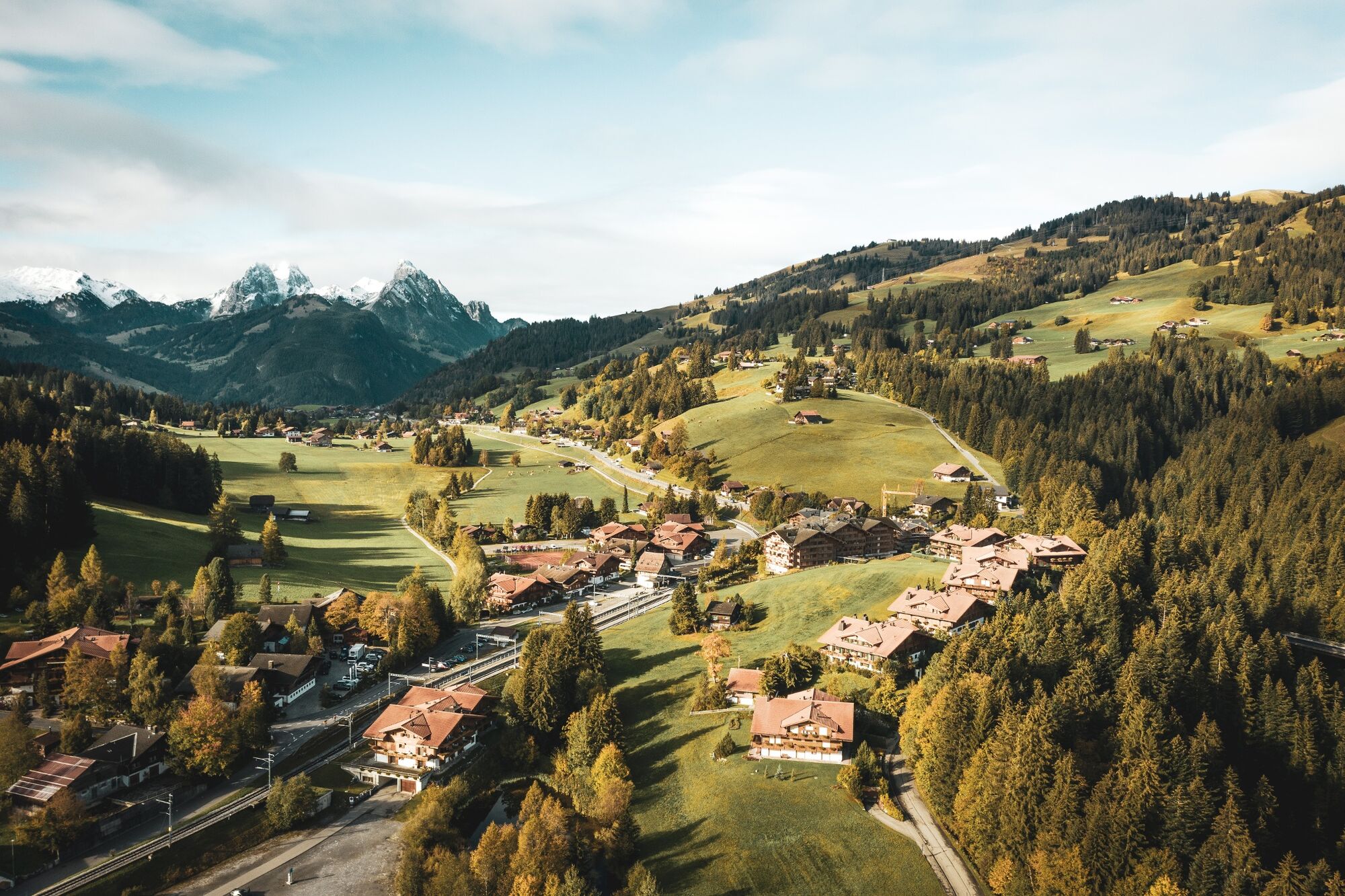
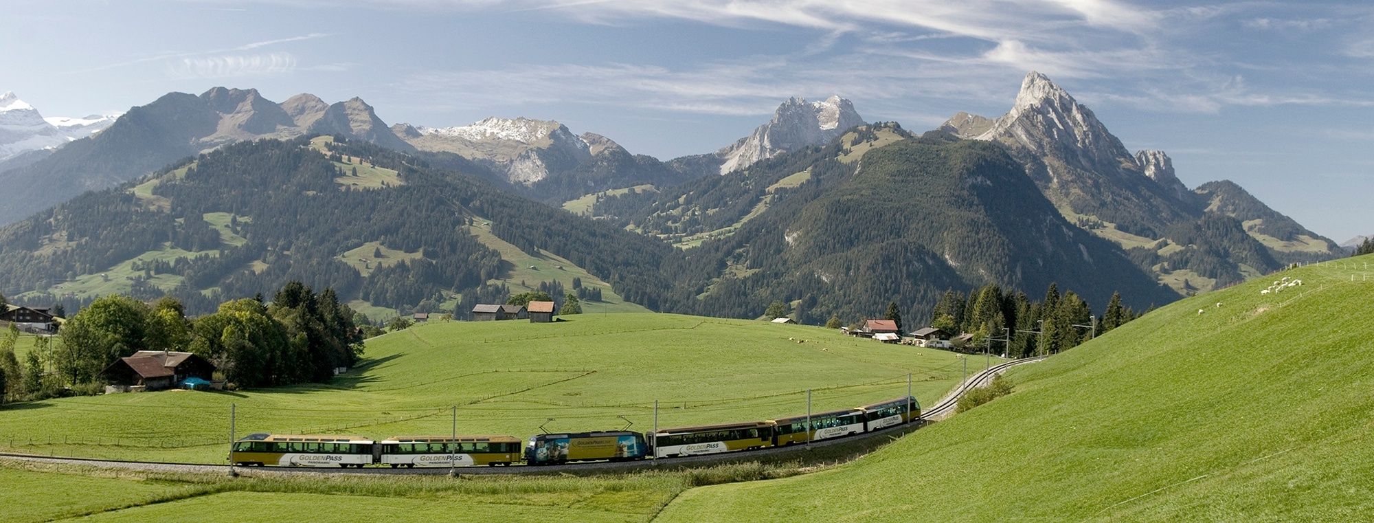
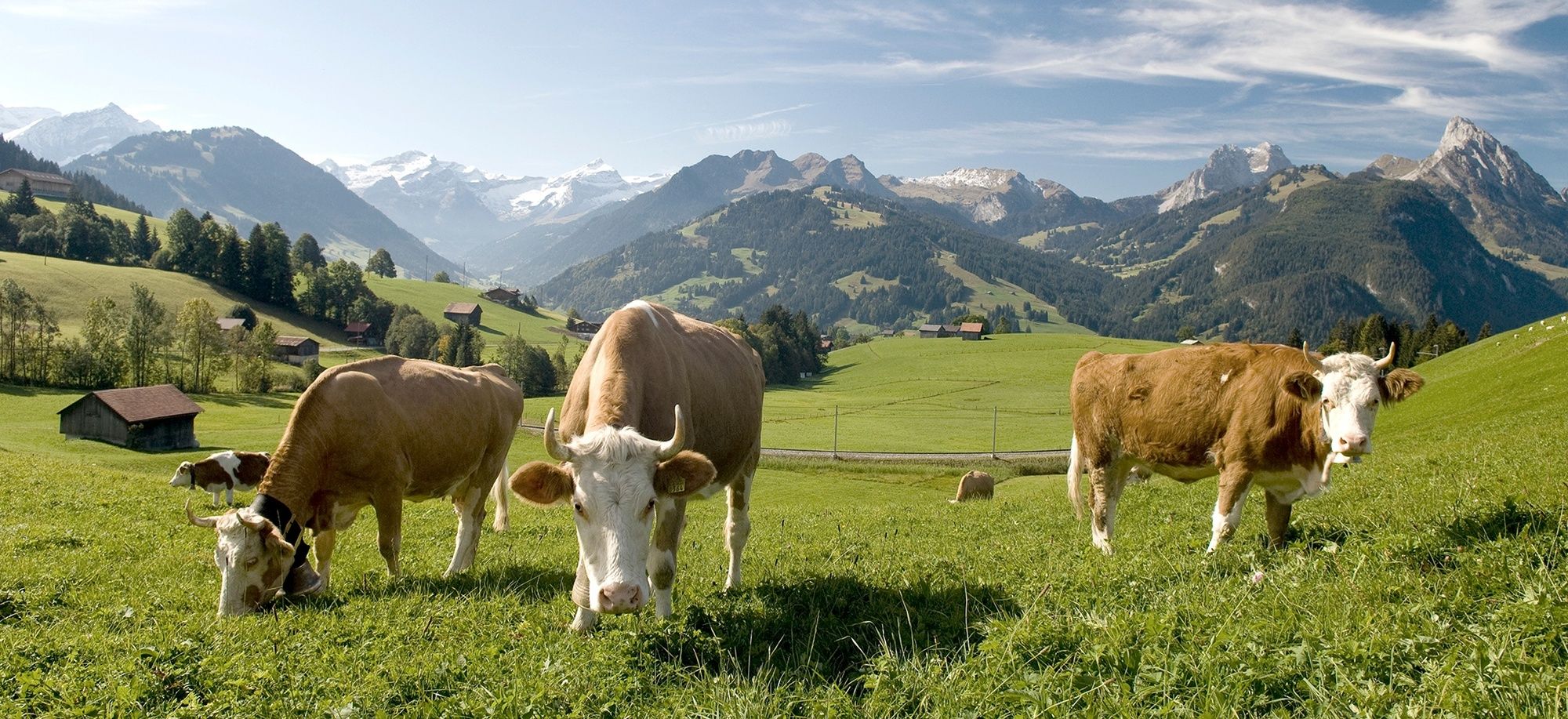
This trail starts in Saanenmöser and continues on to Schönried (1,230 metres above sea level) along trail no. 447 for wheelchair users. The beautiful, sunny and level panoramic route crosses the Moos plateau from Saanenmöser to Schönried, the Gstaad region’s sunny mountain terrace. The trail leaves the wheelchair-accessible path and continues on towards Gstaad. This easy hiking trail runs along the foot of the Hornberg and maintains a continual gentle descent to Gstaad. As you cross meadows and pathways you have beautiful views of Saanen, the historical heart of the Saanenland. This village, with its cosy chalets dating from the 15th to the 18th century, is on the Inventory of Swiss Heritage Sites. Not to be missed: the Le Rubli, or as the Saanenlanders call it: Rübli(horn), towering majestically into the sky. The second part of the hike brings you close to the railway tracks. With a bit of luck you will see the GoldenPassPanoramic train with its famous panorama cars gliding its way through the idyllic landscape. Soon you catch sight of your destination and within a few minutes you reach the chalet village of Gstaad and its special landmark, the Gstaad Palace with its four striking towers. Once again, the hiking trail above Gstaad takes you across the railway line before you reach the village with its charming and inviting promenade.
- Directions
-
Saanenmöser – Schönried – Gruben – Gstaad
- Highest point
- 1,273 m
- Endpoint
-
Gstaad
- Height profile
-
 © outdooractive.com
 - Equipment
-
Good footwear, snacks to savor during a break - why not a Fondue-Backpack?
- Additional information
- Directions
-
The Destination Gstaad is located in the south-west of Switzerland right on the border to the French-speaking part of the country. The Destination is easily accessed by rail or car from the regions around Lake Thun and Lake Geneva and the Gruyere region Direct connections to the European high-speed rail network and all international airports in Switzerland guarantee a time-saving and pleasant journey. The main means of transport in the destination of Gstaad are the "MOB" (Montreux-Oberland Bernois) train and numerous post bus lines.
- Public transportation
-
MOB station Schönried, Postauto Station Schönried
- Parking
-
Near Saanenmöser station
-

-
AuthorThe tour Saanenmöser – Schönried – Gstaad is used by outdooractive.com provided.


-
Thyon les Collons
1426
-
Destination Gstaad
729
-
Schönried
192