


- Brief description
-
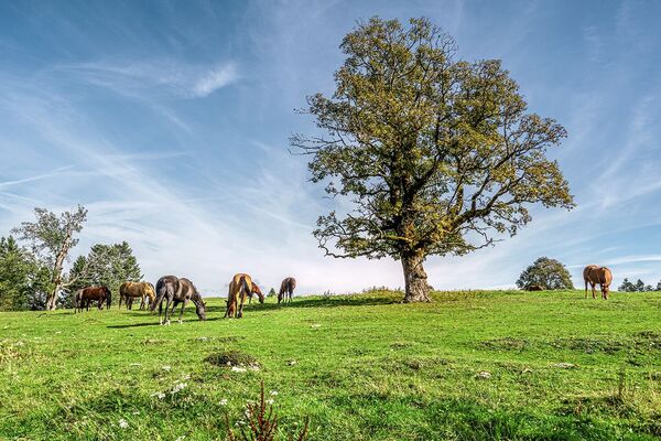
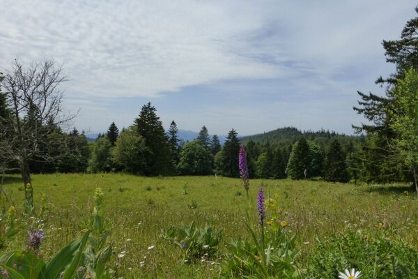
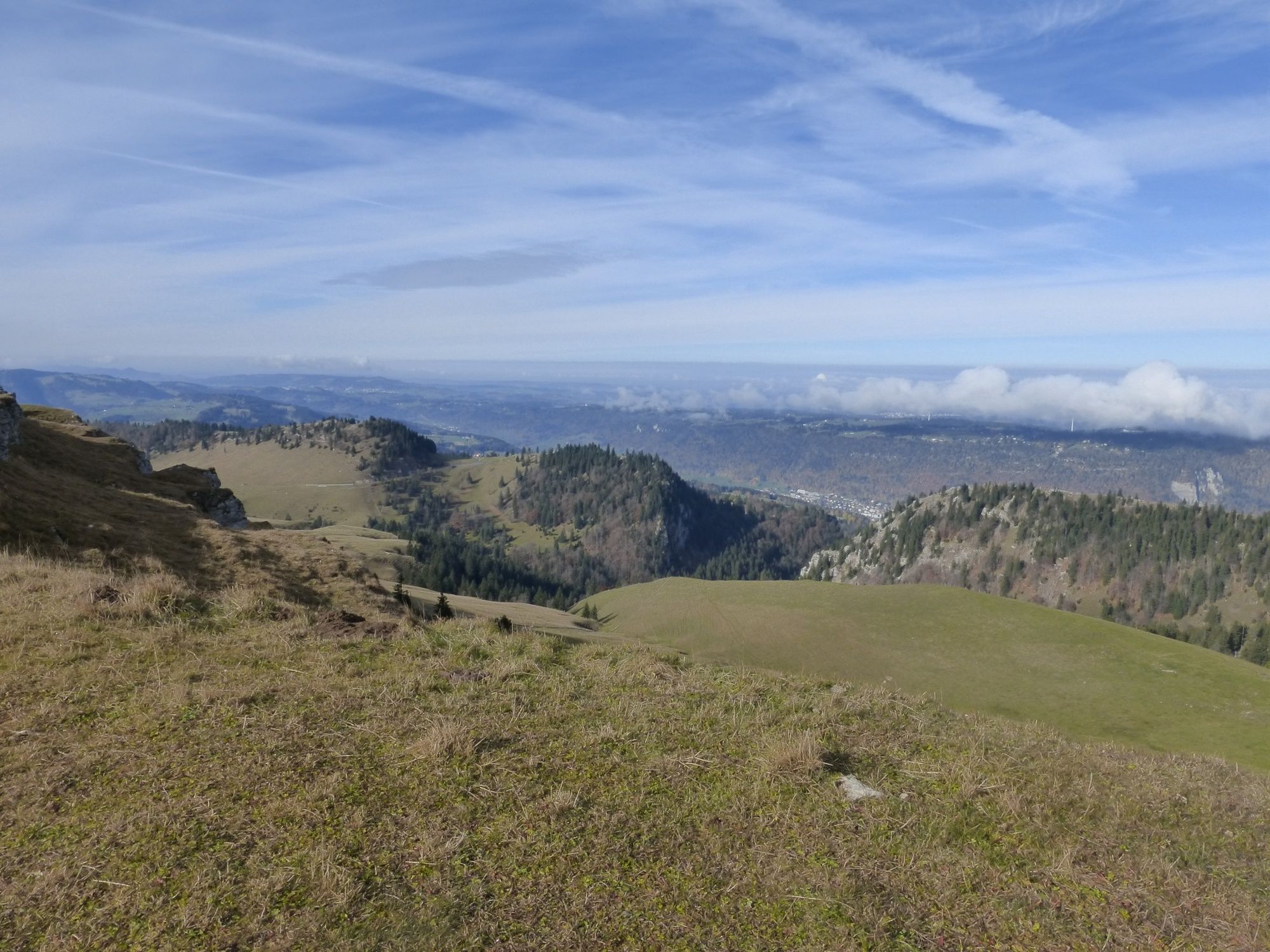
This is a hike that cannot be surpassed in terms of views: to the south, the spectacular view takes in Lakes Biel, Murten and Lake Neuchâtel, the Mittelland (Central Plateau) and the Alpine peaks extending from Eastern to Western Switzerland. To the north, the views of the Jura mountains complete this stunning panorama. Practically no hard-surfaced areas.
- Difficulty
-
medium
- Rating
-
- Route
-
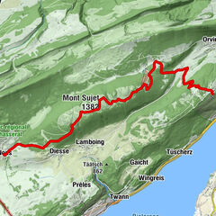
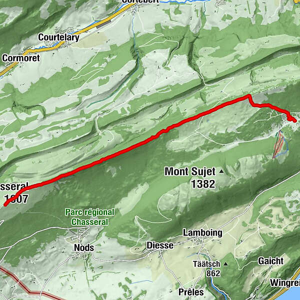
Chasseral (1,607 m)1.2 kmChasseral panorama1.3 kmPlace Centrale7.8 kmJurahaus9.4 kmLeubringenberg9.9 kmMétairie d'Évilard9.9 kmLes Prés-d'Orvin11.6 km
- Best season
-
JanFebMarAprMayJunJulAugSepOctNovDec
- Description
-
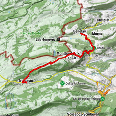
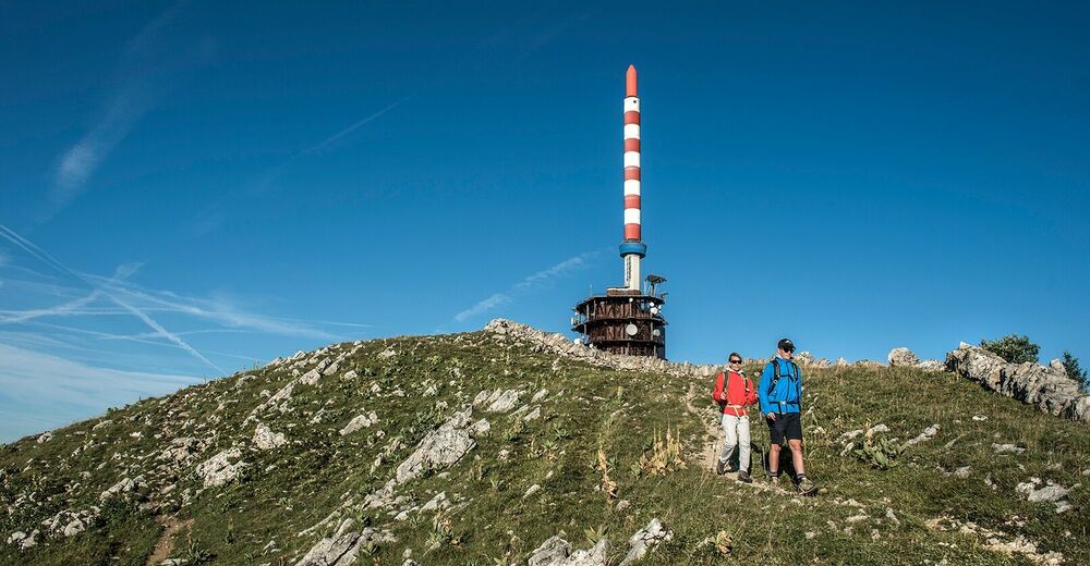
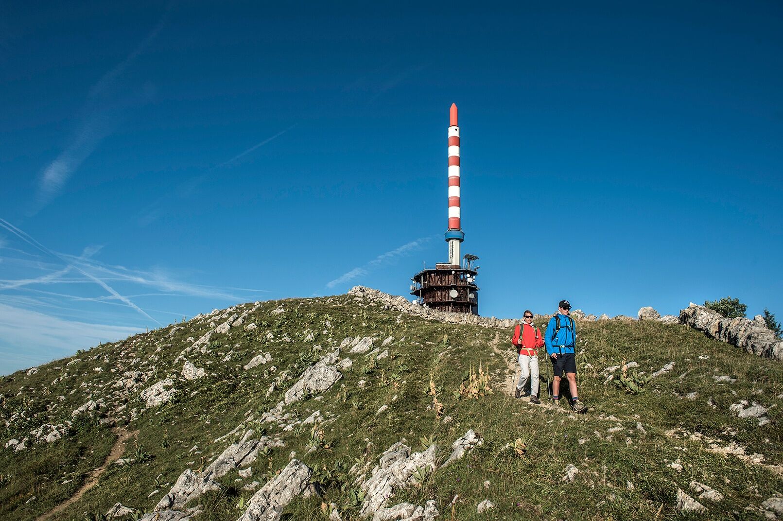
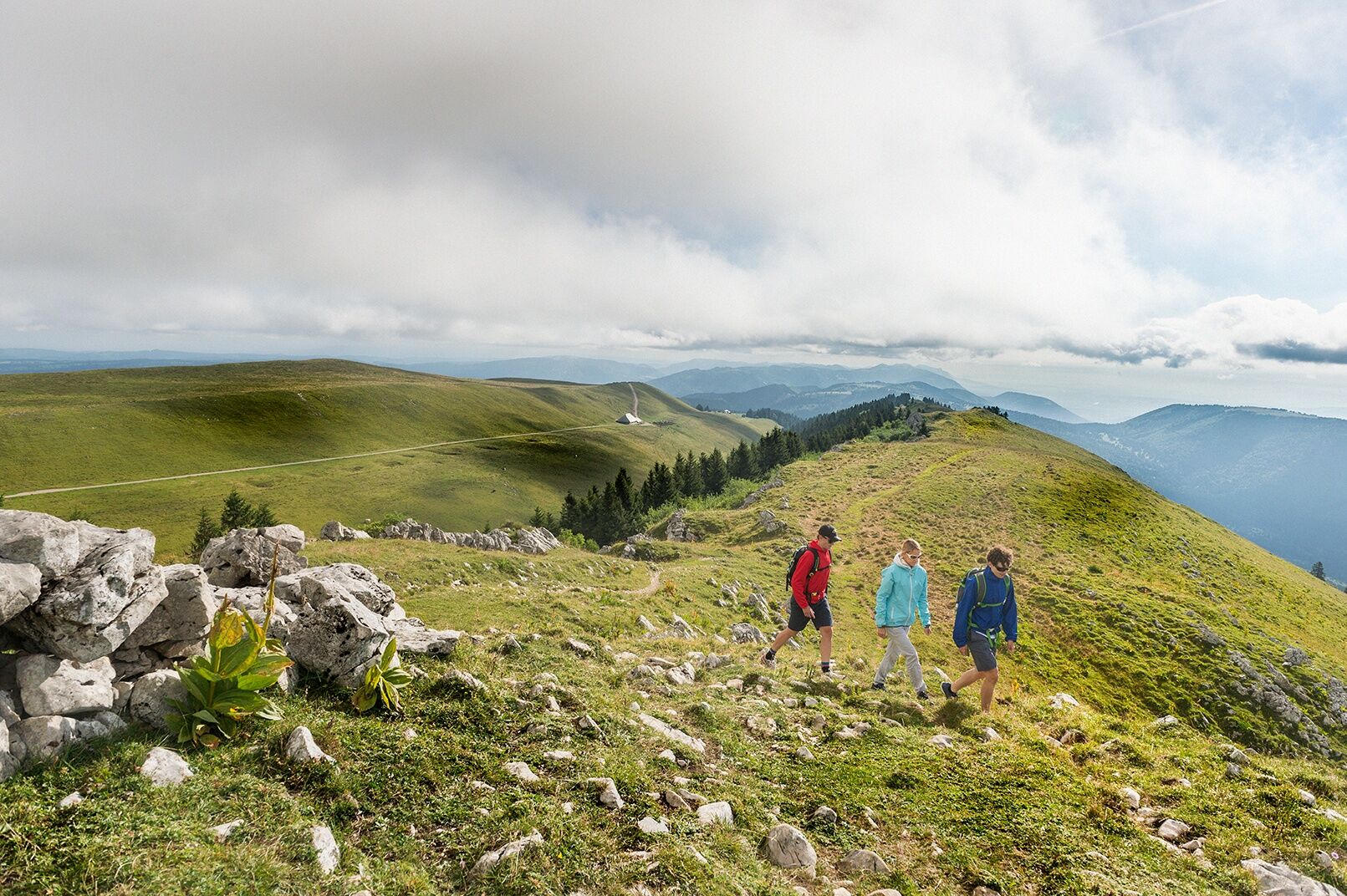
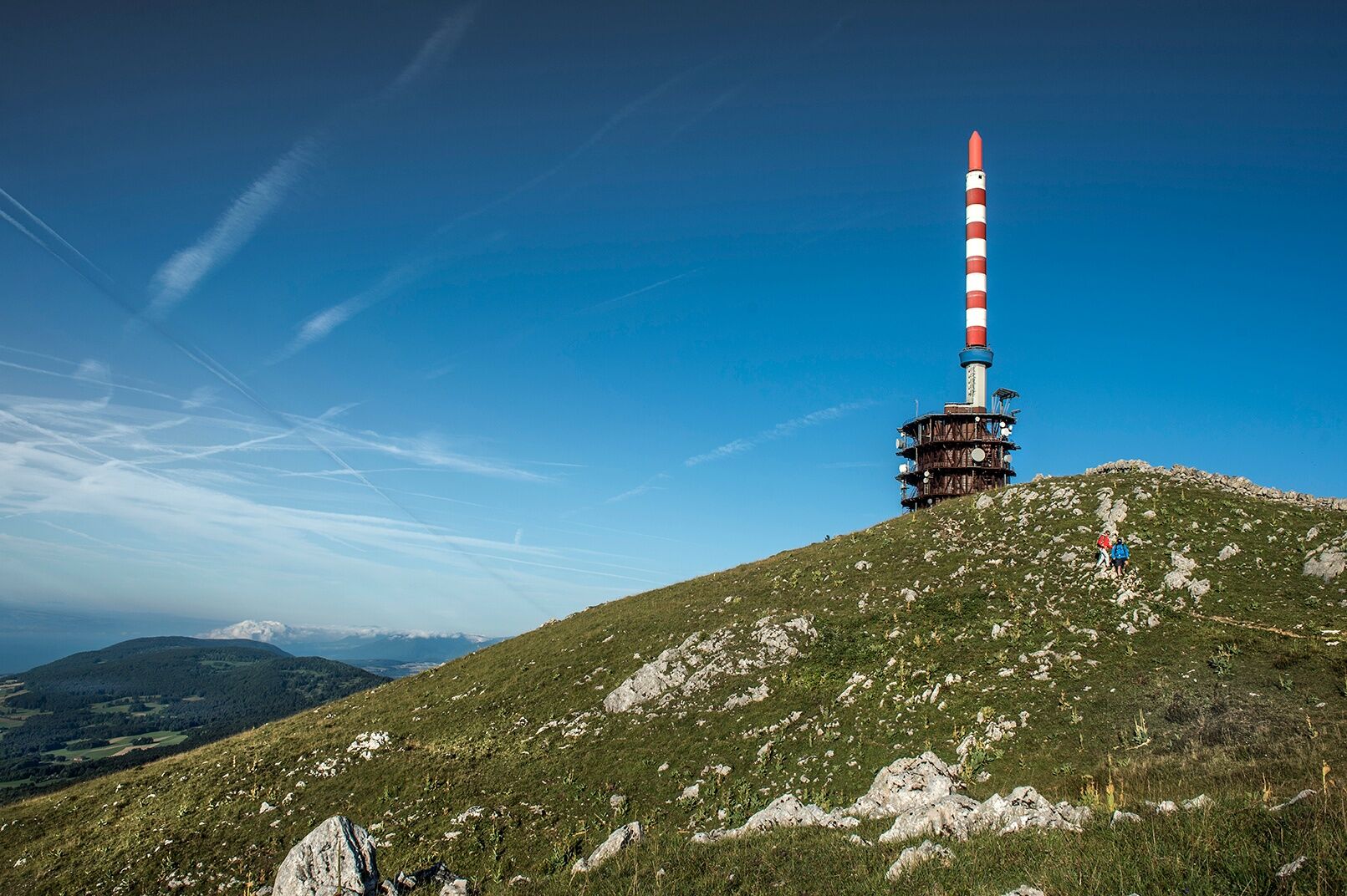
At the hike's starting point next to the Hotel Chasseral, follow the signs for Orvin. The route runs mostly on Jura Crest Trail 5 from Hiking in Switzerland (Wanderland Schweiz) and is signposted accordingly. This long-distance hiking trail leads from Dielsdorf in the canton of Zurich to Nyon in 15 stages. Enjoying the view is particularly worthwhile at the hotel: there is a magnificent panorama that stretches from the three-lakes landscape, across the Central Plateau, and through to the Alps. To the north, your view will sweep from St. Immertal to Mont Soleil with its numerous wind turbines, to the heights of the Freiberge plateau. The walk to reach the summit of the Chasseral and the hike's highest point is a gentle ascent. Information about the transmission tower is given on an information panel. The tower can be seen from afar and makes direction-finding easier. A longer descent on a path through wooded areas to Les Colisses du Haut now follows. You will be able to catch glimpses of the view in areas where there are fewer trees. The route continues across pastures with fewer fir trees and via Clédar de Pierrefeu to Zentralplatz / Place Centrale, Pt. 1288. Now continue across further pastures and past a reservoir to reach the SAC's "Jurahaus" mountain shelter. You will now leave the Jura Crest Trail 5 and turn off right towards Les Prés d'Orvin. Passing alongside the Métairie d'Evilard, the descent takes you over open pastures, some of which are sparsely covered with fir trees, and through woodland to your destination, next to the Les Prés-d'Orvin Bellevue bus stop.
- Highest point
- 1,604 m
- Endpoint
-
Les Prés-d'Orvin
- Height profile
-
 © outdooractive.com
 - Equipment
-
We recommend the following items: light trekking shoes, light rucksack, sun protection, rain jacket, first-aid kit, light picnic, enough liquid, mobile phone.
- Safety instructions
-
This route is exclusively on signposted paths of the hiking trail category.
- Additional information
-
Bernese Hiking Trails Association, Bern, Tel.: 031 340 01 01, email: info@beww.ch, website: www.bernerwanderwege.ch
- Public transportation
-
Getting there: By train to Biel/Bienne and then to St-Imier, continue by bus to Chasseral, Hôtel. Alternatively, by train to Ligerz, then by funicular and bus to Chasseral, Hôtel via Tessenberg.
Getting back: By bus from Les Prés-d'Orvin, Bellevue to Biel/Bienne
-

-
AuthorThe tour Hike the Chasseral ridge is used by outdooractive.com provided.