© Interlaken Tourismus - Melanie Studer

© Interlaken Tourismus - Melanie Studer

© Interlaken Tourismus - Melanie Studer

- Brief description
-
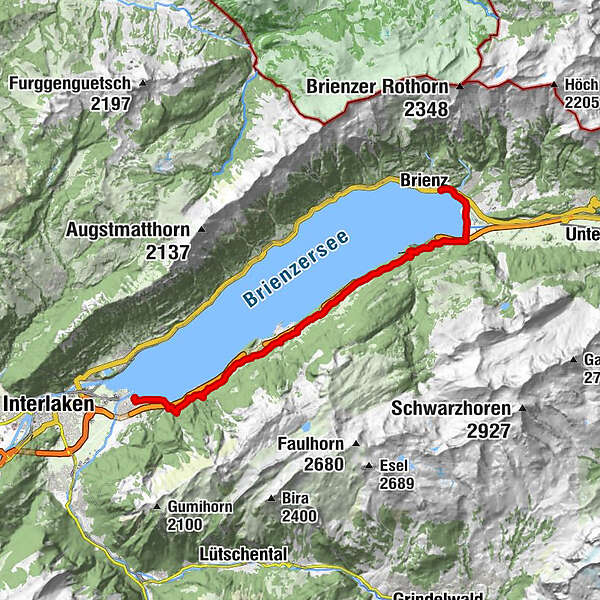
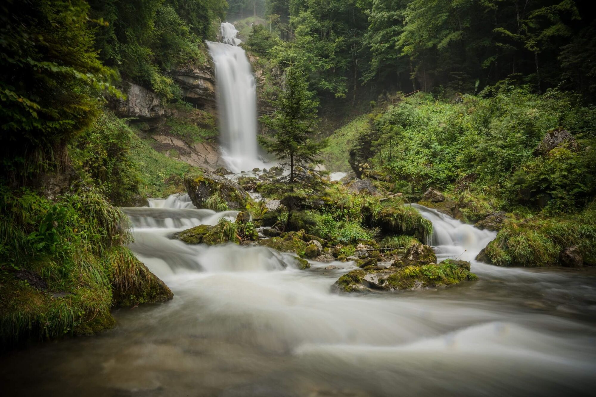
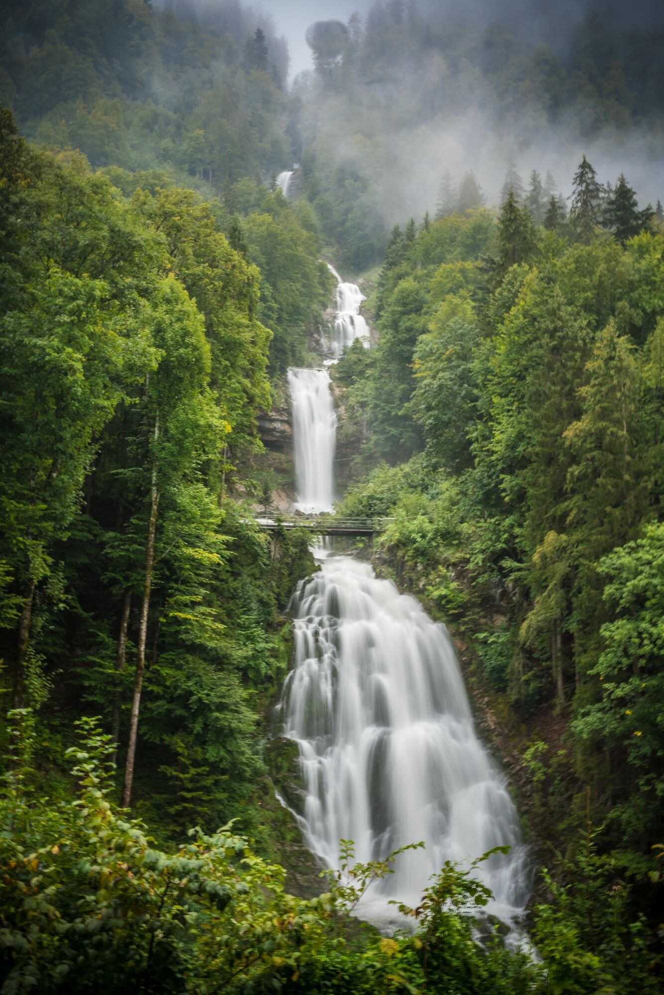
Water can splish, splash, babble, rush, roar or thunder. The Three Waterfalls Trail offers an exhilarating hike from Bönigen via Iseltwald to Brienz. The hike is a special experience for families as well as for all hikers, a route to three of the most impressive waterfalls in the Interlaken holiday region. Depending on your physical fitness, the entire hike can be made in one piece or in several stages.
- Difficulty
-
medium
- Rating
-
- Starting point
-
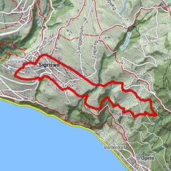
Bönigen, Schiffstation
- Route
-
Bönigen (568 m)Chalchofe0.6 kmErli0.9 kmRüti1.3 kmErschwandenbachfall3.3 kmEgg Fuhren5.6 kmOberi Fura5.7 kmFura6.0 kmMüli6.9 kmIseltwald7.3 kmLouberli7.5 kmEgg Isch7.8 kmIsch8.2 kmBrand9.3 kmHohflue11.2 kmGiessbachfall X12.7 kmGiessbachfall VI12.8 kmGiessbachfall III12.8 kmGiessbachfälle12.8 kmGiessbachfall V12.8 kmGiessbachfall IV12.9 kmGiessbachfall II12.9 kmGiessbachfall VII13.0 kmGiessbachfall VIII13.0 kmGiessbachfall IX13.2 kmGiessbach13.3 kmEngi14.4 kmEngi14.6 kmEngihubel14.8 kmNasen15.0 kmUeltsch15.1 kmWinterstäg16.4 kmInsel16.6 kmBrienz17.9 kmBrienz18.1 kmBrienz (See) (566 m)18.1 km
- Best season
-
JanFebMarAprMayJunJulAugSepOctNovDec
- Description
-
The other stations can be reached from Bönigen, Iseltwald, Giessbach and Brienz by boat, bus or train.
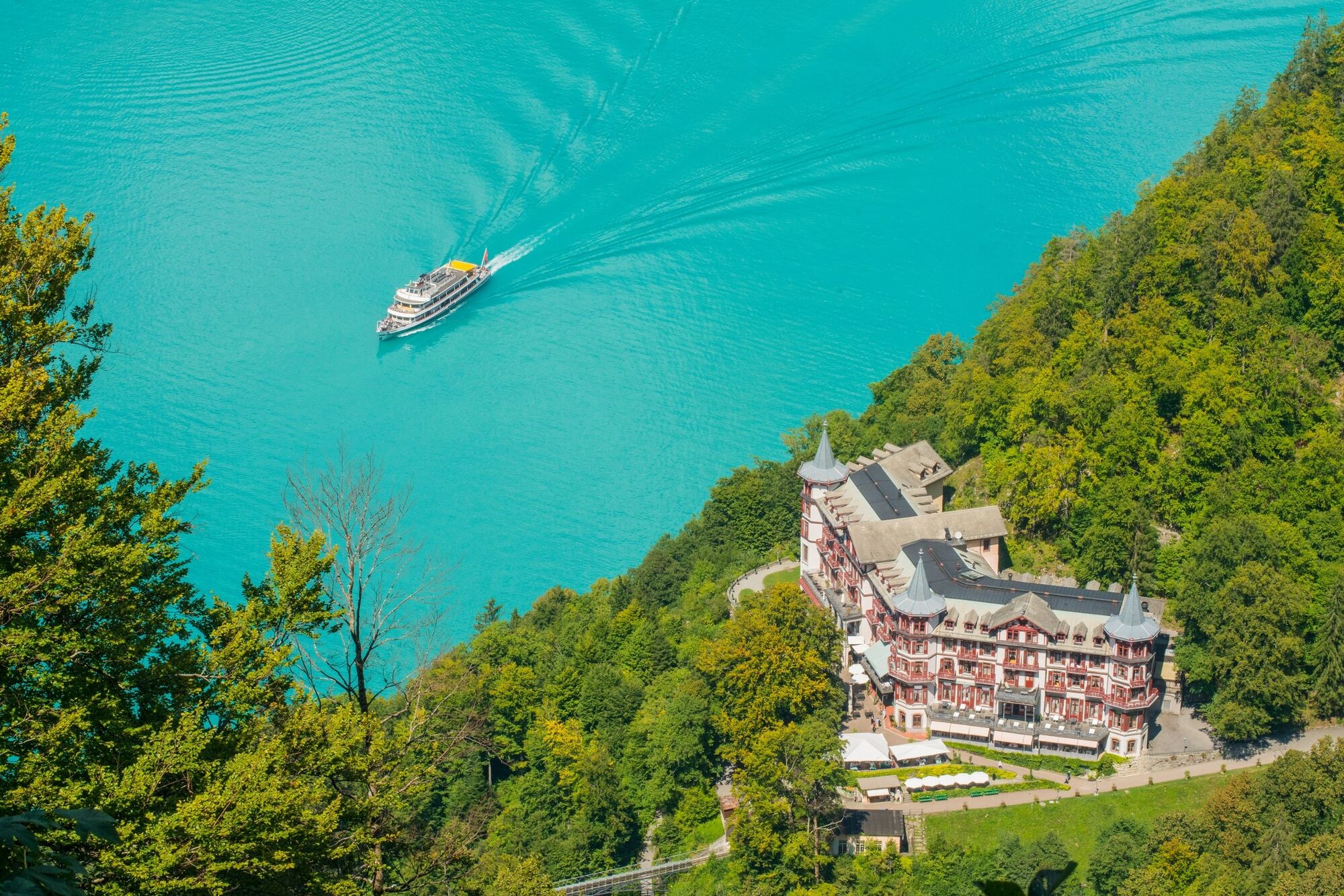
The trail has something to suit all tastes: lakeside sections and meadows, woodlands and craggy cliffs. The highlights of the hike include the three waterfalls, the incredible colour of Lake Brienz, a ride on the oldest tourist funicular in Switzerland (dating from 1879), a historic hotel (Grand Hotel Giessbach) resembling a fairy-tale castle and a romantic boat trip.
Bönigen boat station - Erschwandenbach Falls - Iseltwald Fura (1h 50 min).
Take the Uferweg (Lake Brienz shore path) and turn right into the forest after about 1 km. After the underpass follow the trail to the left towards Erschwandenbach. You reach the light-flooded waterfall by turning right along a narrow forest path. Back on the bridge, the hike continues to the end of the wide forest path and on through the forest alongside a cliff face where you reach the pilgrims' path and the Fura above Iseltwald.
Iseltwald Fura - Mülibach Falls (35 min.)
After a short walk on a surfaced road you turn left on to the hiking trail to the Mülibach Falls - a wonderful, mystic spot above Iseltwald.
Mülibach Falls - Giessbach Falls (1 h 55 min.)
You hike along a well maintained hiking trail through a forest, then across open fields with views of Lake Brienz to reach the impressive Giessbach Falls, which cascade over 14 steps into Lake Brienz.
Giessbach - Brienz boat station/railway station (1h 20 min.)
Europe's oldest funicular takes you from the historic Grand Hotel Giessbach down to the boat station. It's also possible to walk down to the boat station in about 20 minutes. You can also walk along a forest path to the Engi postbus stop above the hotel, from where you can take the postbus to Brienz or walk down the Axalpstrasse to Lake Brienz. You then follow the lake shore to reach the picturesque village of Brienz.
Looking for more hiking ideas in the Bernese Oberland?
Learn more about the hiking options around lakes Thun and Brienz. - Directions
-
Bönigen - Wasserfall Erschwandenbach - Iseltwald Fura - Wasserfall Mülibach - Giessbachfälle - Brienz
- Highest point
- 791 m
- Endpoint
-
Brienz, Bahnhof / Schiffstation
- Height profile
-
 © outdooractive.com
 - Additional information
- Author
-
The tour Three Waterfalls Trail is used by outdooractive.com provided.
GPS Downloads


General info
Refreshment stop
A lot of view
Other tours in the regions
-
Obwalden
2018
-
Brienzersee
1057
-
Brienz - Axalp
383