- Brief description
-
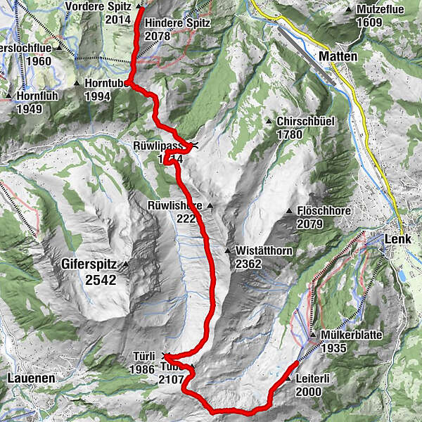
Take the gondola up to the Rinderberg, via Alp Wistätt to the Leiterli mountain station and take the gondola down to Lenk.
- Difficulty
-
difficult
- Rating
-
- Starting point
-
Zweisimmen, mountain station Rinderberg
- Route
-
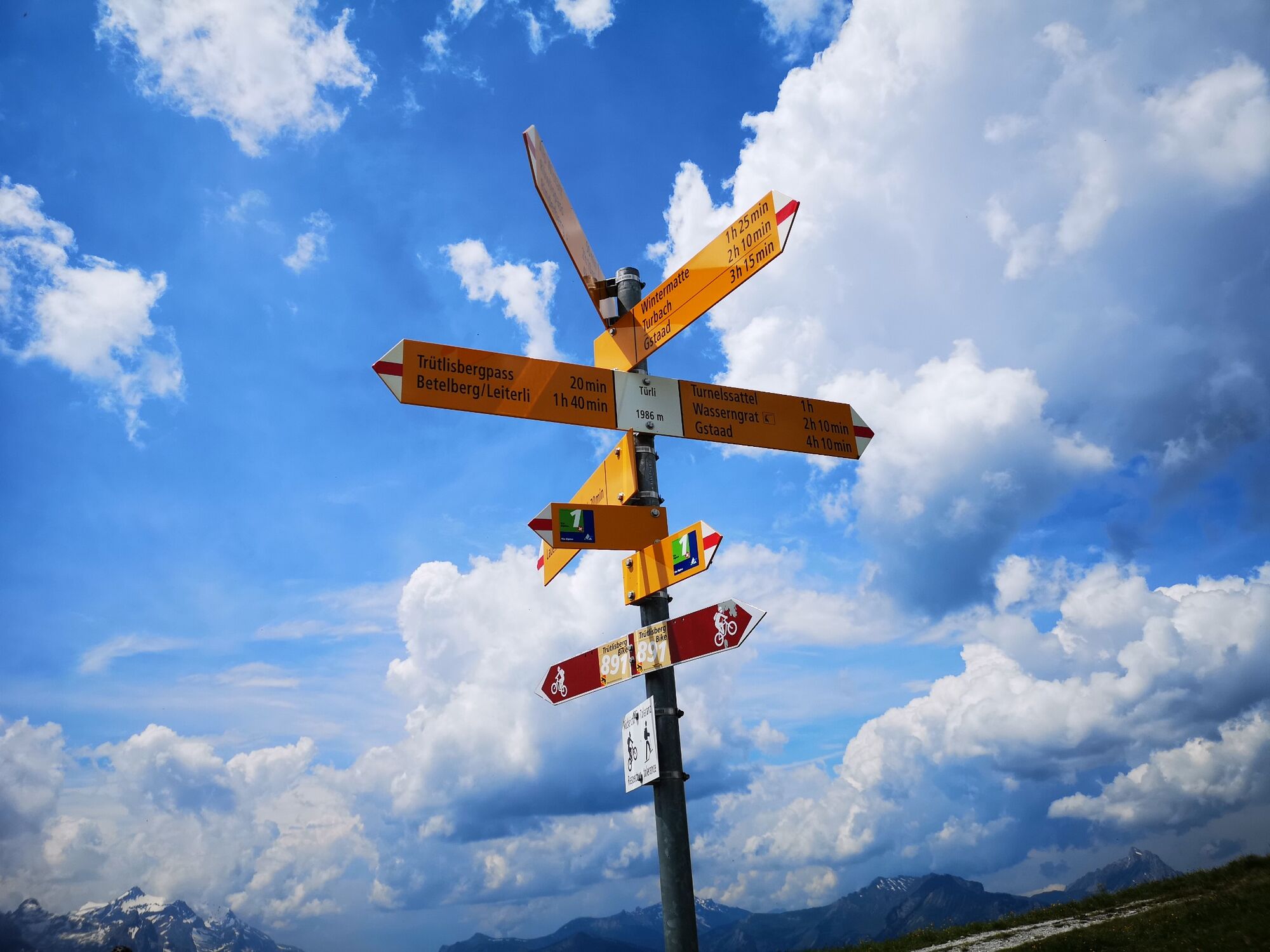
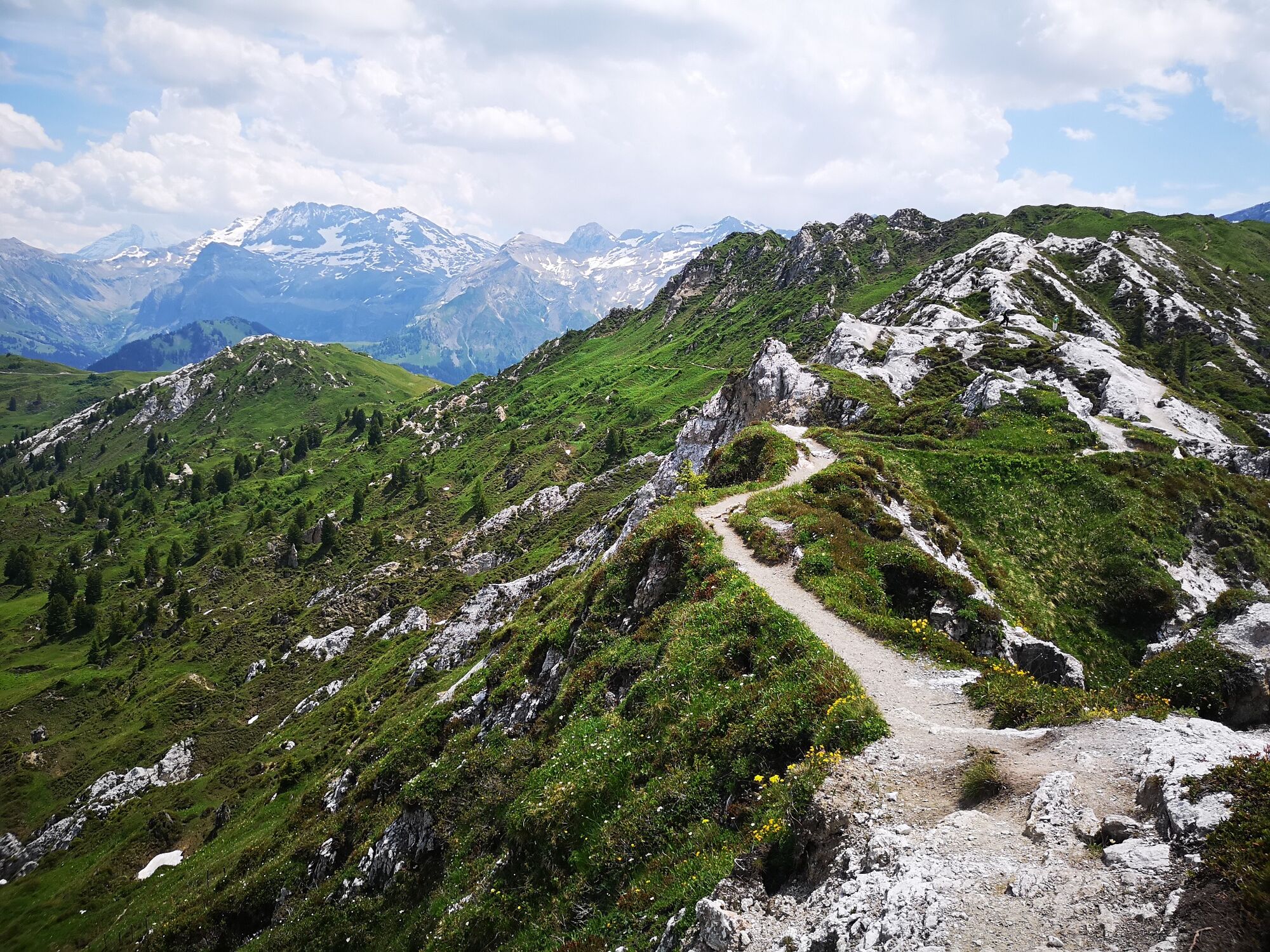
Bergrestaurant Rinderberg-SpitzHindere Spitz (2,078 m)0.3 kmParwengesattel (1,990 m)1.3 kmRüwlipass (1,714 m)4.7 kmTürli (1,986 m)12.1 kmTube (2,107 m)12.8 kmTrütlisbergpass (2,032 m)13.1 kmBerghaus Leiterli17.4 kmLeiterli (Bergstation) (1,947 m)17.5 km
- Best season
-
JanFebMarAprMayJunJulAugSepOctNovDec
- Description
-
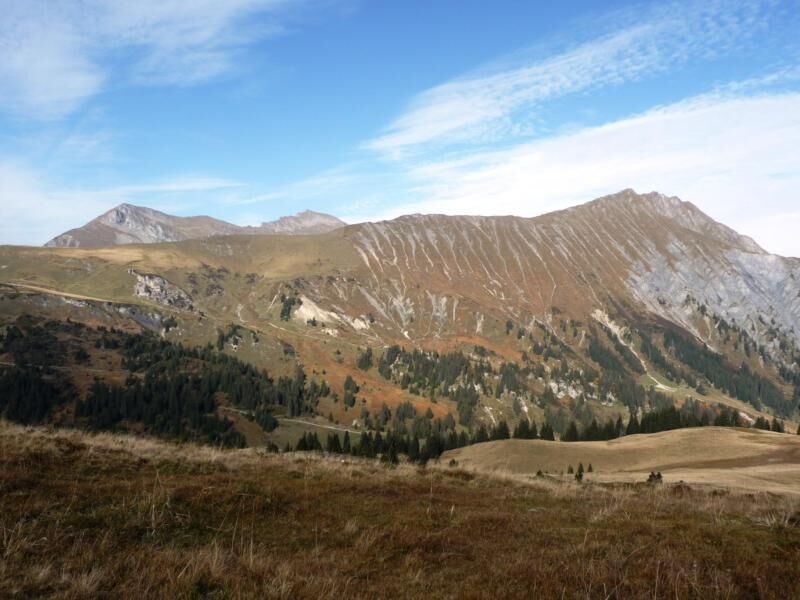
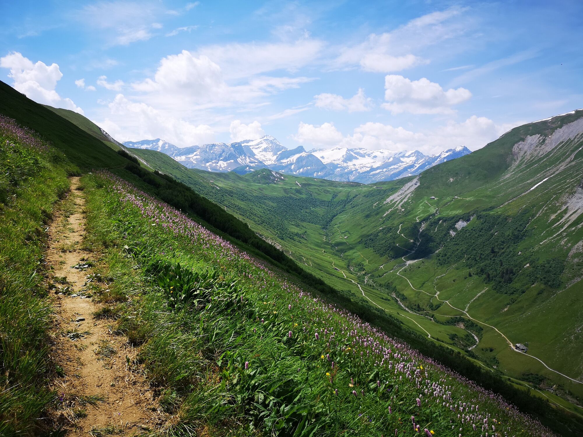
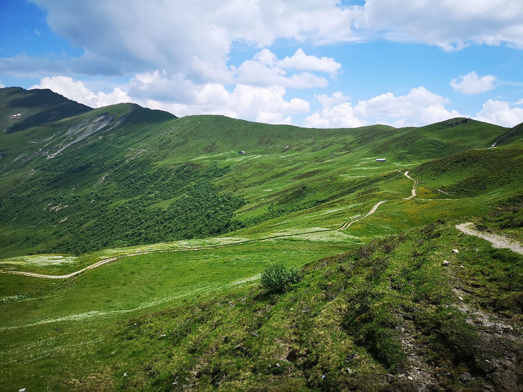
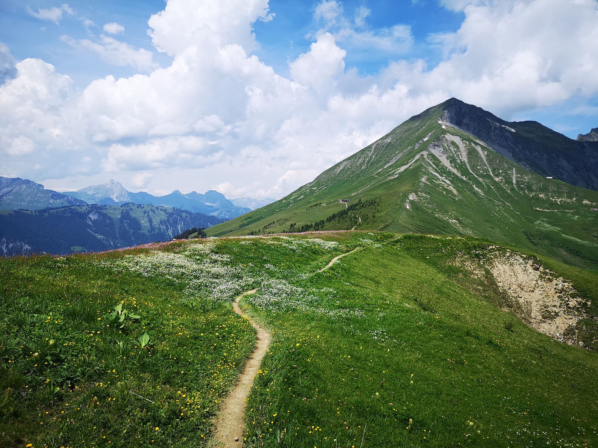
Take the cable car up to the Rinderberg for this high-mountain hike, characterised by wide-open alpine pastures and steep meadows of wild hay. At the end of the Gandlouenengrat you cross over the Parwengechessel and Undere Zwitseregg down to the Rüwlise Pass. The trail then gains in altitude as it takes you up to the Heuberg. Caution: here the path is narrow and falls away sharply as it winds its way high above the Turbachtal valley towards the Trüttlisberg Pass. From there on the way takes you to the amazing Gipskrater landscape «Gryden» (attention: the rocks are slippery if they are wet!) Vith the view on the Lenker alps to the mountain station Leiterli (Betelberg). For the return journey take the cable car to Lenk and then the train to Zweisimmen.
- Directions
-
Zweisimmen - Rinderberg - Alp Wistätt - Leiterli - Lenk
- Highest point
- 2,071 m
- Endpoint
-
Lenk, Berghaus Leiterli
- Height profile
-
 © outdooractive.com
 - Equipment
-
Good footwear, snacks to savor during a break - why not a Fondue-Backpack?
- Tips
-
More informations on www.gstaad.ch.
- Additional information
- Directions
-
The Destination Gstaad is located in the south-west of Switzerland right on the border to the French-speaking part of the country. The Destination is easily accessed by rail or car from the regions around Lake Thun and Lake Geneva and the Gruyere region Direct connections to the European high-speed rail network and all international airports in Switzerland guarantee a time-saving and pleasant journey.
- Public transportation
-
By train: Zweisimmen, train station
By bus: Zweisimmen, train station or Zweisimmen, Talst. Rinderberg
As of the first night, free use of the public transport in the Destination Gstaad as well as in the Lenk-Simmental region with the Gstaad Card. You can find more information about the Gstaad Card at: www.gstaad.ch/gstaadcard - Parking
-
Paid parking at the valley station Rinderberg
-

-
AuthorThe tour Rinderberg - Alp Wistätt - Leiterli is used by outdooractive.com provided.
General info
-
Thyon les Collons
1433
-
Destination Gstaad
740
-
St. Stephan / Simmental
297