- Brief description
-
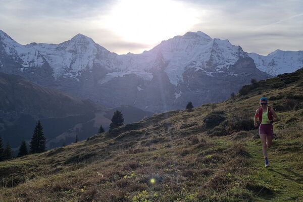
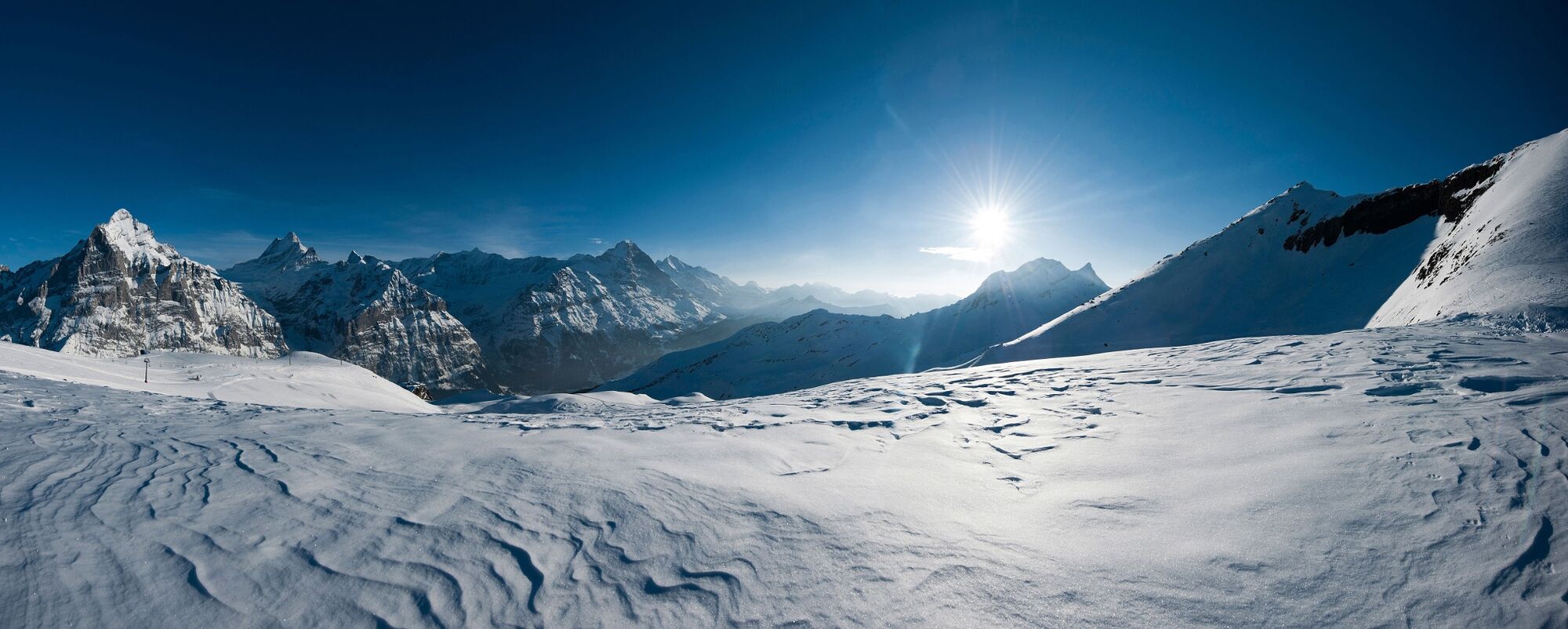
Multifaceted winter trail that entices hikers with 1,300 metres of elevation, countless places to stop for refreshment and a magnificent view of the Eiger, Schreckhorn and Wetterhorn.
- Difficulty
-
medium
- Rating
-
- Starting point
-
Grindelwald sports centre
- Route
-
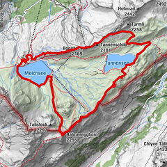
Grindelwald0.1 kmMilchbach1.9 kmBergrestaurant Bort5.4 kmChuestall5.5 kmBort (1,564 m)5.6 kmNodhalten7.7 kmBerggasthaus Waldspitz10.1 kmBachlägerwasserfall10.9 kmFirst14.7 km
- Best season
-
JanFebMarAprMayJunJulAugSepOctNovDec
- Description
-
This trail starts in the centre of Grindelwald and follows the winter hiking trail through the small village of Mühlebach to the Bort station. It continues along the winter hiking trail and sledging run through a wooded landscape in the direction of the Waldspitz mountain inn, which has a beautiful terrace with plenty of sun. Next comes an uphill climb over several strenuous metres of elevation on the winter hiking trail up to the First mountain inn, where hikers can find something to satisfy their hunger and thirst. One highlight not to be missed is the memorable First Cliff Walk. The observation platform, which is located below the mountain inn, juts out 45 metres into nothingness and guarantees sheer thrills. From the First, you can head back down to Grindelwald by gondola or on foot.
- Directions
-
Grindelwald-Terrassenweg-Mühlebach-Bort-Waldspitz-First
- Highest point
- 2,272 m
- Endpoint
-
First summit station (2168 asl)
- Height profile
-
 © outdooractive.com
 - Equipment
-
First aid kit
Weather-appropriate clothing - Onion principle (always carry waterproofs)
Drink and food provisions
Mobile telephone - Safety instructions
- Tips
-
Adi’s Skibar
First Cliff Walk
Mountain Restaurant First - Additional information
- Directions
-
There are different ways to reach the region by car. The fastest way from Basel and Geneva is via Berne. The fastest route from Zurich is through Lucerne and the Brünig Pass. The pass is open in summer and winter.
From the south, the route goes over the Grimsel or Susten Pass into the region. Both passes are only open in summer. Alternatively, you can take the Simplon Pass and then Lötschberg car transport.
- Public transportation
-
Thanks to its central location in Europe, Switzerland is served by international trains from over 12 countries. Within Switzerland, Intercity trains run directly from Basel and Lucerne to the Jungfrau Region. Travellers from Zurich have to change in Berne. The trains run every half hour.
Ticket purchase Jungfrau Region
- Parking
-
Grindelwald has public car parks with covered parking spaces: Eiger+ car park (252 parking spaces) and Sportzentrum car park (160 parking spaces). They cannot be reserved in advance. Uncovered parking spaces are available everywhere in the village.

- Author
-
The tour Winter Uphill Trail to the First W2 is used by outdooractive.com provided.


General info
-
Obwalden
66
-
Jungfrau Region
54
-
Grindelwald - First
40