- Brief description
-
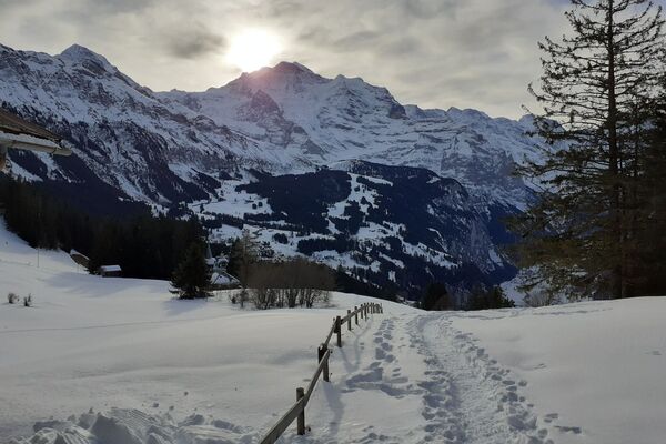
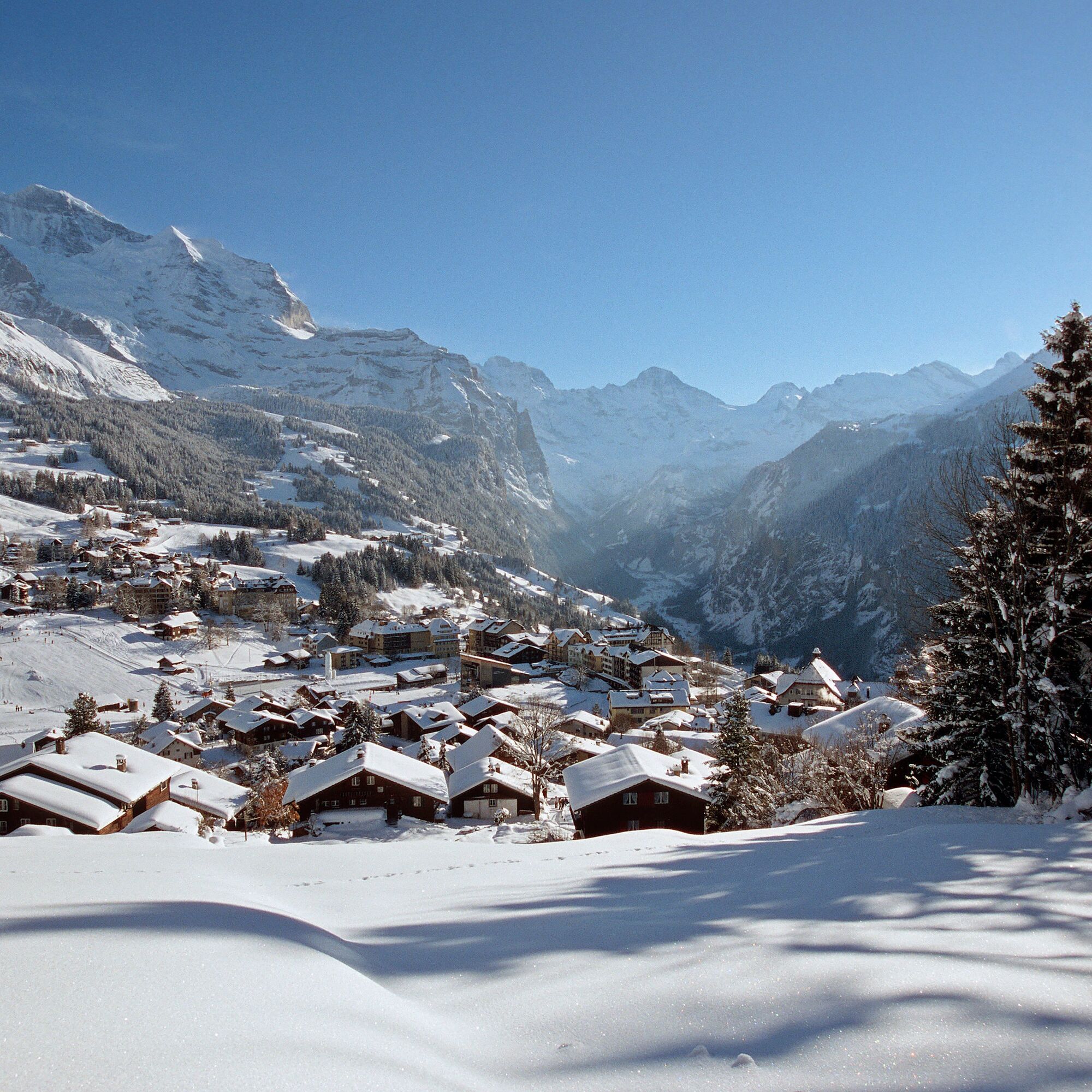
From the Leiterhorn, the Lauterbrunnen Valley presents itself in its entire length. Also magnificent: the view all the way up to the Jungfrau and the striking, pyramid-shaped Silberhorn.
- Difficulty
-
easy
- Rating
-
- Starting point
-
Wengen
- Route
-
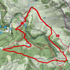
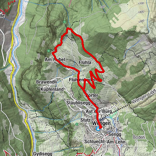
WengenGertschlimatteAm AcherGlausfuhrenRestaurant Eiger (1,276 m)0.0 kmGruebi beim Falken0.0 kmSchonegg0.0 kmPasta & More Restaurant0.1 kmSchilt0.2 kmRestaurant 19030.2 kmAuf der Burg0.3 kmAuf dem Bühl0.3 kmBodendiehle0.3 kmSchleif0.4 kmStutzera0.5 kmGruebiweidli0.5 kmGalliweidli0.5 kmStäublisegg0.5 kmBorter0.6 kmBirchen0.9 kmAn der Matte1.0 kmAn der Ledi1.2 kmAm Hubel1.5 kmLeiterhorn (1,515 m)2.4 kmFlühla4.0 kmStutzera4.3 kmFlühlenboden4.6 kmStäublisegg4.8 kmBorter4.9 kmGalliweidli4.9 kmGruebiweidli5.0 kmRestaurant 19035.1 kmSchleif5.1 kmBodendiehle5.1 kmAuf dem Bühl5.2 kmAuf der Burg5.2 kmSchilt5.2 kmPasta & More Restaurant5.4 kmWengen5.4 kmGertschlimatte5.4 kmSchonegg5.5 kmGruebi beim Falken5.5 kmRestaurant Eiger (1,276 m)5.5 kmAm Acher5.5 kmGlausfuhren5.5 km
- Best season
-
AugSepOctNovDecJanFebMarAprMayJunJul
- Description
-
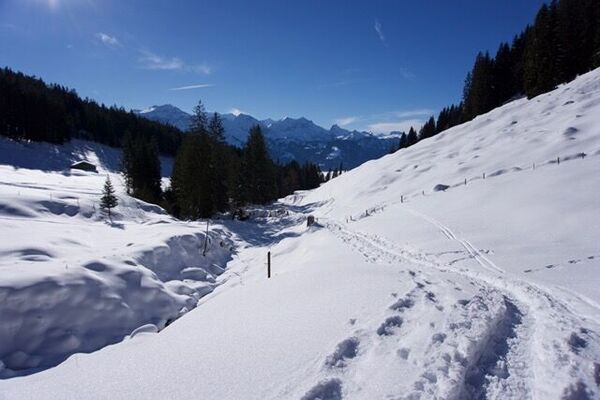
From the village centre of Wengen, a reasonably flat trail leads via Ledi to Hunnenfluh. En route, the trail affords breath-taking views of the Lauterbrunnen Valley. From Hunnenfluh, you can enjoy an amazing vista of the Lütschental, and even down as far as Interlaken. Here you'll have to put on your snowshoes.
Then you'll climb up for 20 to 30 minutes, through picturesque woodland, to the Leiterhorn. Along the way, the snow-covered trail affords views of Wengen and the mighty Jungfrau. Once you reach the Leiterhorn, you'll have an incredible view of the 4000m high mountain chain and the deep Lauterbrunnen Valley. For those who don't suffer from vertigo, there's an impressive view to the north, of an almost 700m vertical drop down to Zweilütschinen.
The subsequent return is via Ussri Allmi and Flielenboden, down a none-too-steep wooded pathway to Wengen.
See also
Wengen Tourismus
Dorfstrasse
CH-3823 Wengen
+41 (0)33 856 85 85
www.wengen.ch
info@wengen.swiss - Directions
-
Wengen - Lischboden - Hunnenfluh - Ussri Allmi - Wengen
- Highest point
- 1,521 m
- Endpoint
-
Wengen
- Height profile
-
 © outdooractive.com
 - Equipment
-
Snowshoes
Telescopic poles
Maps
Sun cream & lip protection
Drinks and food
If available: Altimeter, compass
- Directions
-
From Basel and Geneva, the fastest route to the Jungfrau Region is via Bern. From Zurich, the route via Lucerne and the Brünig Pass is recommended. The pass is open all year round.
From the south, travel to the Jungfrau Region via the Grimsel or Susten Pass. Both passes are only open in summer. An alternative is the Simplon Pass with subsequent car transport through the Lötschberg tunnel.
The journey from Interlaken to Lauterbrunnen takes about 20 minutes.
- Public transportation
-
Thanks to its central location in Europe, Switzerland is served by international trains from over 12 countries. Within Switzerland, Intercity trains run from Basel and Lucerne directly to the Jungfrau Region. Travellers from Zurich change trains in Bern. The trains run every half hour.
The journey on the blue and yellow Bernese Oberland Bahn (BOB) train from Interlaken Ost to Lauterbrunnen takes 20 minutes. We board the front part of the train, as it splits in Zweilütschinen. Those who get on at the back travel to Grindelwald.
- Parking
- Author
-
The tour Leiterhorn Trail is used by outdooractive.com provided.

General info
-
Aletsch Arena
131
-
Jungfrau Region
73
-
Wengen
26