
- Brief description
-
Im Nationalpark durch die letzte, noch völlig intakte Flussauenlandschaft Europas.
- Difficulty
-
medium
- Rating
-
- Route
-
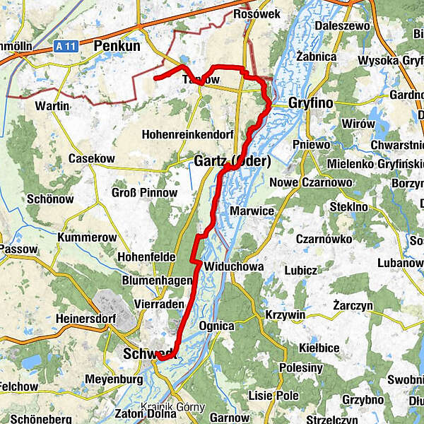
SchwedtGatow7.1 kmTeerofenbrücke9.9 kmGartz (6 m)21.1 kmPark Restaurant26.4 kmDorfkirche Mescherin27.2 kmMescherin (4 m)27.8 kmStaffelde30.1 kmNeurochlitz (35 m)32.7 kmTantow (18 m)37.5 km
- Best season
-
JanFebMarAprMayJunJulAugSepOctNovDec
- Highest point
- 47 m
- Endpoint
-
Tantow (Bahnhof)
- Height profile
-
 © outdooractive.com
- Author
-
The tour Oder-Neiße-Radweg (2) is used by outdooractive.com provided.
GPS Downloads


General info
Refreshment stop
Cultural/Historical
Flora
Fauna
A lot of view