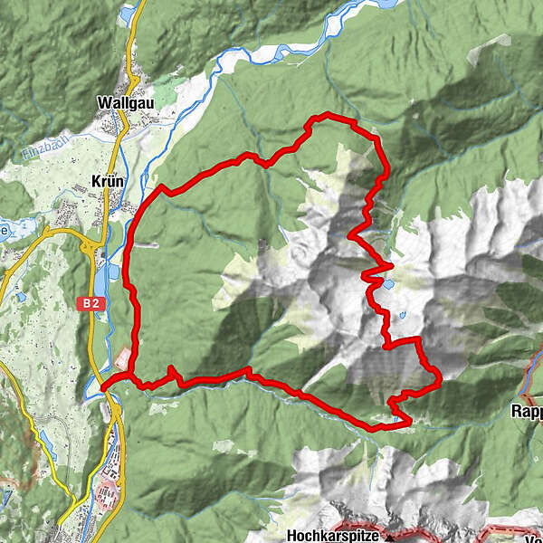
Soiernspitze Südseite

Logo Soiernspitze Südseite
Tour data
26.7km
862 - 2,257m
Distance
1,428hm
Ascent
09:00h
 
Duration
Rating
Technique
Fitness
Landscape
Experience
Route
Vereiner Alm
6.7 km
Soiernscharte (2,112 m)
10.7 km
Soiernhaus
13.2 km
Fischbachalm
16.5 km
Schöttelgraben
19.9 km
Isarhorner Alm
26.5 km
Highest point
2,257 m

2,8
Overall rating

5

20

%

4

20

%

3

20

%

2

0

%

1

40

%

GPS Downloads
  • GPX GPS Exchange Format (XML)
  • KML Google Earth, Google Maps
QR Download Codes for Mobile Phones

Trail conditions

Asphalt
Gravel
Meadow
Forest
Rock
Exposed
Other tours in the regions

Popular tours in the area

"Königstour" über die Gipfel

Hiking
4.52km | 322hm | 04:00h

Wasserfall-Weg Jachenau

easy Hiking
9km | 136hm | 03:00h

Wank

medium Hiking
12.7km | 922hm | 04:42h

Jochberg

medium Hiking
9.64km | 714hm | 05:00h