© Tourist Information Schwangau - Jana Lebetz

© Tourist Information Schwangau - Jana Lebetz

© Tourist Information Schwangau - Jana Lebetz

© Tourist Information Schwangau - Jana Lebetz

© Tourist Information Schwangau - Hannes Bruckdorfer

- Brief description
-
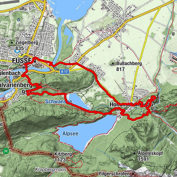
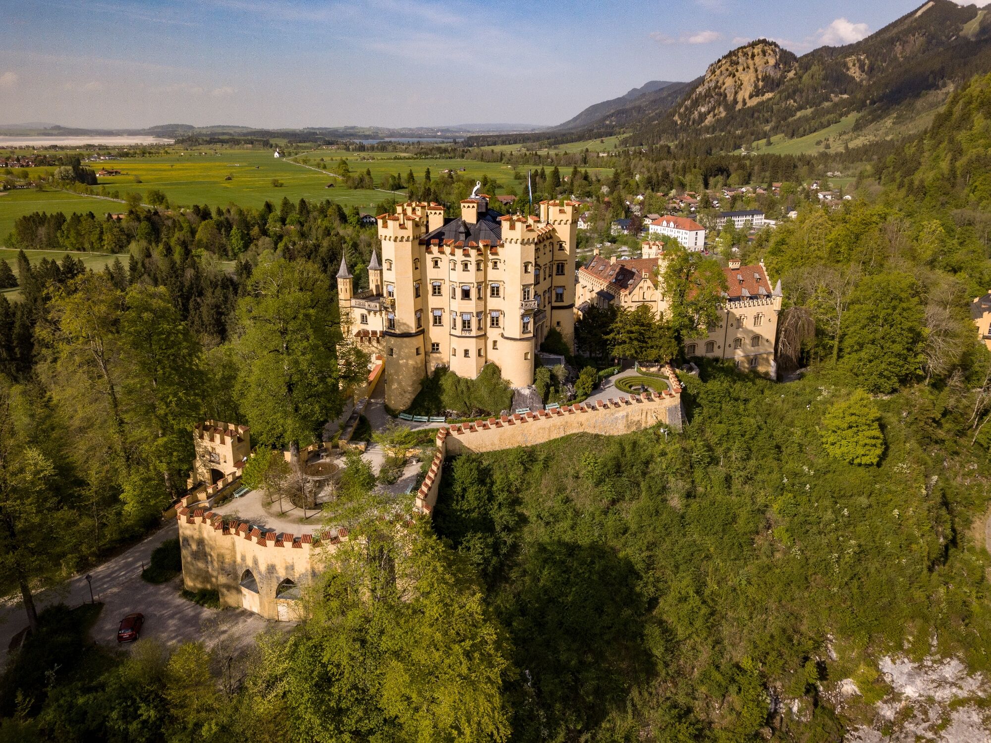
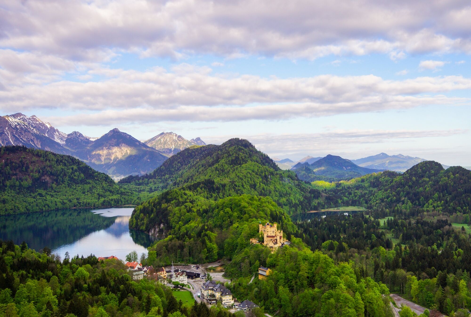
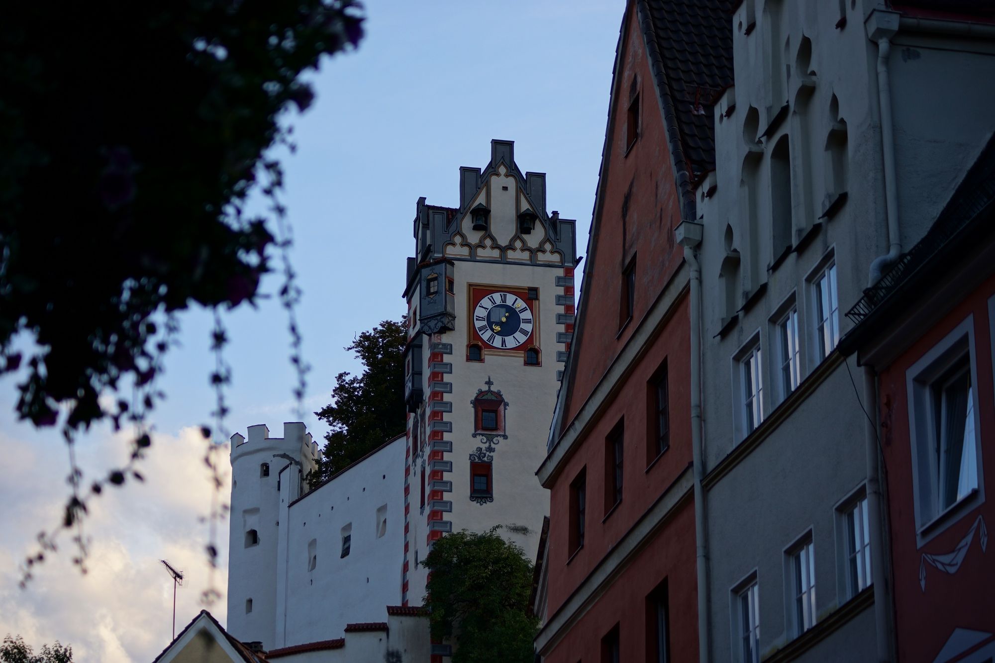
Parkplatz Hohenschwangau – Schloss Neuschwanstein – Schloss Hohenschwangau – Schwansee – Kalvarienberg – Füssen – Hohes Schloss – Parkplatz Hohenschwangau
- Difficulty
-
medium
- Rating
-
- Route
-
Hohenschwangau0.1 kmWasserfall unterm Schloss0.6 kmSchlossrestaurant Neuschwanstein1.0 kmPanoramablick Schwangau1.7 kmPöllatfall1.9 kmChristkönigskapelle3.3 kmHeiligkreuz-Kapelle7.7 kmStation 127.7 kmStation 137.7 kmKalvarienberg (953 m)7.8 kmStation 117.8 kmStation 107.8 kmStation 14 Heiliggrab-Kapelle7.8 kmStation 97.9 kmKerkerkapelle7.9 kmStation 87.9 kmStation 78.0 kmStation 68.0 kmStation 58.0 kmStation 48.2 kmMarienkapelle8.2 kmStation 38.2 kmStation 28.3 kmStation 18.5 kmAbschied-Jesu-Kapelle8.5 kmUnsere Liebe Frau am Berg8.6 kmMagnusblick8.7 kmSpitalkirche Hl. Geist8.8 kmFüssen (808 m)9.0 kmSt. Sebastian9.3 kmWaldmann11.4 kmNeuschwanstein-Blick11.5 kmAlterschrofen11.5 kmHohenschwangau13.2 km
- Best season
-
JanFebMarAprMayJunJulAugSepOctNovDec
- Highest point
- 974 m
- Endpoint
-
Parkplatz Hohenschwangau
- Height profile
-
 © outdooractive.com


- Author
-
The tour Drei-Schlösser-Weg is used by outdooractive.com provided.
GPS Downloads


General info
Refreshment stop
Cultural/Historical
Flora
Fauna
A lot of view
Other tours in the regions
-
Allgäu
2357
-
Naturparkregion Reutte
1432
-
Hohenschwangau
527