Tour data
4.96km
702
- 807m
129hm
140hm
01:28h


Die Länderbahn GmbH DLB
- Brief description
-
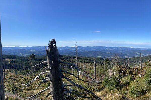
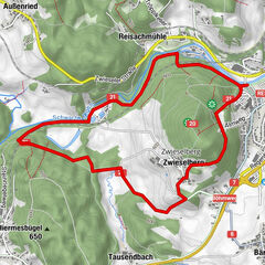
Die Rundwanderung hat eine Länge von 5km und eine leichte Schwierigkeitsstufe. Außerdem bietet sie Einkehrmöglichkeiten und wird als familienfreundlich bezeichnet.
- Route
-
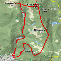
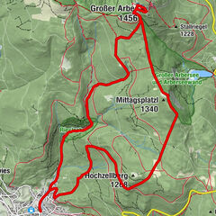
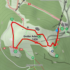
Böhmhof0.1 kmKuh - Alm1.9 kmObere Glashütte2.7 kmGlashütte2.9 kmAussichtsplattform des roten Pfads der Ameisenstraße3.9 kmBöhmhof4.8 km
- Highest point
- 807 m
- Endpoint
-
Haltestelle Böhmhof
- Height profile
-
 © outdooractive.com
- Author
-
Die Länderbahn GmbH DLBThe tour Riederin - Rundweg ab Haltestelle Böhmhof is used by outdooractive.com provided.
GPS Downloads


Other tours in the regions
-
Bayerischer Wald
520
-
Bodenmais
250