- Brief description
-
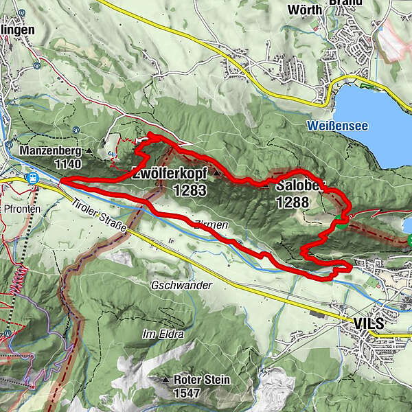
Die Tour führt zur Burgruine Falkenstein und zur Ruine Vilsegg.
- Difficulty
-
medium
- Rating
-
- Route
-
Falkenstein (1,267 m)1.7 kmRestaurant 12501.8 kmSalober (1,288 m)3.9 kmWeißensee Panorama Blick4.7 kmVierseenblick5.0 kmBlick über Alatsee und Neuschwanstein5.5 kmSaloberalm5.7 kmVils (826 m)7.2 kmSt. Anna7.4 kmKapelle zum Guten Hirten10.2 km
- Best season
-
JanFebMarAprMayJunJulAugSepOctNovDec
- Highest point
- 1,267 m
- Endpoint
-
Parkplatz gegenüber der Breitenbergbergbahn
- Height profile
-
 © outdooractive.com
- Author
-
The tour Höchstgelegene Burgruine Deutschlands is used by outdooractive.com provided.
GPS Downloads


General info
Refreshment stop
Cultural/Historical
A lot of view