© Alpenregion Tegernsee Schliersee - Dietmar Denger

© Alpenregion Tegernsee Schliersee - Dietmar Denger

© Alpenregion Tegernsee Schliersee - Lukas Hanrieder

© Alpenregion Tegernsee Schliersee - Dietmar Denger

- Difficulty
-
easy
- Rating
-
- Route
-
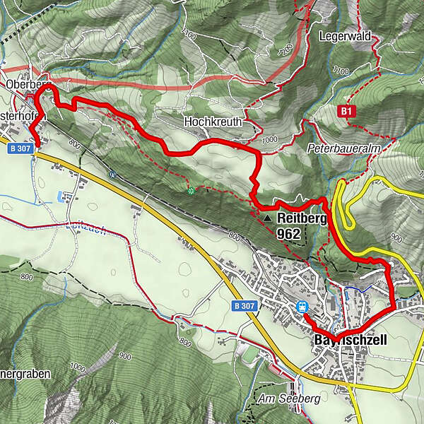
Bayrischzell0.3 kmSchönborn Kapelle0.6 kmHochkreuth2.8 kmOberberg4.2 kmOsterhofen4.4 km
- Best season
-
JanFebMarAprMayJunJulAugSepOctNovDec
- Highest point
- 988 m
- Height profile
-
 © outdooractive.com

- Author
-
The tour Wendelstein-Ringlinie: Hochkreuth-Tour is used by outdooractive.com provided.
GPS Downloads


General info
Refreshment stop
A lot of view
Other tours in the regions
-
Chiemsee - Alpenland
1212
-
Bayrischzell
548