- Brief description
-
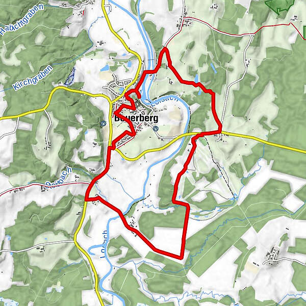
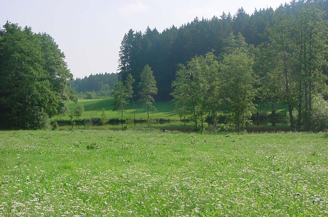
A very varied hike. It takes us from Beuerberg with its former monastery through pure nature, but also past the lawns of a golf course.
- Difficulty
-
medium
- Rating
-
- Starting point
-
Car park in front of the volunteer fire brigade Beuerberg
- Route
-
Beuerberg0.2 kmGasthaus Zur Mühle0.7 kmHofstätt3.7 kmSterz4.4 kmBoschhof7.4 kmBierbichl8.4 kmBachbauer9.0 kmOberfeld9.0 kmBrandstätt9.3 kmBeuerberg10.4 kmRistorante Bellavista10.8 km
- Best season
-
JanFebMarAprMayJunJulAugSepOctNovDec
- Description
-
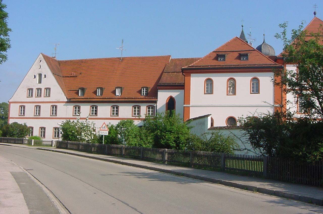
The monastery in Beuerberg is dedicated to St. Peter and Paul and was founded in the 12th century by Count Otto von Eurasburg. In the course of secularisation, the Beuerberg monastery was dissolved in 1803, and Salesian nuns worked here again from 1835. Today, the former convent church is the parish church of Beuerberg.
- Directions
-
From the car park, we take the right-hand road „Am Pfarranger“. Before the Beuerberg monastery, we turn left. After turning left, follow the signs to Gasthaus Mühle. Behind the inn begins the footpath and cycle path to Eurasberg via Herrnhausener Strasse, which we follow. After the second bridge over the Loisach, turn left and then right again through the Schaberer- and left past the Bräumann Hof. After crossing a stream, you come to the road and turn right to the golf course. Here you also have the possibility to stop for a break. At the golf course we take the right path. At the end of the course, we turn right into the forest and up to the Boschhof. We cross a bridge and see the cycle path sign „Beuerberg“, which shows us the way to our destination.
- Highest point
- 621 m
- Endpoint
-
Car park in front of the volunteer fire brigade Beuerberg
- Height profile
-
 © outdooractive.com
 - Equipment
-
Day hiking rucksack (approx. 20 litres) with rain cover, sturdy and comfortable shoes, multi-layered clothing suitable for the weather and hard-wearing, telescopic poles if necessary, sun and rain protection, provisions and drinking water, first aid kit, pocket knife, mobile phone, headlamp if necessary, maps.
- Directions
-
A95, exit Seeshaupt, direction Königsdorf, until Beuerberg
- Parking
-
Bahnhofstraße Beuerberg, car park in front of the volunteer fire brigade

- Author
-
The tour Round Beuerberg is used by outdooractive.com provided.


General info
-
Tölzer Land
848
-
Eurasburg
88