Via Aule-Alm to the Riessersee – short but beautiful running trail

Hiking

© Unbekannt - GaPa Tourismus GmbH

© GaPa Tourismus

© GaPa Tourismus - Markt Garmisch-Partenkirchen

© GaPa Tourismus GmbH - GaPa Tourismus Online

© Unbekannt - GaPa Tourismus GmbH
© GaPa Tourismus GmbH - ©GaPa Tourismus GmbH-Christian Stadler


- Brief description
-
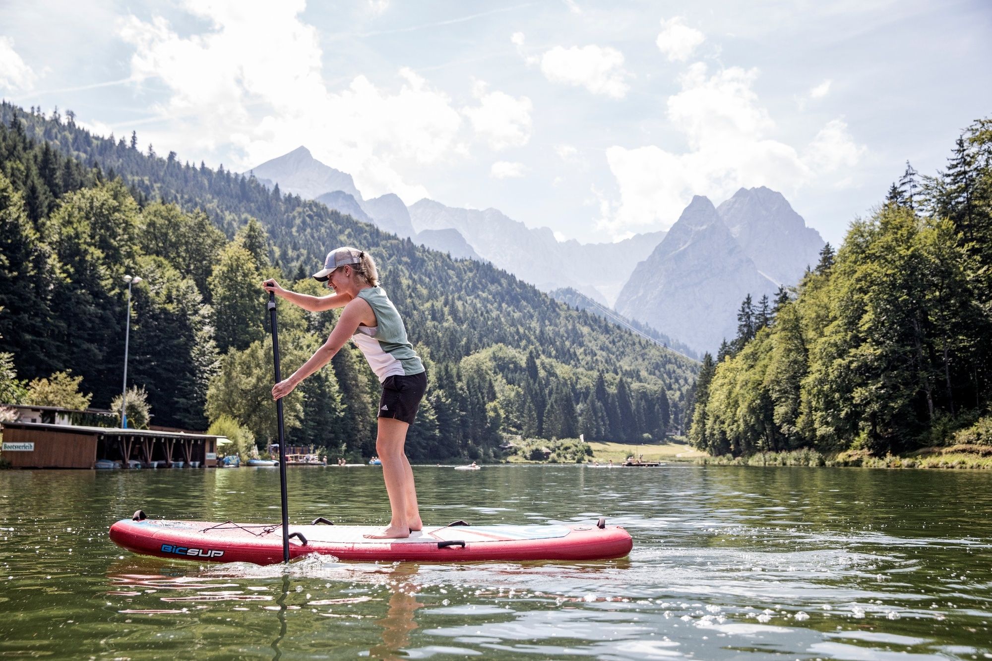
This is a romantic trail for runners who also like to enjoy nature – this tour is always interesting, no matter which season. Enjoy the unique panoramic views and don’t miss the chance to have a refreshing swim in the summer.
- Difficulty
-
medium
- Rating
-
- Starting point
-
Hammersbacher Fußweg
- Route
-
Hotel Restaurant Café Hausberg0.7 kmSeehaus4.5 kmAule-Alm5.9 kmGarmisch-Partenkirchen (708 m)9.4 km
- Best season
-
JanFebMarAprMayJunJulAugSepOctNovDec
- Description
-
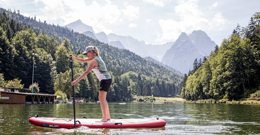
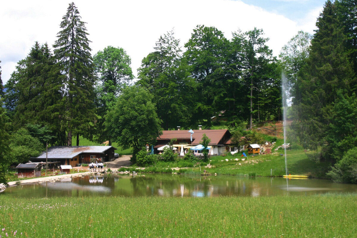
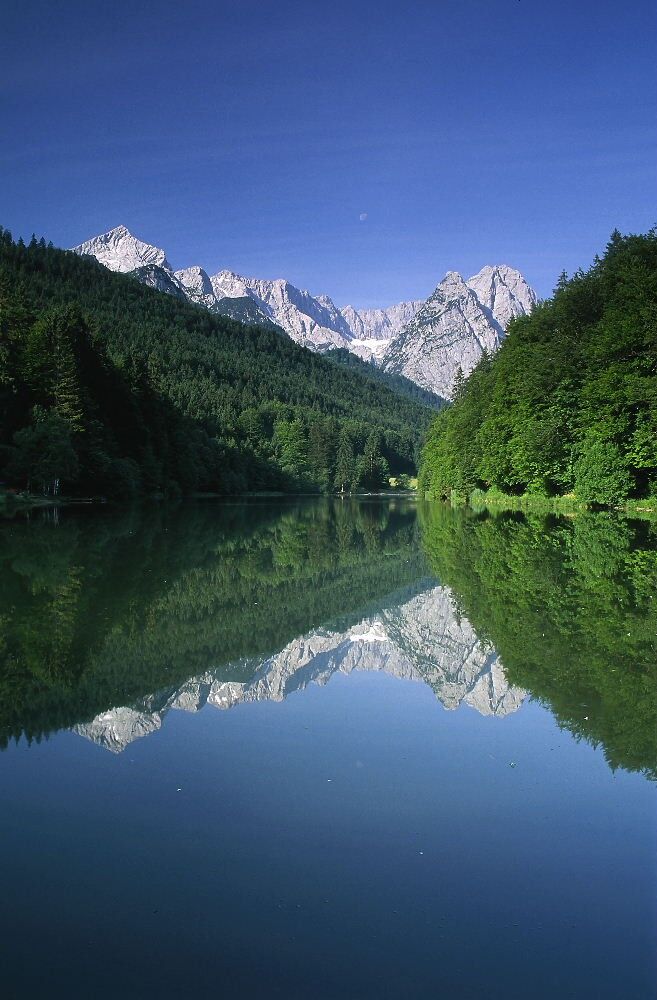
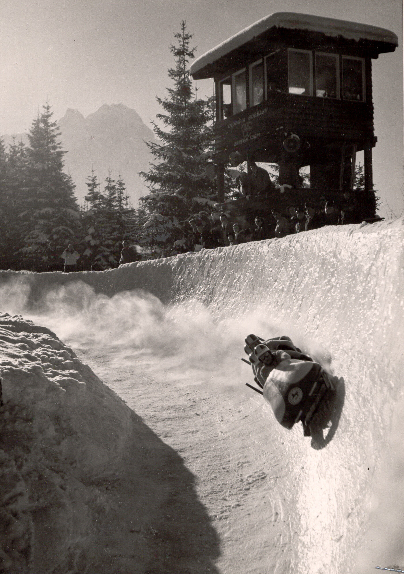
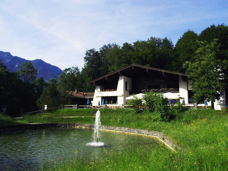
The Riesersee (Lake Riesser) used to be the setting of ice sports and famous international winter sports competitions. Of course, when the weather is fine in the summer, nothing reminds one of this icy pleasure: The small public swimming area, boat hire and café located at the shores of the lake as well as the impressive panoramic view all make you immediately feel as if you were on a holiday.
For a more detailed description of the tour, please refer to "PDF Print" above.
- Directions
-
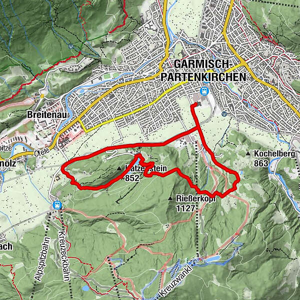
Your running tour starts near the base terminal of the Kreuzeckbahn cable car. Run a short distance on Kreuzeckbahnstraße in the direction of the town. At the first possibility, turn right onto a country lane that will lead you to the Aule-Alm Hut and further on to the Riessersee (Lake Riesser). In running along the lake’s northern shores, you will reach the Seehotel Riessersee and the Riessersee Hotel Sport & Spa Resort located next to it. A small path will lead "through" the hotel - there is an alleyway – and will continue winding downhill to the footpath in the valley. Turn left in the valley and continue your way back to your starting point parallel to the railway tracks.
- Highest point
- 908 m
- Endpoint
-
Parkplatz am Alpspitzwellenbad
- Height profile
-
 © outdooractive.com
 - Tips
-
No matter which season, the trails around Lake Riesser are always fun; due to the fact that they are cleared in wintertime, they are always accessible.
- Additional information
-
www.gapa.de, www.riessersee.eu, www.riessersee-hotel.de
- Directions
-
Take the motorway A95 from Munich to its end at Eschenlohe, and then follow the state road B2 to Garmisch-Partenkirchen. After the Farchanter tunnel drive in the direction of the Garmisch part of town and Grainau/Zugspitze. Go on through Garmisch and follow the signs to the left to the Kreuzeckbahn/Alpspitzbahn when you are near the end of the town (at the barracks).
If you are coming from Innsbruck/Mittenwald, take the state road B2 to Garmisch-Partenkirchen and stay on the main road. Turn left at the intersection at the town hall (3rd traffic lights) in the direction of Garmisch/Grainau/Zugspitze. Just before leaving town, follow the signs to the Kreuzeckbahn/Alpspitzbahn and turn left at the barracks.
If you are coming from Ehrwald/Tirol/Grainau via the state road B23, drive to Garmisch-Partenkirchen and turn right at the first traffic light. Follow the course of the road and, then, the signs to Kreuzeckbahn/Alpspitzbahn. - Public transportation
-
There is an hourly connection to and from München (Munich) land Garmisch-Partenkirchen (there are also regular trains from Innsbruck and Reutte). Continue with the Zugspitzbahn, which leaves from the area right behind the station of the German Federal Railway. The schedules of both railways are co-ordinated. Alternatively, take the local bus routes 1 and 2 from the station forecourt to the bus stop Kreuzeckbahn.
- Parking
-
Parking is available at the base terminals of the Alpspitzbahn/Kreuzeckbahn cable cars (P9).

- Author
-
The tour Via Aule-Alm to the Riessersee – short but beautiful running trail is used by outdooractive.com provided.
GPS Downloads


General info
Refreshment stop
Healthy climate
Cultural/Historical
A lot of view
Other tours in the regions
-
ZugspitzLand
1624
-
Garmisch-Partenkirchen
558