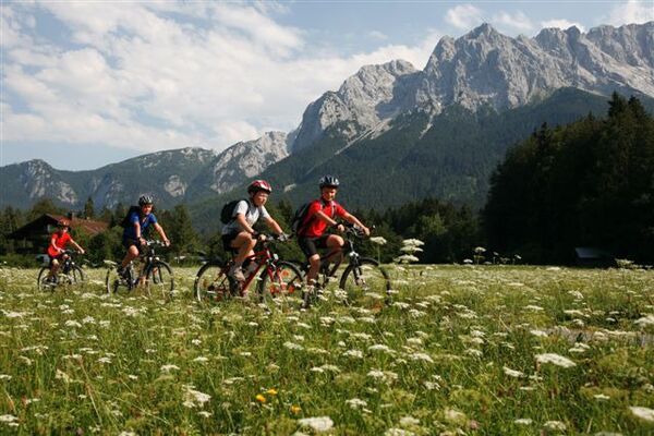
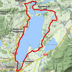
Tour data
16.78km
783
- 892m
298hm
316hm
01:45h
- Difficulty
-
medium
- Rating
-
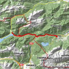
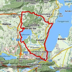
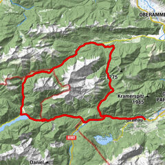
- Route
-
St. Georg0.4 kmSchwangau (796 m)0.5 kmHorn1.5 kmFranziskanerkirche St. Stephan3.2 kmFüssen (808 m)3.4 kmSpitalkirche Hl. Geist3.5 kmPfarrkirche St. Mang3.6 kmSchmerzensmannkapelle3.9 kmSt. Max4.0 kmBad Faulenbach4.3 kmHotel & Restaurant Alatsee7.9 kmWeißensee (850 m)11.3 kmOberried11.3 kmHub11.6 kmMoos11.8 kmLotus Asia Gourmet14.1 kmPfarrkirche St. Mang16.6 kmFüssen (808 m)16.6 kmSpitalkirche Hl. Geist16.7 km
- Best season
-
JanFebMarAprMayJunJulAugSepOctNovDec
- Highest point
- 892 m
GPS Downloads


Surfaces
Asphalt
Gravel
Mountain paths
Single trails
Trial
Traffic