
- Brief description
-
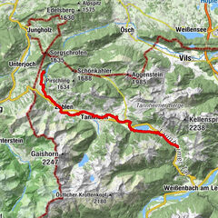
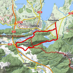
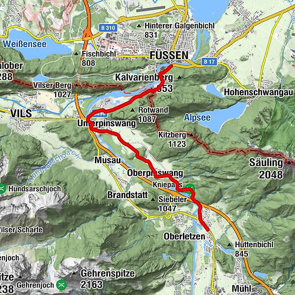
Füssen - Lech Falls - Forest Adventure Center & Treetop Trail - Weisshaus - Stiglberg-Kratzer - Unterpinswang - Oberpinswang - Kniepass - Pflach - Bird Watching Tower in the Lechauen
- Starting point
-
Lech bridge Füssen
- Route
-
MagnusblickFüssen (808 m)Abschied-Jesu-Kapelle0.2 kmUnsere Liebe Frau am Berg0.2 kmLechfall0.5 kmUnterpinswang4.2 kmOberpinswang7.3 kmSt.-Katharina-Kapelle7.3 kmUnterletzen10.1 kmKappl10.2 kmKirche Hl. Drei Könige10.5 kmHotel - Gasthof zum Schwanen10.6 kmPflach (840 m)10.6 km
- Description
-
Area:
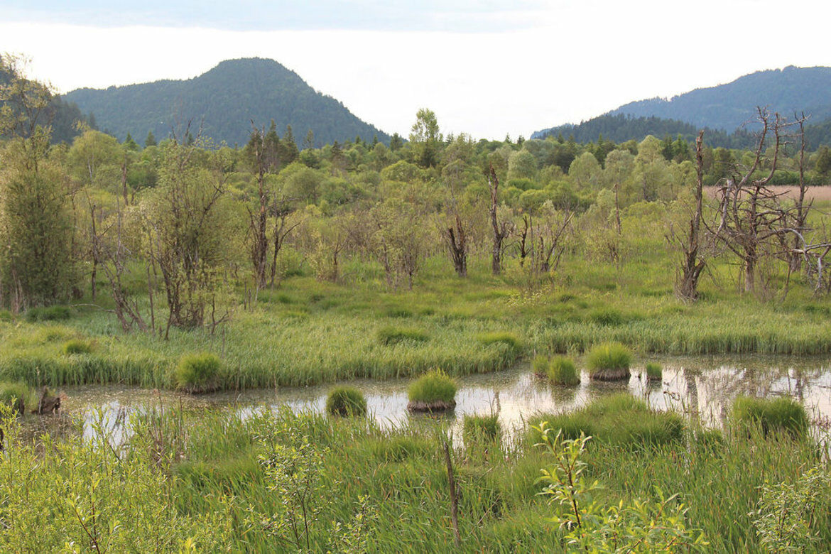
The first mountain ridges at the border between Germany and Austria form a gate, which the Via Claudia Augusta crossed into the Alps and the Reutte nature reserve region in Tyrol. This is where the only untouched section of the Lech in the northern Alps begins. The realm of the ‘last wild one’, as the nature park exhibition dubs the river, is dominated by extensive gravel banks and wetlands that cover the entire valley in some sections. Since time immemorial, the river has determined where settlements and roads could be built. Large parts of the valley have always been prone to flooding, so the Roman route of the Via Claudia Augusta crossed two plateaus between Füssen and the valley basin of Reutte: the mountain ridge between the Stiglberg and Kratzer and the Kniepass.
Route:
Leave the old town of Füssen and cross the Lech river. Make sure you look back at the town from the south bank of the river: the view is wonderful! As you enter Austria, the cycling route runs parallel to the Lech river and the picturesque, old country road, parts of which are lined with trees. It departs from the river to cross the quaint villages of Unterpinswang and Oberpinswang before crossing the Kniepass to Pflach, just like the old Roman road did. At the edge of the Lech floodplains, the route crosses verdant pastures to lead you into the district capital of Reutte.
In printed form, this stage can be found in the Reutte edition of the series "4 maps through the millennia", which shows the region today and at 3 interesting times in history.
There is also an interactive map for gazing and planning your tour along the Via Claudia Augusta, a routing app for Android and iPhone in which you can transfer the planned trip, as well as printed cycling guides for the ALTINATE variant (Danube - Adriatic Sea - Trento - Feltre - Altino near Venice) and the PADANA variant (Danube - Alps - Trento - Verona - Ostiglia in the Po Valley = Piana Padana).
All this is also available for a separate customized walking route and a travel route for car, camper, bus, ... along the Via Claudia Augusta.
- Directions
-
Leave the old town of Füssen and cross the Lech river. Make sure you look back at the town from the south bank of the river: the view is wonderful! As you enter Austria, the cycling route runs parallel to the Lech river and the picturesque, old country road, parts of which are lined with trees. It departs from the river to cross the quaint villages of Unterpinswang and Oberpinswang before crossing the Kniepass to Pflach, just like the old Roman road did. At the edge of the Lech floodplains, the route crosses verdant pastures to lead you into the district capital of Reutte.
- Highest point
- 870 m
- Endpoint
-
Center of the village Pflach
- Height profile
-
 © outdooractive.com
 - Equipment
-
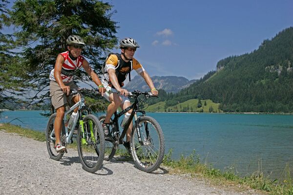
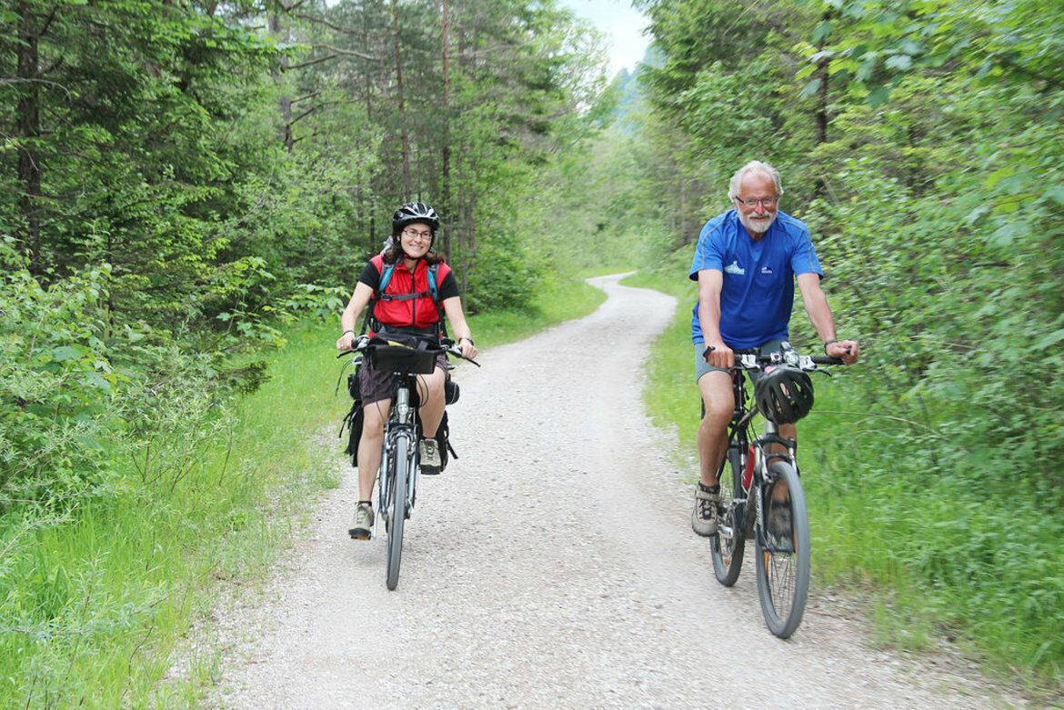
Trekking, City- or Mountainbike
- Safety instructions
-
Between Füssen and Pinswang partly gravel
- Additional information
-
History of the Via Claudia Augusta
Detailed description of the Via Claudia Augusta cycling route (Altinate variant: Danube - Alps - Trento - Feltre - Altino near Venice)
Detailed description of the Via Claudia Augusta cycling route (Padana variant: Danube - Alps - Trento - Verona - Ostiglia in the Padana plain)
History(s) of the regions and places (Altinate variant)
History(s) of the regions and places (Padana variant)
- Author
-
The tour VIA CLAUDIA AUGUSTA 10 along the natural river Tiroler Lech is used by outdooractive.com provided.


-
Allgäu
389
-
Naturparkregion Reutte
112
-
Pinswang
67