© Tegernseer Tal Tourismus GmbH - Stefanie Pfeiler

© Tegernseer Tal Tourismus GmbH - Stefanie Pfeiler

© DER TEGERNSEE - Dietmar Denger

© Alpenregion Tegernsee Schliersee - Stefanie Pfeiler

- Brief description
-
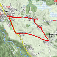
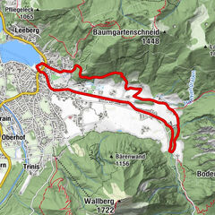
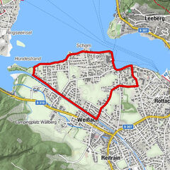
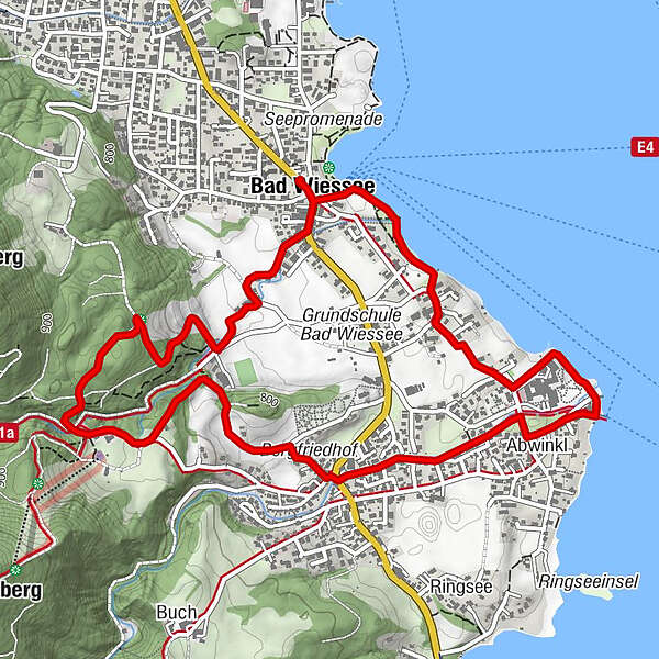
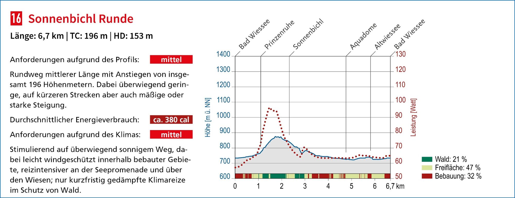
Rundweg mittlerer Schwierigkeit mit einer Länge von 6,7 km.
- Difficulty
-
medium
- Rating
-
- Route
-
Prinzenruh1.5 kmHotel -Restaurant Am Sonnenbichl2.2 kmAbwinkl4.2 kmBad Wiessee Abwinkl4.7 kmFischerei Bistro4.7 kmBad Wiessee Ortsmitte6.3 kmBad Wiessee (740 m)6.6 km
- Best season
-
JanFebMarAprMayJunJulAugSepOctNovDec
- Highest point
- 865 m
- Endpoint
-
Bad Wiessee - Lindenplatz
- Height profile
-
 © outdooractive.com
-

-
AuthorThe tour Sonnenbichl Runde is used by outdooractive.com provided.
GPS Downloads


General info
Refreshment stop
Healthy climate
A lot of view
Other tours in the regions