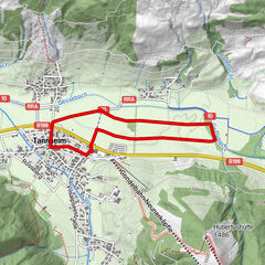
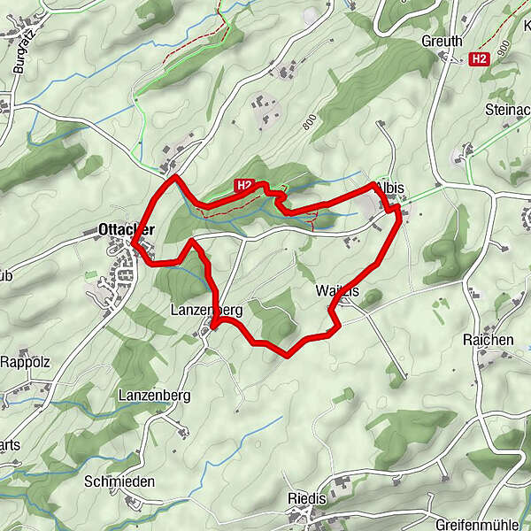
Ottacker Rundweg - Nordic Walking

Logo Ottacker Rundweg - Nordic Walking
Tour data
4.11km
745 - 882m
Distance
147hm
147hm
Ascent
01:45h
 
Duration
Rating
Technique
Fitness
Landscape
Experience
Route
Albis
1.7 km
Waitzis
2.3 km
Lanzenberg
3.2 km
Gasthof Rössle
4.0 km
Ottacker
4.1 km

Best season
Jan
Feb
Mar
Apr
May
Jun
Jul
Aug
Sep
Oct
Nov
Dec
Highest point
882 m
Height profile
© outdooractive.com

Author

Overall rating

5

0

%

4

0

%

3

0

%

2

0

%

1

0

%

Error
An error has occurred. Please try again.
Thank you for your review

Rating has been deleted

GPS Downloads
  • GPX GPS Exchange Format (XML)
  • KML Google Earth, Google Maps
QR Download Codes for Mobile Phones

General info

Refreshment stop
A lot of view
Other tours in the regions

Popular tours in the area

Schneit-Runde in Tannheim

easy Nordic Walking
3.84km | 36hm | 00:40h

Vilsalpsee round

easy Nordic Walking
12.53km | 113hm | 02:15h

Haldensee round

easy Nordic Walking
4.32km | 117hm | 00:40h

Walking Tour um den Niedersonthofener See

easy Nordic Walking
7.34km | 41hm | 01:33h