
- Brief description
-
A beautiful, varied circular route through the Estergebirge Mountains with three Alpine huts to stop for refreshments – every wish can come true!
- Difficulty
-
difficult
- Rating
-
- Starting point
-
Bahnhof (train station) Garmisch-Partenkirchen
- Route
-
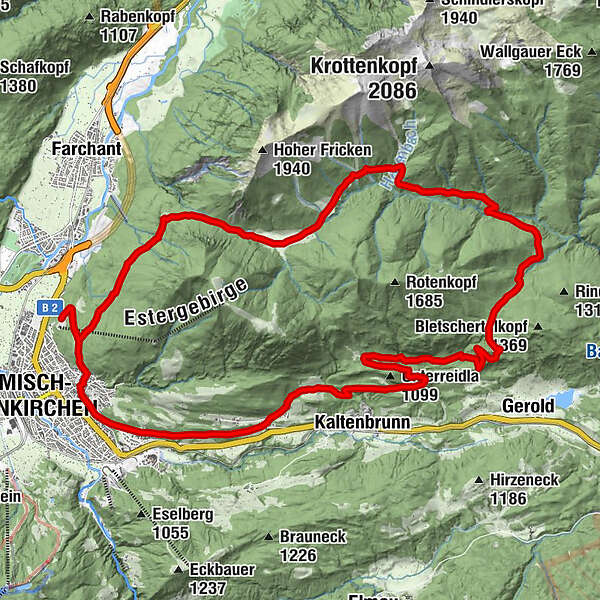
Garmisch-Partenkirchen (708 m)0.9 kmDaxkapelle (964 m)2.1 kmEsterbergalm5.6 kmGschwandtnerbauer21.7 kmGarmisch-Partenkirchen (708 m)26.1 kmPfarrkirche Maria-Himmelfahrt26.3 kmPartenkirchen26.3 kmWallfahrtskirche St.Anton27.0 km
- Best season
-
JanFebMarAprMayJunJulAugSepOctNovDec
- Description
-
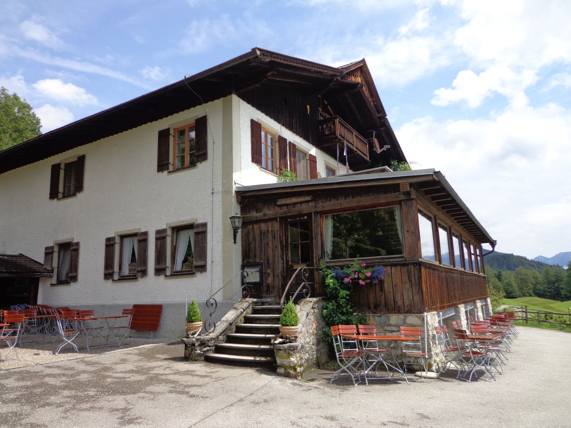
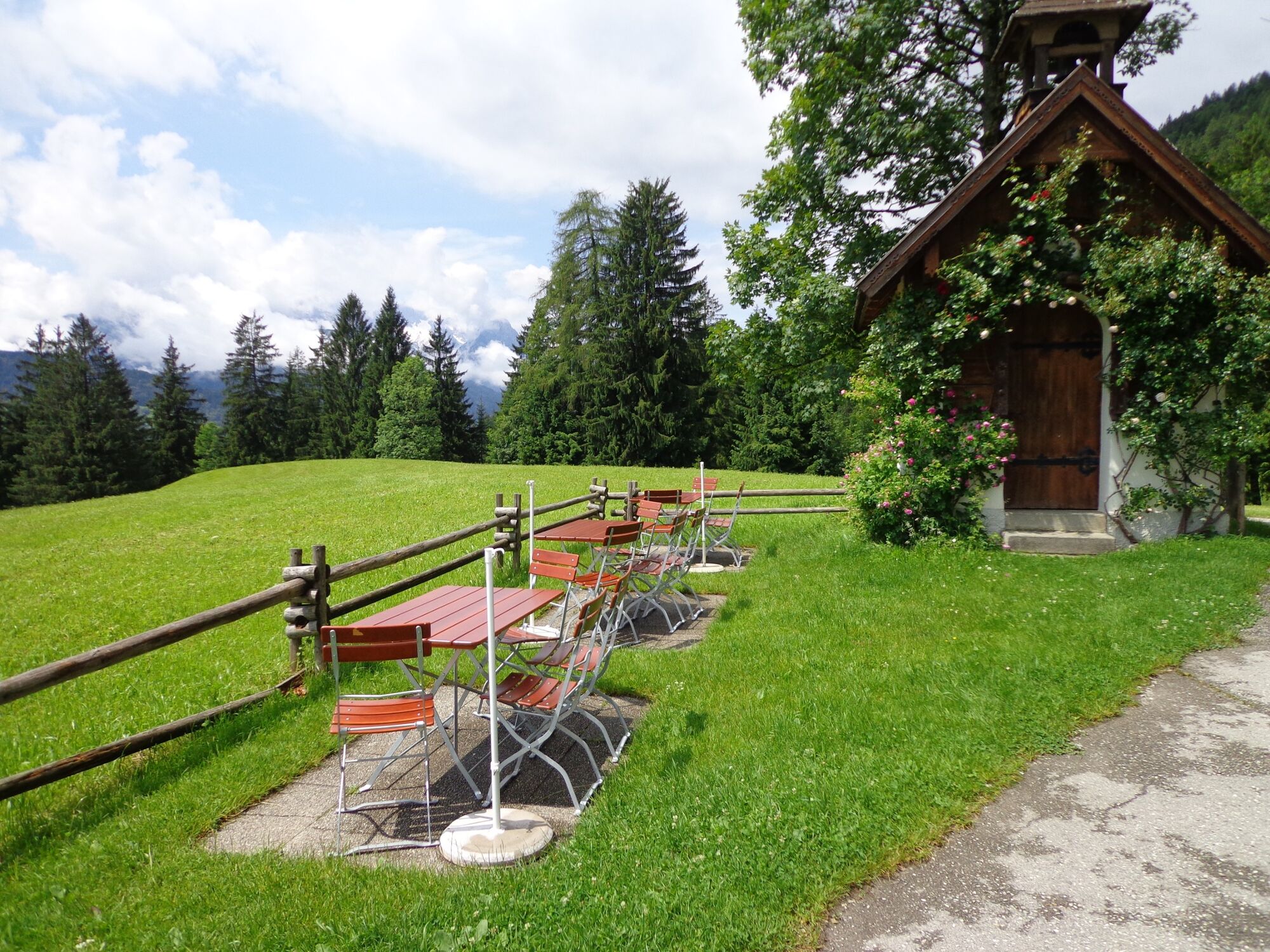
This tour has everything: a steep climb, a romantic lonely high valley, downhill on single trails and, towards the end of the tour, magnificent panoramic views. First you cycle – on a way with rather steep uphill sections – to the Alpine hut Esterbergalm. From there a nice forest track leads you through the Finzbachtal valley, which is the heart of the Esterberg Mountains. On a great single trail you will arrive at the Alpine hut Gschwandtnerbauer, where you can marvel at the wonderful view of the Wetterstein Mountains. Along the foot of Wank Mountain you can get back to Partenkirchen.
For a more detailed description of the tour, please refer to "PDF Print" above.
- Directions
-
Directly at the station start along Bahnhofstraße and cross the town hall intersection to the Partenkirchen part of town. After having passed the small church Sebastianskircherl turn left onto Münchnerstraße and follow its course until you get to the turnoff in the direction of the Wankbahn cable car. Follow Wankbahnstraße, pass the parking site on the right and then pedal on over the cattle grid. After ca. 800 m turn left in the direction of “Esterbergalm”, where you will arrive 6 km later (1,264). Should you be thirsty, you can take a break here. On you go thereafter on the main path towards Krün. You will pass the Alpine hut Hintere Esterbergalm, which is also called Farchanter Alm, on your right hand side and cycle downhill through the Finzbachtal valley. After crossing the Finzbachbrücke bridge, take the forest track uphill in the direction of the Gschwandtnerbauer. After ca. 2 km you will reach an intersection of three tracks. Keep to the right and pass the huts of the Schweizer Alple shortly afterwards. Go on ahead at the next junction and turn right ca. 60 m later. Now you will cycle downhill through the forest on narrow, sometimes technically challenging, paths. After a while you will reach another forest track, which you will cross and then follow the shortcut along a forest path. On the next forest track turn left and cycle downhill. Around 3 km later turn right in the direction of “Gschwandtnerbauer”. You will reach the inn after crossing a meadow. Here you can recover and enjoy the impressive scenery of the Wetterstein Mountains. After a break, take the gravel path downhill. A little bit later you will come to Schlattan and pedal slightly uphill to the Pfeiffer-Alm. Just in front of the mountain inn turn left onto the gravel path. Now you should cycle along the foot of the Wank Mountain above Partenkirchen. At the following bend to the left, go on ahead, turn right at the next junction and then left dowhill to Partenkirchen. When you reach the first buildings, stay on the tarmac road. Follow Michael-Sachs-Straße to the Floriansplatz square. Here you will head downhill to the right until you come to Hauptstraße. Cross the town hall intersection and go straight on to the train station.
- Highest point
- 1,293 m
- Endpoint
-
Bahnhof in Garmisch-Partenkirchen
- Height profile
-
 © outdooractive.com
 - Equipment
-
Weatherproof clothing, cycling helmet, water bottle, repair kit, first-aid kit, and protection against the sun
- Safety instructions
-
Phone number for Alpine emergencies: Phone 112 (Mountain Rescue Service)
Weather forecast for the local mountains of the Bayerischen Zugspitzbahn Bergbahnen cable car company: Phone +49 8821 797 979
- Tips
-
Opposite the Pfeiffer-Alm you can see Wamberg, the highest-altitude village in Germany with its own church.
Difficult to choose: Where to stop for refreshments? Esterberg-Alm? Gschwandtnerbauer? Pfeiffer-Alm? All of them are famous for their homemade Alpine delicacies. Just take enough time and stop at all three... cycling will make you hungry and thirsty, after all
- Additional information
-
www.gapa.de
www.pfeiffer-alm.de
- Directions
-
Take the motorway A95 from Munich to its end at Eschenlohe, and then follow the state road B2 to Garmisch-Partenkirchen. Drive in the direction of Partenkirchen/Mittenwald/Innsbruck. Turn right at the intersection at the town hall (4th traffic light), and then turn left to the train station at the second traffic light.
When coming from Mittenwald, take the state road B2 to Garmisch-Partenkirchen. There, follow the signs to Munich. At the town hall intersection (3rd traffic light), turn left, and then left again at the 2nd traffic light.
When coming from Reutte/Ehrwald/Tirol/Grainau, take the state road B23 into Garmisch-Partenkirchen and follow the signs to “Ortsteil Partenkirchen”. After the underpass on St.-Martin-Straße there is a sharp bend to the right, immediately followed by traffic lights. Here you should turn right to the train station. - Public transportation
-
Take the train to Garmisch-Partenkirchen (connections from Munich every hour, regular connections from Innsbruck and Reutte).
- Parking
-
Bahnhof (train station) Garmisch-Partenkirchen (paid parking, P4)
- Author
-
The tour Via the Esterbergalm to the Finzbachtal and Gschwandtnerbauer is used by outdooractive.com provided.


General info
-
Zugspitz Region
78
-
Farchant
24