
- Brief description
-
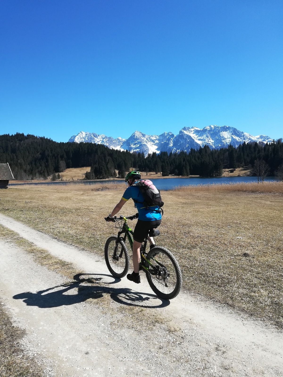
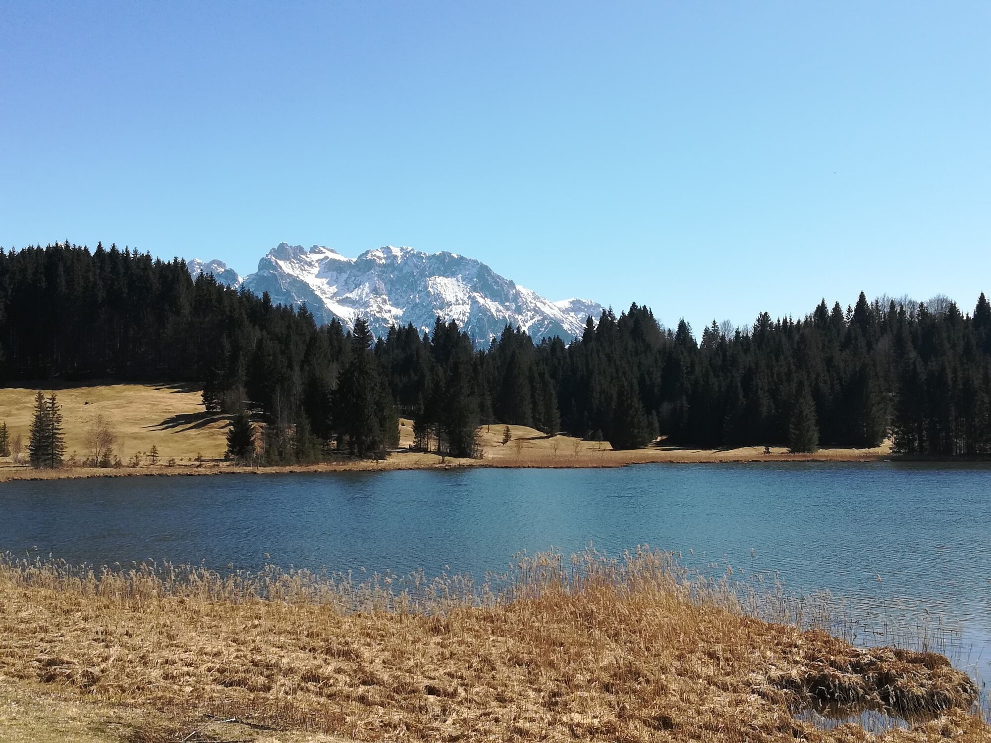
In the small village Gerold you will find one the most beautiful moor lakes in the Alps, amidst meadows and forests in front of the majestic backdrop of the Wetterstein and Karwendel Mountains.
- Difficulty
-
medium
- Rating
-
- Starting point
-
Bahnhof (train station) Garmisch-Partenkirchen
- Route
-
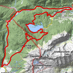
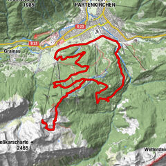
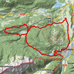
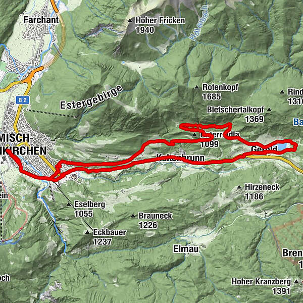
Garmisch-Partenkirchen (708 m)Gschwandtnerbauer6.5 kmGerold16.6 kmPlattele18.3 kmKaltenbrunn19.7 kmKainzenbad23.8 kmGarmisch-Partenkirchen (708 m)26.5 km
- Best season
-
JanFebMarAprMayJunJulAugSepOctNovDec
- Description
-
Here it is not the journey that is the reward but rather lake Wagenbrüchsee, which is better known as Geroldsee. As one of the most beautiful moor lakes in the Alps, it is located amidst meadows and forests. Behind the treetops you can see the majestic scenery of the Wetterstein and Karwendel Mountains. Even the Zugspitze is visible from the cozy sunbathing area.
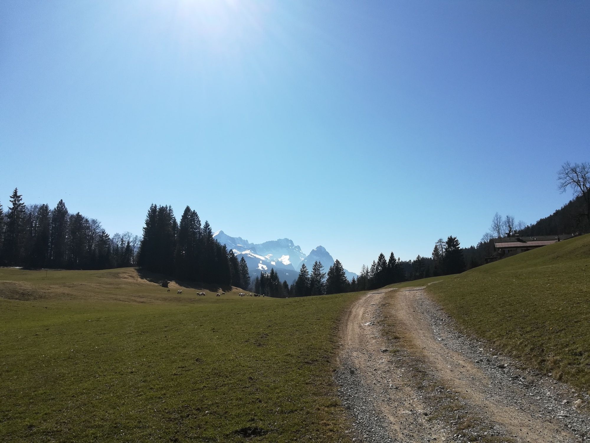
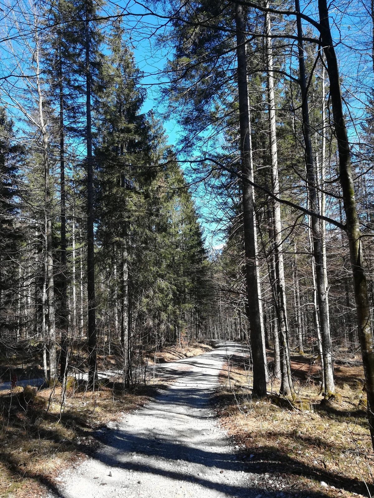
From Garmisch-Partenkirchen the cycle track along the B2 leads you uphill to Gerold. If you prefer a quieter route, take the “Alte Gsteig”, which is wonderfully quiet, but a bit steeper.
For a more detailed description of the tour, please refer to "PDF Print" above.
- Directions
-
At the station turn right and cross the taxi stand to Lagerhausstraße. This street leads into Gehfeldstraße. After ca. 200 m, the road forks. Ensure to keep right. At the end of Kochelbergstraße cross the railway tracks and turn left. Along the tracks continue on to the skiing stadium. From there take Wildenauer Straße until you come to Hauptstraße. If you prefer the less steep option, cross the street and follow the cycle track. Otherwise, cross the street and take the street opposite, leading to the Dorint SporthoPhone At the hotel parking site, keep left and enter the small forest track at the end of the parking area, which shall in turn take you directly to Dr.-Wigger-Straße. Follow this street uphill to the junction. Here you should go left onto Gsteigstraße. At the Berggasthof “Schöne Aussicht” (restaurant) you can catch your breath and have a look at the ski jump. At the next junction turn right and go downhill to the cycle track along the road. If you still prefer a quieter way, go uphill to the left (only for a bit) and then turn right twice, pass the Höflebauer and cross the meadows, until an opening in the fence on the right wayside leads the way to Kaltenbrunn. Here you will go downhill through the spruce forest until you reach the cycle track along the state road B2. Having passed the restaurant “Zum Schweizerbartl” you can get to the other side of the street via an underpass and cycle onward on the level track. The fields on your right are a popular area for cross-country skiing in winter. After a few kilometers, a sign points you to Gerold. Here you will go through another underpass, then uphill for a bit. At the junction follow the street to the left. After only a few metres, a dirt track leads you directly to the lake. If you want to get to the opposite bank, just go on for a bit and take the next dirt track, which is probably more convenient.
- Highest point
- 1,069 m
- Endpoint
-
Bahnhof in Garmisch-Partenkirchen
- Height profile
-
 © outdooractive.com
 - Equipment
-
Weatherproof clothing, cycling helmet, water bottle, repair kit, first-aid kit, and protection against the sun
- Safety instructions
-
Phone number for Alpine emergencies: Phone 112 (Mountain Rescue Service)
Weather forecast for the local mountains of the Bayerischen Zugspitzbahn Bergbahnen cable car company: Phone +49 8821 797 979
- Tips
-
The way via the “Alte Gsteig” and the Höflebauer is worth the effort.
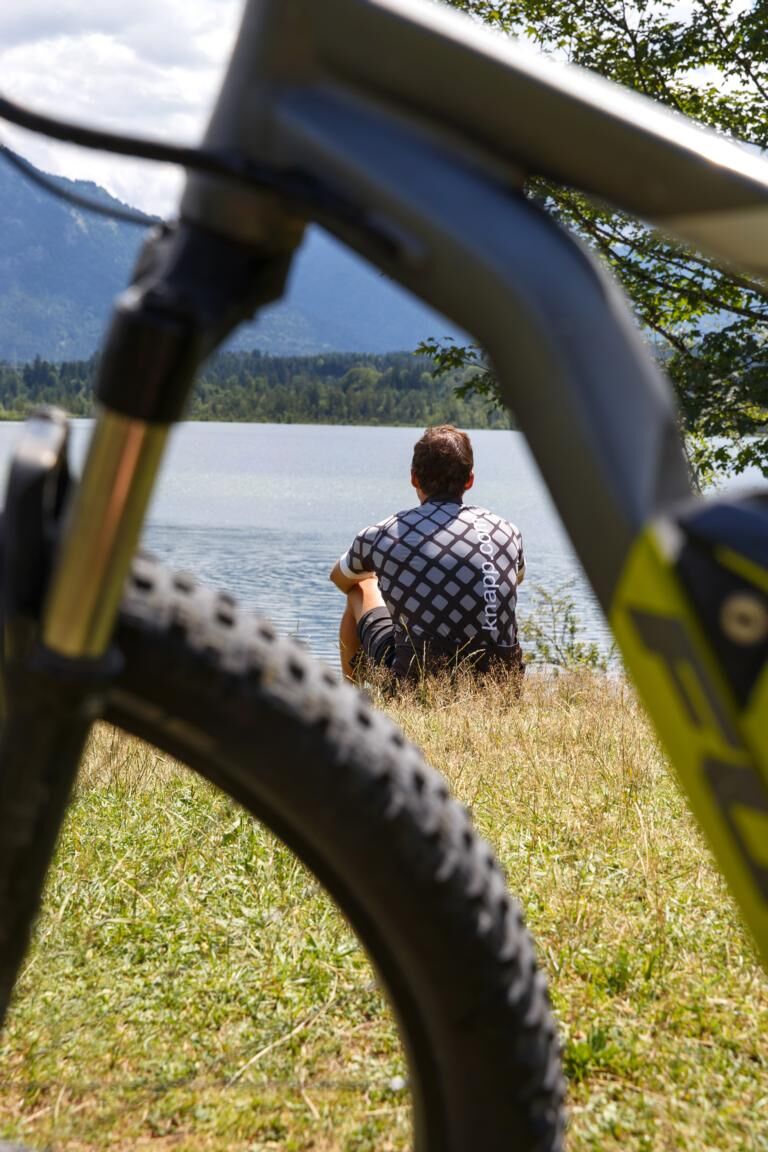
Do not forget your swimming gear!
- Additional information
-
www.gapa.de, www.hotel-schoene-aussicht.net, www.hoeflebauer.de
- Directions
-
Take the motorway A95 from Munich to its end at Eschenlohe, and then follow the state road B2 to Garmisch-Partenkirchen. Drive in the direction of Partenkirchen/Mittenwald/Innsbruck. Turn right at the intersection located at the town hall (4th traffic light), and then turn left to the train station at the second traffic light.
When coming from Mittenwald, take the state road B2 to Garmisch-Partenkirchen. There, follow the signs to Munich. At the town hall intersection (3rd traffic light), turn left, and then left again at the 2nd traffic light.
When coming from Reutte/Ehrwald/Tirol/Grainau, take the state road B23 into Garmisch-Partenkirchen and follow the signs to “Ortsteil Partenkirchen”. After the underpass on St.-Martin-Straße there is a sharp bend to the right, immediately followed by traffic lights. Here you should turn right to the train station. - Public transportation
-
Take the train to Garmisch-Partenkirchen (connections from Munich every hour, regular connections from Innsbruck and Reutte).
- Parking
-
Bahnhof (train station) (P4, paid parking)
- Author
-
The tour Up to Lake Geroldsee is used by outdooractive.com provided.

General info
-
ZugspitzLand
291
-
Farchant
42