

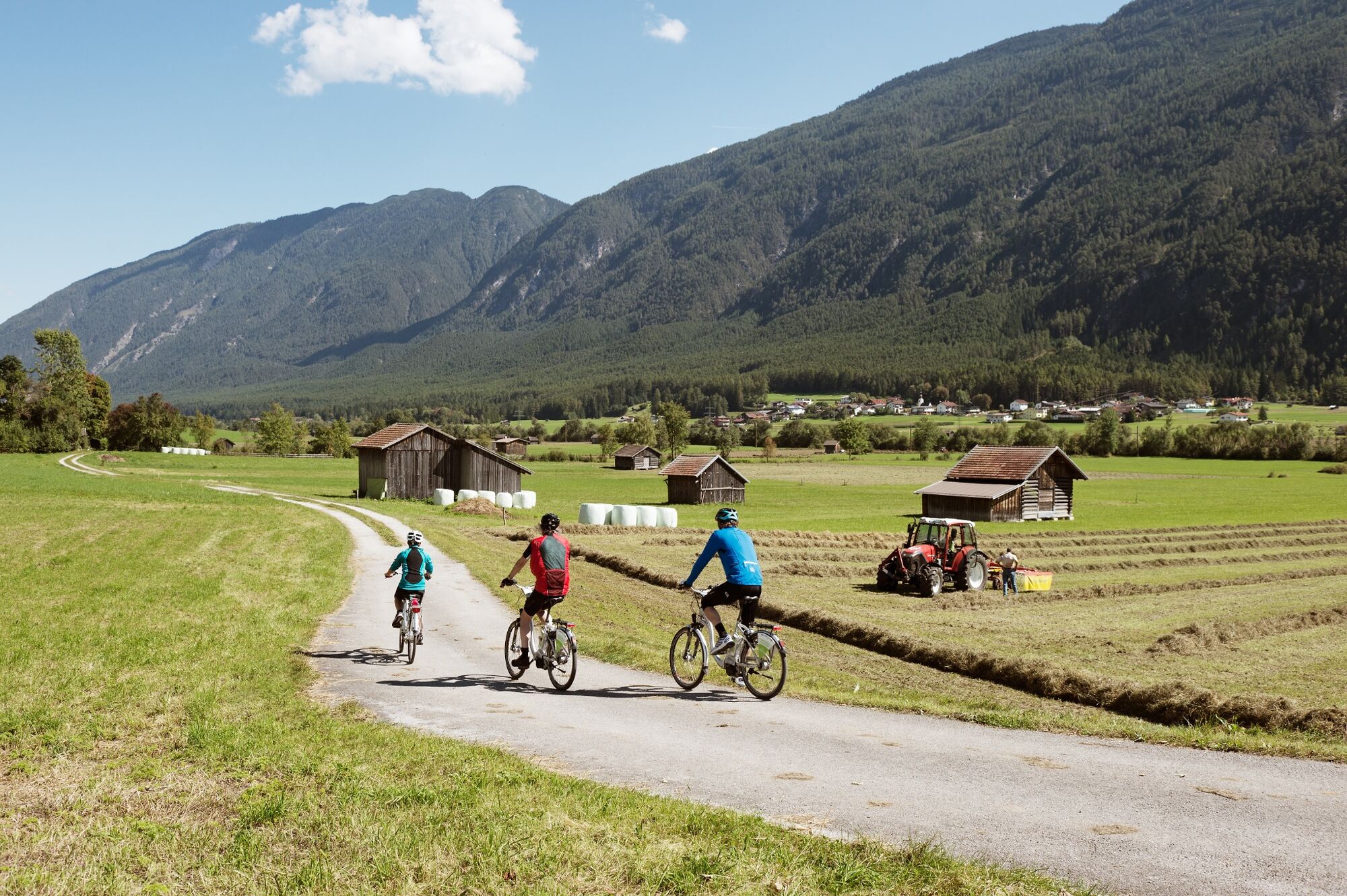
© Tirol Werbung/Franz Bauer

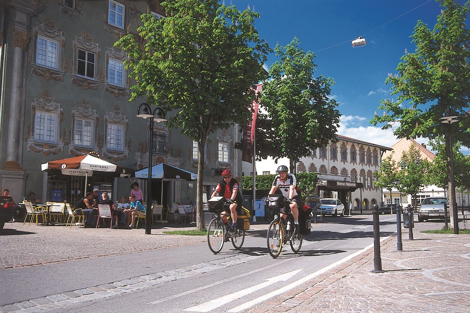
© (c) Naturparkregion Reutte - (c) Naturparkregion Reutte Anton Vorauer
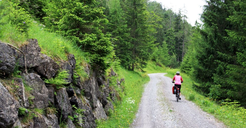
© Community - Stefan Tichter

© Community - Stefan Tichter

© Community - Stefan Tichter

© Community - Stefan Tichter

© (c) Auerbergland - (c) Auerbergland Anton Vorauer

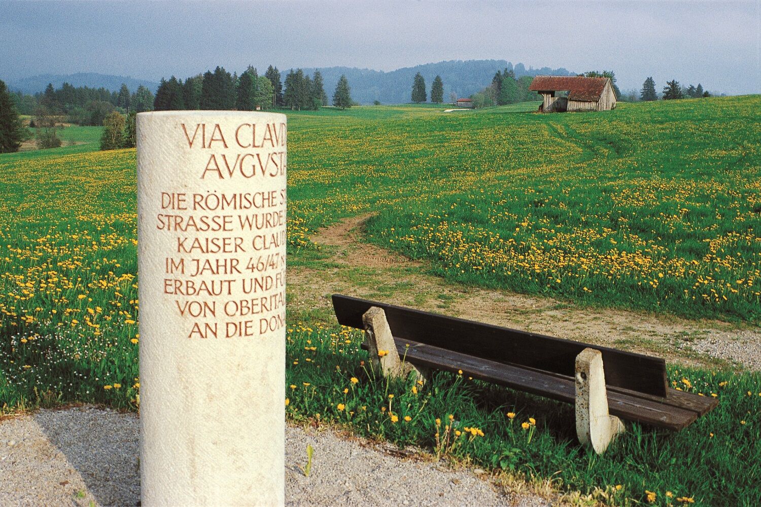
© (c) Via Claudia Augusta - (c) Via Claudia Augusta Christoph Tschaikner

© (c) Via Claudia Augusta - (c) Via Claudia Augusta Christoph Tschaikner

- Brief description
-
Where once the Romans traveled
- Difficulty
-
difficult
- Rating
-
- Starting point
-
Donauwörth (Bavaria)
- Route
-
DonauwörthSpitalkirche Heiligste Dreifaltigkeit0.7 kmDonauwörth (404 m)0.9 kmNordheim3.3 kmBäumenheim6.3 kmMertingen9.5 kmPfarrheim St. Martin9.5 kmSt. Martin9.6 kmAlte Brauerei Mertingen9.9 kmDruisheim12.3 kmBrunnenmahdsiedlung13.6 kmGut Schwaighof14.7 kmGasthaus Miller17.2 kmNordendorf17.2 kmWestendorf19.4 kmOstendorf21.0 kmGasthaus zur Lechbrücke23.4 kmMeitingen (433 m)25.2 kmStettenhofen36.2 kmGersthofen (469 m)41.5 kmPfingstgemeinde Augsburg48.7 kmSt. Peter am Perlach49.4 kmAugsburg49.6 kmSt. Moritz49.6 kmUlrichsviertel50.3 kmSiebenbrunn56.7 kmHaunstetten-Siebenbrunn59.4 kmKönigsbrunn (516 m)64.7 kmOberottmarshausen71.6 kmKleinaitingen73.7 kmGraben78.3 kmUntermeitingen82.3 kmObermeitingen (575 m)83.8 kmBäßler Genuss Gasthaus83.8 kmSüdwärts - Bar & Restaurant86.8 kmHurlach87.1 kmWeißes Lamm Schützenheim91.6 kmIgling (595 m)92.0 kmPfarrei St. Michael98.7 kmErpfting (617 m)98.7 kmEllighofen102.3 kmObst- und Gartenbauverein Unter- und Oberdießen104.5 kmUnterdießen104.9 kmGasthaus zum Zapfenwirt105.3 kmOberdießen106.6 kmAsch109.1 kmSportgaststätte SV Fuchstal110.4 kmGasthof "Zum Luitpold"111.3 kmLeeder111.3 kmDenklingen114.3 kmAntonius Kapelle114.5 kmTruck Stop Tina & Benny's116.5 kmEpfach (650 m)120.7 kmGasthaus zur Sonne121.0 kmKinsau (664 m)125.0 kmHohenfurch (699 m)129.0 kmRestaurant Piroska129.3 kmSchwabniederhofen (710 m)130.8 kmAltenstadt132.9 kmBurggen (747 m)141.5 kmSt. Stephan141.7 kmZieglerkapelle143.0 kmZiegler143.0 kmDessau145.5 kmGasthaus zum Weißen Rößl152.2 kmLechbruck am See152.3 kmEgelmoosen156.9 kmOsterreinen166.6 kmAnlegestelle Osterreinen Rieden167.1 kmAchmühle169.7 kmFeldkirche St. Ulrich und Afra171.0 kmSt. Sebastian172.4 kmFranziskanerkirche St. Stephan173.3 kmSpitalkirche Hl. Geist173.6 kmFüssen (808 m)173.6 kmMagnusblick173.7 kmUnsere Liebe Frau am Berg173.9 kmAbschied-Jesu-Kapelle173.9 kmLechfall174.3 kmUnterpinswang178.0 kmSt.-Katharina-Kapelle181.1 kmOberpinswang181.1 kmUnterletzen183.9 kmKappl183.9 kmKirche Hl. Drei Könige184.2 kmHotel - Gasthof zum Schwanen184.4 kmPflach (840 m)184.8 kmHüttenbichl185.0 kmEdelweis186.8 kmReutte (853 m)187.3 kmSt. Anna187.5 kmJosefsheim187.9 kmNeuapostolische Kirche Reutte188.1 kmEhrenberg Klause190.8 kmLandgasthof Klause190.9 kmKlausenkapelle Christus am Stein190.9 kmGasthof Post194.3 kmHeiterwang (994 m)194.8 kmOberdorf194.9 kmUnterdorf195.2 kmAlmkopf Rastland198.2 kmBichlbach (1,079 m)199.4 kmWengle202.2 kmLähn203.1 kmObergarten204.7 kmUntergarten205.6 kmGasthof Grieserhof206.2 kmOrtskapelle hl. Josef206.2 kmLermoos (1,004 m)207.1 kmLermoos (1,004 m)208.3 kmMariahilf in der Schmitte211.7 kmDas Walters212.0 kmBiberwier (989 m)212.6 kmBrabander Alm213.5 kmOTTOs Grillstube213.5 kmFernpass221.1 kmFernpass (1,216 m)221.4 kmVierzehn Nothelfer Kapelle224.9 kmNassereith (838 m)228.8 kmRestaurant Pizzeria Papalina229.4 kmRestaurant Gurgltalblick230.2 kmGasthof Seewald237.0 kmStrad237.2 kmHappi`s Hütte238.7 kmKnappenwelt Gurgltal238.7 kmHappi's Hütte238.7 kmTarrenz (836 m)239.7 kmTrinelerkapelle242.8 kmJohanneskirche243.4 kmSpielscheune243.4 kmImst (827 m)243.8 kmBrennbichler Kirche246.2 kmGschnallenhöfe249.4 kmFeldkapelle252.3 kmMils Au253.0 kmMils bei Imst (743 m)253.5 kmRied253.9 kmSaurs254.1 kmJosefskapelle254.4 kmÖde254.7 kmGasthof Gabl255.0 kmDorf255.3 kmTotenkapelle255.4 kmPfarrkirche St. Michael255.4 kmOberhäuser255.9 kmSchönwies (737 m)256.2 kmKapelle Patscheid257.4 kmZams (767 m)262.6 kmLötzkapelle263.1 kmPerjen265.2 kmPfarrkirche Perjen265.3 kmSannamündung / Raftingausstieg266.3 kmLandeck (817 m)266.9 kmUrgen271.2 kmUrgener Kirche271.2 kmNesselgarten272.4 kmNiedergallmigg272.9 kmEntbruck279.7 kmHotel Post280.4 kmPrutz (864 m)280.6 kmGasthof Gemse280.6 kmKath. Pfarrkirche hl. Leonhard283.6 kmRied im Oberinntal (876 m)283.7 kmSchulerkapelle283.7 kmKapuzinerkirche283.9 kmMaria Kapelle283.9 kmHotel Belvedere284.1 kmSankt Christina285.4 kmKapelle Heiliger Josef287.4 kmSteinbrücken287.4 kmBreithaslachkapelle288.4 kmUntertösens289.0 kmTösens (930 m)289.5 kmNeue Totenkapelle289.5 kmKirche Heiliger Laurentius289.6 kmAlte Totenkapelle289.6 kmWilder Mann289.6 kmGasthof Tschupbach290.7 kmKapelle Mariahilf290.7 kmSchönegg291.8 kmStein (945 m)292.5 kmMariastein293.7 kmPfarrkirche297.5 kmLourdeskapelle297.9 kmEnskapelle297.9 kmMarienkirche298.2 kmPfunds (970 m)298.3 kmHinter Rauth302.6 kmSchalkl304.1 kmVinadi306.5 kmOvella308.7 kmMartina (1,035 m)311.5 kmMutzkopflift318.3 kmSpitalkirche319.5 kmNauders (1,394 m)319.6 kmMariahilfkirche319.6 kmLärchenhanglift I321.6 kmDeiländerblick324.7 kmPizzeria Hans324.8 kmPizzeria Irene325.0 kmReschen (1,500 m)327.6 kmMein Dörfl Bar-Bungalov327.6 kmGraun im Vinschgau (1,520 m)331.0 kmKirche St. Valentin336.1 kmSt. Valentin auf der Haide336.1 kmPadöll337.3 kmZeress337.9 kmBurgeis343.2 kmSt. Michaelskirche343.4 kmMals (1,052 m)345.8 kmSt. Benedikt346.0 kmSt. Anton Kapelle346.8 kmSchleis (1,064 m)347.0 kmGasthof zum Goldenen Adler347.2 kmResidence Calva348.7 kmCalva348.7 kmLaatsch (987 m)348.8 kmGlurns (908 m)350.5 kmBelvenu350.8 kmUnsere liebe Frau350.8 kmPrad am Stilfser Joch (911 m)359.4 kmLaas (869 m)368.2 kmRadtreff Fischteich Brugg370.9 kmGöflan374.3 kmMorter379.4 kmLatsch (642 m)382.6 kmPfarrkirche382.8 kmSpitalkirche zum Hl. Geist382.9 kmKastelbell (587 m)386.2 kmKesslwirt389.0 kmTschars389.1 kmStaben391.8 kmTschirland393.6 kmNaturns394.9 kmPlaus398.0 kmTöll (509 m)401.5 kmBad Egart401.6 kmTöll402.6 kmUnter Vertigen403.3 kmMarling (369 m)407.9 kmMeran408.0 kmMarling409.0 kmTscherms411.7 kmPfarrkirche St. Sebastian und Nikolaus411.9 kmLana414.9 kmKapuzinerkirche415.1 kmHappm Pappm416.8 kmSanta Maria417.0 kmVorstadt418.1 kmKathi´s Jausenstation422.4 kmRestaurant Pircher423.2 kmNals425.9 kmAndrian429.6 kmSigmundskron436.5 kmSigmundskron436.6 kmLeifers445.2 kmNeumarkt457.3 kmSalurn467.7 kmMezzocorona476.8 kmchiesa di Santa Maria Assunta477.2 kmDa Demetrio477.2 kmChiesa dell'Immacolata Concezione479.7 kmMezzolombardo480.3 kmGrumino484.0 kmGrumo484.4 kmSan Michele all'Adige485.0 kmNave San Rocco488.5 kmNave San Felice (208 m)489.2 kmMaso Callianer489.5 kmLavis497.4 kmPristol497.7 kmSan Lazzaro di Meano (232 m)498.2 kmVela505.7 kmCristo Re507.1 kmPiedicastello507.9 kmFunivia Trento Sardagna507.9 kmTrient (194 m)508.5 kmchiesa di San Francesco Saverio508.5 kmCentro storico508.5 kmSan Martino509.1 kmTridente509.9 kmSolteri510.8 kmPiazzina (311 m)512.8 kmPinara (390 m)513.8 kmMartignano514.6 kmCamilastri (429 m)515.1 kmMoià516.3 kmTavernaro516.8 kmChiesa dell'Addolorata517.8 kmVillamontagna517.8 kmCappella dell'Addolorata519.6 kmCivezzano519.9 kmBarisei521.8 kmCanzolino525.2 kmRistorante Argentino ¨Sapori di Patagonia¨525.4 kmMadrano525.4 kmVigalzano (520 m)527.5 kmCasalino527.7 kmCosta528.1 kmKirche der Geburt Mariens529.3 kmIglesia de San Carlos529.4 kmPergine Valsugana529.7 kmMasetti531.2 kmVisintainer534.0 kmPaluda del Baruchèl534.6 kmBelvedere537.9 kmLevico Terme539.4 kmSelva di Levico540.6 kmLandingplace Barco 2 - Atterraggio Volo Libero Trentino542.8 kmLago Morto544.3 kmCappelletta547.7 kmMarter (423 m)548.1 kmSan Giuseppe550.8 kmAlbergo Vittoria550.8 kmRoncegno Terme550.9 kmMaso Vazzena552.1 kmMaso Rigo552.8 kmMaso Carota552.9 kmSavaro553.1 kmBorgo Valsugana555.1 kmCappella Ceschi di Santa Croce555.3 kmcappella di San Lorenzo555.8 kmCappella San Lorenzo555.9 kmFiore di cardo556.5 kmCeggio556.9 kmBroletti557.6 kmCastelnuovo558.3 kmPizzaExpress558.4 kmScurelle560.2 kmChardonnay560.4 kmSanta Maria Maddalena560.8 kmSièga561.7 kmStrigno562.2 kmChiesa dell'Immacolata562.4 kmTomaselli562.6 kmSoiane563.6 kmBròi564.0 kmSpera564.1 kmSanta Maria Assunta564.2 kmVignaloni564.3 kmPaterni564.4 kmCesure564.4 kmCol Fatero565.1 kmSan Donato565.7 kmSamone566.1 kmSan Giuseppe566.1 kmZunaghe568.5 kmLusumina569.3 kmBieno570.0 kmPradellano571.7 kmQuintasana573.6 kmPieve Tesino (843 m)574.9 kmMolini (800 m)576.9 kmSottomolizza577.9 kmCastello Tesino578.5 kmTastavin579.9 kmRoa (792 m)584.0 kmMasi di Sotto (735 m)584.5 kmLa Val589.5 kmChioè590.4 kmRonche592.4 kmPiei593.5 kmLamon595.6 kmCol delle Vigne597.6 kmZavena598.3 kmOltra599.2 kmGorna600.0 kmSorriva602.0 kmServo604.2 kmSalzen607.5 kmAune609.3 kmCroce d'Aune610.7 kmPiani d'Arase613.9 kmBelvedere616.9 kmAltor617.3 kmPaluch617.8 kmCasanova617.8 kmPedavena619.2 kmLa Sega621.9 kmFarra622.3 kmBoscariz622.5 kmBorgo Tezze623.4 kmBorgo Porta623.4 kmFeltre623.7 kmBorgo Sant'Avvocato623.7 kmBorgo Nassa623.9 kmCampo Mosto624.0 kmBorgo Uniera624.2 kmBorgo Ruga624.2 kmTraversère625.0 kmLa Romanella627.4 kmCart627.7 kmPanevin627.7 kmCàneva630.7 kmVillabruna631.6 kmSalgarda Nuova631.8 kmSpaghetteria Salgarda632.4 kmSalgarda Vecchia632.8 kmFianema632.9 kmPullir634.3 kmMenin634.9 kmCan635.7 kmCesiominore637.0 kmCesiomaggiore638.0 kmTussui640.0 kmCalliol640.8 kmPullir643.4 kmBusche647.9 kmRonchena650.3 kmLentiai652.7 kmChiesetta di S. Antonio Abate653.3 kmBardies653.4 kmCorte654.8 kmTallandino655.1 kmVilla di Villa656.7 kmEx Chiesa di San Marco657.0 kmTiago657.7 kmChiesetta di San Fermo664.6 kmOsteria Vin e Pit664.6 kmPraderadego664.8 kmOsteria A La Becasse672.8 kmChiesa di San Lorenzo673.0 kmValmareno673.1 kmFollina675.0 kmAl Caminetto675.1 kmLa Corte675.1 kmTre Ponti675.8 kmPremaòr676.7 kmBorgo Chech677.7 kmOsteria al Capolinea680.2 kmPedeguarda680.5 kmLa Staccionata680.6 kmOsteria al Castelletto681.1 kmLocanda da Lino681.7 kmSolighetto682.5 kmParrocchia Maria Immacolata682.6 kmPizzeria da asporto Tramonti683.2 kmSanta Maria Assunta684.3 kmPieve di Soligo684.3 kmBarbisanello685.9 kmBarbisano686.6 kmTrattoria Alla Torre Vecchia688.3 kmDue Torri688.4 kmCollalto688.6 kmVista sul Piave690.2 kmSan Daniele Tombola691.8 kmSusegana695.4 kmKami696.0 kmSanta Lucia di Piave698.2 kmPizza Loca di Da Dalt William698.5 kmPizzeria I due sposi698.5 kmSoffio di Romagna Il Cavallino698.8 kmMandre700.3 kmSusegana702.7 kmPonte della Priula702.8 kmRistorante Ponte Priula703.4 kmXiao Sas704.0 kmBidasio705.2 kmTrattoria Bidasio705.4 kmBusco708.6 kmSpresiano711.0 kmChiesetta di San Giovanni717.2 kmLovadina717.7 kmCatena721.0 kmTrattoria Piave723.5 kmSan Sisto723.7 kmLancenigo724.4 kmSorgente dello Storga728.0 kmPizzeria "Da Carla"730.3 kmSanta Maria del Rovere (16 m)730.6 kmTreviso731.9 kmFiera735.4 kmSant'Antonino738.8 kmPizzeria Gelateria Lago Verde740.1 kmSilea741.3 kmCasier742.1 kmAl Sile742.1 kmCendon745.5 km
- Best season
-
JanFebMarAprMayJunJulAugSepOctNovDec
- Description
-
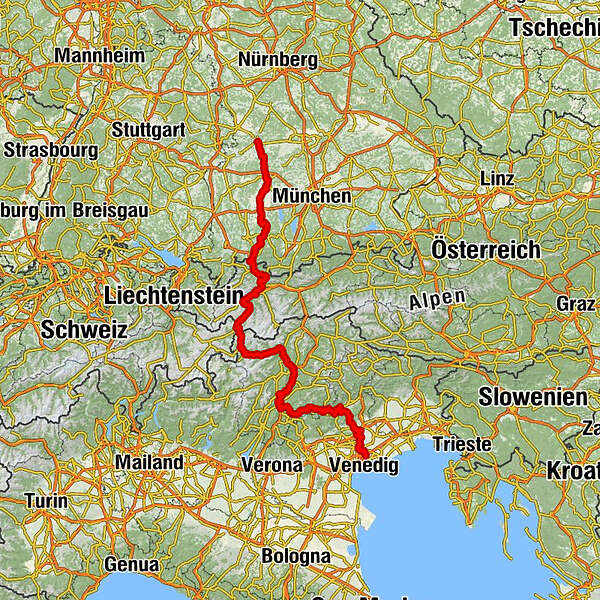
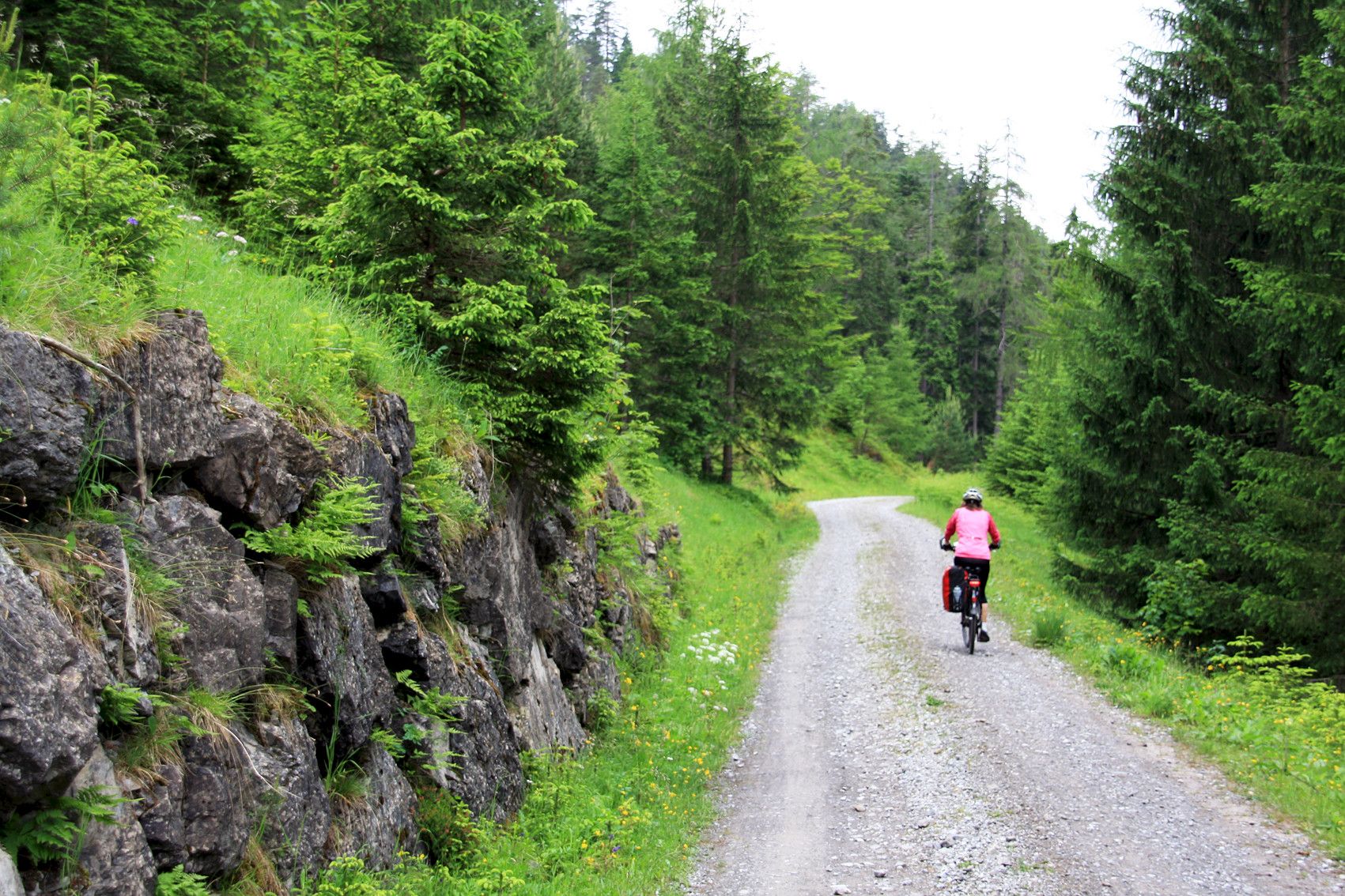
The Via Claudia Augusta began once upon a time in the port of Altinum near Venice and led across the Reschenpass, Landeck , Imst and the Fernpass and further along the Danube to Donauwörth .
- Directions
-
She was even after the Romans, one of the most important north-south connections. The resulting income opportunities, trade and encounters with travelers from many countries shaped the people along this route. Different regions and cultures meet each other here today and take a bike ride on this Roman trail.
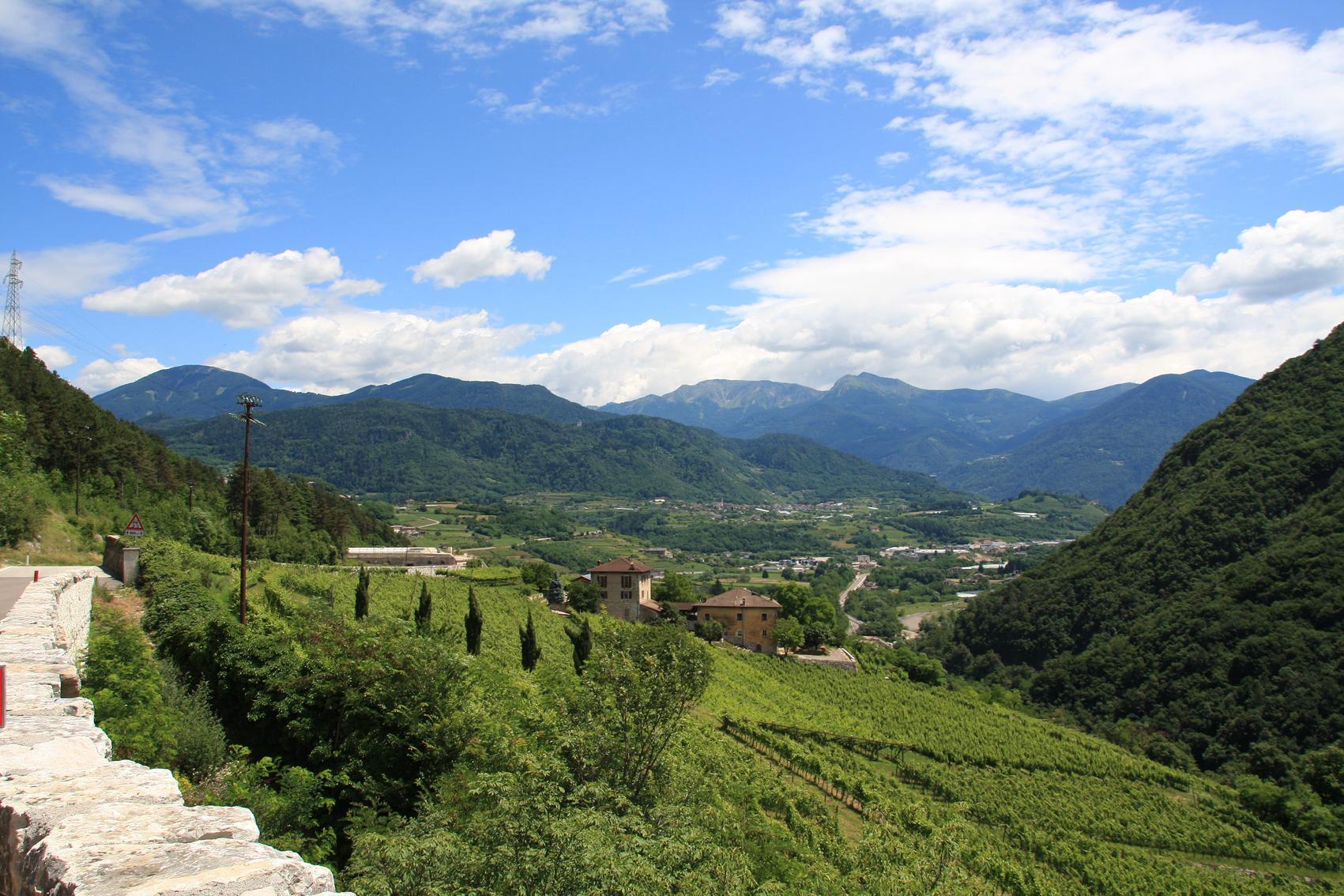
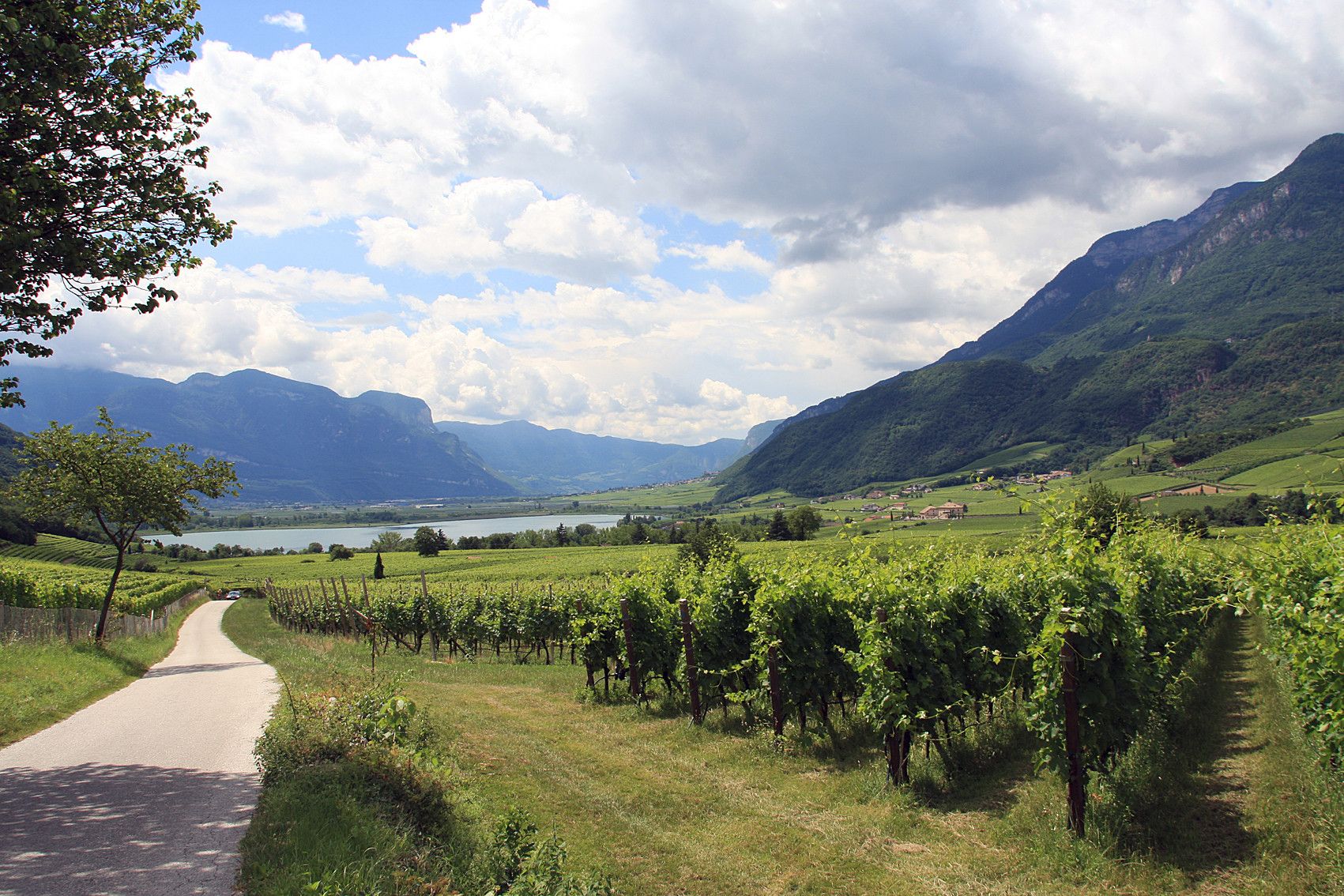
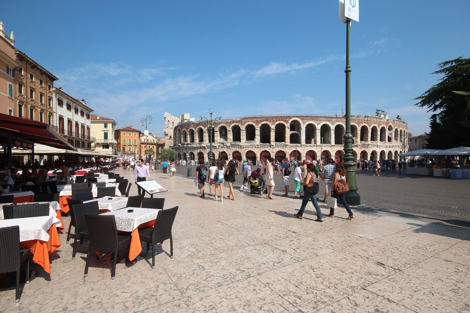
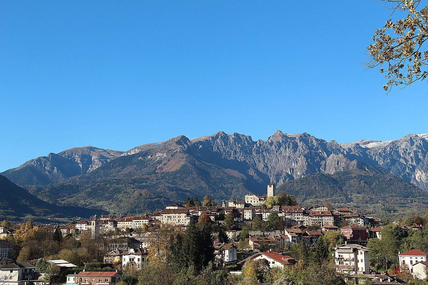
Numerous attractions are lined up togeteher, like glittering pearls on a chain: Starting with the scenic Danube Wörth at the starting point of the tour, with its Romanesque Augsburg and the romantic Neuschwanstein Castle. In the mountains, at the entrance to Tirol, in Reutte, the European Ehrenberg Castle and the picturesque Fern Pass await us. In the wild, romantic valleys follow the House of Fasnacht in Imst, the Tyrolean waterworld in Zams and the Archaeological Museum Fliess, ... before the route goes up onto the Finstermünz and to the Reschenpass. Over this centuries old pass road, the path continues on to South Tyrol, past the idyllic Reschensee and onto the south side of the Alps down to Merano and Bolzano. From the historic city of Trento you finally go either to the former Roman port in Altino near Venice (varied, but with a few hills, for which there will be hopefully soon a shuttle) or Ostiglia on the Po .. A bike ride on a route which the Romans once visited. - Highest point
- 1,511 m
- Endpoint
-
Altino (Venice) / Ostiglia along the Po
- Height profile
-
 © outdooractive.com
 - Safety instructions
-
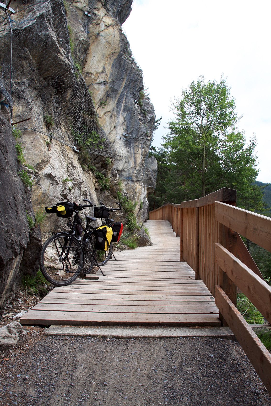
Route: on asphalt or gravel bike paths and quiet side streets. From the Danube to Schongau quite flat, through Allgäu gently undulating. In Tyrol - with slight inclines and descents - through Zwischentoren, the Gurgl- and the Inntal. From the Reschenpass to Trento largely downhill. After Antino by Venice there's still a small hill and 3 passes, but much more varied and interesting . After Verona or Ostiglia, apart from a hill, even.
- Tips
-
VIA CLAUDIA HUCKEPACK : Via the Fernpass ( 1,215 m) and Reschenpass ( 1,450 m ) from around 1,000 meters optional shuttle transport ( the lightest alpine crossing for cyclists ) . From Reschenpass steady decent.
- Additional information
- Directions
-
Getting there: As it is relatively complicated and time consuming to get the train to the starting point of the tour, there is for cyclists in the summer months a return-bus from Altino / Venice or Ostiglia / Verona , which currenlty runs primarily on the weekends, but will in future drive daily and can be used in the opposite direction as luggage service ( Current info and registration on www.viaclaudia.org )
- Author
-
The tour Via Claudia Augusta is used by outdooractive.com provided.
GPS Downloads


General info
Refreshment stop
Cultural/Historical
Flora
Fauna
A lot of view
Other tours in the regions
-
Meraner Land
12
-
Passeiertal
3