
Tour data
35.22km
909
- 2,417m
1,662hm
08:00h
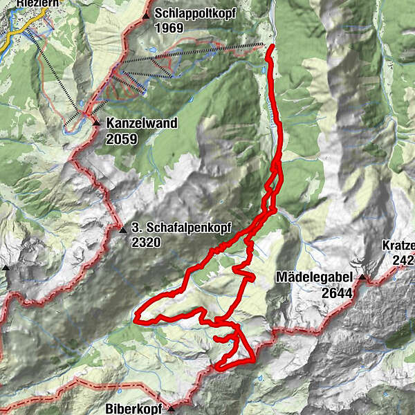
- Brief description
-
Rappenseehütte
- Rating
-
- Route
-
Anatswald1.0 kmBirgsau2.1 kmAdler-Landhaus Birgsau2.2 kmWendelins-Kapelle2.3 kmAlpe Eschbach2.6 kmSt. Katharina4.6 kmEinödsbach4.6 kmBerggasthof Einödsbach4.6 kmEnzianhütte9.9 kmRappenseehütte12.5 kmRappenseekopf (2,469 m)16.2 kmRappenseescharte (2,272 m)16.8 kmRappenseehütte17.8 kmAlpe Eschbach32.3 kmWendelins-Kapelle32.7 kmAdler-Landhaus Birgsau32.8 kmBirgsau32.9 kmAnatswald34.2 km
- Highest point
- 2,417 m
GPS Downloads


Trail conditions
Asphalt
Gravel
Meadow
Forest
Rock
Exposed
Other tours in the regions
-
Kleinwalsertal
2053
-
Steeg im Lechtal
364


