- Brief description
-
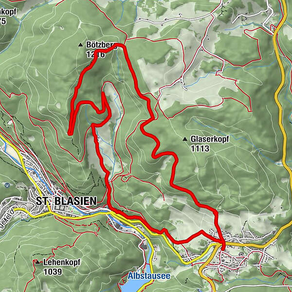
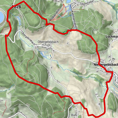
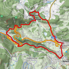
From "Häusern" to "Windberghochtal", down to "St. Blasien" and back to "Häusern".
- Difficulty
-
medium
- Rating
-
- Starting point
-
Rathaus Häusern
- Route
-
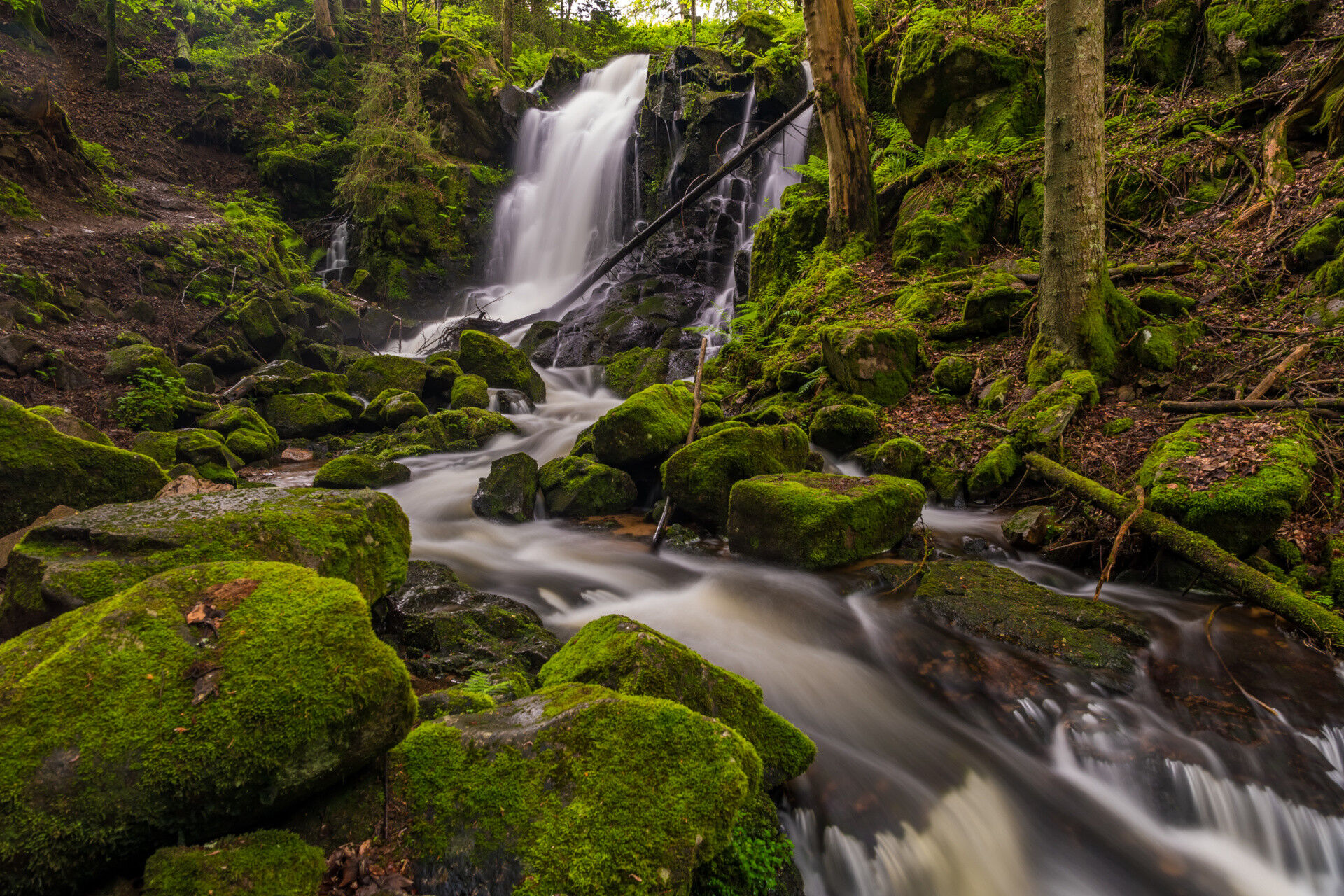
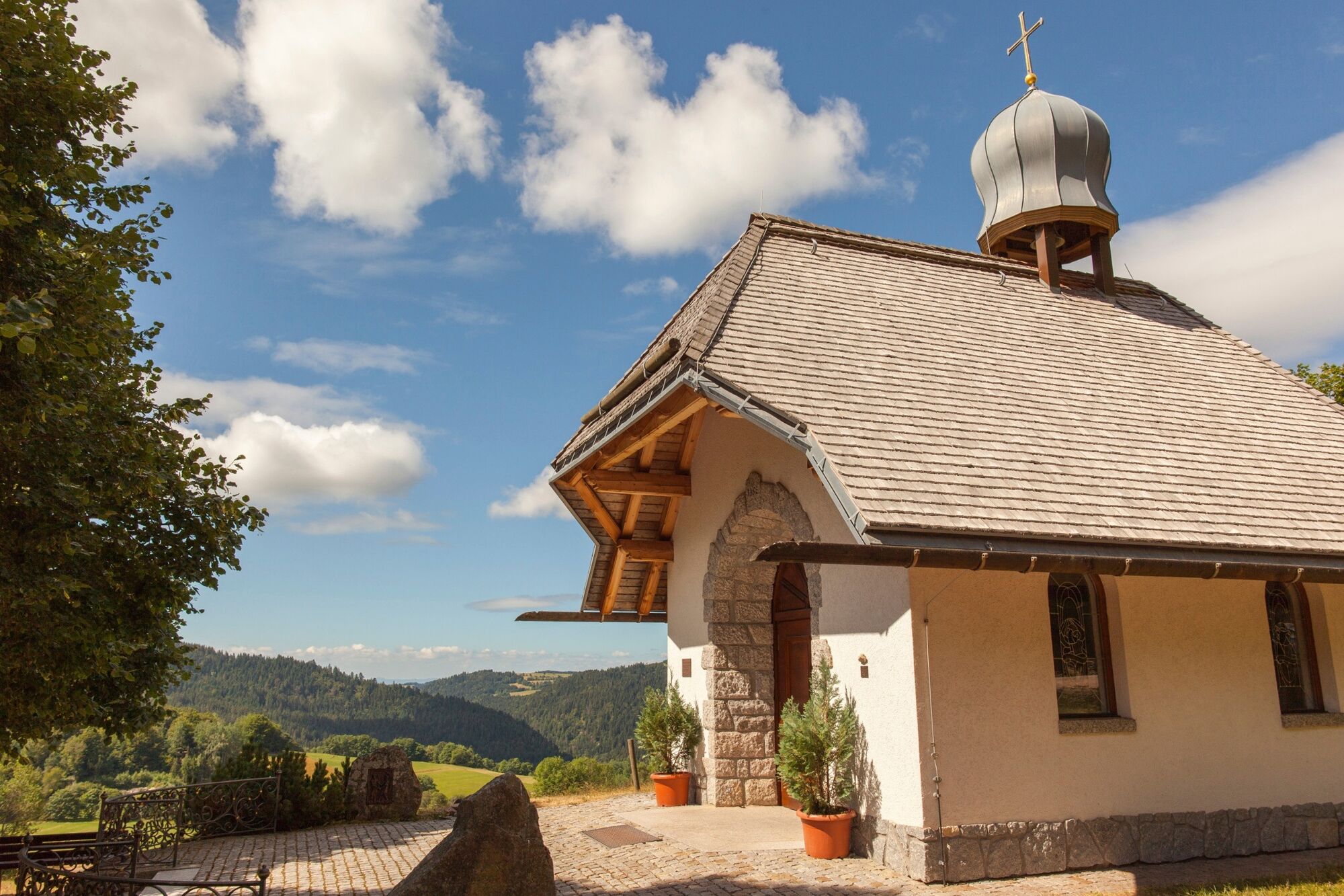
Häusern0.1 kmWittlisberger Kapelle0.6 kmRotrütte1.7 kmWindberg-Wasserfall10.5 kmWindbergschlucht10.8 kmSt. Blasien10.9 kmSchönenbach-Wasserfall11.6 kmHäusern13.3 km
- Best season
-
JanFebMarAprMayJunJulAugSepOctNovDec
- Description
-
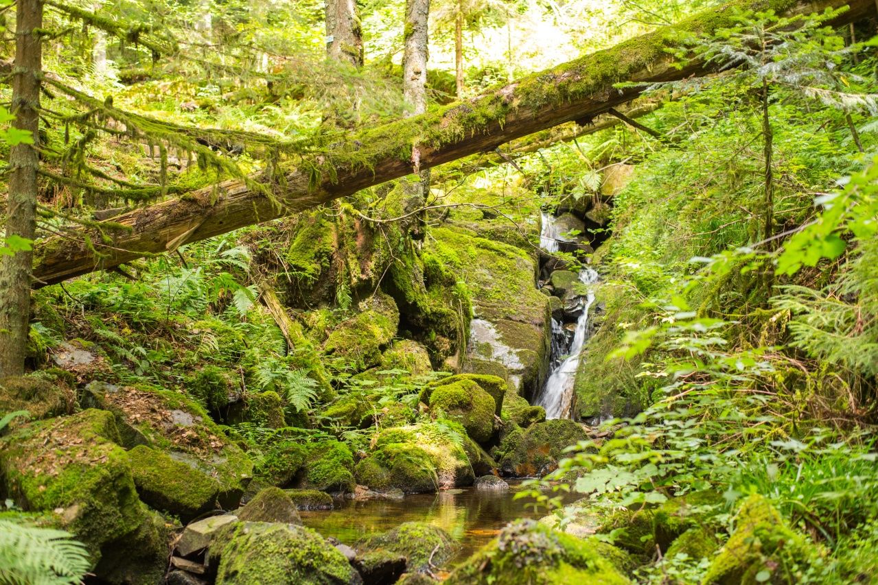
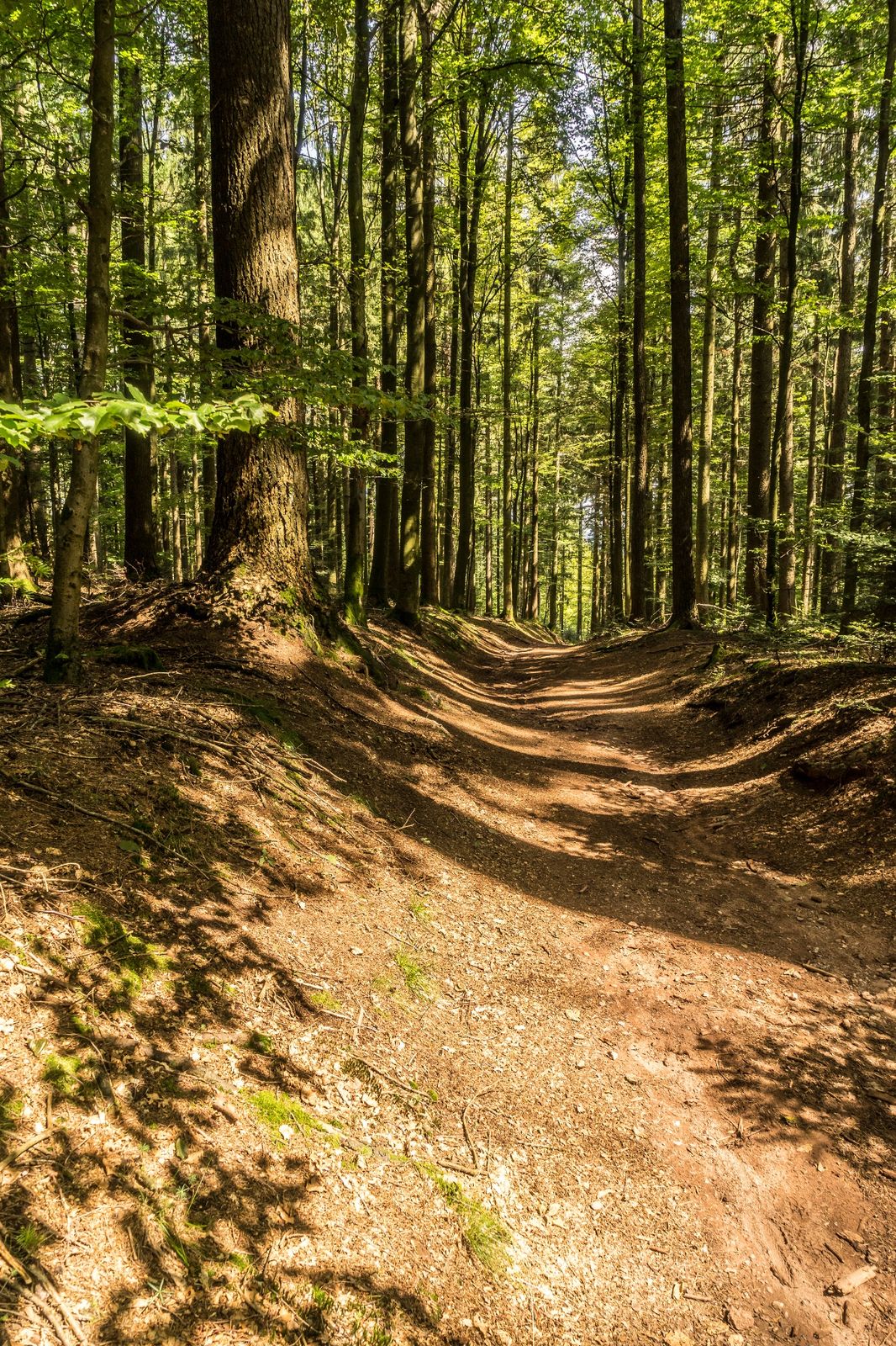
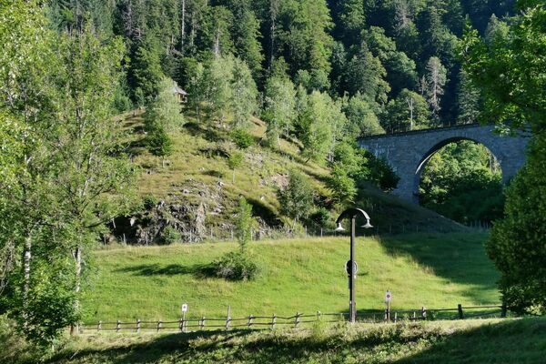
On our hike we pass several huts and walk on narrow paths into the "Windberg valley" and the "Windberg gorge".
- Directions
-
From the "Rathaus Häusern", take the B 500 up to the "Wittlisberger chapel". After about 2 km on the "Rottrütteweg" comes the "Reinholdhütte". Continue to the sand pit. Here we leave the "Mittelweg" and continue to "Wittemlehütte". We stay on the forest road towards "Windberghof". Then we hike 2 km down to the "Windberg bridge". Through the "Windberg Gorge" we continue down to St. Blasien. At the lower bridge we finish our tour uphill towards Häusern and back to the starting point.
- Highest point
- 1,143 m
- Height profile
-
 © outdooractive.com
 - Equipment
-
We recommend sturdy shoes.
- Tips
-
In good weather you have on the way a magnificent view to the Alps.
- Directions
-
Von Freiburg:
B31 in Richtung Donaueschingen, auf die Ausfahrt B317/B500 Richtung Basel/Feldberg/Waldshut-Tiengen/Schluchsee/Lenzkirch. Weiter B 500 über Schluchsee nach Häusern. Sie passieren die Ortseinfahrt Häusern. Fahren Sie nach der Ampel links. Nach wenigen Metern sehen Sie links das Rathaus Häusern.
Von Donaueschingen:
B31 in Richtung Neustadt, auf die Ausfahrt B317/B500 Richtung Basel/Feldberg/Waldshut-Tiengen/Schluchsee/Lenzkirch. Weiter B 500 über Schluchsee nach Häusern.
Von Lörrach:
B317 Richtung Schopfheim, weiter auf B518 / L148 Richtung Todtmoos bis Häusern.
- Public transportation
-
Von Freiburg:
Mit der S1 nach Seebrugg, Bahnhof Seebrugg, umsteigen in den Bus 7319 nach St. Blasien, Ausstieg Rathaus Häusern.
Von Donaueschingen:
Mit der S10 nach Titisee (Schw.), umsteigen in S1 nach Seebrugg, Ausstieg Seebrugg, Bus 7319 nach St. Blasien, Ausstieg Rathaus Häusern.
Von Lörrach:
Mit der Bahn nach Basel Bad BF, umsteigen in den Zug nach Waldshut. Mit dem Bus Richtung St. Blasien, Ausstieg Rathaus Häusern.
- Parking
-
Rathaus Häusern,St.-Fridolin-Str. 579837 Häusern und am Kur- und Sporthaus Häusern, Spitzacker 1, 79837 Häusern


- Author
-
The tour In the footsteps of charcoal burner and glass carriers is used by outdooractive.com provided.

-
Schwarzwald
1857
-
Hochschwarzwald
1178
-
St. Blasien - Menzenschwand
308

")