
- Brief description
-
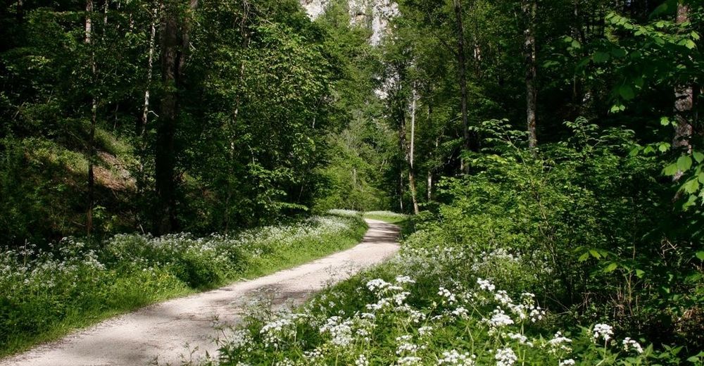
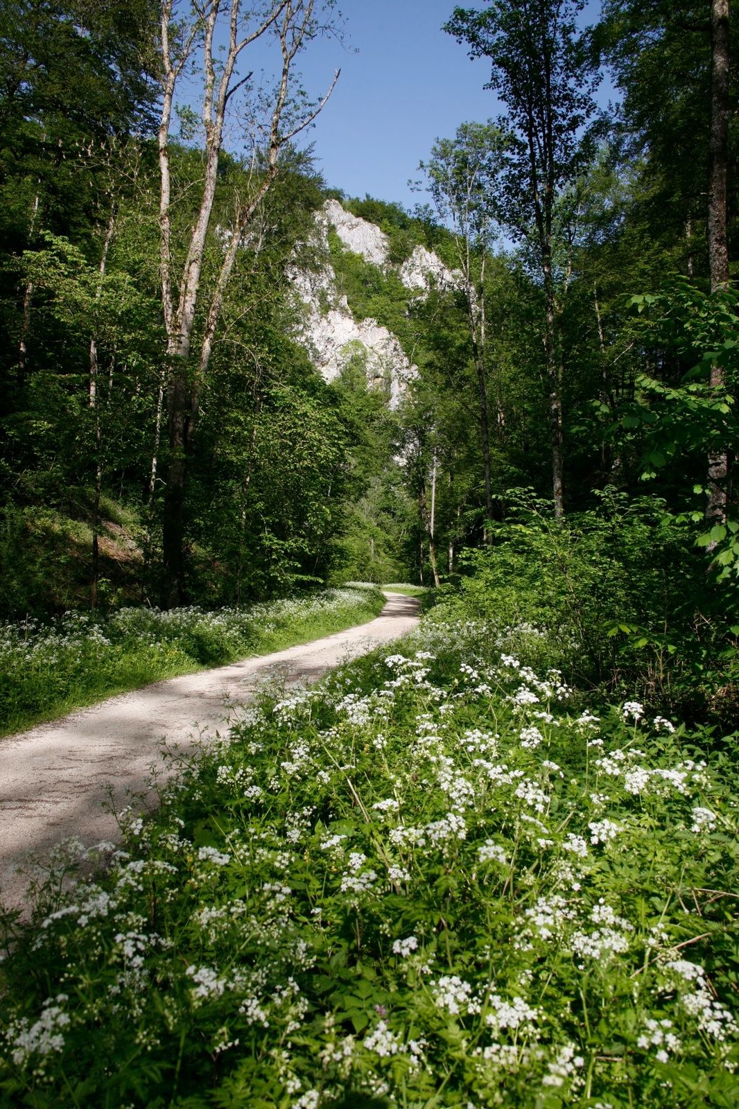
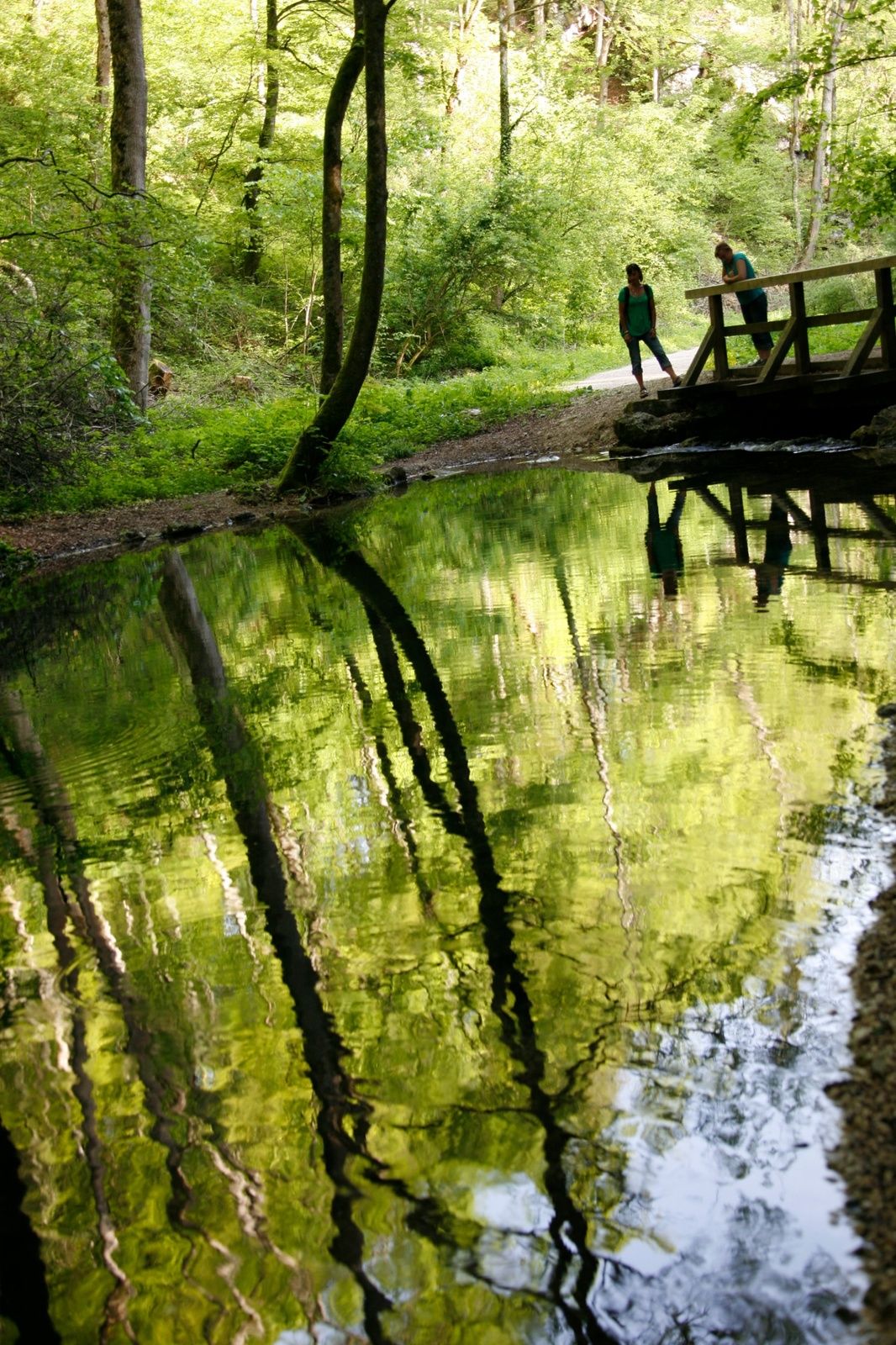
This hike leads us to the narrow and romantic Glas valley (Glastal), passing high cliffs and little bridges.
- Difficulty
-
medium
- Rating
-
- Starting point
-
Village centre of Hayingen or hikers´ parking "Hayinger Brücke/Glastal"
- Route
-
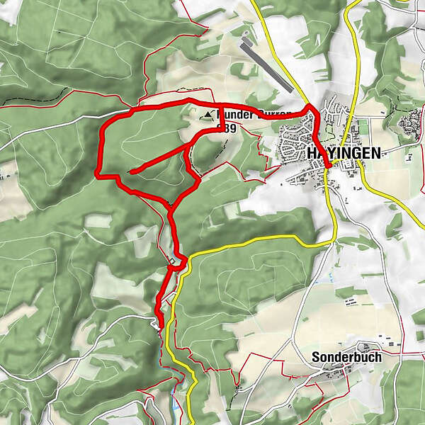
Hayingen (661 m)Gemeindehaus0.1 kmRunder Burren (689 m)2.0 kmBärenhöhle3.9 kmGlashöhle4.2 kmWimsener Wasserfälle6.7 kmWasserspielplatz6.8 kmGemeindehaus13.6 kmHayingen (661 m)13.7 km
- Best season
-
JanFebMarAprMayJunJulAugSepOctNovDec
- Description
-
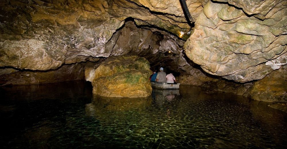
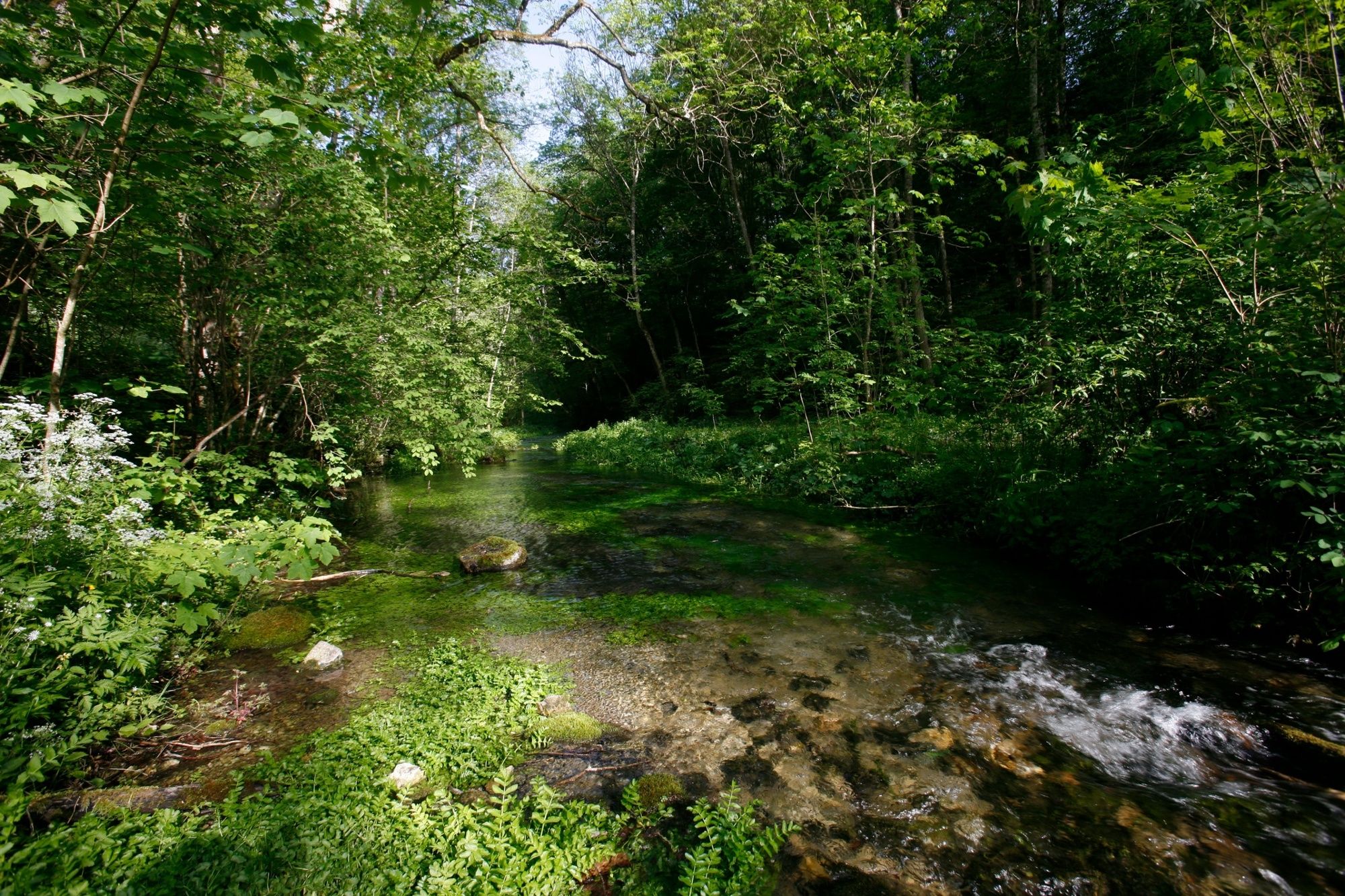
Target of our hike is the only cave that is accessible by boat in Germany. Our way to he Wimsen cave (Wimsener Höhle) leads us through the narrow and romantic Glas valley (Glastal) far away from roads, along high cliffs and small bridges. Our way back offers a good view down into the valley.
- Directions
-
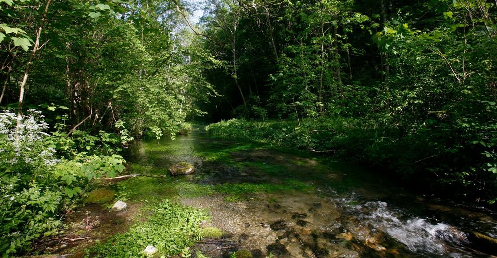
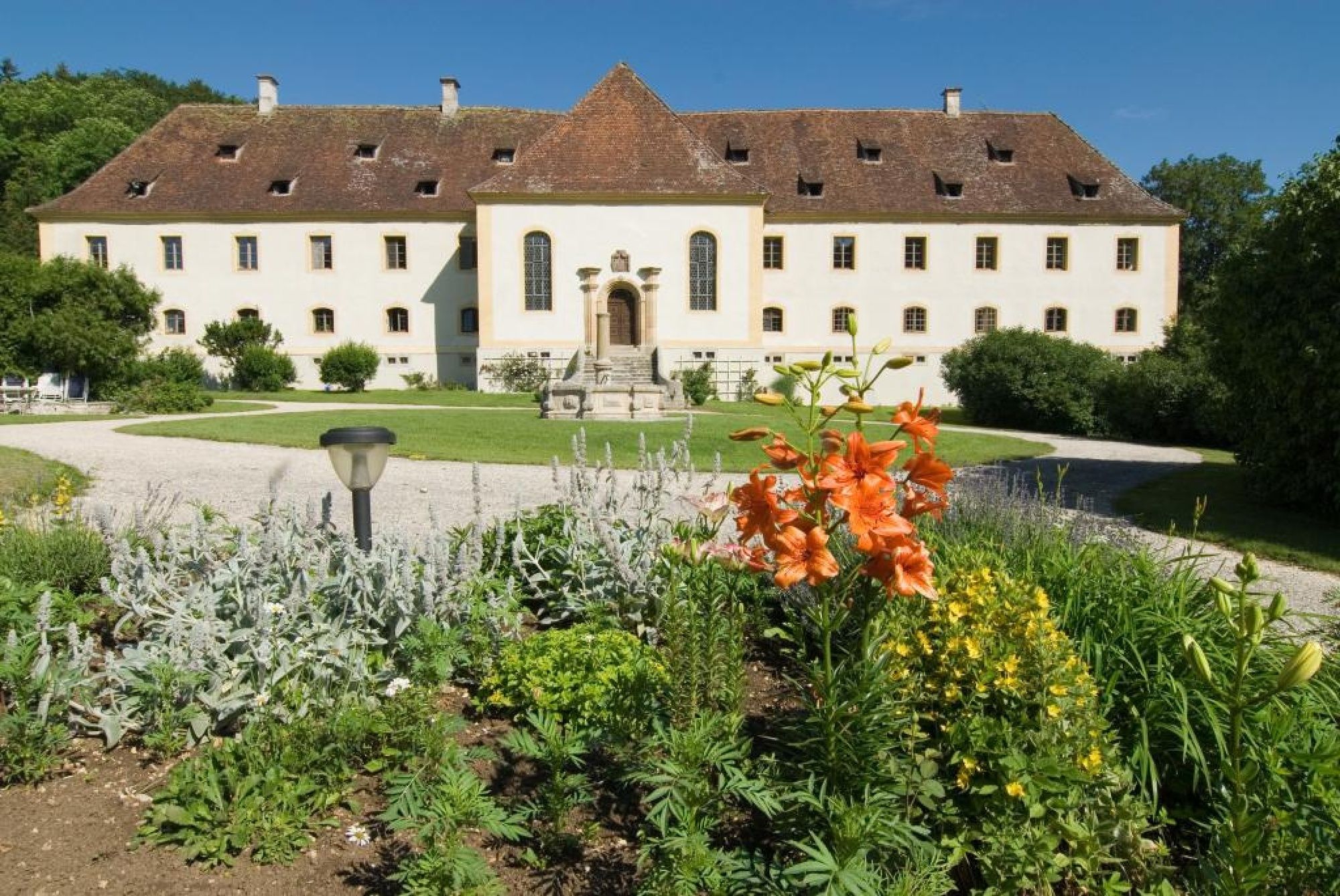
Hayingen is situated at the country road L 249 between Gomadingen and Obermarchtal. Our tour leads us along the red triangle. We start at village centre of Hayingen (stop Zwiefalter Strasse/ Holzgasse) and follow Ehestetter Strasse to reach the connection road Hayingen-Pfronstetten-Aichstetten (gliding area) which we follow to the west. At the hikers´ parking site "Hayinger Brücke" we start our tour into the narrow and romantic Glas valley (Glastal). After only a few meters we find ourselves surrounded by pure nature and in a valley without water. Where has the brook gone? Our way leads ust to "Bärenhöhle" (bear cave) where we turn left. Just a little further on we find "Glashöhle" (Glas cave) on our right. It is said that in ancient times there was a glass factory which gave names to valley and cave. We then get to the most spectacular part of the valley. High cliffs on both parts of the valley and the "Lämmersteig" (685m a.s.l.) which is crowned by a cross. Suddenly we can see "Hasenbach" (rabbit brook). Is this the brook that disappeared just before? We pass the branch to "Schweiftal" (Schweif valley) and on the little bridge we look back at the cliff with the ancient ruined castle of Alt-Ehrenfels" on top of it. We follow the idyllic Glastal (Glas valley) which meanders through mighty cliffs and later on widens itself. At the end of the trail the Glastal (Glas valley) leads to Werfental (Werfen valley). We turn right over a bridge and pass the castle of Ehrenfels which was built between 1735 and 1740. Before we reach the buildings, we turn left and follow the old alley of chestnuts. This trail finally leads ust to the access road to Wimsen cave (Wimsener Höhle) which we follow to the right and get to Wimsen (557m a.s.l.). There we reach the highlight of our tour: Wimsen cave, the only cave in Germany accessible by boat. The cave is approx. 70m long and can be visited with small boats. The source flows with around 150l and 200l per second and thereby forms the beginning of the river "Zwiefalter Aach". Below the water surface the cave continues for around 700m. The cave is a natural monument.
We follow the same way back until we reach the branch of "Alt-Ehrenfels", where we follow the red turned "Y" into Schweiftal (Schweif valley). At a bank we turn left and follow the path to an intersection which to the left leads us to the viewing point "Lämmerstein" (718m a.s.l.) (approx. 2km). We can look down to the cross at "Lämmerstein" and into the Glas valley where we walked before. Back at the intersection we follow the way to "Digelfeld" along fields and juniper heaths wher we can see sheep from time to time. At the calvary we turn left back to the connection road from where we get back to Hayingen or the hikers´ parking site.
- Highest point
- 713 m
- Endpoint
-
Hayingen Ortsmitte oder Wanderparkplatz »Hayinger Brücke/Glastal«
- Height profile
-
 © outdooractive.com
 - Tips
-
- Cave visits: april to october and on request from 10am to 7pm. Phone: 07373 91 52 60, www.wimsen.de
- Visit of the baroque minster at Zwiefalten. Phone: 07373 20 520, www.zwiefalten.de
- Additional information
- Directions
-
Highway A8 from Karlsruhe: exit Stuttgart-Degerloch, then continue on B27/B312 to Reutlingen. Hayingen ist situated at the country road L 249 between Gomadingen and Obermarchtal.
- Public transportation
-
With the train to Stuttgart or Plochingen and from there on the line Stuttgart-Reutlingen-Tübingen. Change trains at Metzingen in direction of Bad Urach and from there on the bus to Münsingen station. At Münsingen we take the bus in direction of Zwiefalten, to the stop "Zwiefaltener Straße, Holzgasse".
- Parking
-
Hikers´ parking site »Hayinger Brücke/Glastal«

- Author
-
The tour Glas valley (Glastal) and Wimsen cave (Wimsener Höhle) is used by outdooractive.com provided.


General info
-
Schwäbische Alb
1240
-
Ferien rund um den Bussen
135
-
Hayingen
65