© Haute Maurienne Vanoise Tourisme - Alban Pernet

© B.Thomas - OTHMV

- Brief description
-
Fancy an offbeat gastronomic excursion? If for you, hiking is synonymous
with gastronomic delights and exploring local heritage, then dive right in
the deep end with a light backpack and your taste buds ready for a treat!
Who knows what you'll bring back from your trip? - Difficulty
-
medium
- Rating
-
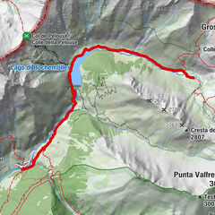
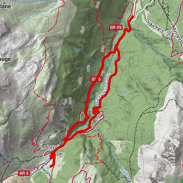
- Route
-
Le Lavoir2.9 km
- Best season
-
JanFebMarAprMayJunJulAugSepOctNovDec
- Description
-
Striking out with gusto, you take the Lavoir road, curious to discover what
surprises await you once you leave the forest.
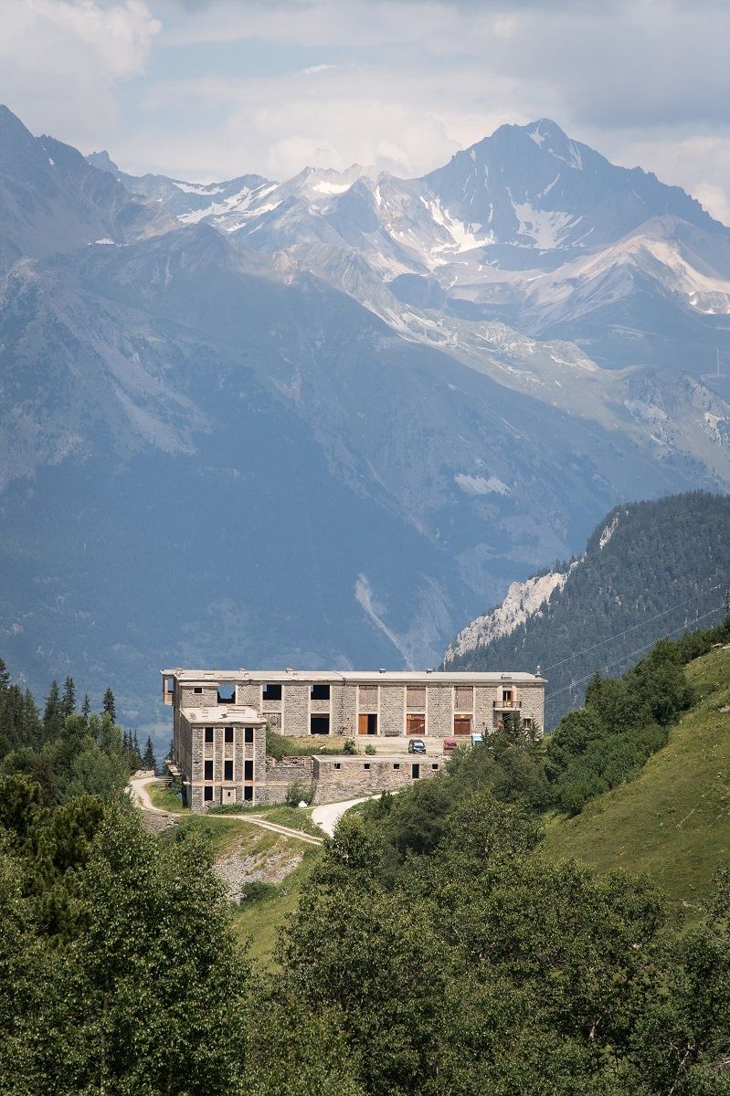
And suddenly, you find yourself on the Maginot line! Look to your right… what's
this peculiar object, mutely testifying to World War II? A little submarine on
land, a real one, of which you can only see a tiny part, round and concrete.
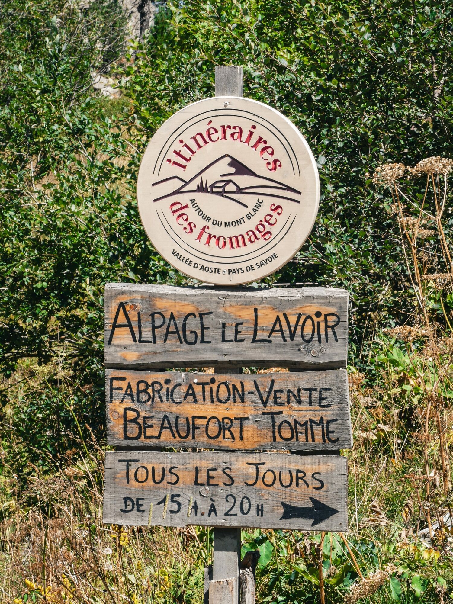
The sound of the Charmaix torrent brings you back to the present, and, as you
pass the alpine pastures, you seize the opportunity to sample the specialties
made at the Lavoir cheese dairy. You're about to become an expert on the
making of alpine cheeses such as Beaufort, Tomme, Raclette, Sérac, and
Fromage Blanc!
And since you've still got some room in your backpack, you're on the hunt
for delicious treats. Your picnic now looks like a proper mountain feast.
But it's time to head back and cross paths with the hikers attracted by the
popular GR5 trail that's made the valley famous. - Highest point
- 1,941 m
- Endpoint
-
Gîte des Tavernes
- Height profile
-
 © outdooractive.com
 - Additional information
-
APIDAE tourism data updated on 10/03/2023 by "Communauté de communes Haute Maurienne Vanoise".
Spotted an error? Write to the owner with the following information:
File name: Le Lavoir et sa fromagerie | Record identifier: 5357314 | URL (link) for this Outdooractive page.
- Author
-
The tour Lavoir Cheese Dairy is used by outdooractive.com provided.
GPS Downloads


Other tours in the regions
-
Haute Maurienne Vanoise
609
-
Bardonecchia
174