- Brief description
- Difficulty
-
difficult
- Rating
-
- Starting point
-
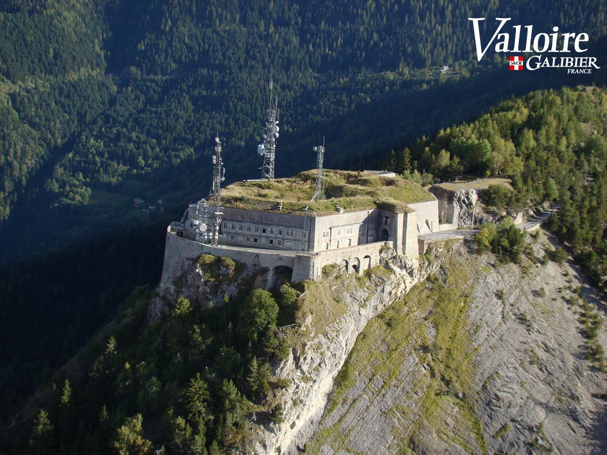
Saint Michel de Maurienne
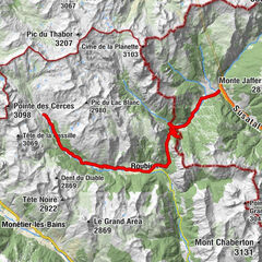
- Route
-
Saint-Michel-de-Maurienne0.9 kmLa Scudéria1.0 kmO comptoir des tontons1.3 kmSaint-Martin-d'Arc2.5 kmLa Ravoire2.7 kmChamontain2.7 kmSaint-Joseph3.2 kmLa Tour3.8 kmLes Petites Seignières4.0 kmLes Grandes Seignières4.7 kmLe Relais du Télégraphe13.3 kmLe Col15.5 kmLes Granges16.5 kmLes Choseaux Ville17.3 kmLes Plans17.6 kmLes Charbonnières17.9 kmLe Praz18.2 kmValloire18.2 kmLe Pontet18.3 kmSaint-Rozaire18.3 kmÉglise de l'Assomption18.3 kmLa Bonne Eau18.6 kmLa Borgé18.8 kmGrotte de la Vierge18.8 kmChapelle Saint-Bernard18.9 kmLe Crêt du Serroz19.2 kmMoulin Benjamin19.4 kmMoulin Benjamin19.5 kmLes Clots19.7 kmLa Ruaz19.8 kmLe Trappeur20.1 kmRestaurant du Crêt Rond20.5 kmChapelle Saint-Claude20.6 kmLes Verneys20.7 kmLa Rivine21.8 kmL'Auberge de Plan Lachat28.2 kmL'Auberge de Plan Lachat44.1 kmLa Rivine49.8 kmLes Verneys51.1 kmChapelle Saint-Claude51.3 kmRestaurant du Crêt Rond51.7 kmLa Ruaz51.9 kmLe Trappeur52.1 kmLes Clots52.4 kmMoulin Benjamin52.5 kmChapelle Saint-Bernard52.7 kmLa Borgé52.8 kmLe Crêt du Serroz52.9 kmGrotte de la Vierge53.5 kmLe Praz53.9 kmTigny53.9 kmLe Pontet53.9 kmValloire54.1 kmLes Charbonnières54.3 kmLes Plans54.6 kmLes Choseaux Ville54.9 kmLes Granges55.6 kmLe Col56.6 kmLe Relais du Télégraphe58.9 kmLes Grandes Seignières67.3 kmLes Petites Seignières68.2 kmLa Tour68.4 kmSaint-Joseph69.1 kmLa Ravoire69.5 kmChamontain69.6 kmSaint-Martin-d'Arc69.6 kmO comptoir des tontons70.6 kmSaint-Michel-de-Maurienne71.0 kmLa Scudéria71.0 km
- Best season
-
JanFebMarAprMayJunJulAugSepOctNovDec
- Description
-
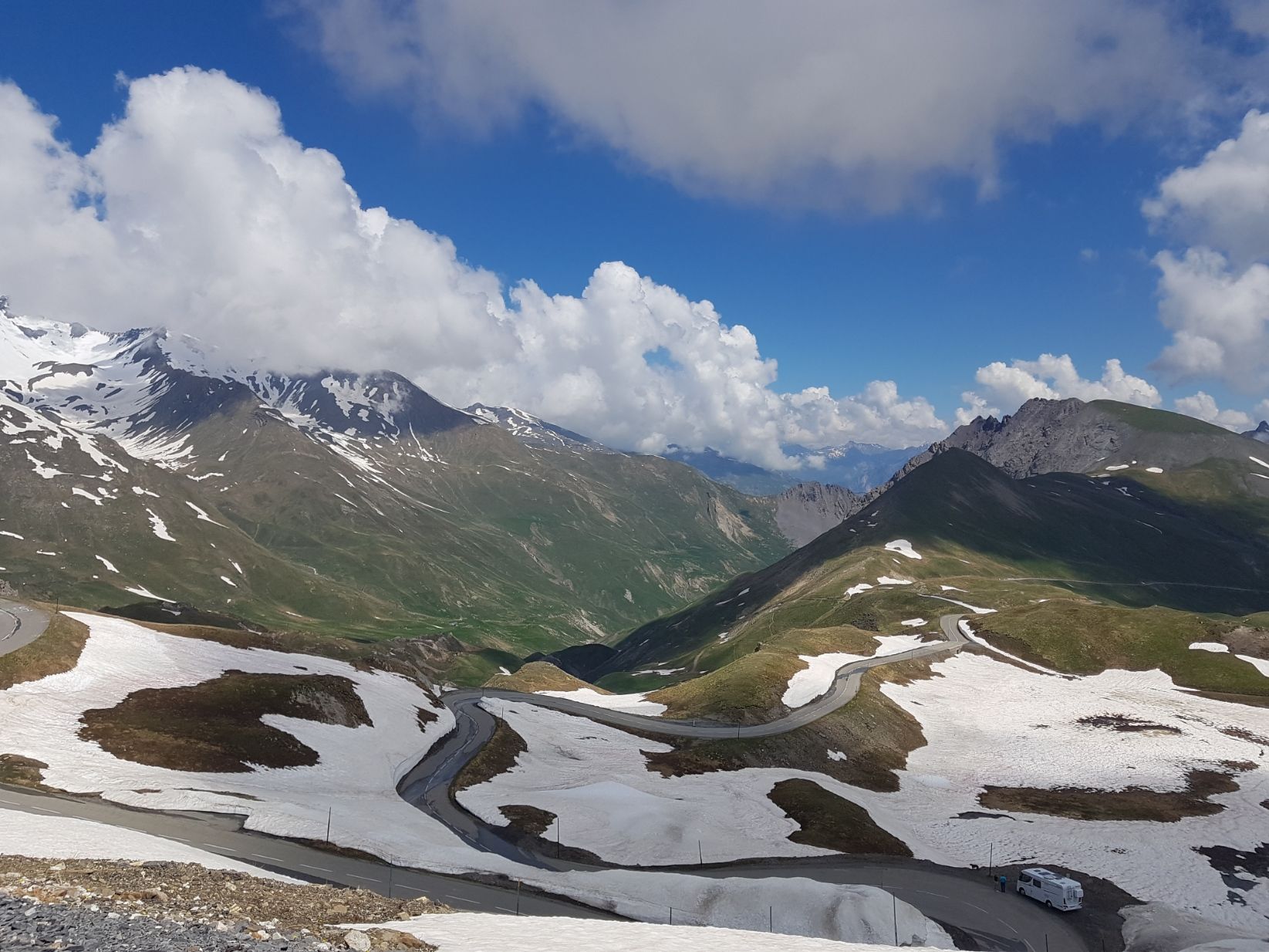
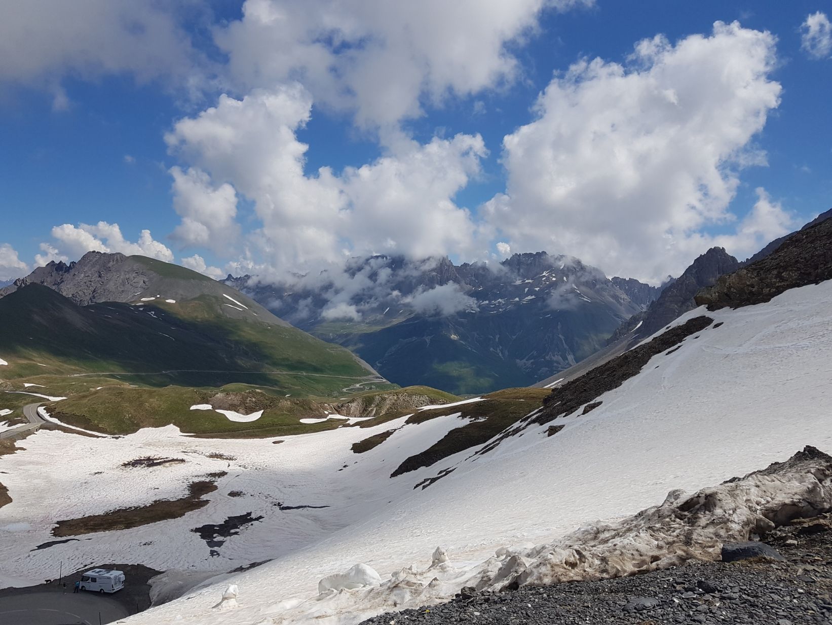
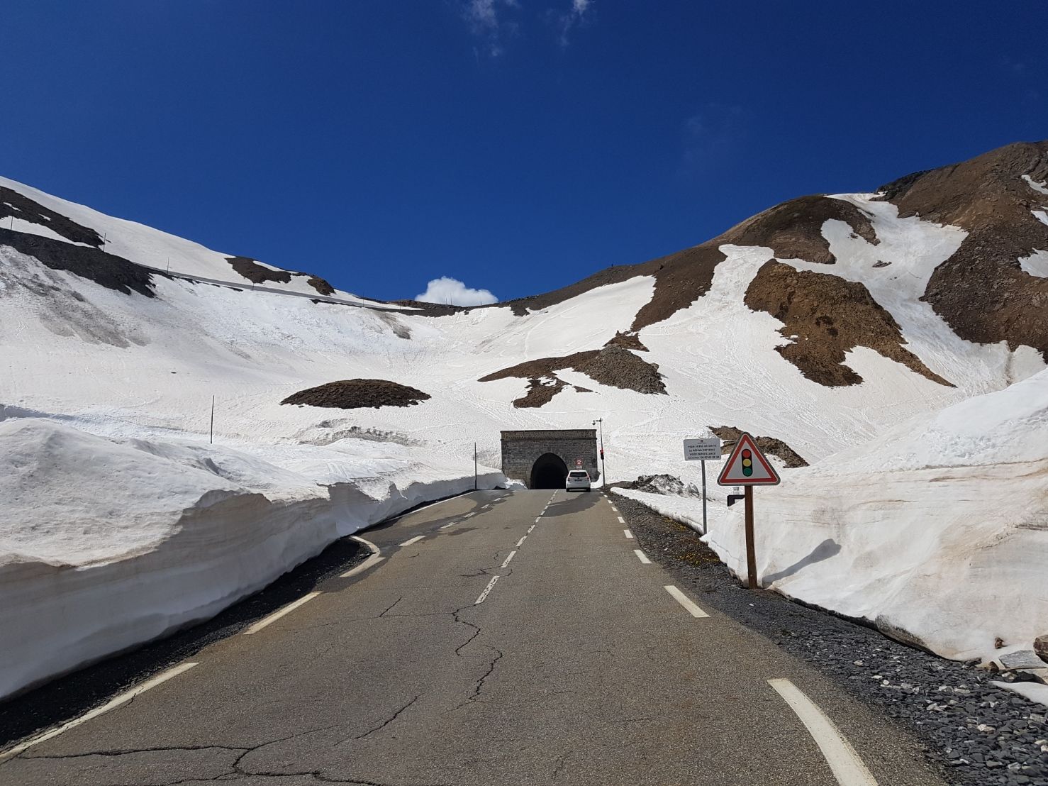
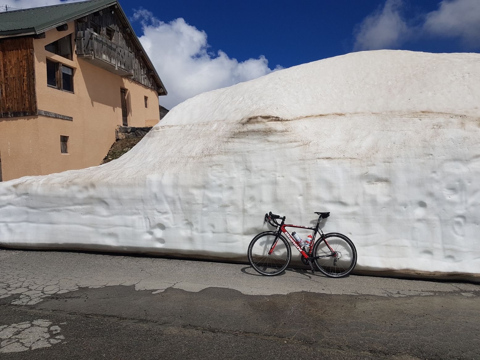
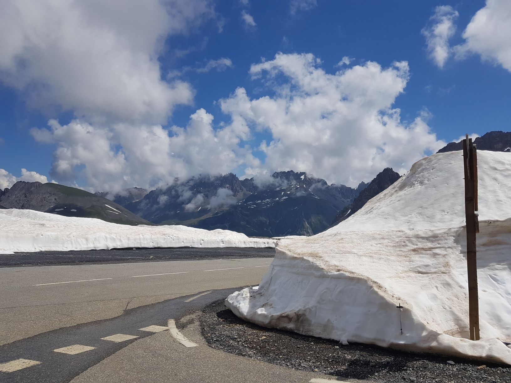
Starting from St Michel de Maurienne, the serious things start from the first kilometre of the Col du Télégraphe and its 12km of 7% ascent. As soon as you leave Saint-Michel-de-Maurienne, you can already see the Telegraph fort above. After Saint-Michel-de-Maurienne, you enter the commune of Saint-Martin-d'Arc and as soon as you leave this same commune, you already dominate Saint-Michel-de-Maurienne. The first kilometres of the Col du Télégraphe show a gradient of 8%, while the ascent, after having passed through communes and hamlets during the first three kilometres, is now in the forest. Later on, we leave the road to the left leading to Valmeinier and continue straight on towards the Telegraph. The last 3 kilometers of the Col du Télégraphe are a little less steep, and at about 100 meters from the summit, you can enjoy the panorama of Saint-Michel-de-Maurienne, and the Maurienne valley.After the summit, you will leave the telegraph fort on your right and start a 5 km descent to Valloire through small hamlets. The Savoyard station is at an altitude of about 1,445 m. At the exit of the station, begins the ascent of the Col du Galibier and its 17 km at 6.9%. The exit of Valloire has a slope of more than 8% but at the exit of the hamlet of Les Verneys, 2 km further on, there is a 2 km drop. We arrive at the hamlet of Bonnenuit and up to the place called Plan Lachat, there are percentages around 5 to 8% as we follow a small stream at altitude. The passage to Plan Lachat, next to the bar, is a short flat area which you should take advantage of because it is then that the serious things really start. Indeed, once the small bridge of Plan Lachat is passed, the road climbs much more sharply and there are still 8 km at an average of 8.5% to be done while we quickly exceed 2,000 m in altitude, which makes the effort even harder, especially for those who are not used to high mountains.From there, you enter a green and rocky setting with almost no buildings. With 3 km of ascent remaining, the summit of the Col du Galibier can be seen in the rocks. In the summer, there may still be a few snowdrifts on the sides of the road, at the beginning of the season you will be in the middle of the snow walls. Some passages appear to be close to 10%. At the beginning of the last km, we arrive in front of the entrance to the Galibier tunnel, at 2,556 m, and we turn left to enter the last ramps at 9%, one last effort and it is deliverance, at 2,645 m altitude.
- Directions
-
From the St Michel Valloire train station, turn right on the D1006, in the direction of Modane. At the only traffic light in St Michel, turn right, just after the light the ascent of the Col du Telegraph begins.
- Highest point
- 2,633 m
- Endpoint
-
Col du Galibier
- Height profile
-
 © outdooractive.com
 - Equipment
-
Provide a windbreaker or vest for the descent, even in summer.
- Safety instructions
-
Check the weather forecast before departure.
- Tips
-
Remember to hydrate and feed yourself during the ascent, there are fountains on the side of the road.Find out about the opening and closing dates of the Galibier Pass: www.savoie-route.fr/fr/conseils/etat-...
- Additional information
- Directions
-
By road, motorway A43 direction Turin, at the St Michel de Maurienne tollgate, exit 29 St Michel de Maurienne.
- Public transportation
-
By train, arrival at St Michel Valloire station.
- Parking
-
Numerous parking possibilities in St Michel de Maurienne.

-

-
AuthorThe tour The mythical Col du Galibier from Saint Michel de Maurienne is used by outdooractive.com provided.

General info
-
Maurienne-Galibier
45
-
Valloire
17